Rosemont is a village in Cook County, Illinois, located immediately northwest of Chicago. as of the 2020 census, the village had a population of 3,952. The village was incorporated in 1956, though it had been settled long before that. While Rosemont’s land area and population are relatively small among municipalities in the Chicago Metropolitan Area, the village is a major center for commercial activity in the region and is a key component of the Golden Corridor.
Due to its proximity to several interstates, O’Hare International Airport, and downtown Chicago, it has emerged as a significant edge city and entertainment district, with corporate facilities, millions of square feet of office space, nearly 50 restaurants, 15 hotels, the 840,000-square-foot (78,000 m) Donald E. Stephens Convention Center (home to conventions and trade shows), the 16,000+ seat Allstate Arena (home to the Chicago Wolves, Chicago Sky, DePaul Blue Demons until 2017, and concerts and other live entertainment events), the 4,000+ seat Rosemont Theatre, the 130-store Fashion Outlets of Chicago, the Rosemont Stadium (home to an outdoor collegiate-level softball stadium and 140,000 sq ft indoor sports dome), Impact Field (home to the Chicago Dogs independent minor league baseball team), and the entertainment complex Parkway Bank Park, which features restaurants, entertainment and a large common area used for summer concerts and ice skating in the winter. Rosemont is near Rivers Casino in Des Plaines and additional hotels, offices, restaurants, and corporate facilities in the adjacent O’Hare neighborhood of Chicago and nearby suburban communities such as Des Plaines and Schiller Park.
The Scott Street subdivision in Rosemont is a gated community, as a result of the 1995 decision by residents. Visitors to the Scott Street subdivision are subject to a visual inspection and questioning by Rosemont Police. However, visitors who refuse questioning are still permitted to enter the subdivision.
| Name: | Rosemont village |
|---|---|
| LSAD Code: | 47 |
| LSAD Description: | village (suffix) |
| State: | Illinois |
| County: | Cook County |
| Founded: | 1956 |
| Total Area: | 1.79 sq mi (4.64 km²) |
| Land Area: | 1.79 sq mi (4.64 km²) |
| Water Area: | 0.00 sq mi (0.00 km²) |
| Total Population: | 3,952 |
| Population Density: | 2,205.36/sq mi (851.26/km²) |
| Area code: | 847 |
| FIPS code: | 1765819 |
| Website: | www.rosemont.com |
Online Interactive Map
Click on ![]() to view map in "full screen" mode.
to view map in "full screen" mode.
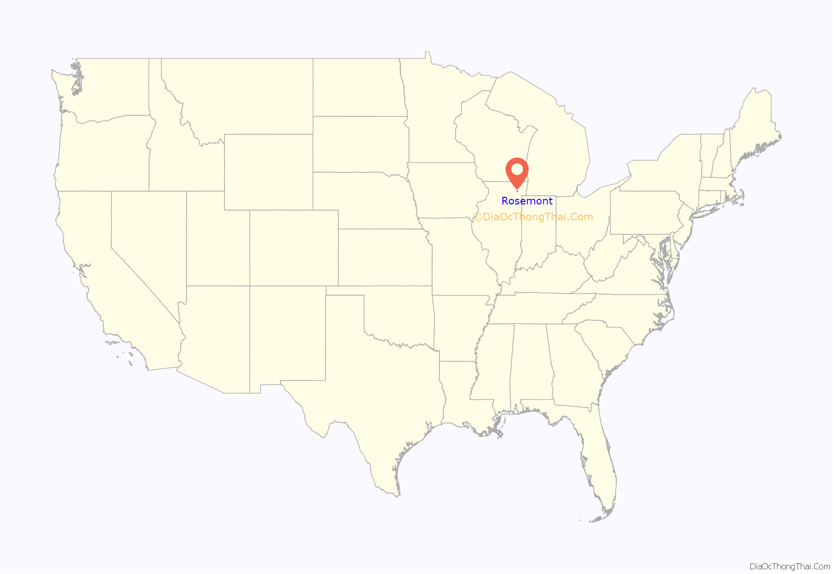
Rosemont location map. Where is Rosemont village?
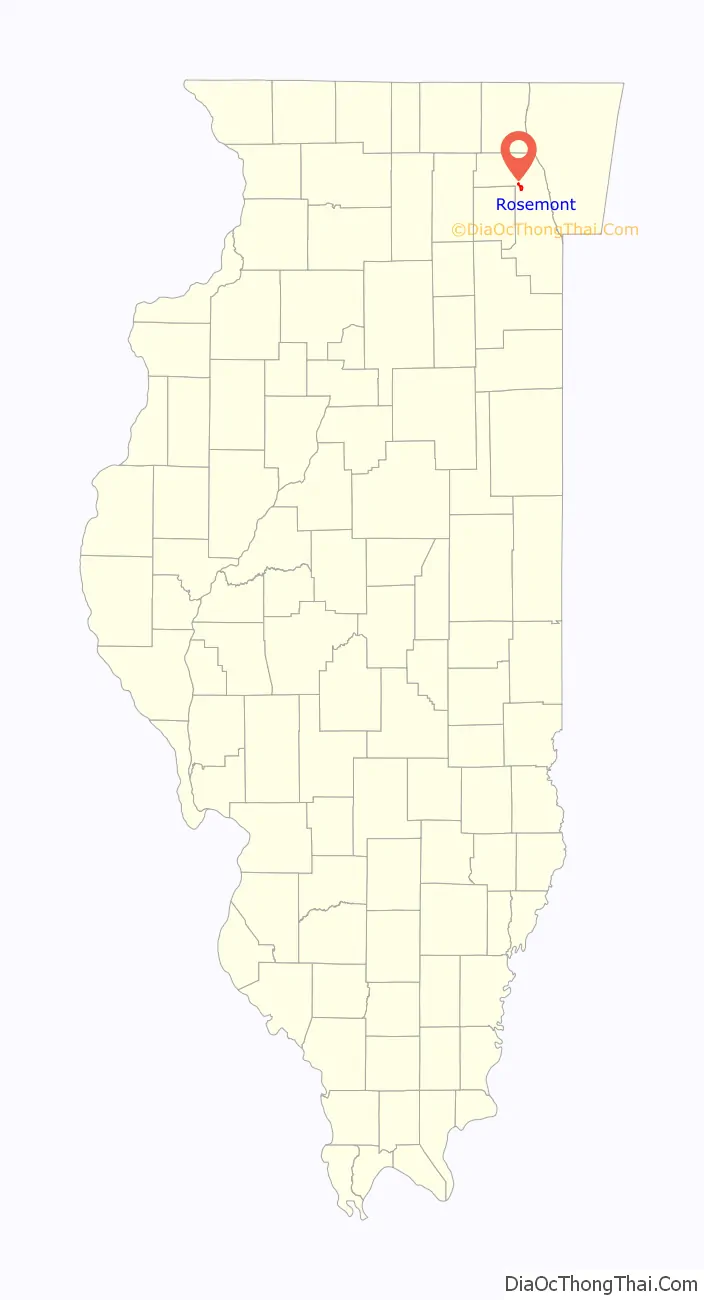
Rosemont Road Map
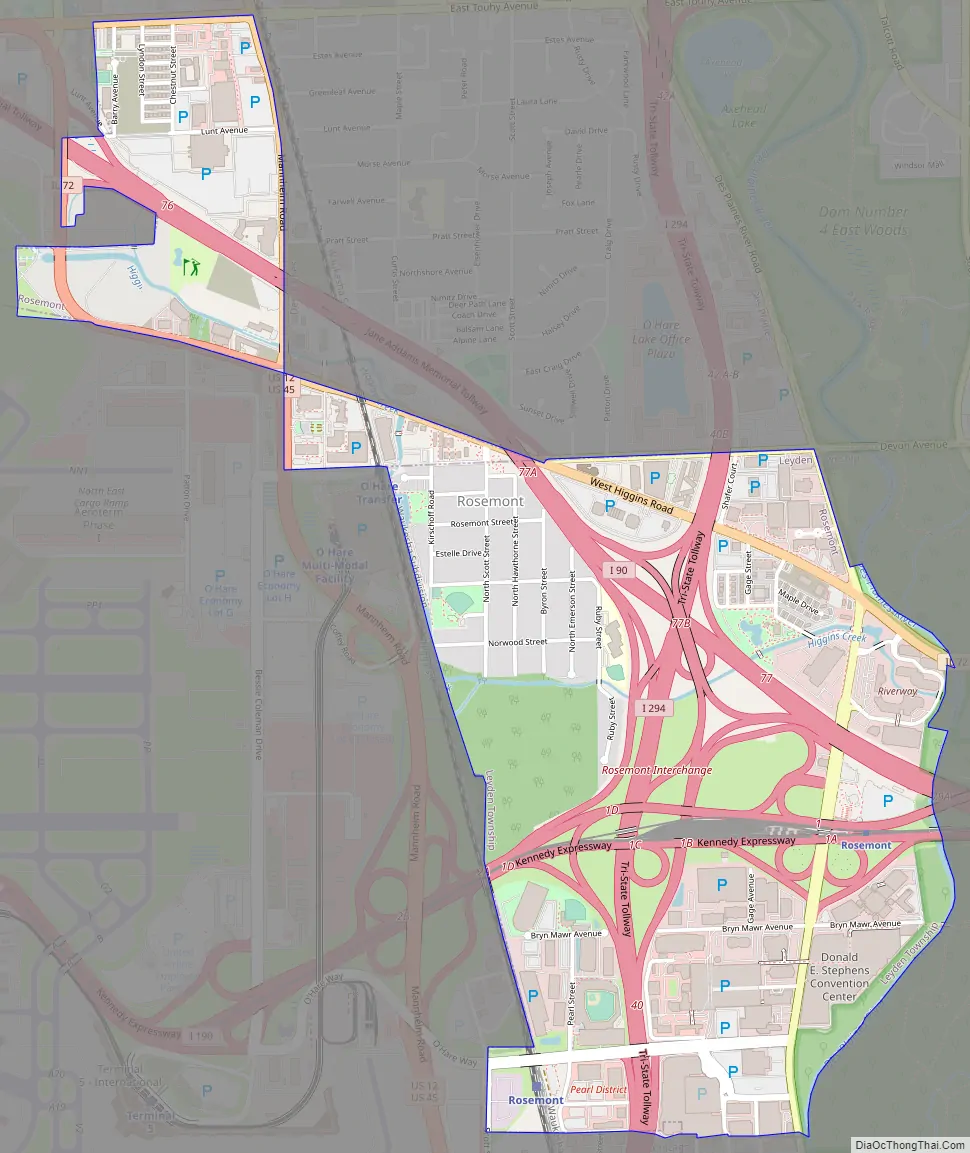
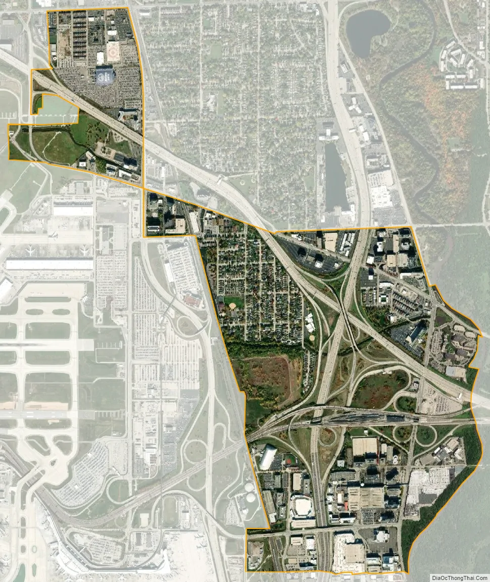
Rosemont city Satellite Map
Geography
Rosemont is at 41°59′27″N 87°52′26″W / 41.99083°N 87.87389°W / 41.99083; -87.87389 (41.990730, −87.873816).
According to the 2010 census, Rosemont has a total area of 1.79 square miles (4.64 km), all land.
See also
Map of Illinois State and its subdivision:- Adams
- Alexander
- Bond
- Boone
- Brown
- Bureau
- Calhoun
- Carroll
- Cass
- Champaign
- Christian
- Clark
- Clay
- Clinton
- Coles
- Cook
- Crawford
- Cumberland
- De Kalb
- De Witt
- Douglas
- Dupage
- Edgar
- Edwards
- Effingham
- Fayette
- Ford
- Franklin
- Fulton
- Gallatin
- Greene
- Grundy
- Hamilton
- Hancock
- Hardin
- Henderson
- Henry
- Iroquois
- Jackson
- Jasper
- Jefferson
- Jersey
- Jo Daviess
- Johnson
- Kane
- Kankakee
- Kendall
- Knox
- La Salle
- Lake
- Lake Michigan
- Lawrence
- Lee
- Livingston
- Logan
- Macon
- Macoupin
- Madison
- Marion
- Marshall
- Mason
- Massac
- McDonough
- McHenry
- McLean
- Menard
- Mercer
- Monroe
- Montgomery
- Morgan
- Moultrie
- Ogle
- Peoria
- Perry
- Piatt
- Pike
- Pope
- Pulaski
- Putnam
- Randolph
- Richland
- Rock Island
- Saint Clair
- Saline
- Sangamon
- Schuyler
- Scott
- Shelby
- Stark
- Stephenson
- Tazewell
- Union
- Vermilion
- Wabash
- Warren
- Washington
- Wayne
- White
- Whiteside
- Will
- Williamson
- Winnebago
- Woodford
- Alabama
- Alaska
- Arizona
- Arkansas
- California
- Colorado
- Connecticut
- Delaware
- District of Columbia
- Florida
- Georgia
- Hawaii
- Idaho
- Illinois
- Indiana
- Iowa
- Kansas
- Kentucky
- Louisiana
- Maine
- Maryland
- Massachusetts
- Michigan
- Minnesota
- Mississippi
- Missouri
- Montana
- Nebraska
- Nevada
- New Hampshire
- New Jersey
- New Mexico
- New York
- North Carolina
- North Dakota
- Ohio
- Oklahoma
- Oregon
- Pennsylvania
- Rhode Island
- South Carolina
- South Dakota
- Tennessee
- Texas
- Utah
- Vermont
- Virginia
- Washington
- West Virginia
- Wisconsin
- Wyoming


