Sammons Point is a village in Otto Township in south-central Kankakee County, Illinois, United States. Initially incorporated as a village on March 21, 2006, it was disincorporated on August 8, 2007, and incorporated again on February 5, 2008. As of the 2010 census it had a population of 279.
The village is part of the Kankakee–Bradley Metropolitan Statistical Area, which includes all of Kankakee County.
| Name: | Sammons Point village |
|---|---|
| LSAD Code: | 47 |
| LSAD Description: | village (suffix) |
| State: | Illinois |
| County: | Kankakee County |
| Incorporated: | March 21, 2006 |
| Total Area: | 1.85 sq mi (4.79 km²) |
| Land Area: | 1.85 sq mi (4.79 km²) |
| Water Area: | 0.00 sq mi (0.00 km²) |
| Total Population: | 214 |
| Population Density: | 115.61/sq mi (44.63/km²) |
| FIPS code: | 1767372 |
| Website: | villageofsammonspoint.org |
Online Interactive Map
Click on ![]() to view map in "full screen" mode.
to view map in "full screen" mode.
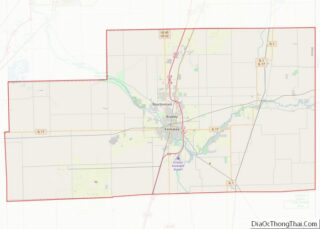
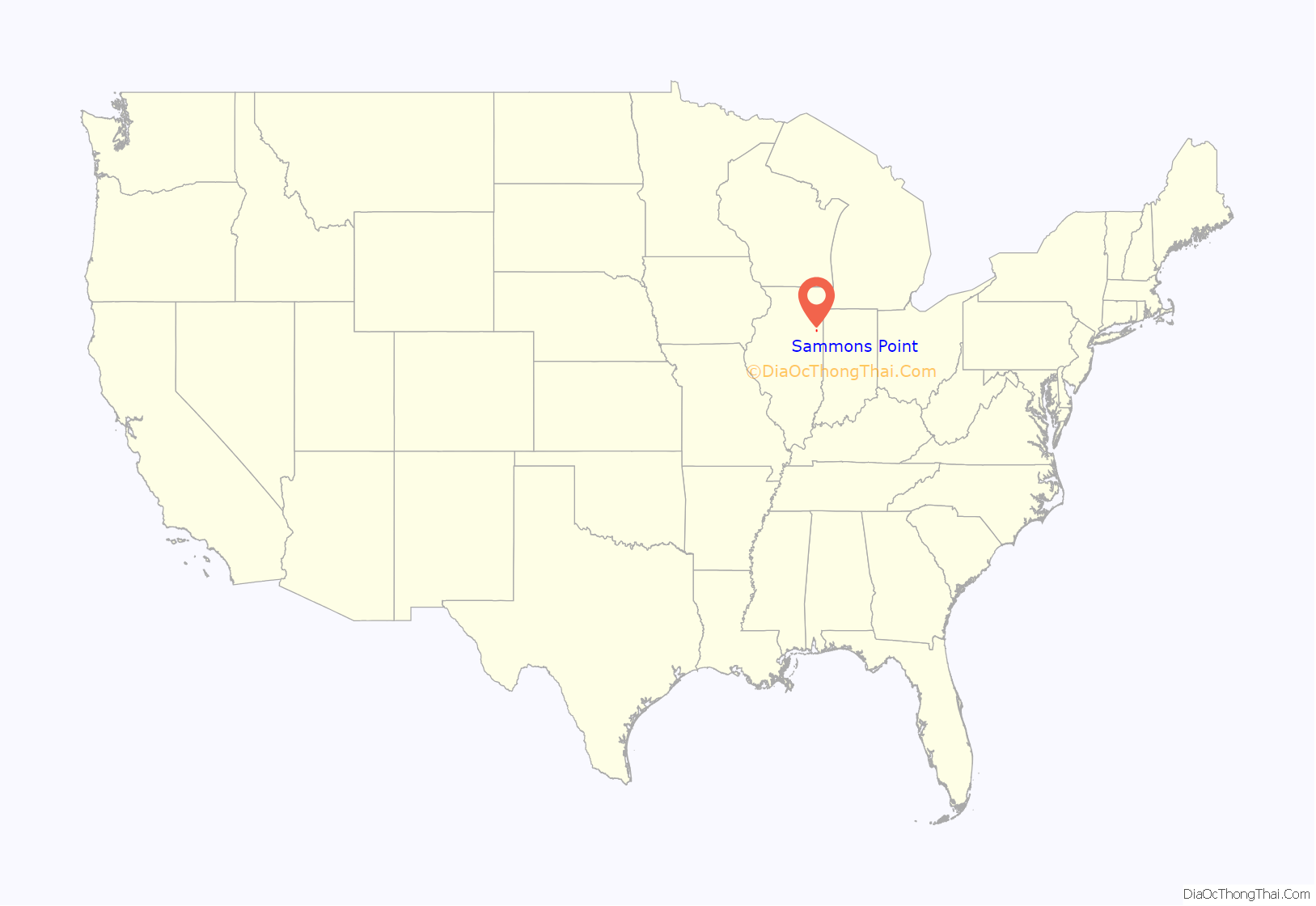
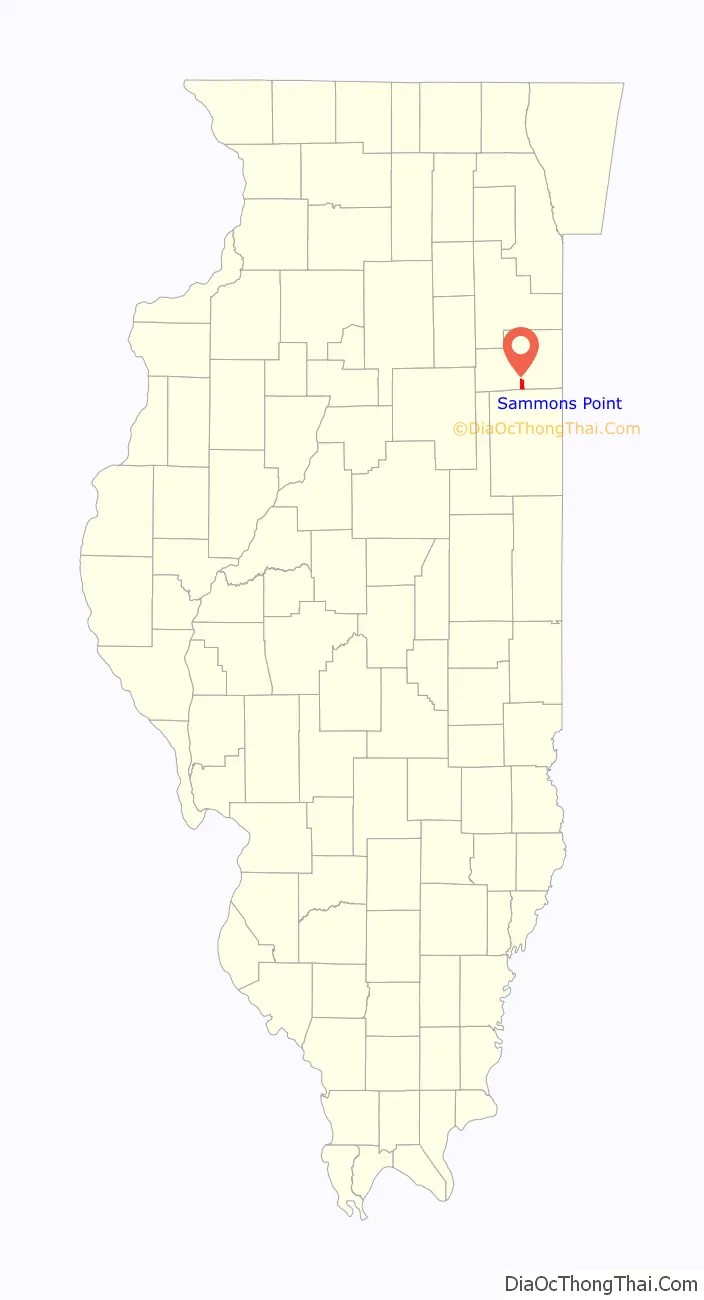
Sammons Point location map. Where is Sammons Point village?
History
Failed incorporation
Sammons Point was first created in an effort to fend off the proposed expansion of the Waste Management Corporation’s landfill. In March 2006, an incorporation election took place, with 82 people (66.7%) voting in favor of the measure and 41 (33.3%) voting against.
Waste Management, which owned land within the new village, wanted all of their land to be unincorporated and under the jurisdiction of the Kankakee County Board instead of Sammons Point. They challenged the validity of the election in court, claiming that its organizers had not followed proper procedures when presenting their original incorporation petitions. The Circuit Court sided with Sammons Point, but Waste Management prevailed in a June 2007 appeal to the Third Appellate Court in Ottawa. A bid by the village for new hearing on the case was denied on August 8, 2007, and Sammons Point was formally disbanded on September 13.
Successful incorporation
Soon after, efforts to reincorporate the community were revived. A new incorporation election was held on February 5, 2008, with 87 votes (57.2%) cast in favor of reestablishing the village and 65 (42.8%) opposed. Approximately 76 percent of eligible voters participated in the election.
At the November 2016 general election, Sammons Point held a referendum to dissolve, but the referendum was defeated, 30 to 127.
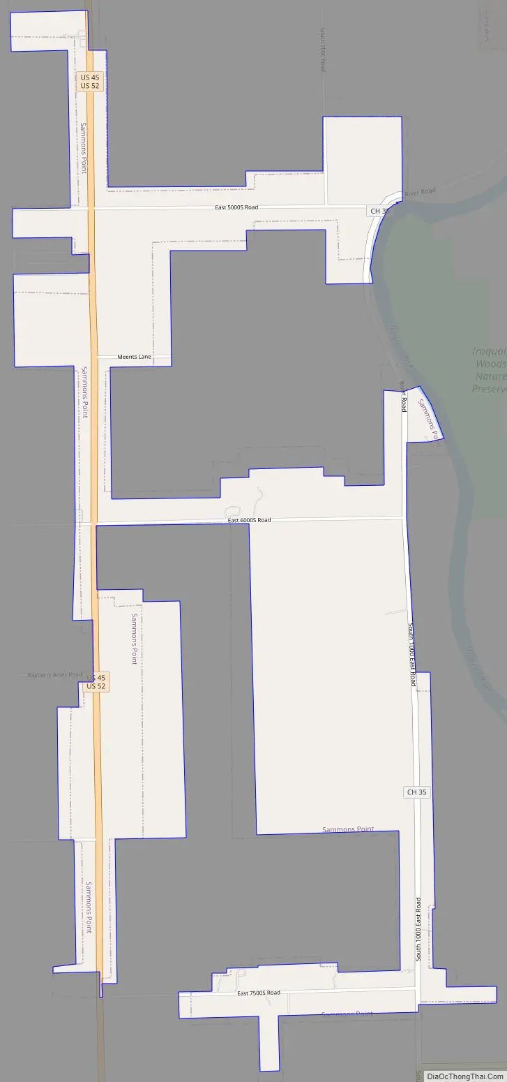
Sammons Point Road Map
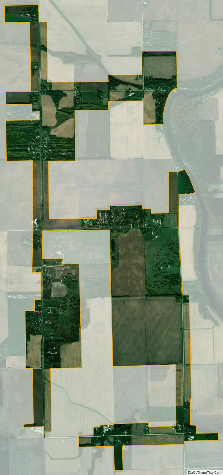
Sammons Point city Satellite Map
Geography
Sammons Point is in south-central Kankakee County, along U.S. Routes 45 and 52, 6 miles (10 km) south of Kankakee, the county seat, and 4 miles (6 km) northeast of Chebanse. It is bounded on the northeast by the Iroquois River, a north-flowing tributary of the Kankakee River. According to the 2010 census, Sammons Point has a total area of 1.82 square miles (4.71 km), all land.
See also
Map of Illinois State and its subdivision:- Adams
- Alexander
- Bond
- Boone
- Brown
- Bureau
- Calhoun
- Carroll
- Cass
- Champaign
- Christian
- Clark
- Clay
- Clinton
- Coles
- Cook
- Crawford
- Cumberland
- De Kalb
- De Witt
- Douglas
- Dupage
- Edgar
- Edwards
- Effingham
- Fayette
- Ford
- Franklin
- Fulton
- Gallatin
- Greene
- Grundy
- Hamilton
- Hancock
- Hardin
- Henderson
- Henry
- Iroquois
- Jackson
- Jasper
- Jefferson
- Jersey
- Jo Daviess
- Johnson
- Kane
- Kankakee
- Kendall
- Knox
- La Salle
- Lake
- Lake Michigan
- Lawrence
- Lee
- Livingston
- Logan
- Macon
- Macoupin
- Madison
- Marion
- Marshall
- Mason
- Massac
- McDonough
- McHenry
- McLean
- Menard
- Mercer
- Monroe
- Montgomery
- Morgan
- Moultrie
- Ogle
- Peoria
- Perry
- Piatt
- Pike
- Pope
- Pulaski
- Putnam
- Randolph
- Richland
- Rock Island
- Saint Clair
- Saline
- Sangamon
- Schuyler
- Scott
- Shelby
- Stark
- Stephenson
- Tazewell
- Union
- Vermilion
- Wabash
- Warren
- Washington
- Wayne
- White
- Whiteside
- Will
- Williamson
- Winnebago
- Woodford
- Alabama
- Alaska
- Arizona
- Arkansas
- California
- Colorado
- Connecticut
- Delaware
- District of Columbia
- Florida
- Georgia
- Hawaii
- Idaho
- Illinois
- Indiana
- Iowa
- Kansas
- Kentucky
- Louisiana
- Maine
- Maryland
- Massachusetts
- Michigan
- Minnesota
- Mississippi
- Missouri
- Montana
- Nebraska
- Nevada
- New Hampshire
- New Jersey
- New Mexico
- New York
- North Carolina
- North Dakota
- Ohio
- Oklahoma
- Oregon
- Pennsylvania
- Rhode Island
- South Carolina
- South Dakota
- Tennessee
- Texas
- Utah
- Vermont
- Virginia
- Washington
- West Virginia
- Wisconsin
- Wyoming