Saybrook is a village in McLean County, Illinois, United States. The population was 654 at the 2020 census. It is part of the Bloomington–Normal Metropolitan Statistical Area.
Known by locals as the “City of Shade and Water”, it is believed to be named in honor of Old Saybrook, Connecticut.
| Name: | Saybrook village |
|---|---|
| LSAD Code: | 47 |
| LSAD Description: | village (suffix) |
| State: | Illinois |
| County: | McLean County |
| Elevation: | 807 ft (246 m) |
| Total Area: | 0.83 sq mi (2.15 km²) |
| Land Area: | 0.80 sq mi (2.08 km²) |
| Water Area: | 0.03 sq mi (0.07 km²) |
| Total Population: | 654 |
| Population Density: | 815.46/sq mi (314.94/km²) |
| ZIP code: | 61770 |
| Area code: | 309 |
| FIPS code: | 1767912 |
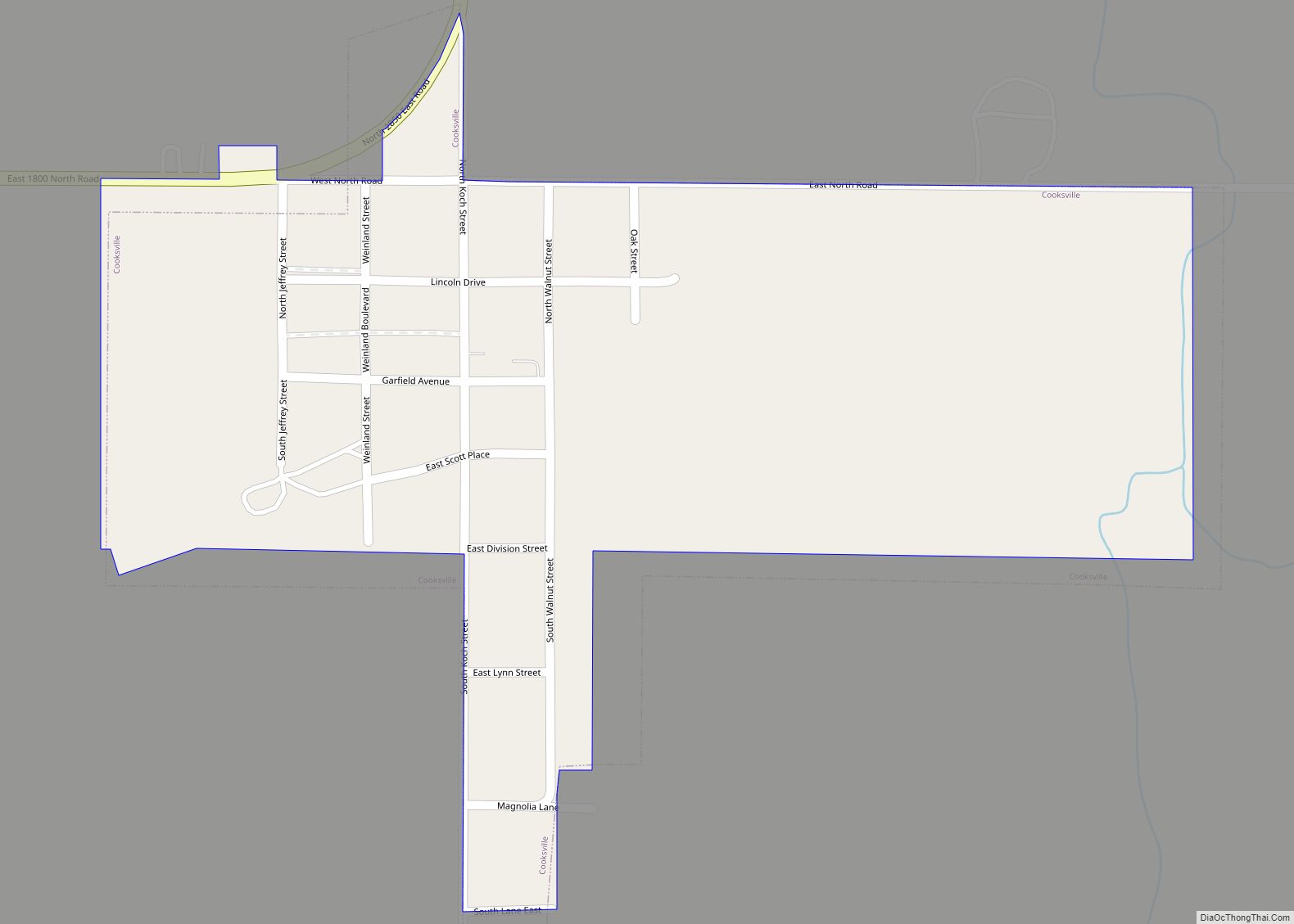
Online Interactive Map
Click on ![]() to view map in "full screen" mode.
to view map in "full screen" mode.
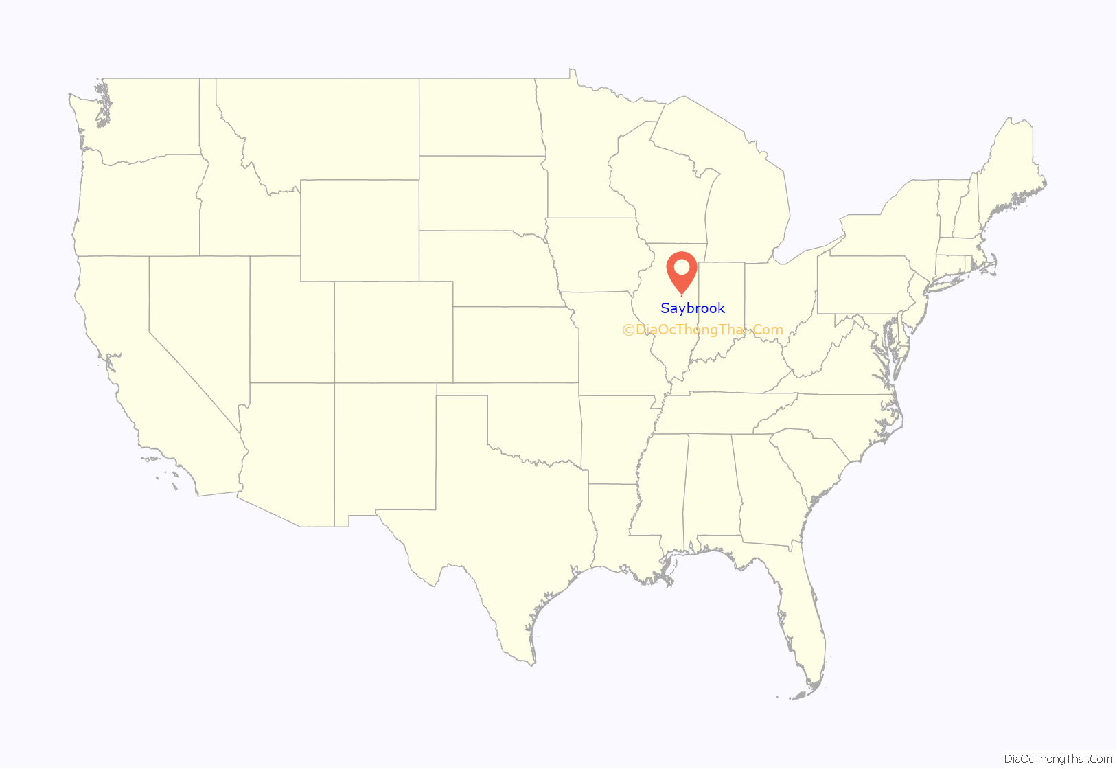
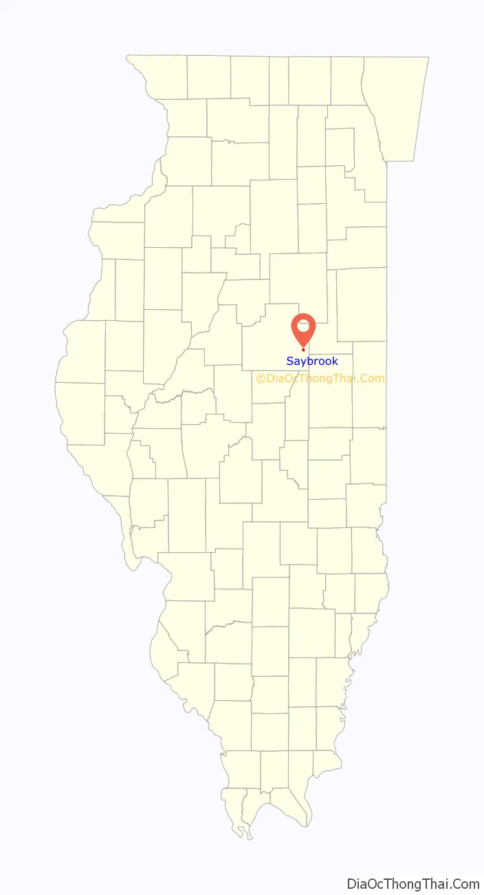
Saybrook location map. Where is Saybrook village?
History
Founding
Saybrook was laid out March 4, 1856, by Isaac M. Polk (c.1814–?). Little is known about Polk as he was born in Indiana and did not live in McLean County for very long. In 1860 and 1870, he was in neighboring Livingston County.
Before Polk, Jonathan Cheney came to the area in 1825 and built a cabin across the river from what is present-day Saybrook. Then, in 1833, Robert Cunningham built a water-driven mill on the Sangamon, which was later replaced by a steam-driven mill. By 1857, the town consisted of a saw mill, a blacksmith shop, a carpenter shop, one store, and eight dwellings. The woodland along the Sangamon, which became known as Cheney’s Grove, attracted early settlers. The township in which the town was situated took its name from the woodland and was called Cheney’s Grove. The name “Saybrook” was adopted in 1865, likely by settlers who came from Old Saybrook, Connecticut.
The town of Saybrook was incorporated May 29, 1866.
Original town plan and development
The original town of Saybrook was one of the smallest in McLean County. It consisted of a simple square of four blocks, each containing eight lots. This original plat was laid out over a series of road and lot lines that were aligned at roughly 45 degrees to the first official town plat. Several old lines, shown in dashed markings, can be seen on the 1856 plat. The original town had no square or other distinguishing features. Lore says its indistinction was to make the town look as large as possible to railroad promoters, but this seems unlikely as Saybrook (and thus its physical properties) was well known to many of the men associated with the founding of the railroad. In 1866, the town council laid out a large addition north and east of town.
Bending the railroad
One thing evident to the citizens of the fledgling town: it would only flourish if a railroad could be attracted. The most likely railroad was the one which would later become the Lake Erie and Western. It would be built to run due east from Bloomington to Paxton in neighboring Ford County and, because of this, would probably miss Saybrook by several miles. At this point, three Cheney brothers, sons of Jonathan Cheney, entered the picture. Haines Cheney, then in the Illinois Senate, had arranged for the charter of the road. To fund the railroad, local towns and townships would issue bonds, which the taxpayers would eventually retire. Two other Cheney brothers, Jonathan H. Cheney and William H. Cheney – who was the second largest landowner in Cheney’s Grove Township – became members of the railroad’s board of directors. William H. Riggs, the supervisor of Cheney’s Grove Township, was also on the board. Cheney’s Grove Township voted to fund $50,000 in bonds, and the town of Saybrook added an additional $10,000 in bonds. With this kind of backing, the route of the road was deflected and it passed through the town. In November 1871, when the tracks reached the village limits of Saybrook, a great celebration was held. A bottle of champagne was produced, but rather than smash the bottle, the thrifty reception committee simply knocked off its neck so the contents could be consumed later. The new Christian church in Saybrook invited visitors from Bloomington to attend their first service and announced that there would be a special train “on our railroad”.
After the railroad
Once the railroad was established in 1870, Saybrook grew rapidly and soon became the largest grain shipping point in eastern McLean County. A depot with depot grounds was established just south of the original town. The railroad goes over the Sangamon River. In 1870, Thomas Holloway built the large brick Union House Hotel. In 1872, a newspaper was established. There was a boom in the construction of houses and stores. By 1900 there were 879 people in the town. In the twentieth century, the population of Saybrook declined by about fifteen percent. By 2000 Saybrook was smaller than it had been a century before.
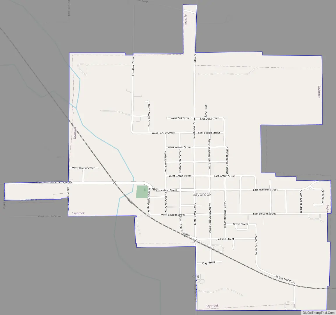
Saybrook Road Map
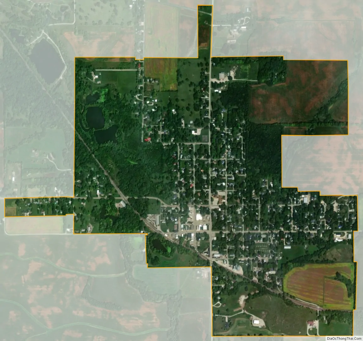
Saybrook city Satellite Map
Geography
Saybrook is in southeastern McLean County, 27 miles (43 km) east of Bloomington, the county seat; 15 miles (24 km) northeast of Farmer City; and 10 miles (16 km) southwest of Gibson City.
According to the U.S. Census Bureau, Saybrook has a total area of 0.83 square miles (2.15 km), of which 0.03 square miles (0.08 km), or 3.49%, are water. The Sangamon River, at this point the size of a small creek, flows southeasterly through the southwest part of the village. Saybrook is the uppermost community on the Sangamon.
See also
Map of Illinois State and its subdivision:- Adams
- Alexander
- Bond
- Boone
- Brown
- Bureau
- Calhoun
- Carroll
- Cass
- Champaign
- Christian
- Clark
- Clay
- Clinton
- Coles
- Cook
- Crawford
- Cumberland
- De Kalb
- De Witt
- Douglas
- Dupage
- Edgar
- Edwards
- Effingham
- Fayette
- Ford
- Franklin
- Fulton
- Gallatin
- Greene
- Grundy
- Hamilton
- Hancock
- Hardin
- Henderson
- Henry
- Iroquois
- Jackson
- Jasper
- Jefferson
- Jersey
- Jo Daviess
- Johnson
- Kane
- Kankakee
- Kendall
- Knox
- La Salle
- Lake
- Lake Michigan
- Lawrence
- Lee
- Livingston
- Logan
- Macon
- Macoupin
- Madison
- Marion
- Marshall
- Mason
- Massac
- McDonough
- McHenry
- McLean
- Menard
- Mercer
- Monroe
- Montgomery
- Morgan
- Moultrie
- Ogle
- Peoria
- Perry
- Piatt
- Pike
- Pope
- Pulaski
- Putnam
- Randolph
- Richland
- Rock Island
- Saint Clair
- Saline
- Sangamon
- Schuyler
- Scott
- Shelby
- Stark
- Stephenson
- Tazewell
- Union
- Vermilion
- Wabash
- Warren
- Washington
- Wayne
- White
- Whiteside
- Will
- Williamson
- Winnebago
- Woodford
- Alabama
- Alaska
- Arizona
- Arkansas
- California
- Colorado
- Connecticut
- Delaware
- District of Columbia
- Florida
- Georgia
- Hawaii
- Idaho
- Illinois
- Indiana
- Iowa
- Kansas
- Kentucky
- Louisiana
- Maine
- Maryland
- Massachusetts
- Michigan
- Minnesota
- Mississippi
- Missouri
- Montana
- Nebraska
- Nevada
- New Hampshire
- New Jersey
- New Mexico
- New York
- North Carolina
- North Dakota
- Ohio
- Oklahoma
- Oregon
- Pennsylvania
- Rhode Island
- South Carolina
- South Dakota
- Tennessee
- Texas
- Utah
- Vermont
- Virginia
- Washington
- West Virginia
- Wisconsin
- Wyoming