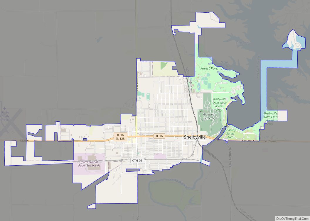
Shelbyville is a city in and the county seat of Shelby County, Illinois, United States, along the Kaskaskia River. As of the 2020 census, the population was at 4,674. HSHS Good Shepherd Hospital, located in town, is the county’s only hospital. Shelbyville is also home to Chautauqua Auditorium.
| Name: | Shelbyville city |
|---|---|
| LSAD Code: | 25 |
| LSAD Description: | city (suffix) |
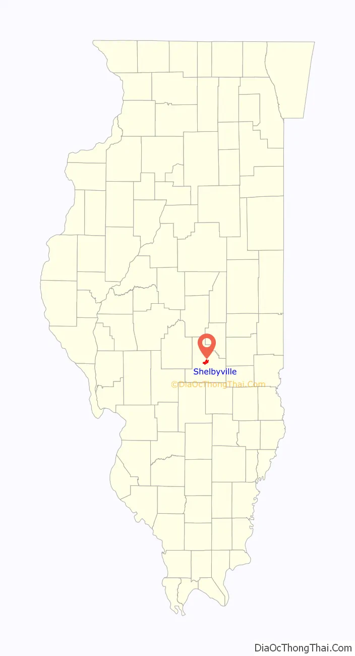
| State: | Illinois |
| County: | Shelby County |
| Elevation: | 624 ft (190 m) |
| Total Area: | 4.26 sq mi (11.05 km²) |
| Land Area: | 4.08 sq mi (10.56 km²) |
| Water Area: | 0.19 sq mi (0.48 km²) |
| Total Population: | 4,674 |
| Population Density: | 1,145.87/sq mi (442.42/km²) |
| Area code: | 217 |
| FIPS code: | 1769186 |
| Website: | www.shelbyvilleillinois.net |
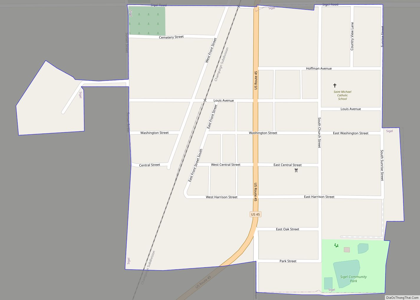
Online Interactive Map
Click on ![]() to view map in "full screen" mode.
to view map in "full screen" mode.
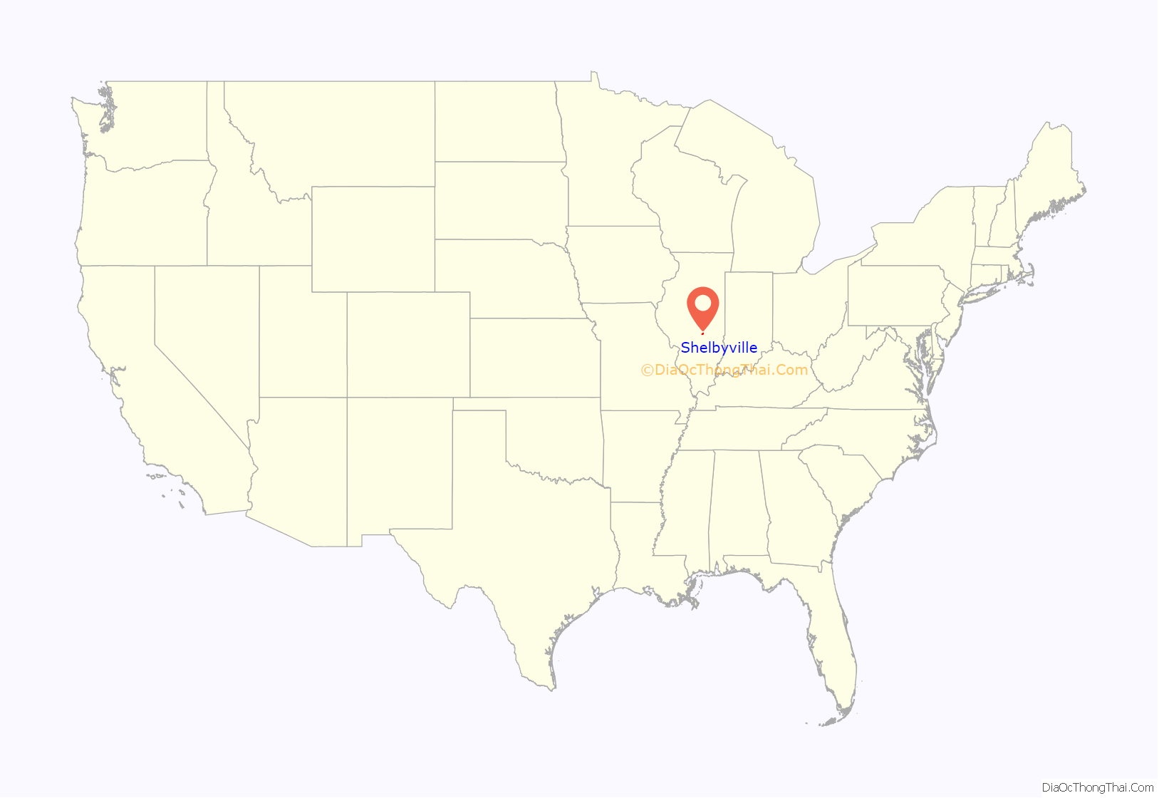
Shelbyville location map. Where is Shelbyville city?
History
Shelbyville is the home of Josephine Garis Cochran who invented one of the first mechanical dishwashers ever built in 1886. It was exhibited at the 1893 Chicago Columbian Exposition, where it won “the highest award.” Another Shelbyville invention, the first commercial pick-up baler, was designed and developed by Raymore McDonald, as conceived and financed by Horace M. Tallman and his two sons, Leslie and Gentry. These balers were marketed for many years by the Ann Arbor Machine Company of Shelbyville. This concept of field processing of farm forages made a significant contribution to the efficiency and economy of harvesting in the world’s agriculture. This basic field pick-up mechanism has been used in over 15 million balers. The American Society of Agricultural and Biological Engineers designated Shelbyville as an historical landmark of agricultural engineering, of which there are only 47 in the entire United States. Mr. Tallman’s home has been restored and is on the National Register of Historic Places. Located on West Main Street, the Tallman home is currently part of the Shelby Inn.
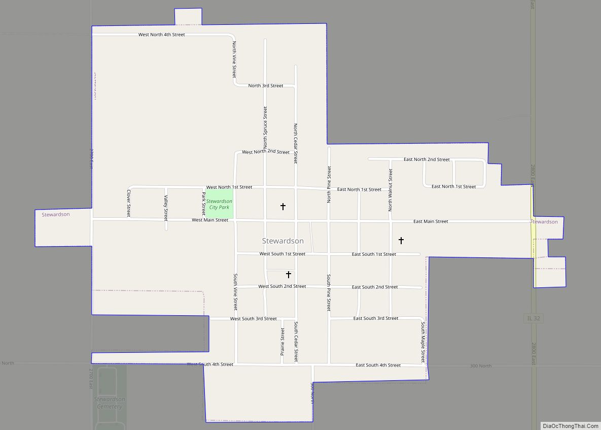
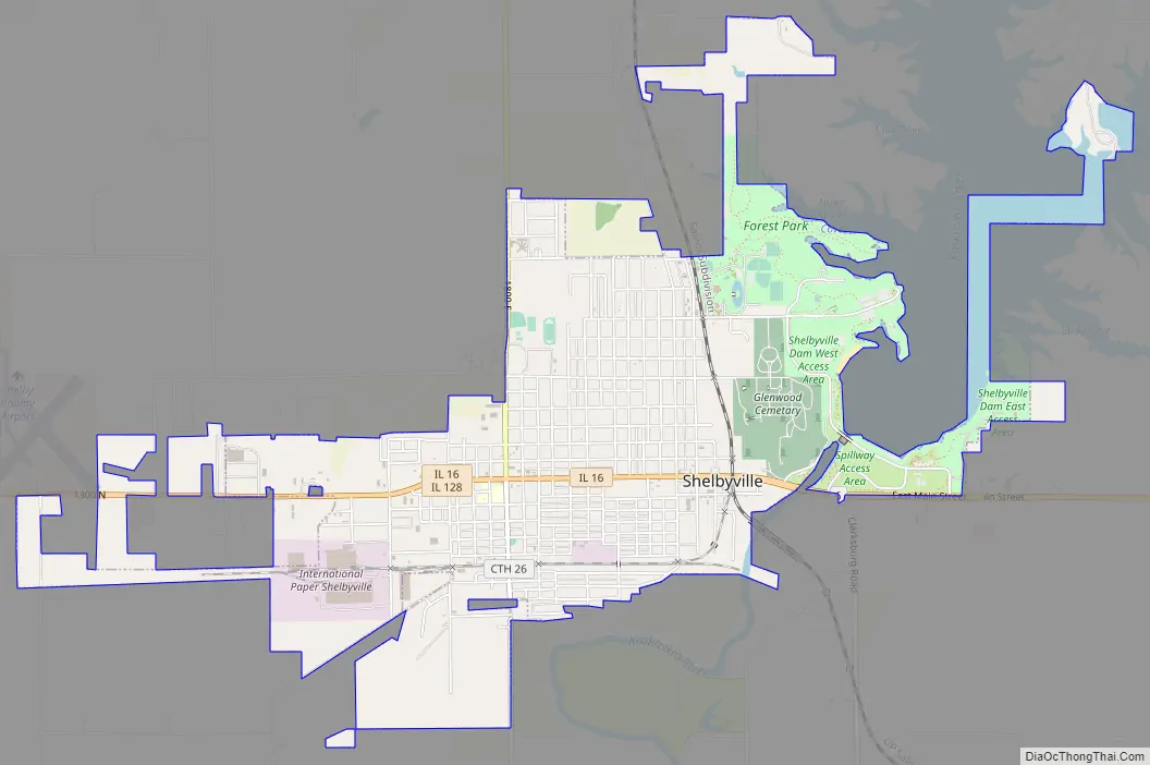
Shelbyville Road Map
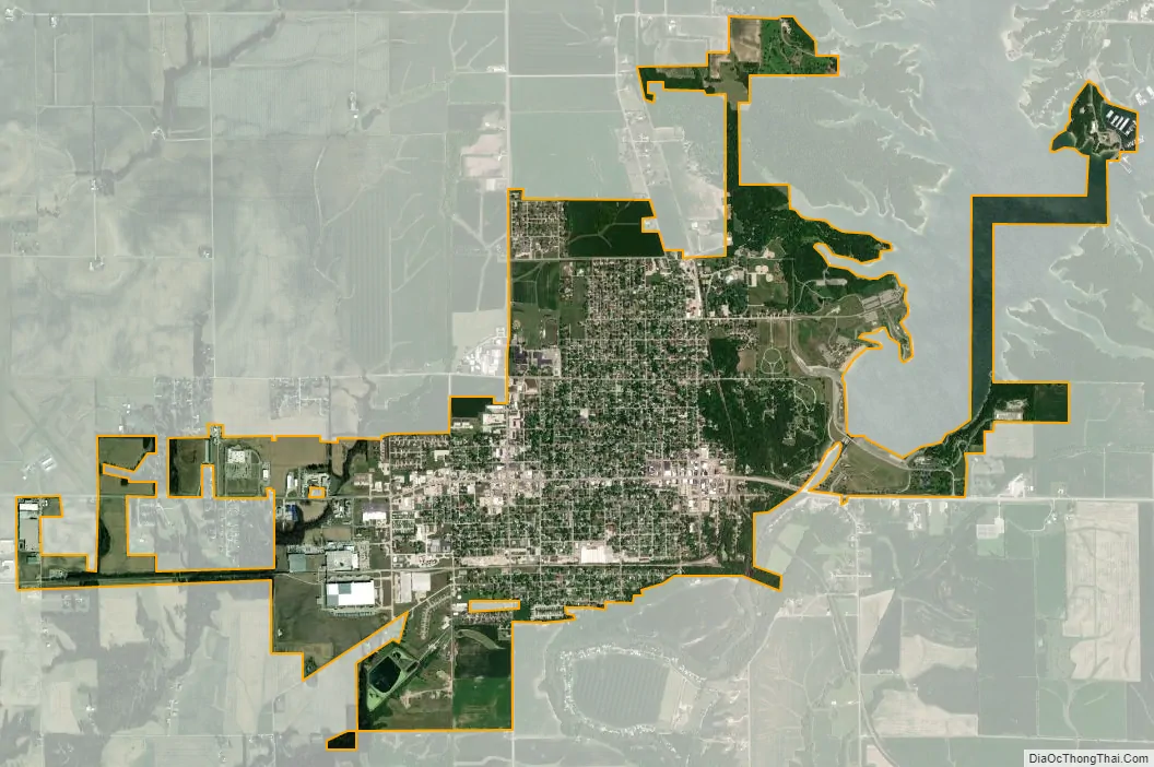
Shelbyville city Satellite Map
Geography
Shelbyville is located at 39°24′29″N 88°47′59″W / 39.40806°N 88.79972°W / 39.40806; -88.79972 (39.408142, -88.799730).
According to the 2010 census, Shelbyville has a total area of 4.016 square miles (10.40 km), of which 3.83 square miles (9.92 km) (or 95.37%) is land and 0.186 square miles (0.48 km) (or 4.63%) is water.
Shelbyville was founded in 1827 and named in honor of Isaac Shelby, hero of the Revolutionary War and Governor of Kentucky. The history of Shelbyville begins with Barnett Bone, a Tennessean who, in 1835, built a log cabin along the Kaskaskia River. His cabin eventually became the county courthouse. The first businesses were blacksmith shops, a general store and stage coach stop, and a grist mill.
The terminal moraine of the Wisconsin Glacier is located near Shelbyville. This is referred to as the Shelbyville Moraine.
Climate
See also
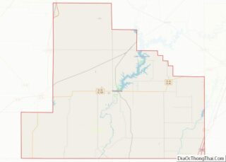
Map of Illinois State and its subdivision:- Adams
- Alexander
- Bond
- Boone
- Brown
- Bureau
- Calhoun
- Carroll
- Cass
- Champaign
- Christian
- Clark
- Clay
- Clinton
- Coles
- Cook
- Crawford
- Cumberland
- De Kalb
- De Witt
- Douglas
- Dupage
- Edgar
- Edwards
- Effingham
- Fayette
- Ford
- Franklin
- Fulton
- Gallatin
- Greene
- Grundy
- Hamilton
- Hancock
- Hardin
- Henderson
- Henry
- Iroquois
- Jackson
- Jasper
- Jefferson
- Jersey
- Jo Daviess
- Johnson
- Kane
- Kankakee
- Kendall
- Knox
- La Salle
- Lake
- Lake Michigan
- Lawrence
- Lee
- Livingston
- Logan
- Macon
- Macoupin
- Madison
- Marion
- Marshall
- Mason
- Massac
- McDonough
- McHenry
- McLean
- Menard
- Mercer
- Monroe
- Montgomery
- Morgan
- Moultrie
- Ogle
- Peoria
- Perry
- Piatt
- Pike
- Pope
- Pulaski
- Putnam
- Randolph
- Richland
- Rock Island
- Saint Clair
- Saline
- Sangamon
- Schuyler
- Scott
- Shelby
- Stark
- Stephenson
- Tazewell
- Union
- Vermilion
- Wabash
- Warren
- Washington
- Wayne
- White
- Whiteside
- Will
- Williamson
- Winnebago
- Woodford
- Alabama
- Alaska
- Arizona
- Arkansas
- California
- Colorado
- Connecticut
- Delaware
- District of Columbia
- Florida
- Georgia
- Hawaii
- Idaho
- Illinois
- Indiana
- Iowa
- Kansas
- Kentucky
- Louisiana
- Maine
- Maryland
- Massachusetts
- Michigan
- Minnesota
- Mississippi
- Missouri
- Montana
- Nebraska
- Nevada
- New Hampshire
- New Jersey
- New Mexico
- New York
- North Carolina
- North Dakota
- Ohio
- Oklahoma
- Oregon
- Pennsylvania
- Rhode Island
- South Carolina
- South Dakota
- Tennessee
- Texas
- Utah
- Vermont
- Virginia
- Washington
- West Virginia
- Wisconsin
- Wyoming