Sleepy Hollow is a village in Kane County, Illinois, United States. The population was 3,214 at the 2020 census.
| Name: | Sleepy Hollow village |
|---|---|
| LSAD Code: | 47 |
| LSAD Description: | village (suffix) |
| State: | Illinois |
| County: | Kane County |
| Total Area: | 2.04 sq mi (5.29 km²) |
| Land Area: | 2.02 sq mi (5.23 km²) |
| Water Area: | 0.02 sq mi (0.06 km²) |
| Total Population: | 3,214 |
| Population Density: | 1,591.88/sq mi (614.61/km²) |
| ZIP code: | 60118 |
| Area code: | 847 & 224 |
| FIPS code: | 1770161 |
| Website: | www.sleepyhollowil.org |
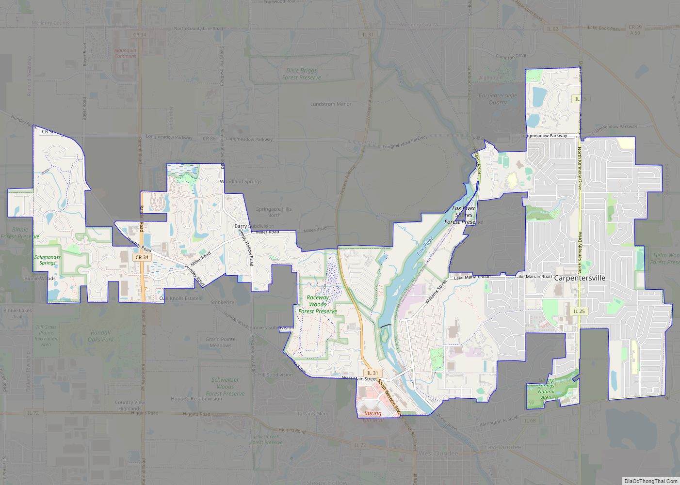
Online Interactive Map
Click on ![]() to view map in "full screen" mode.
to view map in "full screen" mode.
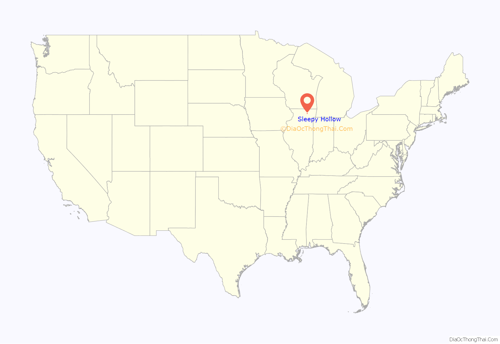
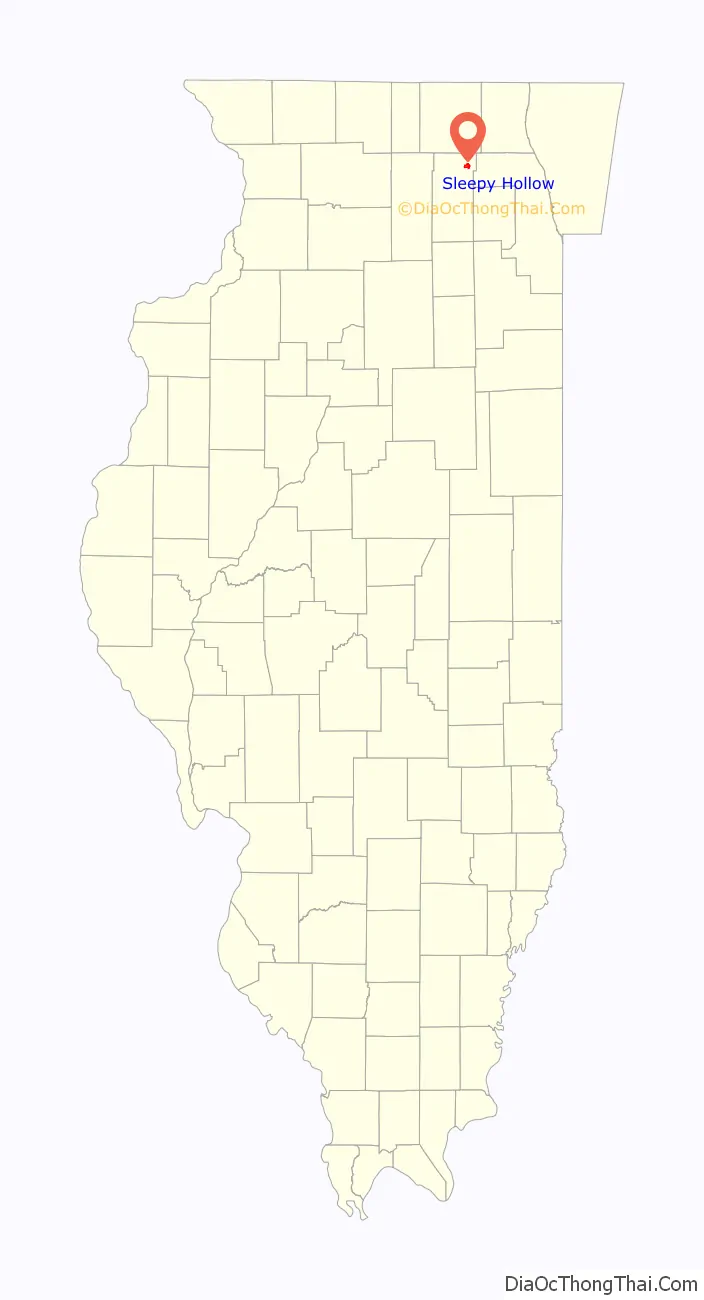
Sleepy Hollow location map. Where is Sleepy Hollow village?
History
The village is on the site of Sleepy Hollow Farm, which was owned by the late J. H. McNabb, board chairman of Bell and Howell Company. McNabb’s heirs sold the farm to Mr. and Mrs. Jack Polivka, who sold it in turn to Floyd T. Falese in 1953. Falese retained the services of a prominent planner and landscape architect, Raymond W. Hazekamp, who laid out a pattern of meandering roads, without curbs or sidewalks, that wound into curvilinear cul-de-sacs, avoiding the destruction of a single tree. This design retained the rural charm and natural contours of the farm and avoided taking down any existing trees.
Falese developed lakes in Sleepy Hollow from existing springs and stocked them with fish. Lake Paula and Lake Sharon were the first ones completed, with Lake Ichabod dug in 1962. Falese created Lake Legend and Lake Jacqueline in 1967. The village now owns and maintains several of the lakes. Early residents of the village could keep horses on their property, with outlots used as bridle paths.
The designs were carefully selected to enhance what Falese called “the Sleepy Hollow concept of good living”. Falese encouraged multiple builders and custom-built homes within the community. In the 1960s many of the homes were prefabricated Scholz Design Homes constructed by the Mark 60 Corporation.
Falese marketed lots in the unincorporated subdivision called “Sleepy Hollow Manor”. In 1958, the residents voted to incorporate Sleepy Hollow as a separate village rather than being annexed to West Dundee. In 1958, the Faleses purchased the Petitti farm, and in 1961 the Winmoor and Whitney farms added to the family holdings. By 1960, Sleepy Hollow’s population was 311. By 1970, it had grown to 1,729. The only commercial activity was the Sleepy Hollow Resort Motel (later renamed the Chateau Louise) and Crichton’s Super Mart. In 1966, the Glen Oak Country Club was opened as a member-supported outdoor pool facility (which was later transferred to the Dundee Township Park District.) Later, the Sleepy Hollow Elementary School was opened adjacent to the pool.
The Sleepy Hollow population continued to increase through the 1980s and 1990s as the remaining lots in Falese’s original subdivision were developed and as three other adjacent subdivisions were annexed: Saddle Club Estates, and Surrey Ridge and the Bluffs. Sleepy Hollow’s ability to annex additional land to the west and south is limited by an agreement with the city of Elgin, which also provides for the city to supply water to the village.
Sleepy Hollow has had its own police force since the 1960s. For years, it was a one-man force: Larry Sabatino Jr., the second police chief. The village named a park in his memory. On March 9, 2014, the Sleepy Hollow police force had its first fatal shooting in a domestic disturbance case.
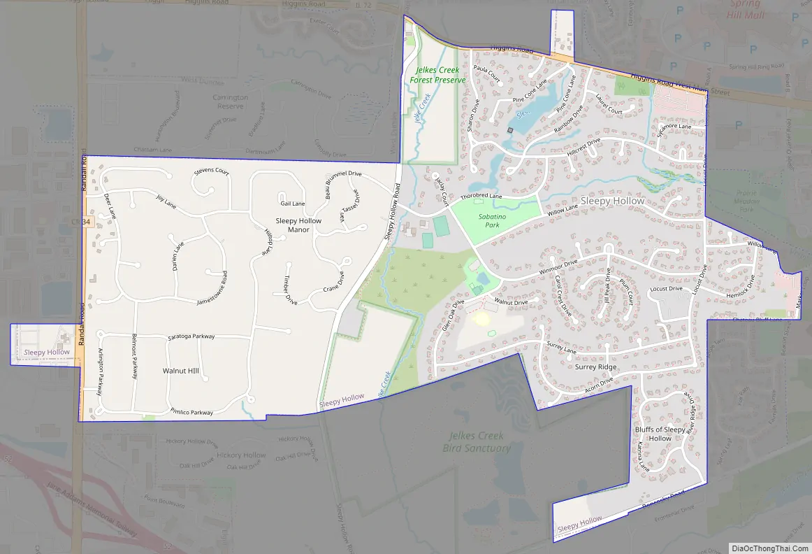
Sleepy Hollow Road Map
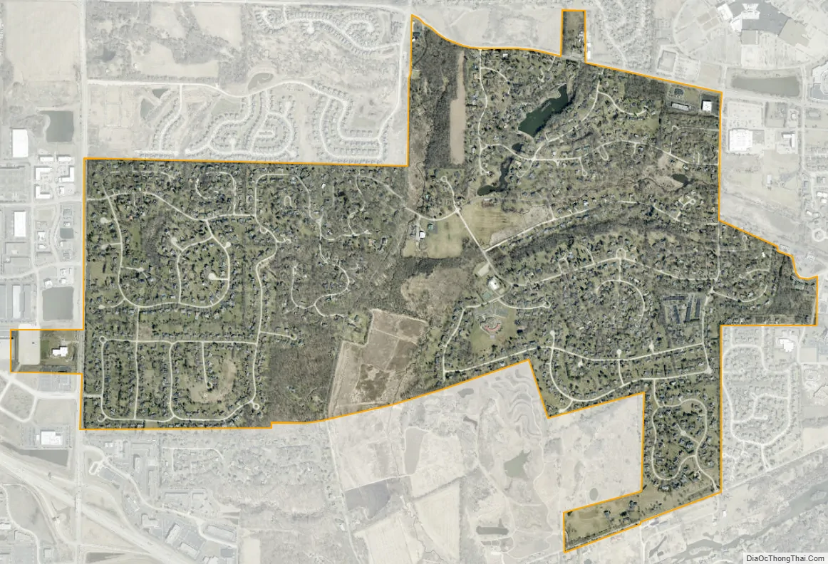
Sleepy Hollow city Satellite Map
Geography
Sleepy Hollow is located in northeastern Kane County at 42°5′27″N 88°18′44″W / 42.09083°N 88.31222°W / 42.09083; -88.31222 (42.090792, -88.312314). It is bordered to the north and east by the village of West Dundee and to the south and west by the city of Elgin.
According to the 2010 census, Sleepy Hollow has a total area of 2.026 square miles (5.25 km), of which 2 square miles (5.18 km) (or 98.72%) is land and 0.026 square miles (0.07 km) (or 1.28%) is water.
Sleepy Hollow is generally bounded by Randall Road to the west and Illinois Route 72 to the north. Illinois Route 31 runs east of the village limits, and Interstate 90 passes to the south.
See also
Map of Illinois State and its subdivision:- Adams
- Alexander
- Bond
- Boone
- Brown
- Bureau
- Calhoun
- Carroll
- Cass
- Champaign
- Christian
- Clark
- Clay
- Clinton
- Coles
- Cook
- Crawford
- Cumberland
- De Kalb
- De Witt
- Douglas
- Dupage
- Edgar
- Edwards
- Effingham
- Fayette
- Ford
- Franklin
- Fulton
- Gallatin
- Greene
- Grundy
- Hamilton
- Hancock
- Hardin
- Henderson
- Henry
- Iroquois
- Jackson
- Jasper
- Jefferson
- Jersey
- Jo Daviess
- Johnson
- Kane
- Kankakee
- Kendall
- Knox
- La Salle
- Lake
- Lake Michigan
- Lawrence
- Lee
- Livingston
- Logan
- Macon
- Macoupin
- Madison
- Marion
- Marshall
- Mason
- Massac
- McDonough
- McHenry
- McLean
- Menard
- Mercer
- Monroe
- Montgomery
- Morgan
- Moultrie
- Ogle
- Peoria
- Perry
- Piatt
- Pike
- Pope
- Pulaski
- Putnam
- Randolph
- Richland
- Rock Island
- Saint Clair
- Saline
- Sangamon
- Schuyler
- Scott
- Shelby
- Stark
- Stephenson
- Tazewell
- Union
- Vermilion
- Wabash
- Warren
- Washington
- Wayne
- White
- Whiteside
- Will
- Williamson
- Winnebago
- Woodford
- Alabama
- Alaska
- Arizona
- Arkansas
- California
- Colorado
- Connecticut
- Delaware
- District of Columbia
- Florida
- Georgia
- Hawaii
- Idaho
- Illinois
- Indiana
- Iowa
- Kansas
- Kentucky
- Louisiana
- Maine
- Maryland
- Massachusetts
- Michigan
- Minnesota
- Mississippi
- Missouri
- Montana
- Nebraska
- Nevada
- New Hampshire
- New Jersey
- New Mexico
- New York
- North Carolina
- North Dakota
- Ohio
- Oklahoma
- Oregon
- Pennsylvania
- Rhode Island
- South Carolina
- South Dakota
- Tennessee
- Texas
- Utah
- Vermont
- Virginia
- Washington
- West Virginia
- Wisconsin
- Wyoming