St. Anne (sometimes spelled Saint Anne) is a village in Kankakee County, Illinois, United States. The population was 1,161 at the 2020 census. It is part of the Kankakee–Bourbonnais–Bradley Metropolitan Statistical Area. It was founded in 1851 by Charles Chiniquy, a French-Canadian Roman Catholic priest and friend of the 16th U.S. President Abraham Lincoln who was excommunicated by the Roman Catholic Church in 1856. He later converted to Protestant Christianity, becoming a Presbyterian Evangelical minister and a well-known temperance activist in Canada and the United States.
| Name: | St. Anne village |
|---|---|
| LSAD Code: | 47 |
| LSAD Description: | village (suffix) |
| State: | Illinois |
| County: | Kankakee County |
| Elevation: | 664 ft (202 m) |
| Total Area: | 0.86 sq mi (2.23 km²) |
| Land Area: | 0.83 sq mi (2.15 km²) |
| Water Area: | 0.03 sq mi (0.08 km²) |
| Total Population: | 1,161 |
| Population Density: | 1,398.80/sq mi (539.81/km²) |
| ZIP code: | 60964 |
| FIPS code: | 1766638 |
| Website: | www.villageofstanne.com |
Online Interactive Map
Click on ![]() to view map in "full screen" mode.
to view map in "full screen" mode.
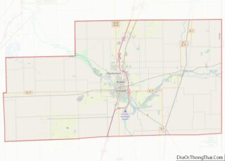
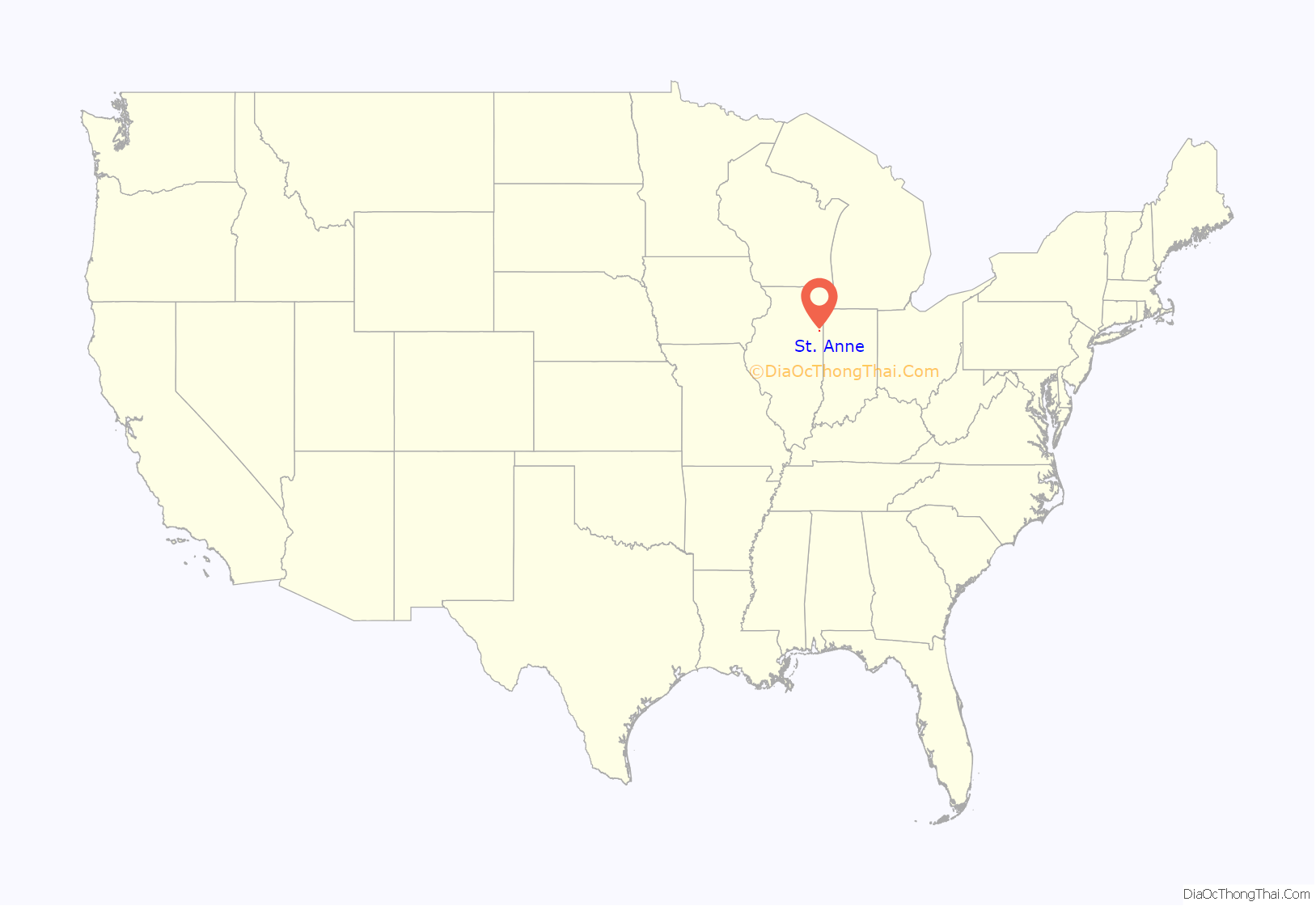
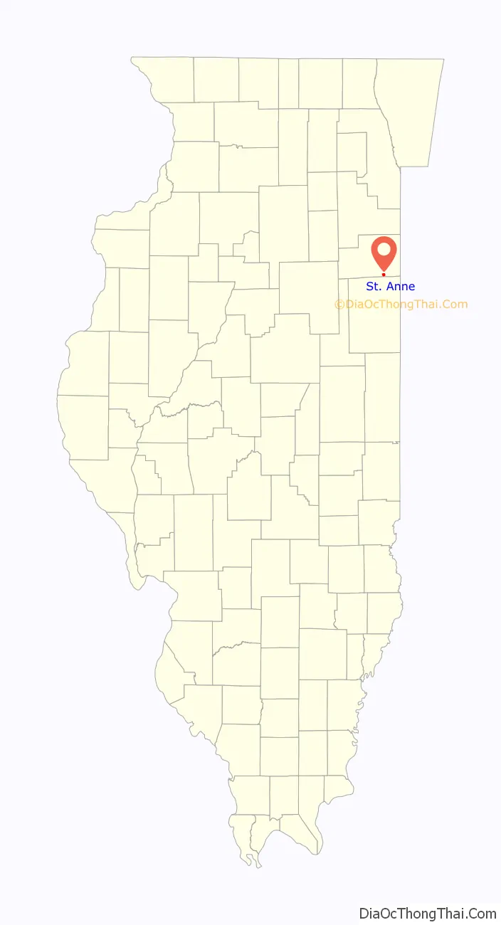
St. Anne location map. Where is St. Anne village?
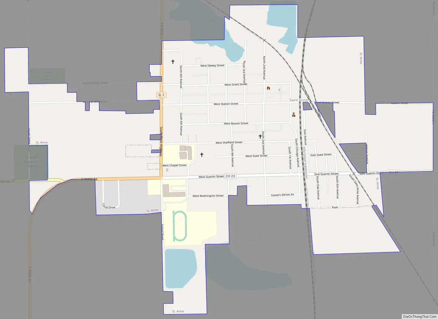
St. Anne Road Map
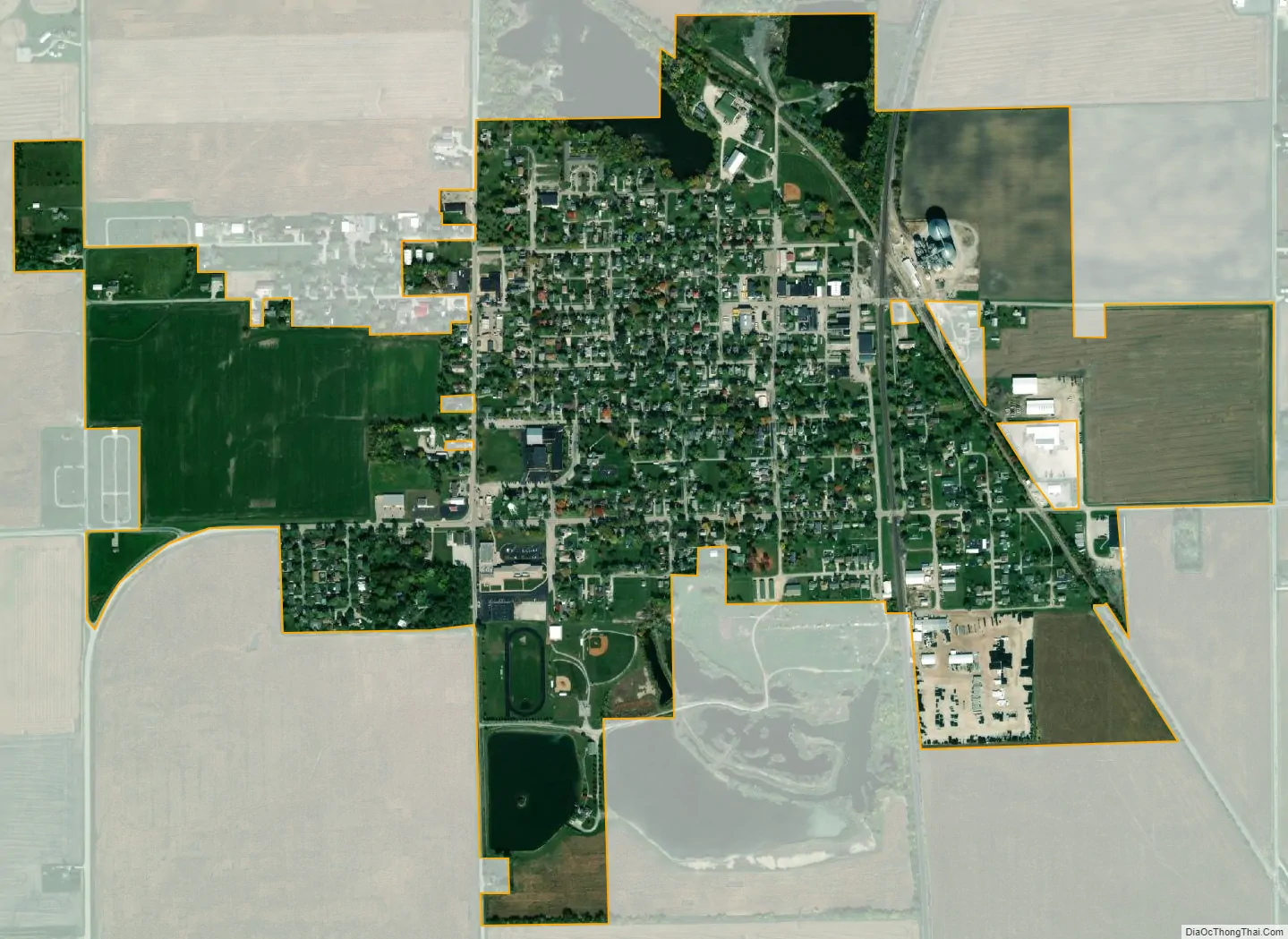
St. Anne city Satellite Map
Geography
St. Anne is located in southeastern Kankakee County at 41°1′24″N 87°43′1″W / 41.02333°N 87.71694°W / 41.02333; -87.71694 (41.023363, -87.717050). Illinois Route 1 passes through the west side of the village. It is 13 miles (21 km) southeast of Kankakee, the county seat, and 18 miles (29 km) north of Watseka.
According to the 2010 census, St. Anne has a total area of 0.793 square miles (2.05 km), of which 0.77 square miles (1.99 km) (or 97.1%) is land and 0.023 square miles (0.06 km) (or 2.9%) is water.
See also
Map of Illinois State and its subdivision:- Adams
- Alexander
- Bond
- Boone
- Brown
- Bureau
- Calhoun
- Carroll
- Cass
- Champaign
- Christian
- Clark
- Clay
- Clinton
- Coles
- Cook
- Crawford
- Cumberland
- De Kalb
- De Witt
- Douglas
- Dupage
- Edgar
- Edwards
- Effingham
- Fayette
- Ford
- Franklin
- Fulton
- Gallatin
- Greene
- Grundy
- Hamilton
- Hancock
- Hardin
- Henderson
- Henry
- Iroquois
- Jackson
- Jasper
- Jefferson
- Jersey
- Jo Daviess
- Johnson
- Kane
- Kankakee
- Kendall
- Knox
- La Salle
- Lake
- Lake Michigan
- Lawrence
- Lee
- Livingston
- Logan
- Macon
- Macoupin
- Madison
- Marion
- Marshall
- Mason
- Massac
- McDonough
- McHenry
- McLean
- Menard
- Mercer
- Monroe
- Montgomery
- Morgan
- Moultrie
- Ogle
- Peoria
- Perry
- Piatt
- Pike
- Pope
- Pulaski
- Putnam
- Randolph
- Richland
- Rock Island
- Saint Clair
- Saline
- Sangamon
- Schuyler
- Scott
- Shelby
- Stark
- Stephenson
- Tazewell
- Union
- Vermilion
- Wabash
- Warren
- Washington
- Wayne
- White
- Whiteside
- Will
- Williamson
- Winnebago
- Woodford
- Alabama
- Alaska
- Arizona
- Arkansas
- California
- Colorado
- Connecticut
- Delaware
- District of Columbia
- Florida
- Georgia
- Hawaii
- Idaho
- Illinois
- Indiana
- Iowa
- Kansas
- Kentucky
- Louisiana
- Maine
- Maryland
- Massachusetts
- Michigan
- Minnesota
- Mississippi
- Missouri
- Montana
- Nebraska
- Nevada
- New Hampshire
- New Jersey
- New Mexico
- New York
- North Carolina
- North Dakota
- Ohio
- Oklahoma
- Oregon
- Pennsylvania
- Rhode Island
- South Carolina
- South Dakota
- Tennessee
- Texas
- Utah
- Vermont
- Virginia
- Washington
- West Virginia
- Wisconsin
- Wyoming