Stanford is a village in McLean County, Illinois, United States. The population was 600 at the 2020 census. It is part of the Bloomington–Normal Metropolitan Statistical Area.
| Name: | Stanford village |
|---|---|
| LSAD Code: | 47 |
| LSAD Description: | village (suffix) |
| State: | Illinois |
| County: | McLean County |
| Elevation: | 673 ft (205 m) |
| Total Area: | 0.66 sq mi (1.71 km²) |
| Land Area: | 0.66 sq mi (1.71 km²) |
| Water Area: | 0.00 sq mi (0.00 km²) |
| Total Population: | 600 |
| Population Density: | 906.34/sq mi (349.98/km²) |
| ZIP code: | 61774 |
| Area code: | 309 |
| FIPS code: | 1772260 |
| Website: | https://www.stanford-il.org/ |
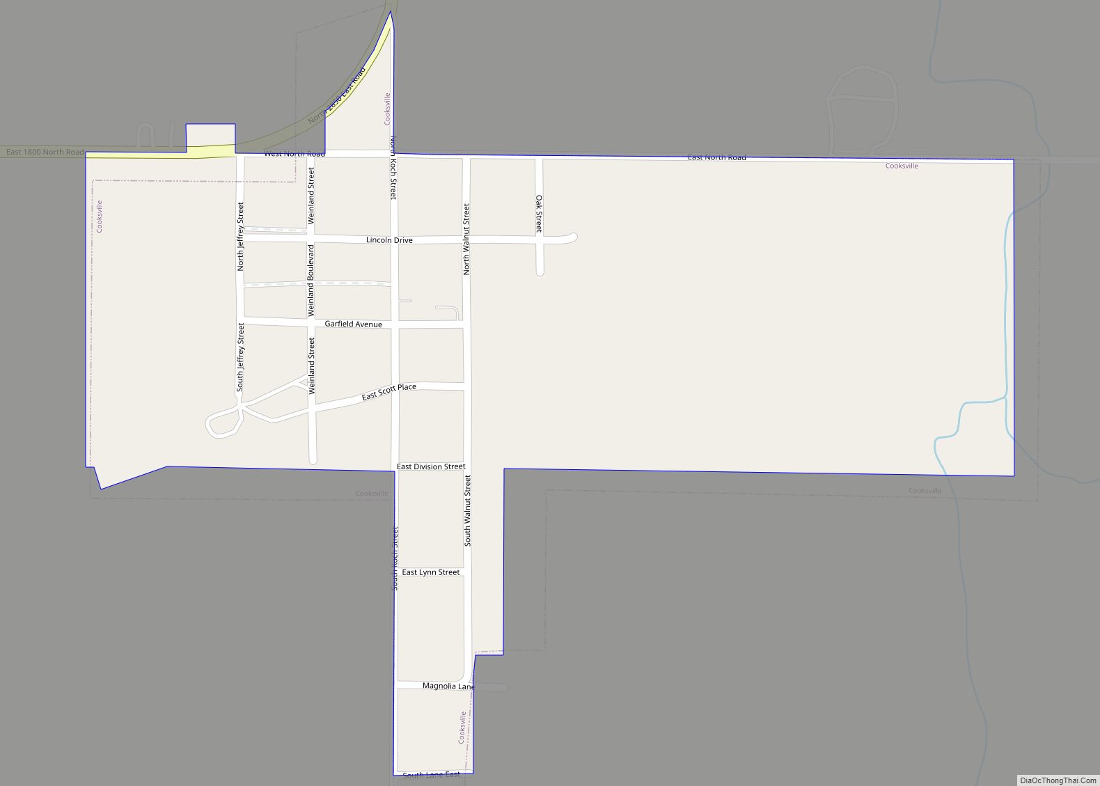
Online Interactive Map
Click on ![]() to view map in "full screen" mode.
to view map in "full screen" mode.
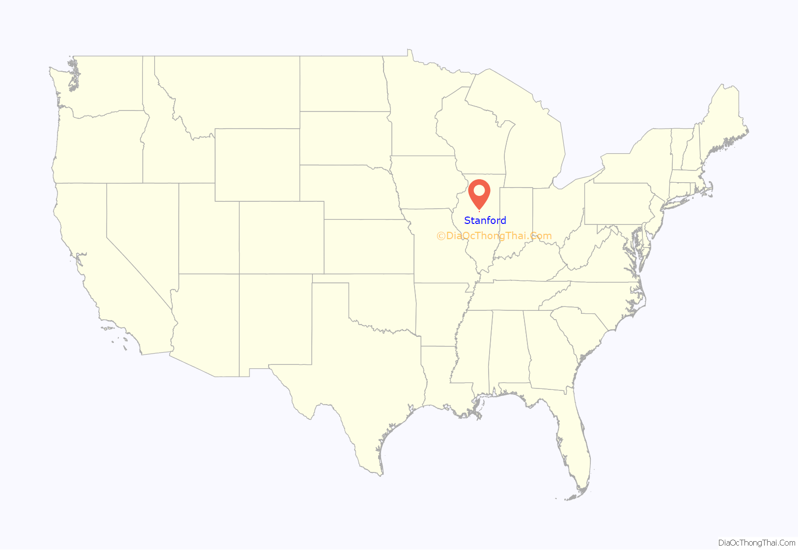
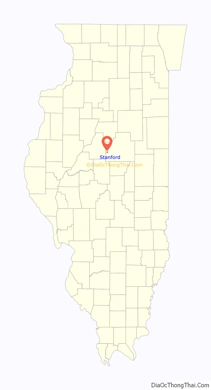
Stanford location map. Where is Stanford village?
History
The beginnings of Stanford
Stanford was platted, under the name of “Allin”, on December 14, 1867. Its founder was John Armstrong (1820 – 1912). It was founded when the Jacksonville Division of the Chicago Alton and St. Louis Railroad was extended westward from Bloomington. The McLean County town of Covell was founded, within a few months of Allin, as a station on the same railroad. In 1870 the name of Allin was changed to “Stanford”. It was incorporated as a village in June 1874. The town’s founder, John Armstrong, was born in Posey County, Indiana. He was first a farmer and then ran a grocery in Stanford, where he continued to live until his death in 1912. For many years after the town was founded, John Armstrong ran a grocery in Stanford.
Original town design and development
The original town of what would soon become Stanford had an unusual “L” shaped design, with the leg of the “L” extending to the east along the railroad tracks. The large area in the crook of the “L” was not platted, but remained in the hands of John Armstrong, the town founder, whose residence was near the tracks on the north side of the railroad. Rather than a central square, the original plat of Stanford, like many towns laid out in the 1850s and 1860s, featured two rectangular public areas labeled as “Depot Grounds” which extended along either side of the tracks. The depot itself was on the north side of the tracks and, in 1874, the grain elevator on the south side. As the town developed, most businesses were located south of the tracks. By 1895 these included a hotel, a bank, the Masonic Hall, and several stores. Except for the depot, most of the railroad-related facilities were on the depot ground south of the railroad. These included a stock yard, a lumber yard, and several elevators. This area also held a bandstand. There were two early churches in Stanford: the Christian Church on Boundary Street south of the business district and the Presbyterian Church in the southeastern part of town.
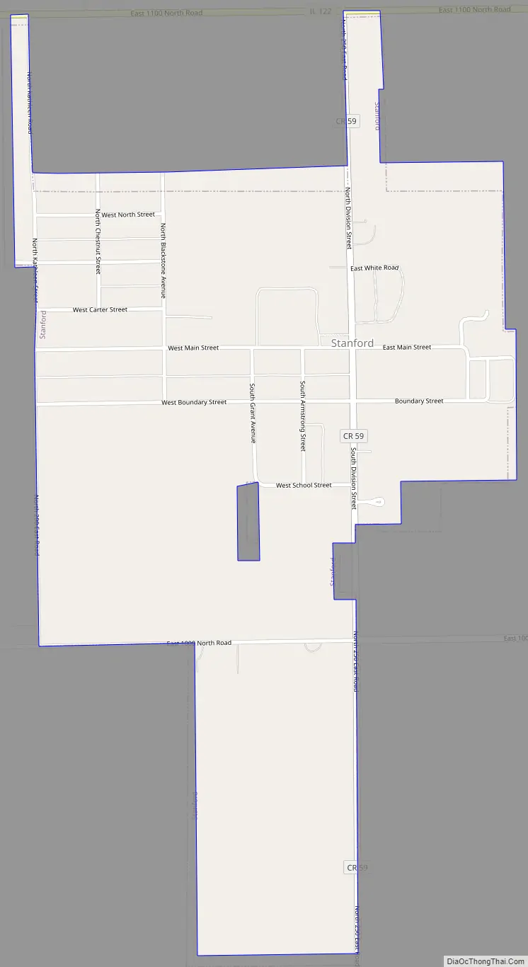
Stanford Road Map
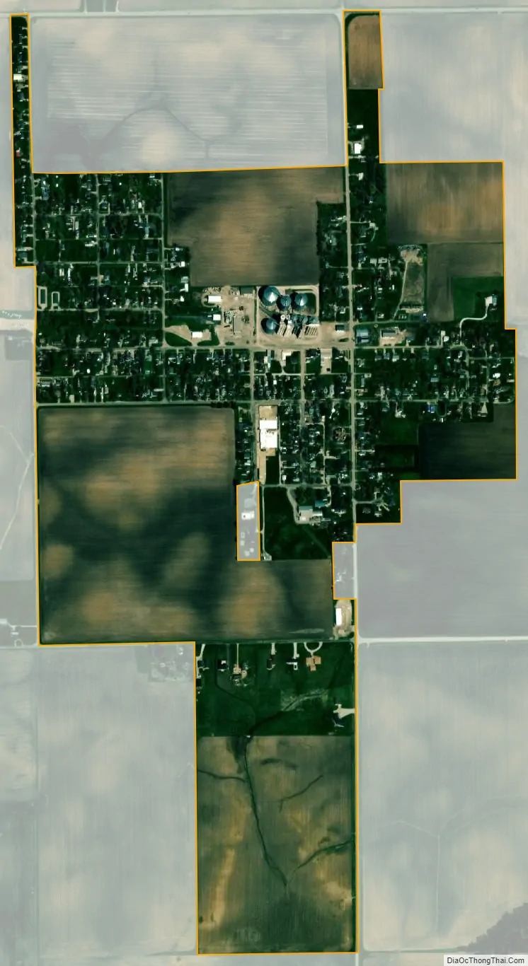
Stanford city Satellite Map
Geography
Stanford is in western McLean County, 14 miles (23 km) west-southwest of Bloomington, the county seat. Illinois Route 122 passes just north of the village, leading northeast to Bloomington and west 5 miles (8 km) to Minier.
According to the U.S. Census Bureau, Stanford has a total area of 0.66 square miles (1.71 km), all land.
See also
Map of Illinois State and its subdivision:- Adams
- Alexander
- Bond
- Boone
- Brown
- Bureau
- Calhoun
- Carroll
- Cass
- Champaign
- Christian
- Clark
- Clay
- Clinton
- Coles
- Cook
- Crawford
- Cumberland
- De Kalb
- De Witt
- Douglas
- Dupage
- Edgar
- Edwards
- Effingham
- Fayette
- Ford
- Franklin
- Fulton
- Gallatin
- Greene
- Grundy
- Hamilton
- Hancock
- Hardin
- Henderson
- Henry
- Iroquois
- Jackson
- Jasper
- Jefferson
- Jersey
- Jo Daviess
- Johnson
- Kane
- Kankakee
- Kendall
- Knox
- La Salle
- Lake
- Lake Michigan
- Lawrence
- Lee
- Livingston
- Logan
- Macon
- Macoupin
- Madison
- Marion
- Marshall
- Mason
- Massac
- McDonough
- McHenry
- McLean
- Menard
- Mercer
- Monroe
- Montgomery
- Morgan
- Moultrie
- Ogle
- Peoria
- Perry
- Piatt
- Pike
- Pope
- Pulaski
- Putnam
- Randolph
- Richland
- Rock Island
- Saint Clair
- Saline
- Sangamon
- Schuyler
- Scott
- Shelby
- Stark
- Stephenson
- Tazewell
- Union
- Vermilion
- Wabash
- Warren
- Washington
- Wayne
- White
- Whiteside
- Will
- Williamson
- Winnebago
- Woodford
- Alabama
- Alaska
- Arizona
- Arkansas
- California
- Colorado
- Connecticut
- Delaware
- District of Columbia
- Florida
- Georgia
- Hawaii
- Idaho
- Illinois
- Indiana
- Iowa
- Kansas
- Kentucky
- Louisiana
- Maine
- Maryland
- Massachusetts
- Michigan
- Minnesota
- Mississippi
- Missouri
- Montana
- Nebraska
- Nevada
- New Hampshire
- New Jersey
- New Mexico
- New York
- North Carolina
- North Dakota
- Ohio
- Oklahoma
- Oregon
- Pennsylvania
- Rhode Island
- South Carolina
- South Dakota
- Tennessee
- Texas
- Utah
- Vermont
- Virginia
- Washington
- West Virginia
- Wisconsin
- Wyoming