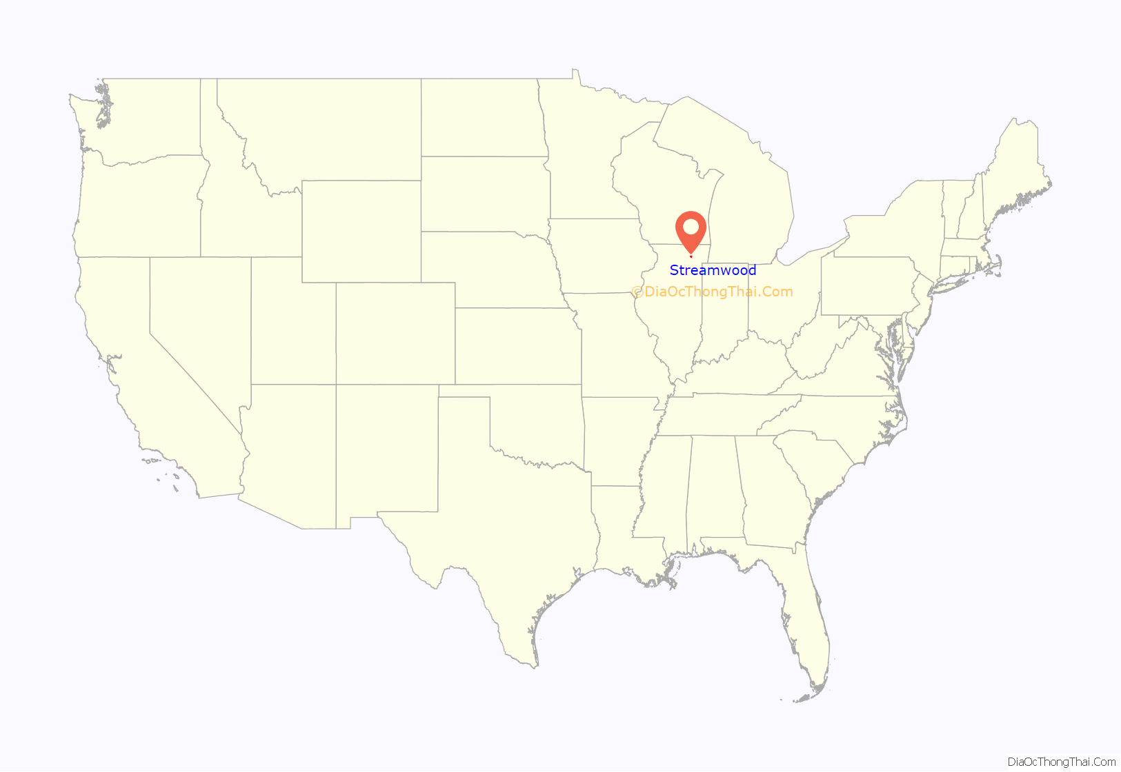
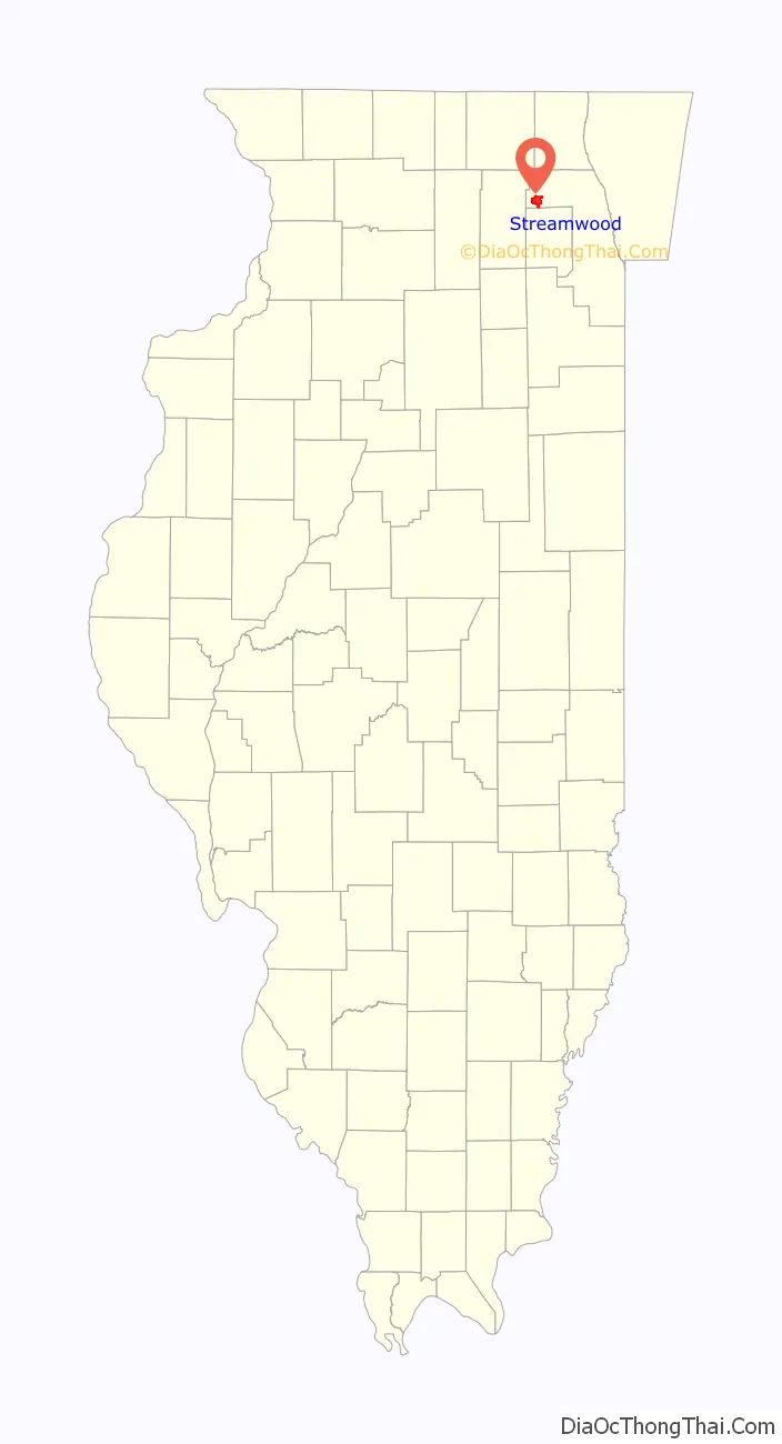
Streamwood is a village in Cook County, Illinois, United States. Per the 2020 census, the population was 39,577. It is a northwest suburb of Chicago, and is a part of the Chicago metropolitan area.
Streamwood is one of the three communities that make up the so-called “Tri Village” area, along with Bartlett and Hanover Park. Streamwood was first incorporated as a village on February 9, 1957.
| Name: | Streamwood village |
|---|---|
| LSAD Code: | 47 |
| LSAD Description: | village (suffix) |
| State: | Illinois |
| County: | Cook County |
| Total Area: | 7.83 sq mi (20.28 km²) |
| Land Area: | 7.80 sq mi (20.20 km²) |
| Water Area: | 0.03 sq mi (0.09 km²) |
| Total Population: | 39,577 |
| Population Density: | 5,075.28/sq mi (1,959.51/km²) |
| Area code: | 630 |
| FIPS code: | 1773157 |
| Website: | www.streamwood.org |
Online Interactive Map
Click on ![]() to view map in "full screen" mode.
to view map in "full screen" mode.
Streamwood location map. Where is Streamwood village?
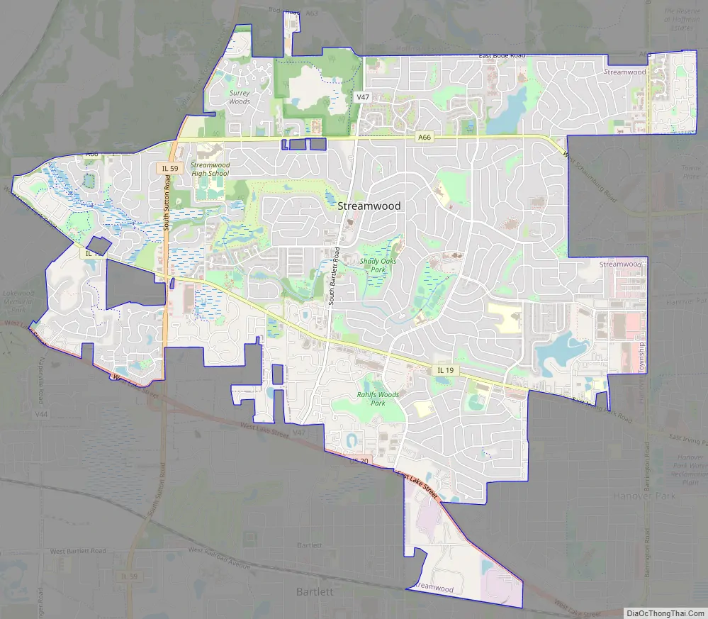
Streamwood Road Map
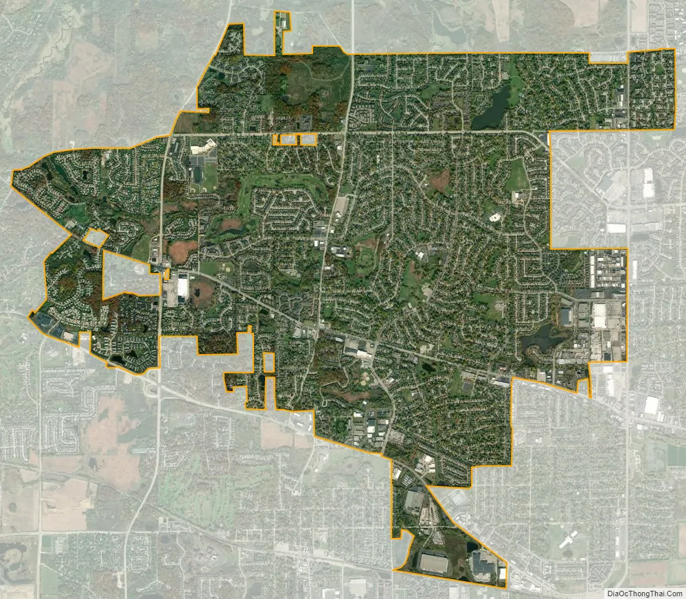
Streamwood city Satellite Map
Geography
Streamwood is located at 42°1′14″N 88°10′24″W / 42.02056°N 88.17333°W / 42.02056; -88.17333 (42.020627, -88.173409).
According to the 2010 census, Streamwood has a total area of 7.854 square miles (20.34 km), of which 7.82 square miles (20.25 km) (or 99.57%) is land and 0.034 square miles (0.09 km) (or 0.43%) is water.
See also
Map of Illinois State and its subdivision:- Adams
- Alexander
- Bond
- Boone
- Brown
- Bureau
- Calhoun
- Carroll
- Cass
- Champaign
- Christian
- Clark
- Clay
- Clinton
- Coles
- Cook
- Crawford
- Cumberland
- De Kalb
- De Witt
- Douglas
- Dupage
- Edgar
- Edwards
- Effingham
- Fayette
- Ford
- Franklin
- Fulton
- Gallatin
- Greene
- Grundy
- Hamilton
- Hancock
- Hardin
- Henderson
- Henry
- Iroquois
- Jackson
- Jasper
- Jefferson
- Jersey
- Jo Daviess
- Johnson
- Kane
- Kankakee
- Kendall
- Knox
- La Salle
- Lake
- Lake Michigan
- Lawrence
- Lee
- Livingston
- Logan
- Macon
- Macoupin
- Madison
- Marion
- Marshall
- Mason
- Massac
- McDonough
- McHenry
- McLean
- Menard
- Mercer
- Monroe
- Montgomery
- Morgan
- Moultrie
- Ogle
- Peoria
- Perry
- Piatt
- Pike
- Pope
- Pulaski
- Putnam
- Randolph
- Richland
- Rock Island
- Saint Clair
- Saline
- Sangamon
- Schuyler
- Scott
- Shelby
- Stark
- Stephenson
- Tazewell
- Union
- Vermilion
- Wabash
- Warren
- Washington
- Wayne
- White
- Whiteside
- Will
- Williamson
- Winnebago
- Woodford
- Alabama
- Alaska
- Arizona
- Arkansas
- California
- Colorado
- Connecticut
- Delaware
- District of Columbia
- Florida
- Georgia
- Hawaii
- Idaho
- Illinois
- Indiana
- Iowa
- Kansas
- Kentucky
- Louisiana
- Maine
- Maryland
- Massachusetts
- Michigan
- Minnesota
- Mississippi
- Missouri
- Montana
- Nebraska
- Nevada
- New Hampshire
- New Jersey
- New Mexico
- New York
- North Carolina
- North Dakota
- Ohio
- Oklahoma
- Oregon
- Pennsylvania
- Rhode Island
- South Carolina
- South Dakota
- Tennessee
- Texas
- Utah
- Vermont
- Virginia
- Washington
- West Virginia
- Wisconsin
- Wyoming


