Summit is a village in Cook County, Illinois, United States. The population was 11,161 at the 2020 census. The name Summit, in use since 1836, refers to the highest point on the Chicago Portage between the northeast-flowing Chicago River and the southwest-flowing Des Plaines River located just north of the village.
Argo is a subdivision annexed by Summit in 1911 when it was new. Named for the nearby cornstarch and baking powder manufacturing plant, it developed separately from the older part of the village. The name “Argo” is still widely used but is not part of the name of the village itself.
| Name: | Summit village |
|---|---|
| LSAD Code: | 47 |
| LSAD Description: | village (suffix) |
| State: | Illinois |
| County: | Cook County |
| Founded: | 1890 |
| Total Area: | 2.26 sq mi (5.85 km²) |
| Land Area: | 2.12 sq mi (5.49 km²) |
| Water Area: | 0.14 sq mi (0.36 km²) |
| Total Population: | 11,161 |
| Population Density: | 5,267.11/sq mi (2,033.86/km²) |
| Area code: | 708 |
| FIPS code: | 1773638 |
| Website: | www.summit-il.org |
Online Interactive Map
Click on ![]() to view map in "full screen" mode.
to view map in "full screen" mode.
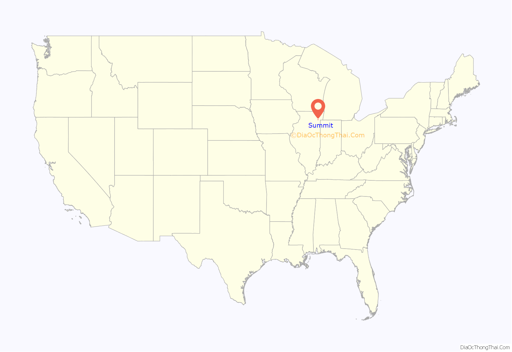
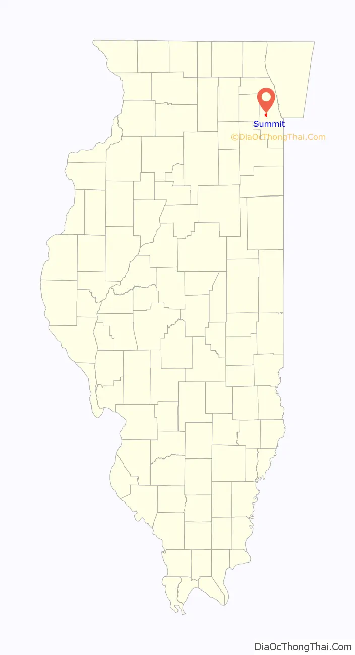
Summit location map. Where is Summit village?
History
The area around Summit has been hunted and traveled through for 12,000 years but only continuously occupied since 900CE. When Europeans first arrived the area was inhabited or used by the Fox, Illini, Miami, Sauk, and Chippewa-Ottawa-Potawatomi tribes.
In 1673 the Marquette-Joliet expedition arrived at the portage north of the village and went on to the location of Chicago. At that time the importance of a portage was noted. A local trading network developed from that time until the Native Americans were removed beginning in 1816.
Surveyed in 1821, in 1830 land was for sale by the Illinois and Michigan Canal Commission. There may have been a tavern at “Summit Ford” in 1832, by 1835 there was a sub-divided settlement with a tavern, blacksmith shop, and stagecoach stop. “Summit Corners” was where westbound Archer Ave. turned south and Lyons-Summit Rd. (now approximately Lawndale Ave.) went west. Chicago politician “Long John” Wentworth bought much of the surrounding area and used it for farming.
Between 1836 and 1848 the Illinois and Michigan Canal was built through the subdivision. Most of the canal workers were Irish laborers and many were able to buy property with their canal script pay.
In 1850 gravel and clay pits were opened in the area for local use. After 1865 limestone quarries north of the canal provided jobs into the 1920s, when they were closed, often used as garbage dumps, then covered over. Today’s Hanover Park is a filled gravel and clay pit.
In 1856 the Joliet and Chicago Railroad (Chicago and Alton Railroad in 1862) built a line along the south bank of the canal. Today this is Metra’s Heritage Corridor commuter line.
In 1890 Summit was incorporated as a village. When John Wentworth, and his political influence, died in 1888 his heirs and the settlement residents feared being annexed by Chicago. The settlement was re-platted much as it is today, with Center St. going north from Archer Ave. and Lincoln St./Lawndale Ave. going northwest from Center St. over the canal. This area was changed with the construction of Interstate 55, which effectively replaced Lawndale Ave. with the Illinois Route 171 ramp. A housing complex was at the site of the 1836 settlement.
Between 1892 and 1900 the Chicago Sanitary Canal was built. It was just north of the Illinois and Michigan Canal but was much larger. In 1899 a large center-pier swing steel bridge was built for Lawndale Ave., the only crossing for miles in either direction until the 1920s. In 1900 the Chicago Sanitary Canal opened and replaced the Illinois and Michigan Canal, which was abandoned. In Summit the old canal was filled in 1974.
In 1901 the Chicago and Joliet Electric Railway Interurban was operating a double-track line down Archer Ave. To the east it connected with Chicago streetcars at Cicero Ave. (then the city limits), to the southwest it went past Argo and on to Joliet. A branch went north on Lawndale Ave to Ogden Ave. in Lyons. In 1933 the rail-cars were replaced with buses.
In 1907 Corn Products Corp. (now Ingredion) began construction of the world’s largest corn-processing plant south of Summit (Bedford Park today) in 1907. At the same time two properties, north and south of 63rd St., were sub-divided as a “company town” type neighborhood called “Argo” after the factory. In 1911 Summit annexed Argo but its separation by the Indiana Harbor Belt Railroad tracks at 59th St., dependence on the factory, and separate business district along 63rd St. with Chicago streetcar (later bus) service made it develop as a separate community. The name “Argo” is still in widespread use in both the public and private sectors.
Between 1910 and 1920 the population of Summit more than tripled, from 949 to 4,019, and increased again to 6,548 in 1930. The nature of the village changed from rural to industrial, largely because of the Corn Products plant. Farms in the old section were sub-divided and the new Argo area was annexed into the village. In addition to Corn Products other industries went up west of Archer Rd. and the large rail yard south of the village created a large number of jobs.
The village was overwhelmed with the increase and public services were not able to keep up. Water supply was a major problem, and schools were severely over-crowded. Between 1910 and 1930 three elementary, one high, and two Catholic schools were opened.
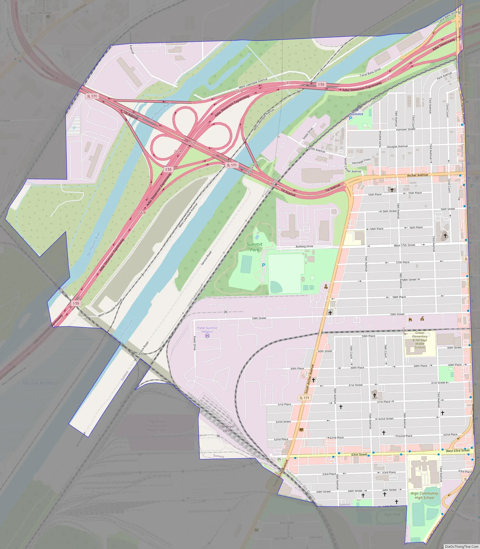
Summit Road Map
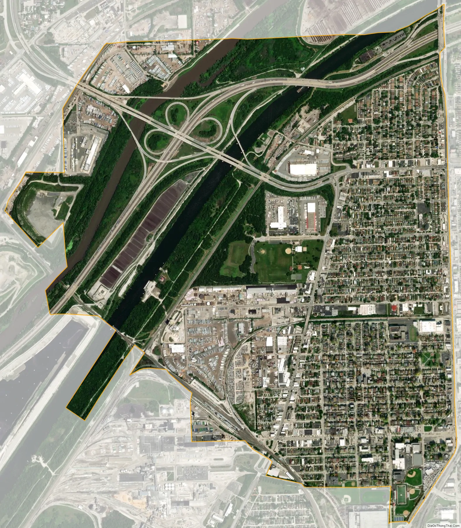
Summit city Satellite Map
Geography
According to the 2010 census, Summit has a total area of 2.257 square miles (5.85 km), of which 2.12 square miles (5.49 km) (or 93.93%) is land and 0.137 square miles (0.35 km) (or 6.07%) is water. Most of Summit is in the floodplain of the Des Plaines River.
See also
Map of Illinois State and its subdivision:- Adams
- Alexander
- Bond
- Boone
- Brown
- Bureau
- Calhoun
- Carroll
- Cass
- Champaign
- Christian
- Clark
- Clay
- Clinton
- Coles
- Cook
- Crawford
- Cumberland
- De Kalb
- De Witt
- Douglas
- Dupage
- Edgar
- Edwards
- Effingham
- Fayette
- Ford
- Franklin
- Fulton
- Gallatin
- Greene
- Grundy
- Hamilton
- Hancock
- Hardin
- Henderson
- Henry
- Iroquois
- Jackson
- Jasper
- Jefferson
- Jersey
- Jo Daviess
- Johnson
- Kane
- Kankakee
- Kendall
- Knox
- La Salle
- Lake
- Lake Michigan
- Lawrence
- Lee
- Livingston
- Logan
- Macon
- Macoupin
- Madison
- Marion
- Marshall
- Mason
- Massac
- McDonough
- McHenry
- McLean
- Menard
- Mercer
- Monroe
- Montgomery
- Morgan
- Moultrie
- Ogle
- Peoria
- Perry
- Piatt
- Pike
- Pope
- Pulaski
- Putnam
- Randolph
- Richland
- Rock Island
- Saint Clair
- Saline
- Sangamon
- Schuyler
- Scott
- Shelby
- Stark
- Stephenson
- Tazewell
- Union
- Vermilion
- Wabash
- Warren
- Washington
- Wayne
- White
- Whiteside
- Will
- Williamson
- Winnebago
- Woodford
- Alabama
- Alaska
- Arizona
- Arkansas
- California
- Colorado
- Connecticut
- Delaware
- District of Columbia
- Florida
- Georgia
- Hawaii
- Idaho
- Illinois
- Indiana
- Iowa
- Kansas
- Kentucky
- Louisiana
- Maine
- Maryland
- Massachusetts
- Michigan
- Minnesota
- Mississippi
- Missouri
- Montana
- Nebraska
- Nevada
- New Hampshire
- New Jersey
- New Mexico
- New York
- North Carolina
- North Dakota
- Ohio
- Oklahoma
- Oregon
- Pennsylvania
- Rhode Island
- South Carolina
- South Dakota
- Tennessee
- Texas
- Utah
- Vermont
- Virginia
- Washington
- West Virginia
- Wisconsin
- Wyoming


