Tallula is a village in Menard County, Illinois, United States. It was founded in 1857 by William G. Greene. The population was 434 at the 2020 census, down from 488 in 2010. It is part of the Springfield, Illinois Metropolitan Statistical Area.
| Name: | Tallula village |
|---|---|
| LSAD Code: | 47 |
| LSAD Description: | village (suffix) |
| State: | Illinois |
| County: | Menard County |
| Total Area: | 0.53 sq mi (1.38 km²) |
| Land Area: | 0.53 sq mi (1.38 km²) |
| Water Area: | 0.00 sq mi (0.00 km²) |
| Total Population: | 434 |
| Population Density: | 817.33/sq mi (315.43/km²) |
| ZIP code: | 62688 |
| Area code: | 217 |
| FIPS code: | 1774379 |
| GNISfeature ID: | 2399948 |
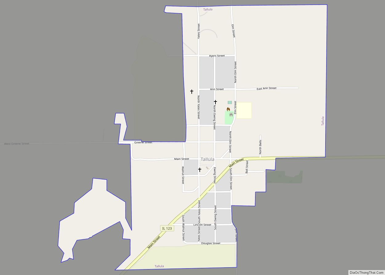
Online Interactive Map
Click on ![]() to view map in "full screen" mode.
to view map in "full screen" mode.
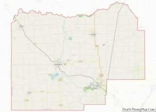
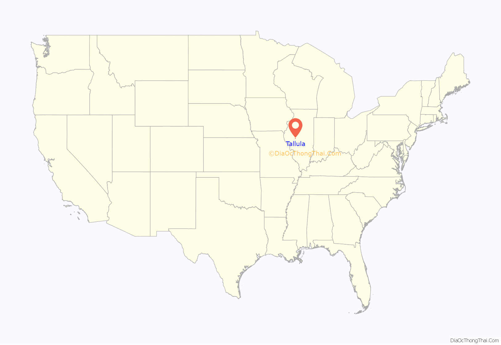
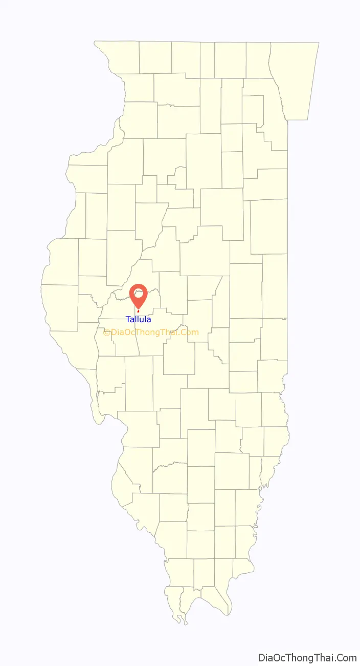
Tallula location map. Where is Tallula village?
History
William G. Greene, J. G. Greene, Richard Yates, T. Baker, and W. G. Spears laid out Tallula in late 1857. The name of “Tallula” was said to be an Indian word. The History of Menard & Mason Counties, Illinois credits Spears with the name, and notes that it was said to mean “dropping water”, but nothing in the area is especially related to dropping water; the county tourist bureau claims that William G. Greene named the town, that it means “trickling water”, and that it is related to “abundant springs in the area”.
Tallula was incorporated as a village under Illinois’ general municipal law in 1871 or 1872. William Greene and physician J. F. Wilson established the local bank in May 1877.
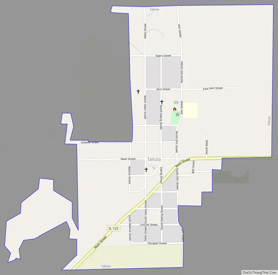
Tallula Road Map
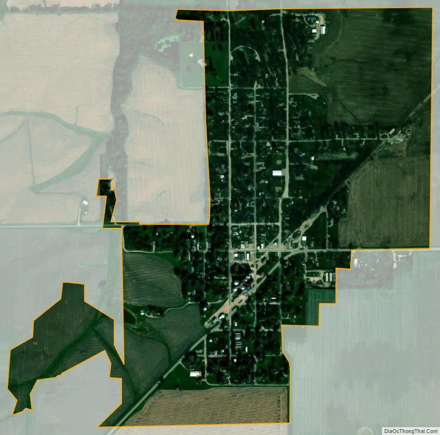
Tallula city Satellite Map
Geography
Tallula is located in southwestern Menard County at 39°56′39″N 89°56′15″W / 39.94417°N 89.93750°W / 39.94417; -89.93750 (39.944197, -89.937610). It is at the center of Tallula Precinct. Illinois Route 123 passes through the southeast side of the village, leading northeast 10 miles (16 km) to Petersburg, the county seat, and south 4.5 miles (7.2 km) to Illinois Route 125 between Pleasant Plains and Ashland.
According to the U.S. Census Bureau, Tallula has a total area of 0.53 square miles (1.37 km), all land. The village is drained to the north by a tributary of Clary Creek, a north-flowing tributary of the Sangamon River and part of the Illinois River watershed.
See also
Map of Illinois State and its subdivision:- Adams
- Alexander
- Bond
- Boone
- Brown
- Bureau
- Calhoun
- Carroll
- Cass
- Champaign
- Christian
- Clark
- Clay
- Clinton
- Coles
- Cook
- Crawford
- Cumberland
- De Kalb
- De Witt
- Douglas
- Dupage
- Edgar
- Edwards
- Effingham
- Fayette
- Ford
- Franklin
- Fulton
- Gallatin
- Greene
- Grundy
- Hamilton
- Hancock
- Hardin
- Henderson
- Henry
- Iroquois
- Jackson
- Jasper
- Jefferson
- Jersey
- Jo Daviess
- Johnson
- Kane
- Kankakee
- Kendall
- Knox
- La Salle
- Lake
- Lake Michigan
- Lawrence
- Lee
- Livingston
- Logan
- Macon
- Macoupin
- Madison
- Marion
- Marshall
- Mason
- Massac
- McDonough
- McHenry
- McLean
- Menard
- Mercer
- Monroe
- Montgomery
- Morgan
- Moultrie
- Ogle
- Peoria
- Perry
- Piatt
- Pike
- Pope
- Pulaski
- Putnam
- Randolph
- Richland
- Rock Island
- Saint Clair
- Saline
- Sangamon
- Schuyler
- Scott
- Shelby
- Stark
- Stephenson
- Tazewell
- Union
- Vermilion
- Wabash
- Warren
- Washington
- Wayne
- White
- Whiteside
- Will
- Williamson
- Winnebago
- Woodford
- Alabama
- Alaska
- Arizona
- Arkansas
- California
- Colorado
- Connecticut
- Delaware
- District of Columbia
- Florida
- Georgia
- Hawaii
- Idaho
- Illinois
- Indiana
- Iowa
- Kansas
- Kentucky
- Louisiana
- Maine
- Maryland
- Massachusetts
- Michigan
- Minnesota
- Mississippi
- Missouri
- Montana
- Nebraska
- Nevada
- New Hampshire
- New Jersey
- New Mexico
- New York
- North Carolina
- North Dakota
- Ohio
- Oklahoma
- Oregon
- Pennsylvania
- Rhode Island
- South Carolina
- South Dakota
- Tennessee
- Texas
- Utah
- Vermont
- Virginia
- Washington
- West Virginia
- Wisconsin
- Wyoming