Trout Valley is a village in McHenry County, Illinois, United States. It was incorporated as a village on 19 March 1996. Per the 2020 census, the population was 515.
| Name: | Trout Valley village |
|---|---|
| LSAD Code: | 47 |
| LSAD Description: | village (suffix) |
| State: | Illinois |
| County: | McHenry County |
| Founded: | March 19, 1996 |
| Total Area: | 0.43 sq mi (1.11 km²) |
| Land Area: | 0.43 sq mi (1.11 km²) |
| Water Area: | 0.00 sq mi (0.00 km²) |
| Total Population: | 515 |
| Population Density: | 1,203.27/sq mi (465.11/km²) |
| Area code: | 847 & 224 |
| FIPS code: | 1776160 |
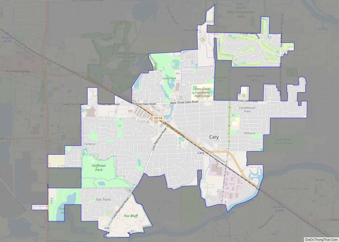
Online Interactive Map
Click on ![]() to view map in "full screen" mode.
to view map in "full screen" mode.
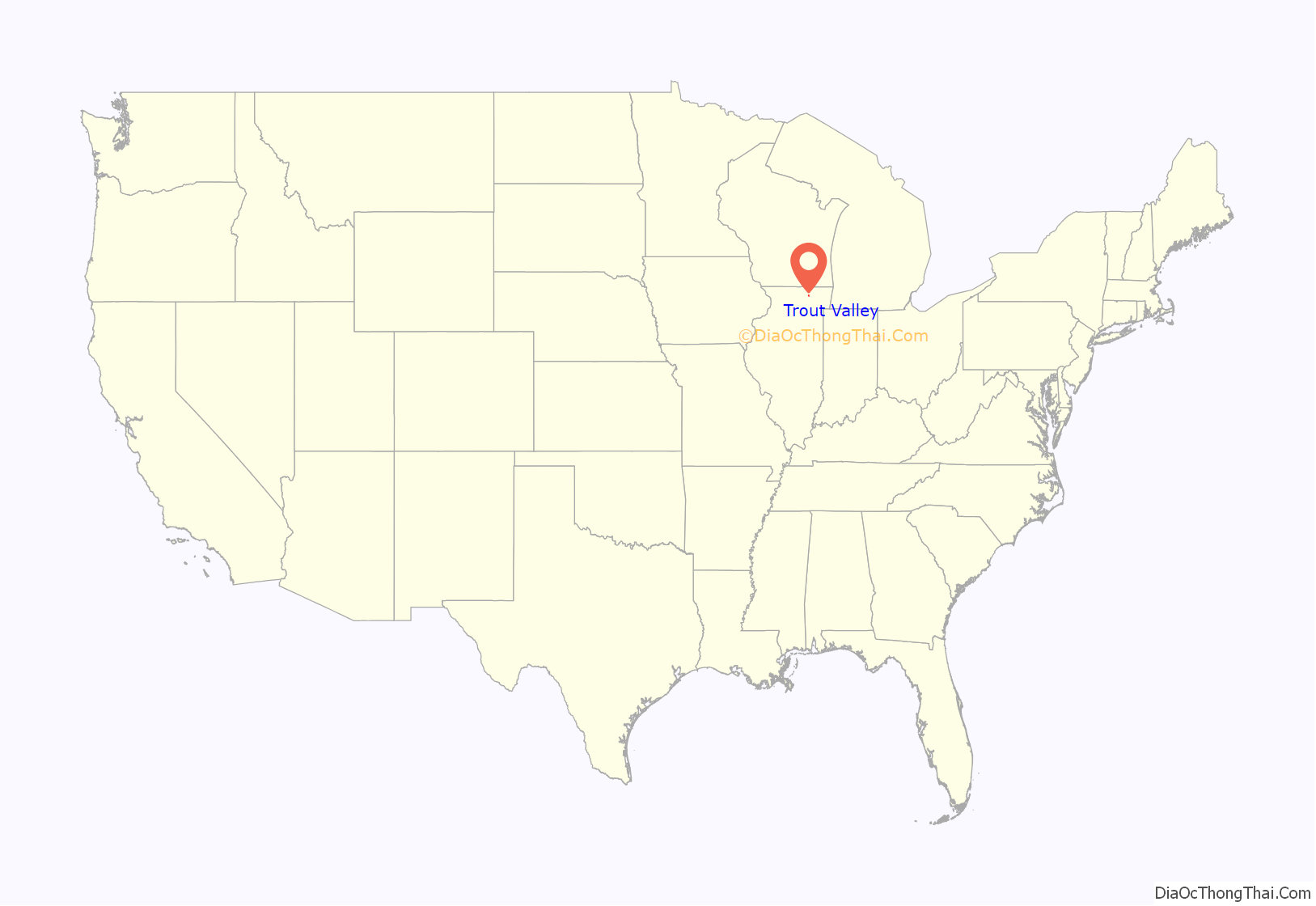
Trout Valley location map. Where is Trout Valley village?
History
Maxon Community Developers of Barrington, Illinois, founders and developers of nearby Streamwood, Barrington Woods, Brigadoon, and later Green Valley, Arizona purchased the Curtiss Candy Farms in 1952 from Otto Schnering, founder of the Curtiss Candy Company. The brothers Norm and Don Maxon promptly renamed it Trout Valley after Norman’s passion for fly fishing.
The estate was once the private estate of John D. Hertz of Hertz Car Rentals, modeled during the gilded age after English estates complete with riding stables, polo grounds, trout fishing and pheasant hunting. Norman Maxon, an avid outdoorsman, reestablished the trout hatchery and approached National Homes of Lafayette, Indiana to develop Trout Valley as a national showcase for their modular homes. By 1956, Trout Valley won the National Home development of the year and the concept of a homeowners association was conceived by C.E.O. Don Maxon as a way to maintain the integrity of Trout Valley.
Trout Valley was once part of unincorporated McHenry County until it became its own village. The residents attend schools in the Cary School District, and the village itself does not have any of its own schools, fire department, or police department. The land was once a farm owned by John D. Hertz and still contains residual structures from that period of time.
At the west side of the village, a magnificent arched set of iron gates with stone pillars mark the entrance at Cary-Algonquin Road. These were probably erected by Mr. Hertz in the 1920s. In 2006, this entrance was designated as a local landmark by the McHenry County Historic Preservation Commission. This protects and preserves the gates by an ordinance enacted by the McHenry County Board.
The first mayor of Trout Valley was Steve Barrett.
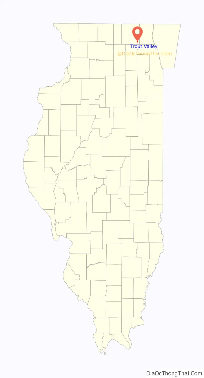
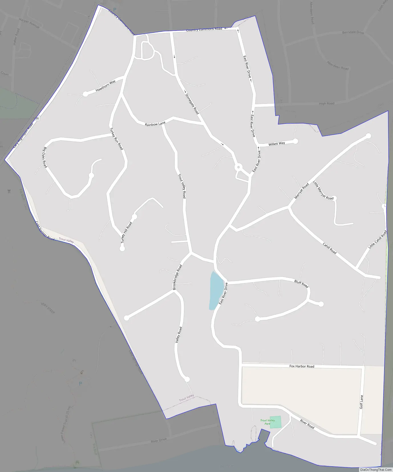
Trout Valley Road Map
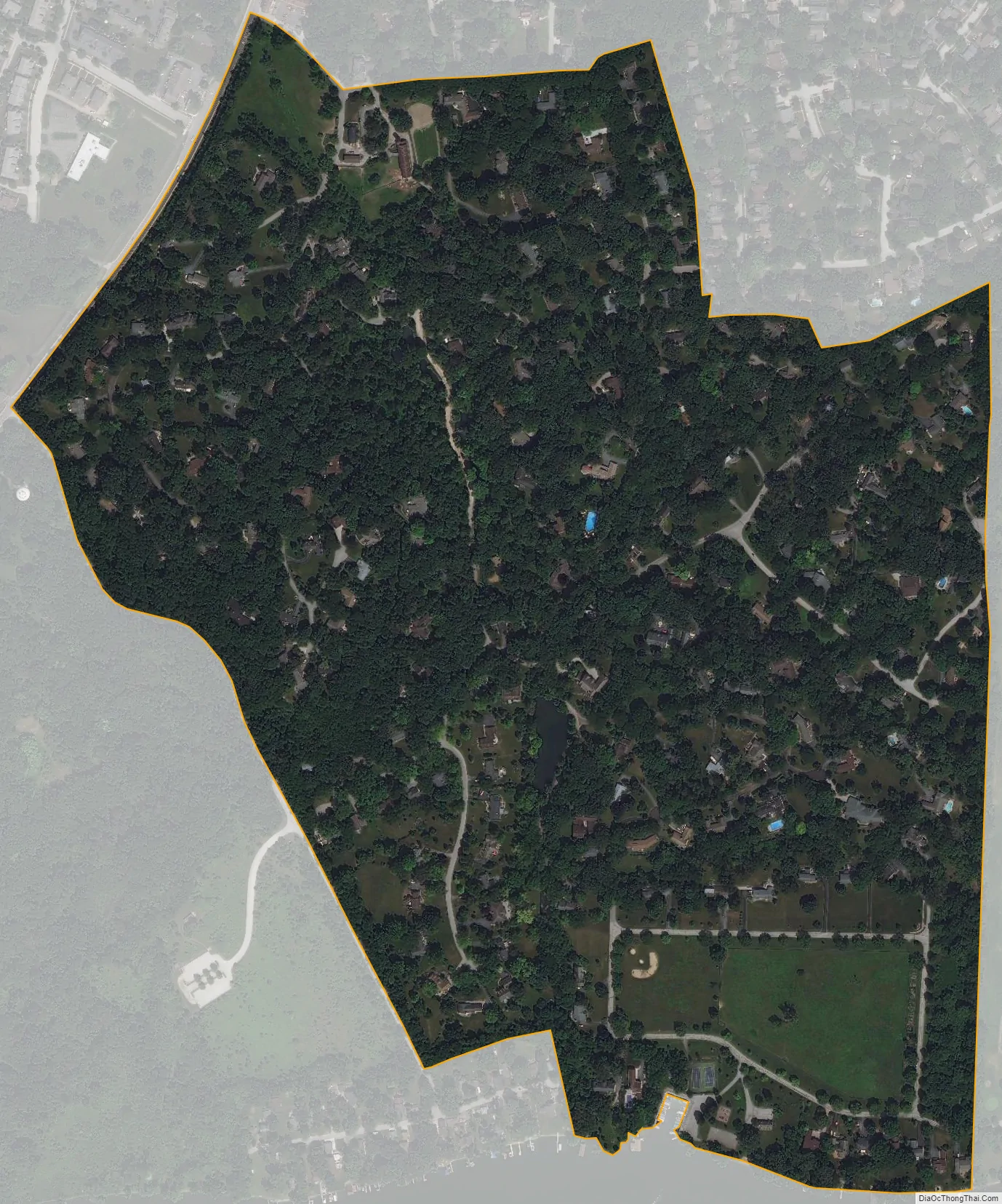
Trout Valley city Satellite Map
Geography
Trout Valley is located at 42°11′57″N 88°15′12″W / 42.19917°N 88.25333°W / 42.19917; -88.25333 (42.199265, -88.253357).
According to the 2010 census, Trout Valley has a total area of 0.432 square miles (1.12 km), of which 0.43 square miles (1.11 km) (or 99.54%) is land and 0.002 square miles (0.01 km) (or 0.46%) is water. There are various small ponds with streams that connect them. The village rests against the Fox River.
See also
Map of Illinois State and its subdivision:- Adams
- Alexander
- Bond
- Boone
- Brown
- Bureau
- Calhoun
- Carroll
- Cass
- Champaign
- Christian
- Clark
- Clay
- Clinton
- Coles
- Cook
- Crawford
- Cumberland
- De Kalb
- De Witt
- Douglas
- Dupage
- Edgar
- Edwards
- Effingham
- Fayette
- Ford
- Franklin
- Fulton
- Gallatin
- Greene
- Grundy
- Hamilton
- Hancock
- Hardin
- Henderson
- Henry
- Iroquois
- Jackson
- Jasper
- Jefferson
- Jersey
- Jo Daviess
- Johnson
- Kane
- Kankakee
- Kendall
- Knox
- La Salle
- Lake
- Lake Michigan
- Lawrence
- Lee
- Livingston
- Logan
- Macon
- Macoupin
- Madison
- Marion
- Marshall
- Mason
- Massac
- McDonough
- McHenry
- McLean
- Menard
- Mercer
- Monroe
- Montgomery
- Morgan
- Moultrie
- Ogle
- Peoria
- Perry
- Piatt
- Pike
- Pope
- Pulaski
- Putnam
- Randolph
- Richland
- Rock Island
- Saint Clair
- Saline
- Sangamon
- Schuyler
- Scott
- Shelby
- Stark
- Stephenson
- Tazewell
- Union
- Vermilion
- Wabash
- Warren
- Washington
- Wayne
- White
- Whiteside
- Will
- Williamson
- Winnebago
- Woodford
- Alabama
- Alaska
- Arizona
- Arkansas
- California
- Colorado
- Connecticut
- Delaware
- District of Columbia
- Florida
- Georgia
- Hawaii
- Idaho
- Illinois
- Indiana
- Iowa
- Kansas
- Kentucky
- Louisiana
- Maine
- Maryland
- Massachusetts
- Michigan
- Minnesota
- Mississippi
- Missouri
- Montana
- Nebraska
- Nevada
- New Hampshire
- New Jersey
- New Mexico
- New York
- North Carolina
- North Dakota
- Ohio
- Oklahoma
- Oregon
- Pennsylvania
- Rhode Island
- South Carolina
- South Dakota
- Tennessee
- Texas
- Utah
- Vermont
- Virginia
- Washington
- West Virginia
- Wisconsin
- Wyoming