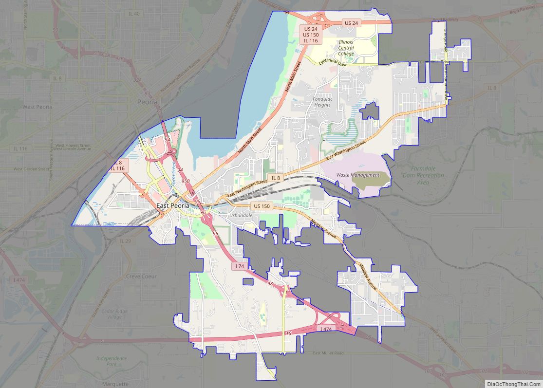
Washington is a city in Tazewell County, Illinois, United States. Washington is on U.S. Route 24 and Illinois Route 8, northeast of East Peoria. The population was 15,134 at the 2010 census, a 39.6 percent increase over 2000. It is a suburb of Peoria and is part of the Peoria Metropolitan Statistical Area.
| Name: | Washington city |
|---|---|
| LSAD Code: | 25 |
| LSAD Description: | city (suffix) |
| State: | Illinois |
| County: | Tazewell County |
| Elevation: | 757 ft (231 m) |
| Total Area: | 8.56 sq mi (22.17 km²) |
| Land Area: | 8.54 sq mi (22.13 km²) |
| Water Area: | 0.01 sq mi (0.03 km²) |
| Total Population: | 16,071 |
| Population Density: | 1,880.75/sq mi (726.17/km²) |
| Area code: | 309 |
| FIPS code: | 1779033 |
| GNISfeature ID: | 2397206 |
| Website: | ci.washington.il.us |
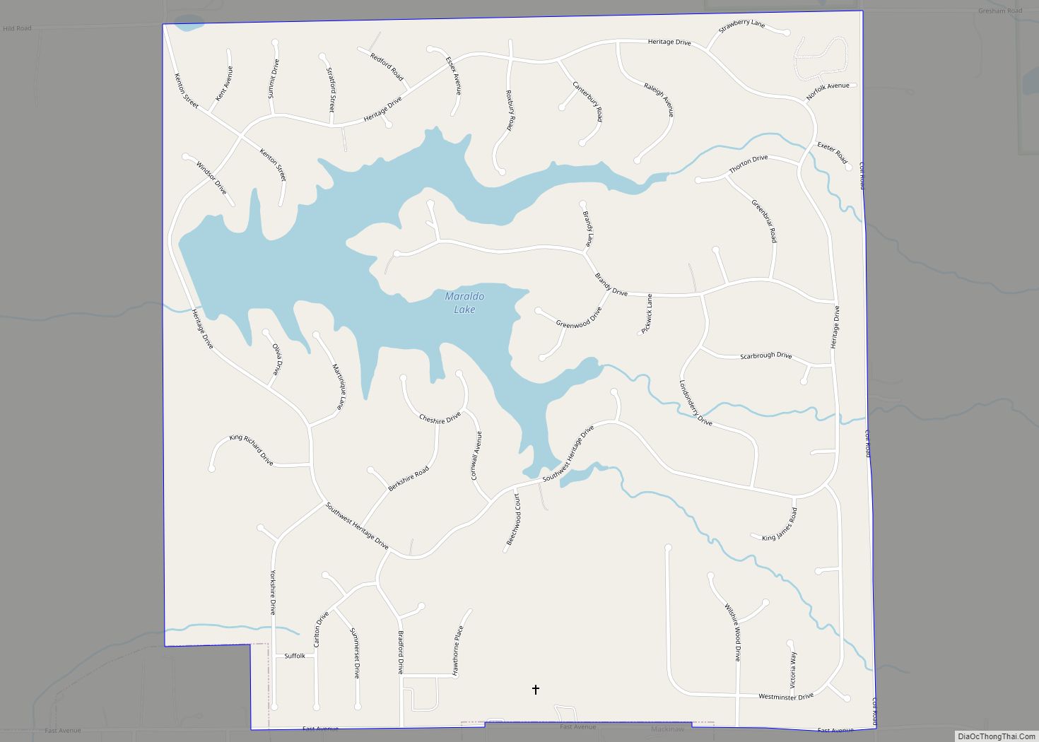
Online Interactive Map
Click on ![]() to view map in "full screen" mode.
to view map in "full screen" mode.
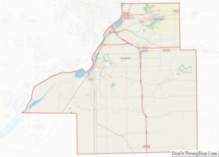
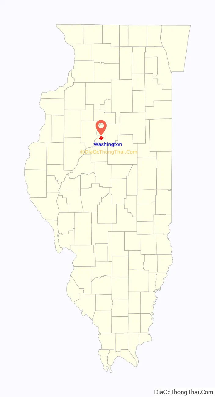
Washington location map. Where is Washington city?

History
Washington was founded in 1825 by William Holland Sr., who came from North Carolina and was hired by the U.S. government to provide blacksmith services to the local Native Americans. During his long and eventful life he was married three times, and was the father of twenty-one children: fourteen by his first wife and seven by his second wife. He had eighty-two grandchildren and fifty great grandchildren. He died in Washington on November 27, 1871, at the age of ninety-one. The post office (and later the city) was originally named Holland’s Grove in 1833 before being renamed in honor of the first U.S. president, George Washington, in 1837.
In the 1920s, a man named George Heyl put Washington on the map as the home of the famous Heyl Pony Farm. Some of the original barns still exist on North Main Street. The Heyl Pony Farm supplied Shetland ponies to buyers around the world; George Heyl also raised pure bred poultry. When Heyl died suddenly in 1932, it was recorded as one of the largest funerals ever held in Washington.
Another local site of interest is the “old canning factory”, which is now occupied by American Allied Railway Equipment Company Inc. In 1943, the canning factory (which after the war was run by the Libby’s company) had a shortage of workers, and the government needed K rations and canned goods to feed the troops. So 50 captured German soldiers from the prisoner of war camp known as Camp Ellis in Fulton County were brought in. The Washington sub-camp was first commanded by Colonel John S. Sullivan, and later by Captain T. A. Cox. The POWs were brought in on the old rail line that ran down Wood Street (the foundation of a sentry tower can be seen just northeast of the intersection of Wood and Jefferson near the entrance to the bike trail). They were trucked from the camp to various local farms to help with the pumpkin harvest. The prisoners were allowed no visitors, nor could residents speak to the prisoners. An exception was made for local ministers, such as Pastor Kammeyer from St. Mark’s Lutheran who spoke fluent German and ministered to the POWs spiritual needs.
A new community center, named Five Points Washington, opened in October 2007. The facility houses the Washington Public Library, a performing arts center, swimming pools, fitness center, and banquet center.
2013 tornado
An EF4 tornado, part of the tornado outbreak of November 17, 2013, entered Washington from the southwest in East Peoria. Three people were killed, one during the storm and two others later from injuries, including a United States Army veteran. The tornado then destroyed the Georgetown Common apartment complex, including ripping second floors off most of the 17 apartment buildings. Hundreds of homes were destroyed as the tornado moved through town before finally exiting on the north side.
Washington Road Map

Washington city Satellite Map

Geography
According to the 2010 census, Washington has a total area of 8.182 sq mi (21.19 km), of which 8.17 sq mi (21.16 km) (or 99.85%) is land and 0.012 sq mi (0.03 km) (or 0.15%) is water.
See also
Map of Illinois State and its subdivision:- Adams
- Alexander
- Bond
- Boone
- Brown
- Bureau
- Calhoun
- Carroll
- Cass
- Champaign
- Christian
- Clark
- Clay
- Clinton
- Coles
- Cook
- Crawford
- Cumberland
- De Kalb
- De Witt
- Douglas
- Dupage
- Edgar
- Edwards
- Effingham
- Fayette
- Ford
- Franklin
- Fulton
- Gallatin
- Greene
- Grundy
- Hamilton
- Hancock
- Hardin
- Henderson
- Henry
- Iroquois
- Jackson
- Jasper
- Jefferson
- Jersey
- Jo Daviess
- Johnson
- Kane
- Kankakee
- Kendall
- Knox
- La Salle
- Lake
- Lake Michigan
- Lawrence
- Lee
- Livingston
- Logan
- Macon
- Macoupin
- Madison
- Marion
- Marshall
- Mason
- Massac
- McDonough
- McHenry
- McLean
- Menard
- Mercer
- Monroe
- Montgomery
- Morgan
- Moultrie
- Ogle
- Peoria
- Perry
- Piatt
- Pike
- Pope
- Pulaski
- Putnam
- Randolph
- Richland
- Rock Island
- Saint Clair
- Saline
- Sangamon
- Schuyler
- Scott
- Shelby
- Stark
- Stephenson
- Tazewell
- Union
- Vermilion
- Wabash
- Warren
- Washington
- Wayne
- White
- Whiteside
- Will
- Williamson
- Winnebago
- Woodford
- Alabama
- Alaska
- Arizona
- Arkansas
- California
- Colorado
- Connecticut
- Delaware
- District of Columbia
- Florida
- Georgia
- Hawaii
- Idaho
- Illinois
- Indiana
- Iowa
- Kansas
- Kentucky
- Louisiana
- Maine
- Maryland
- Massachusetts
- Michigan
- Minnesota
- Mississippi
- Missouri
- Montana
- Nebraska
- Nevada
- New Hampshire
- New Jersey
- New Mexico
- New York
- North Carolina
- North Dakota
- Ohio
- Oklahoma
- Oregon
- Pennsylvania
- Rhode Island
- South Carolina
- South Dakota
- Tennessee
- Texas
- Utah
- Vermont
- Virginia
- Washington
- West Virginia
- Wisconsin
- Wyoming