Waterman is a village in DeKalb County, Illinois, United States. The population was 1,433 at the 2020 census.
The village was known for the “Waterman and Western” train line that operates in Lion’s Club Park. This 1/3 scale train line comprises a 1/2 mile train line circling the park and is a hobby of a local resident.
| Name: | Waterman village |
|---|---|
| LSAD Code: | 47 |
| LSAD Description: | village (suffix) |
| State: | Illinois |
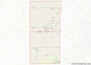
| County: | DeKalb County |
| Total Area: | 1.45 sq mi (3.76 km²) |
| Land Area: | 1.45 sq mi (3.76 km²) |
| Water Area: | 0.00 sq mi (0.00 km²) |
| Total Population: | 1,433 |
| Population Density: | 987.59/sq mi (381.41/km²) |
| Area code: | 815 |
| FIPS code: | 1779163 |
| Website: | https://villageofwaterman.com/ |
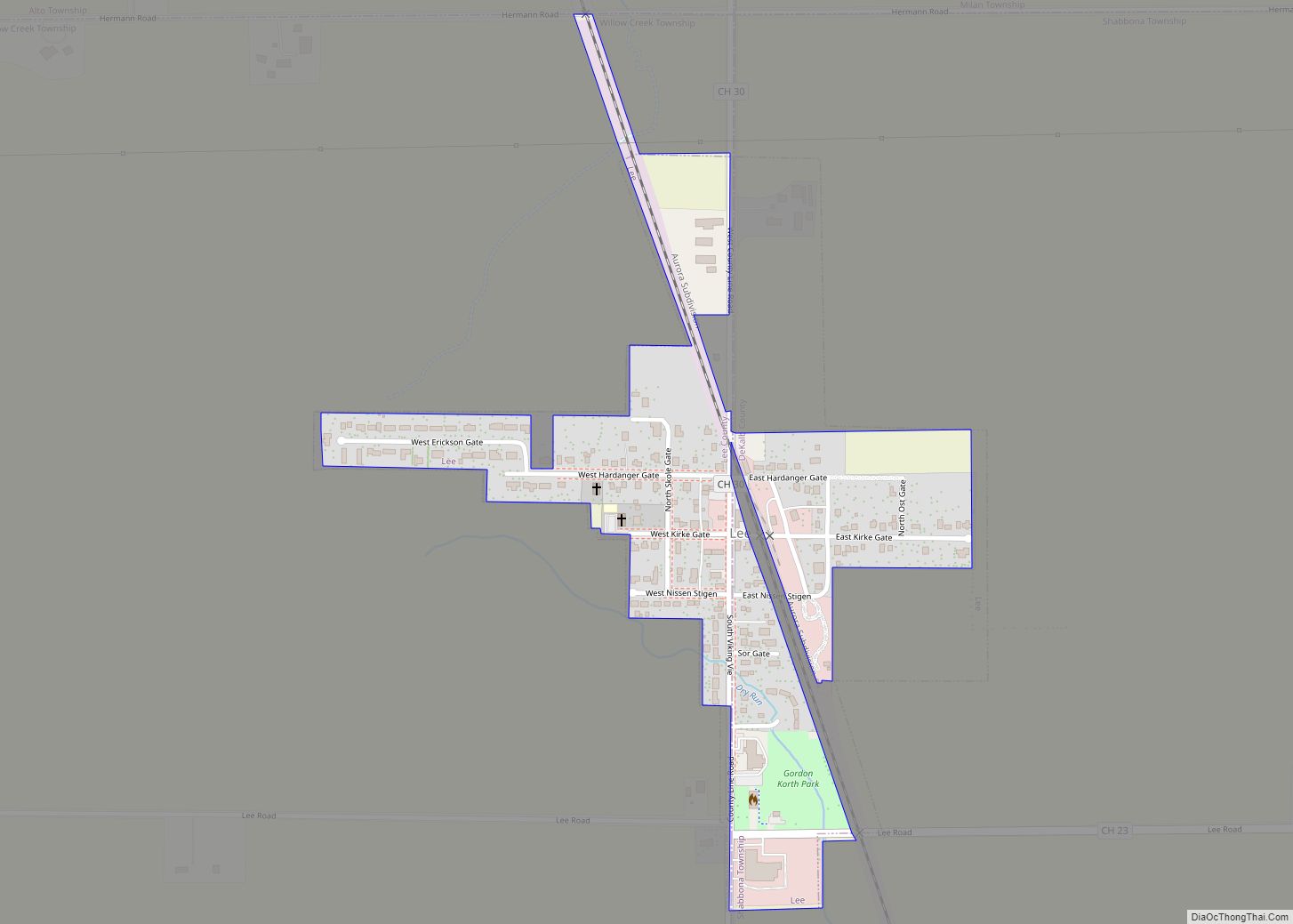
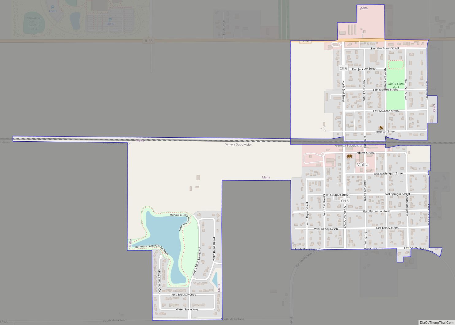
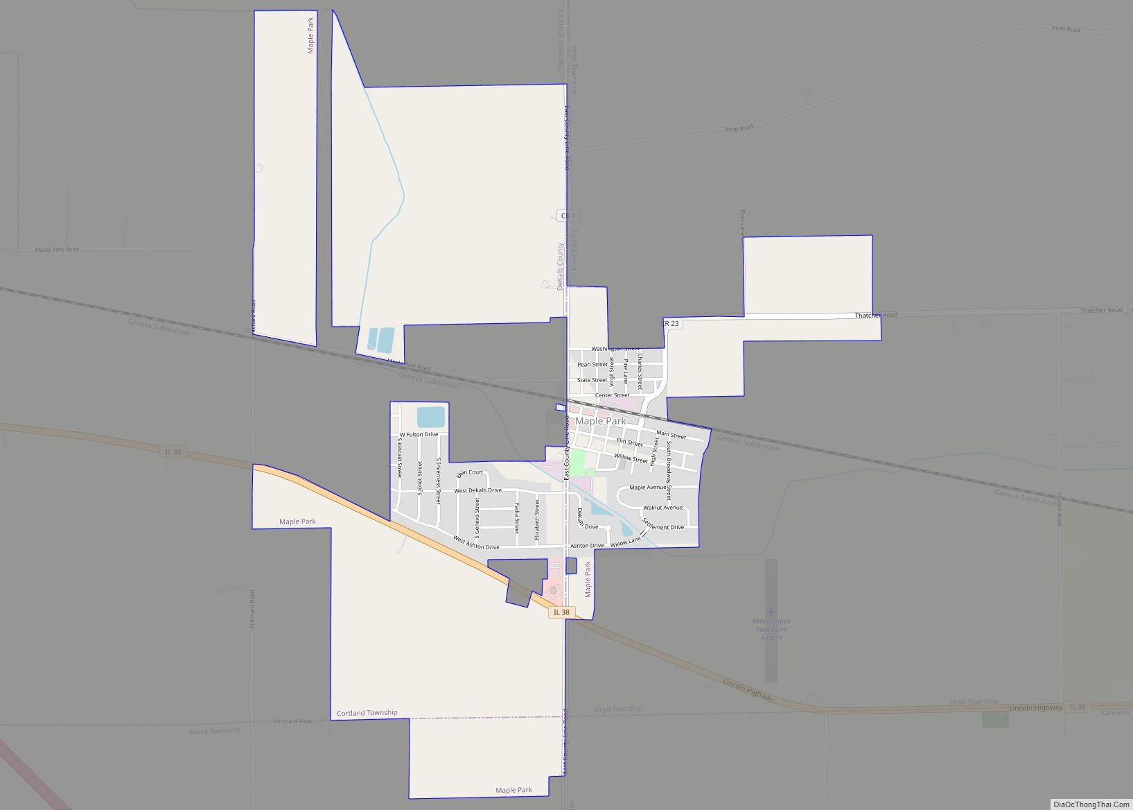
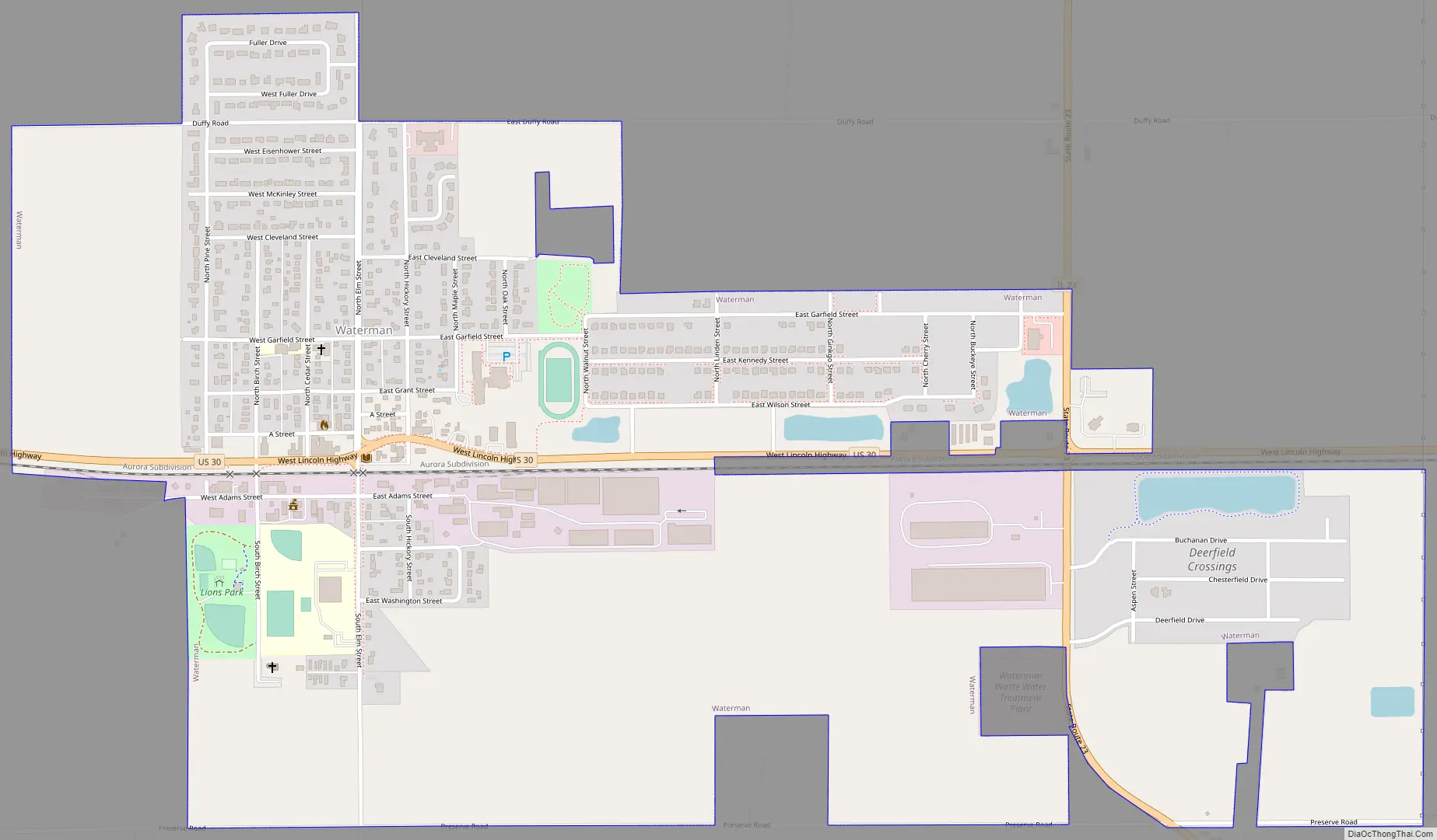
Online Interactive Map
Click on ![]() to view map in "full screen" mode.
to view map in "full screen" mode.
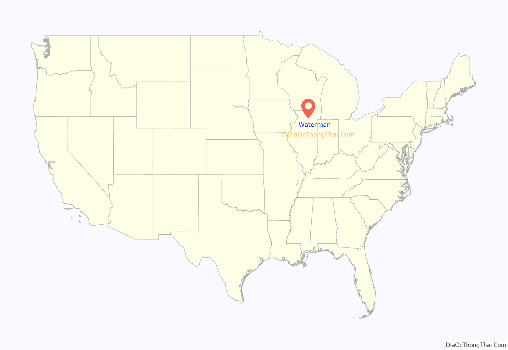
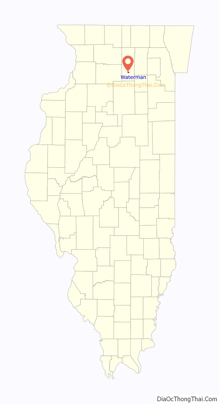
Waterman location map. Where is Waterman village?
Waterman Road Map
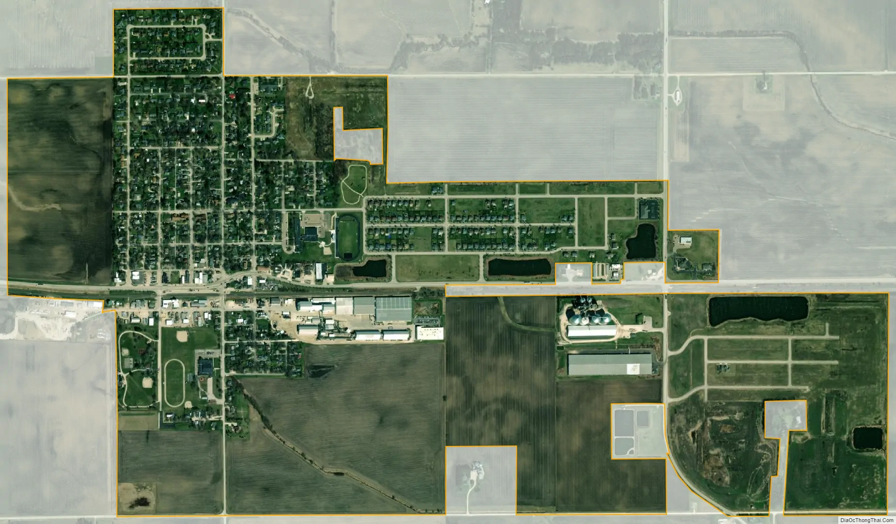
Waterman city Satellite Map
Geography
Waterman is located at 41°46′15″N 88°46′29″W / 41.77083°N 88.77472°W / 41.77083; -88.77472 (41.770971, -88.774697).
According to the 2010 census, Waterman has a total area of 1.482 square miles (3.84 km), of which 1.48 square miles (3.83 km) (or 99.87%) is land and 0.002 square miles (0.01 km) (or 0.13%) is water.
See also
Map of Illinois State and its subdivision:- Adams
- Alexander
- Bond
- Boone
- Brown
- Bureau
- Calhoun
- Carroll
- Cass
- Champaign
- Christian
- Clark
- Clay
- Clinton
- Coles
- Cook
- Crawford
- Cumberland
- De Kalb
- De Witt
- Douglas
- Dupage
- Edgar
- Edwards
- Effingham
- Fayette
- Ford
- Franklin
- Fulton
- Gallatin
- Greene
- Grundy
- Hamilton
- Hancock
- Hardin
- Henderson
- Henry
- Iroquois
- Jackson
- Jasper
- Jefferson
- Jersey
- Jo Daviess
- Johnson
- Kane
- Kankakee
- Kendall
- Knox
- La Salle
- Lake
- Lake Michigan
- Lawrence
- Lee
- Livingston
- Logan
- Macon
- Macoupin
- Madison
- Marion
- Marshall
- Mason
- Massac
- McDonough
- McHenry
- McLean
- Menard
- Mercer
- Monroe
- Montgomery
- Morgan
- Moultrie
- Ogle
- Peoria
- Perry
- Piatt
- Pike
- Pope
- Pulaski
- Putnam
- Randolph
- Richland
- Rock Island
- Saint Clair
- Saline
- Sangamon
- Schuyler
- Scott
- Shelby
- Stark
- Stephenson
- Tazewell
- Union
- Vermilion
- Wabash
- Warren
- Washington
- Wayne
- White
- Whiteside
- Will
- Williamson
- Winnebago
- Woodford
- Alabama
- Alaska
- Arizona
- Arkansas
- California
- Colorado
- Connecticut
- Delaware
- District of Columbia
- Florida
- Georgia
- Hawaii
- Idaho
- Illinois
- Indiana
- Iowa
- Kansas
- Kentucky
- Louisiana
- Maine
- Maryland
- Massachusetts
- Michigan
- Minnesota
- Mississippi
- Missouri
- Montana
- Nebraska
- Nevada
- New Hampshire
- New Jersey
- New Mexico
- New York
- North Carolina
- North Dakota
- Ohio
- Oklahoma
- Oregon
- Pennsylvania
- Rhode Island
- South Carolina
- South Dakota
- Tennessee
- Texas
- Utah
- Vermont
- Virginia
- Washington
- West Virginia
- Wisconsin
- Wyoming