Wayne is a village in DuPage and Kane counties, Illinois, United States. The eastern portion, in DuPage County, is in Wayne Township, while the western portion, in Kane County, is in St. Charles Township. The population was 2,286 as of the 2020 census.
In the late 19th and early 20th century, Wayne was a prominent center of horse breeding and farming research. The community, situated in a small, rural valley, was known for breeding French Percheron horses, a draught horse similar to a Clydesdale. Wayne was founded in the 1800s at the same time as the similarly named Wayne Center. Wayne Center was located on Army Trail Road at DuPage River crossing and no longer exists. “Downtown” Wayne was originally a railroad outpost built along Glos Street and Army Trail Road. The village is much smaller than the cities that surround it. This is partially due to the native Oak savanna landscape between the DuPage and Fox rivers, with Tallgrass prairies that retain a large amount of water in the spring season. The village is surrounded by these prairies on three sides, and has taken steps to maintain them in their natural state.
| Name: | Wayne village |
|---|---|
| LSAD Code: | 47 |
| LSAD Description: | village (suffix) |
| State: | Illinois |
| County: | DuPage County, Kane County |
| Founded: | 1958 |
| Elevation: | 741 ft (226 m) |
| Total Area: | 5.82 sq mi (15.08 km²) |
| Land Area: | 5.73 sq mi (14.84 km²) |
| Water Area: | 0.09 sq mi (0.24 km²) |
| Total Population: | 2,286 |
| Population Density: | 398.95/sq mi (154.04/km²) |
| FIPS code: | 1779397 |
| GNISfeature ID: | 2400112 |
| Website: | www.villageofwayne.org |
Online Interactive Map
Click on ![]() to view map in "full screen" mode.
to view map in "full screen" mode.
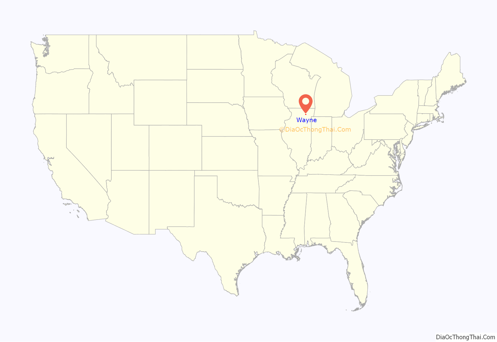
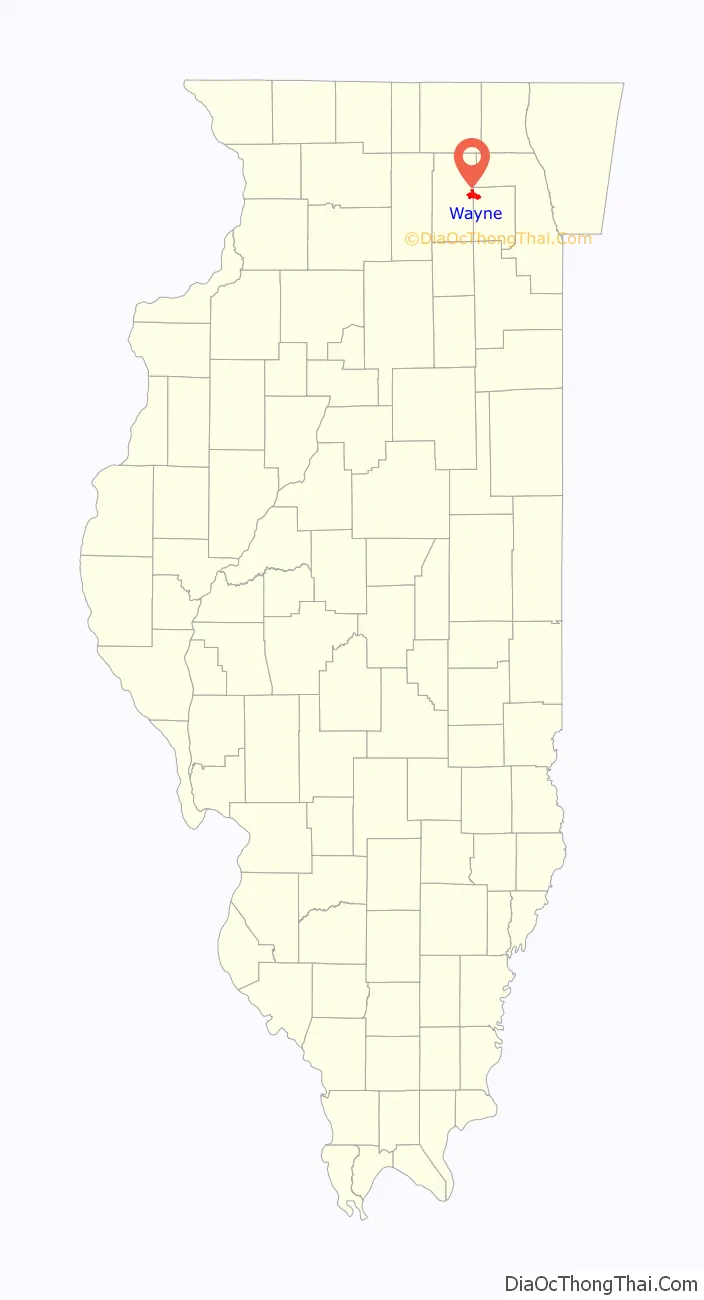
Wayne location map. Where is Wayne village?
History
Wayne was originally named Wayne Station and was named after Anthony Wayne. Wayne was incorporated in 1958. Previously, the community was administered as a private association called the “Wayne Community Association” with voluntary contributions funding village services including police.
Since World War II, Wayne has grown steadily, adding subdivisions near Illinois Route 59, off Munger Road, near Smith Road, near Dunham Castle at Army Trail Road, along Powis Road, and filling in throughout the Village. For work, residents are primarily commuters to Chicago via railroad stations in Geneva, Bartlett, or West Chicago or drive to Chicago or other suburbs particularly in Kane, DuPage, Lake, Cook, or McHenry County.
In October, 2007, the historic Chicago and Northwestern railway station was relocated from Dunham Castle to the Chicago and Northwestern Railroad (now Union Pacific) tracks at Army Trail Road. The station was originally at that location, but moved to Dunham Castle during the 1940s or 1950s; the old station was converted to a horse stable. Through grants and contributions from Dunham Castle’s owners, the station was moved back to its original location and is currently being restored. This building is locally called “The Depot”. Additional railroad buildings were relocated to private property in the Village including one station building about ½ mile west of Munger Road on Army Trail Road.
Oaklawn Farm and Dunham Castle
Wayne’s primary landmark is the Dunham Castle, originally built between 1878 and 1882. The stone structure, complete with turret, was inspired by a Norman castle and was built by one of Wayne’s first pioneers, Mark Dunham, a Percheron horse breeder. Assisting Mark in the design was architect Smith Hoag of Elgin, Illinois.
Mark Dunham’s horse farm, Oaklawn Farm, founded in Wayne in 1866, was one of the earliest Percheron breeding farms in the U.S.; Dunham is known as the “Father of the Percheron in North America”. During the 1893 World’s Columbian Exposition, a train from Chicago to Wayne brought guests to see the Percheron horses at the 2,000 acres (8.1 km) farm. Those that made the trip included Cyrus McCormick, George Pullman, and the Duke of Veragua.
At the height of the Percheron business, Dunham built a house, now called Dunham Castle, near the farm, on the northwest corner of Army Trail Road and Dunham Road. The Dunhams-based the idea for the design of their new home on that of French chateaux. The building, of brick, and stone, with different colored slate roofing, stands surrounded by woods, gardens, and a gently sloping lawn. The interior has parquet floors, statues, tapestries, and copies of fine, French artwork.
In 1899, Wirth Dunham inherited Dunham Castle. He died in 1931. In 1953, Dunham Castle was converted into four spacious apartments. No interior alterations were made that affected the structure. Between 1953 and 1976 there were several owners. In 1976, the Castle was sold to the Griffins family, who looked into making the house a museum, professional office, or private dining club. In 1976, the house was put up for sale.
The castle has been rarely open to public tours, and for charity fund raisers. The house is again privately owned, having been sold in October, 2013 and in early 2016 started extensive renovation by its private owner with completion expected in 2021.
When Marc Dunham finished the construction of Dunham Castle, and made it his primary residence, the original Dunham home evolved into an inn and sales pavilion for the Dunham family’s Oaklawn Farm. However, Percheron horse demand declined steadily as gas-powered cars, trucks, and farm implements grew in popularity, finally making Percherons a novelty or parade horse, and Oaklawn Farm ceased operation as a commercial enterprise. The offices of Dunham’s farm, then popularly known as the “Inn”, are well-preserved, now home to Wayne’s only dining establishment and social club, the Dunham Woods Riding Club.
Dunham Woods Riding Club
The Dunham Woods Riding Club was founded in 1934 by a group of Wayne and Geneva residents who leased the original Dunham family home. A fire destroyed the original old coach house in 1950 and the proceeds of the insurance were utilized by the club to purchase the Inn, the Lower Barn, swimming pool, tennis courts, and surrounding land. The Gray Room ballroom, Formal Dining Room and a new kitchen were added in 1957.
In 1961, the Wayne-DuPage Hunt was instrumental in purchasing more land from Dunham’s Inc., including the Kennels and Upper Barn. This purchase was made in the name of the Dunham Woods Riding Club. Additional land was purchased in 1975, which included the outdoor riding rings, indoor riding ring, outside cross-country course, tenant house, and new pole barn all of which are leased to the Hunt by the club.
In 1979, the four corners comprising the intersection of Army Trail and Dunham Roads, The Dunham Woods Riding Club and Dunham Castle, together with the additional surrounding land and outbuildings were accepted into the National Register of Historic Places.
The Dunham Woods Riding Club is an active social and tennis club, with three dining rooms, two private rooms, a terrace, and a patio. The club hosts a variety of social events and private parties and is open February through December. Club members are primarily Wayne residents, as well as residents from neighboring communities such as St. Charles and Geneva.
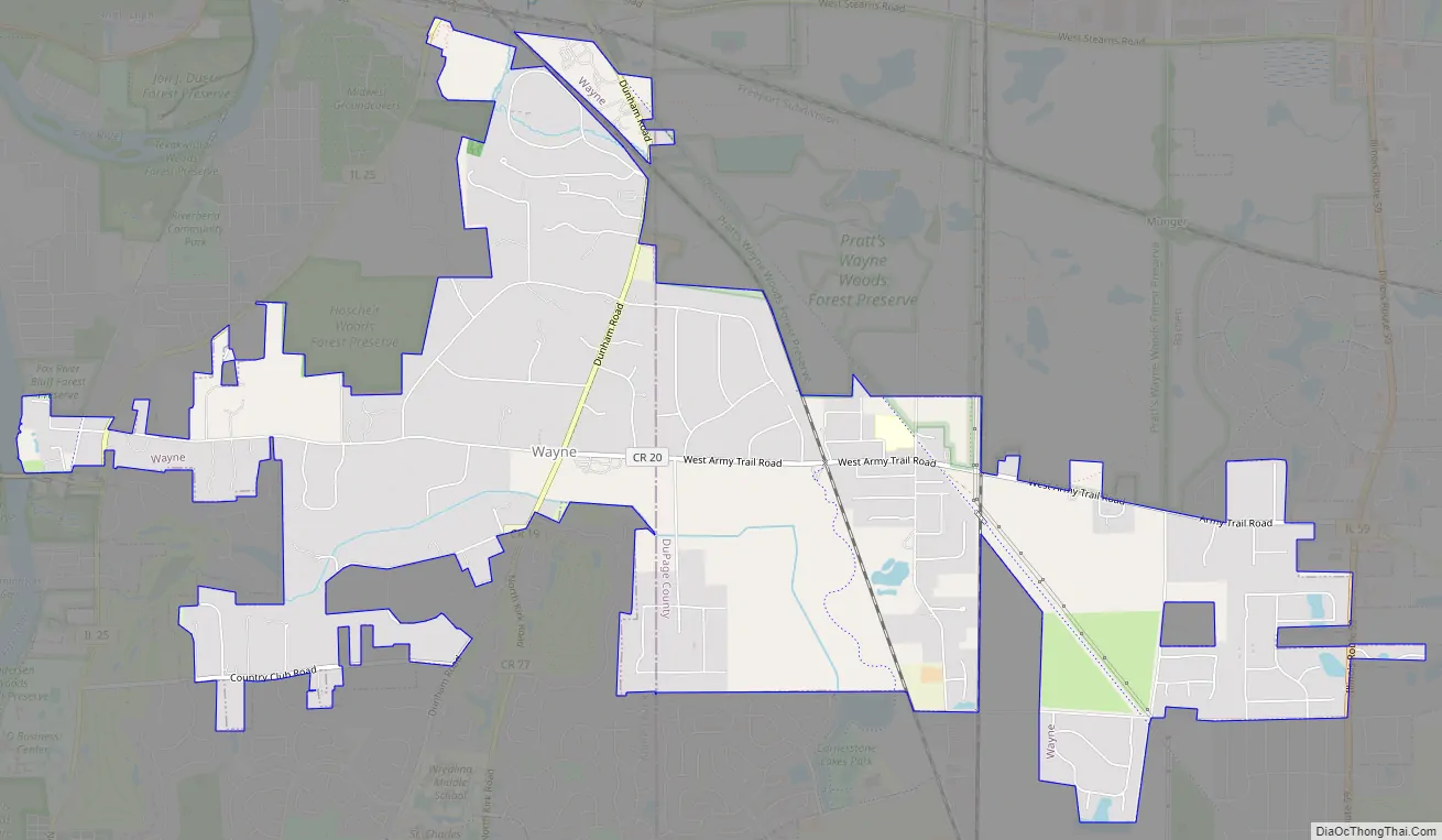
Wayne Road Map
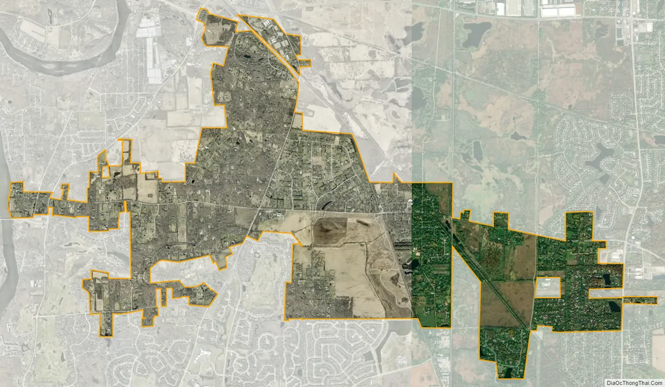
Wayne city Satellite Map
Geography
Wayne is located at 41°56′58″N 88°15′31″W / 41.94944°N 88.25861°W / 41.94944; -88.25861 (41.9493585, -88.2586396).
According to the 2021 census gazetteer files, Wayne has a total area of 5.82 square miles (15.07 km), of which 5.73 square miles (14.84 km) (or 98.40%) is land and 0.09 square miles (0.23 km) (or 1.60%) is water. Wayne is dotted by small streams, wetlands, and small ponds.
See also
Map of Illinois State and its subdivision:- Adams
- Alexander
- Bond
- Boone
- Brown
- Bureau
- Calhoun
- Carroll
- Cass
- Champaign
- Christian
- Clark
- Clay
- Clinton
- Coles
- Cook
- Crawford
- Cumberland
- De Kalb
- De Witt
- Douglas
- Dupage
- Edgar
- Edwards
- Effingham
- Fayette
- Ford
- Franklin
- Fulton
- Gallatin
- Greene
- Grundy
- Hamilton
- Hancock
- Hardin
- Henderson
- Henry
- Iroquois
- Jackson
- Jasper
- Jefferson
- Jersey
- Jo Daviess
- Johnson
- Kane
- Kankakee
- Kendall
- Knox
- La Salle
- Lake
- Lake Michigan
- Lawrence
- Lee
- Livingston
- Logan
- Macon
- Macoupin
- Madison
- Marion
- Marshall
- Mason
- Massac
- McDonough
- McHenry
- McLean
- Menard
- Mercer
- Monroe
- Montgomery
- Morgan
- Moultrie
- Ogle
- Peoria
- Perry
- Piatt
- Pike
- Pope
- Pulaski
- Putnam
- Randolph
- Richland
- Rock Island
- Saint Clair
- Saline
- Sangamon
- Schuyler
- Scott
- Shelby
- Stark
- Stephenson
- Tazewell
- Union
- Vermilion
- Wabash
- Warren
- Washington
- Wayne
- White
- Whiteside
- Will
- Williamson
- Winnebago
- Woodford
- Alabama
- Alaska
- Arizona
- Arkansas
- California
- Colorado
- Connecticut
- Delaware
- District of Columbia
- Florida
- Georgia
- Hawaii
- Idaho
- Illinois
- Indiana
- Iowa
- Kansas
- Kentucky
- Louisiana
- Maine
- Maryland
- Massachusetts
- Michigan
- Minnesota
- Mississippi
- Missouri
- Montana
- Nebraska
- Nevada
- New Hampshire
- New Jersey
- New Mexico
- New York
- North Carolina
- North Dakota
- Ohio
- Oklahoma
- Oregon
- Pennsylvania
- Rhode Island
- South Carolina
- South Dakota
- Tennessee
- Texas
- Utah
- Vermont
- Virginia
- Washington
- West Virginia
- Wisconsin
- Wyoming


