Westmont is a village in DuPage County, Illinois, United States. Located approximately 18 miles (29 km) west of the Chicago Loop in the southeastern portion of DuPage County, Westmont is a community of 5.03 square miles in area with a 2020 population of 24,429.
| Name: | Westmont village |
|---|---|
| LSAD Code: | 47 |
| LSAD Description: | village (suffix) |
| State: | Illinois |
| County: | DuPage County |
| Incorporated: | 1921 |
| Total Area: | 5.11 sq mi (13.23 km²) |
| Land Area: | 5.00 sq mi (12.96 km²) |
| Water Area: | 0.10 sq mi (0.27 km²) 2.14% |
| Total Population: | 24,429 |
| Population Density: | 4,881.89/sq mi (1,884.88/km²) |
| Area code: | 630 and 331 |
| FIPS code: | 1780645 |
| Website: | www.westmont.il.gov |
Online Interactive Map
Click on ![]() to view map in "full screen" mode.
to view map in "full screen" mode.
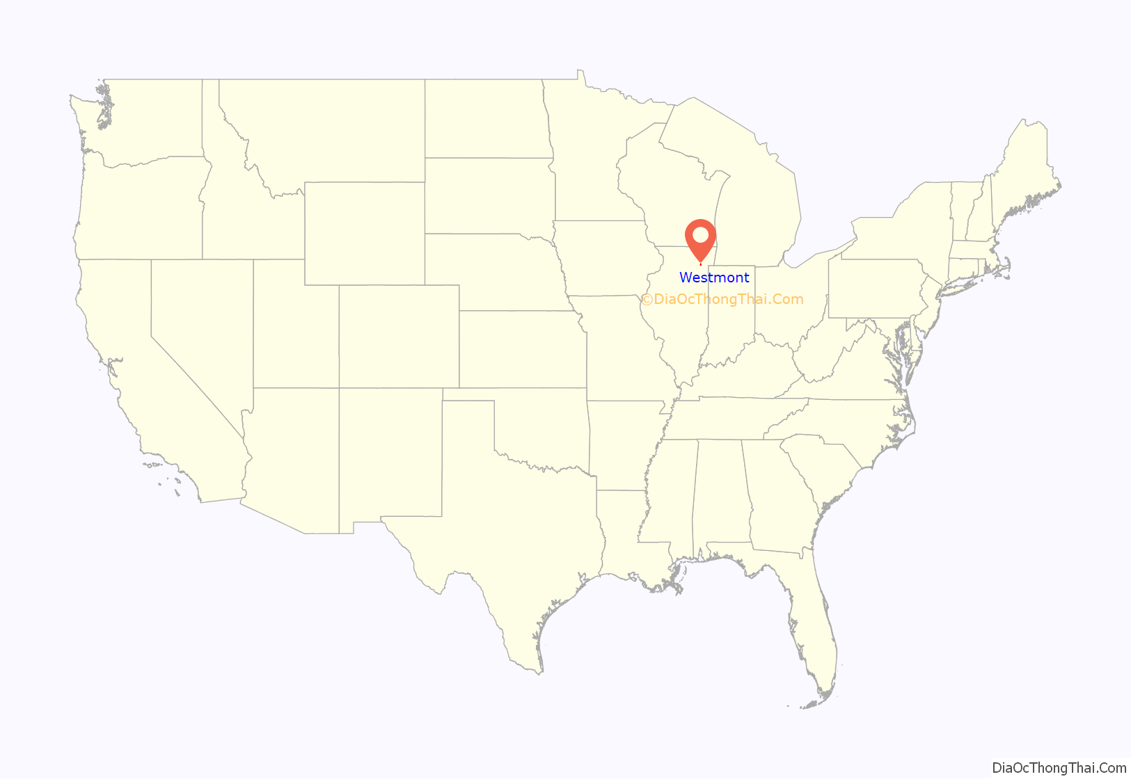
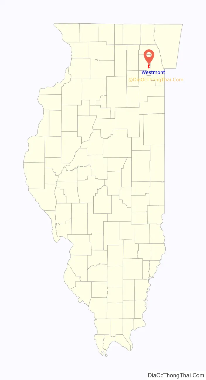
Westmont location map. Where is Westmont village?
History
The area known as Westmont earlier had been inhabited by the Potawatami. After several failed attempts by the U.S. government to persuade the Native Americans to move from the area, in 1833 they agreed under coercion to vacate their land for a nominal payment.
The development of the Illinois-Michigan Canal, authorized by the State of Illinois in the 1820s but delayed in construction until the 1830s, contributed to Westmont’s early growth. Many of the workers turned to farming when the economic panic of 1837 halted canal construction; agriculture became the major occupation with produce sold in nearby Chicago. The area around Westmont became one of the most prosperous sections of the state.
In order to transport agricultural products into the city of Chicago, construction of a plank road from Chicago began in 1840. The path traversed the nine-mile (14 km) swamp between Chicago and the area that later became Westmont; it reached Naperville by 1851. Today, this path is known as Ogden Avenue (U.S. Route 34).
The plank road soon became inadequate; in 1858, local incorporated towns and villages petitioned the Chicago, Burlington and Quincy Railroad to build a branch line from Aurora to Chicago that would pass through their towns. The railroad line was approved, with the first train in 1864. “Gregg’s Milk Station,” from which Westmont developed, was a stop to load agricultural and dairy products. The town transitioned gradually from an agricultural community to a commuter community, with the early growth and development centered around the railroad station.
In the early 1900s, plats for the Village of Westmont were laid out and roads were dedicated; incorporation was decided by a vote of 41-28 in 1921. Westmont was officially incorporated on November 4, 1921; Vince Pastor served as the first president of the Village Board.
The Village did not encourage concentrated commercial or industrial growth until the 1950s, with the development of some light service companies, industrial firms, and wholesaling firms. However, it was not until the 1960s and 1970s that Westmont began to grow in earnest; Westmont High School did not open until 1974. New subdivisions and multiple-family housing units led to the tripling of the population.
The current Westmont Public Library building opened in 1993.
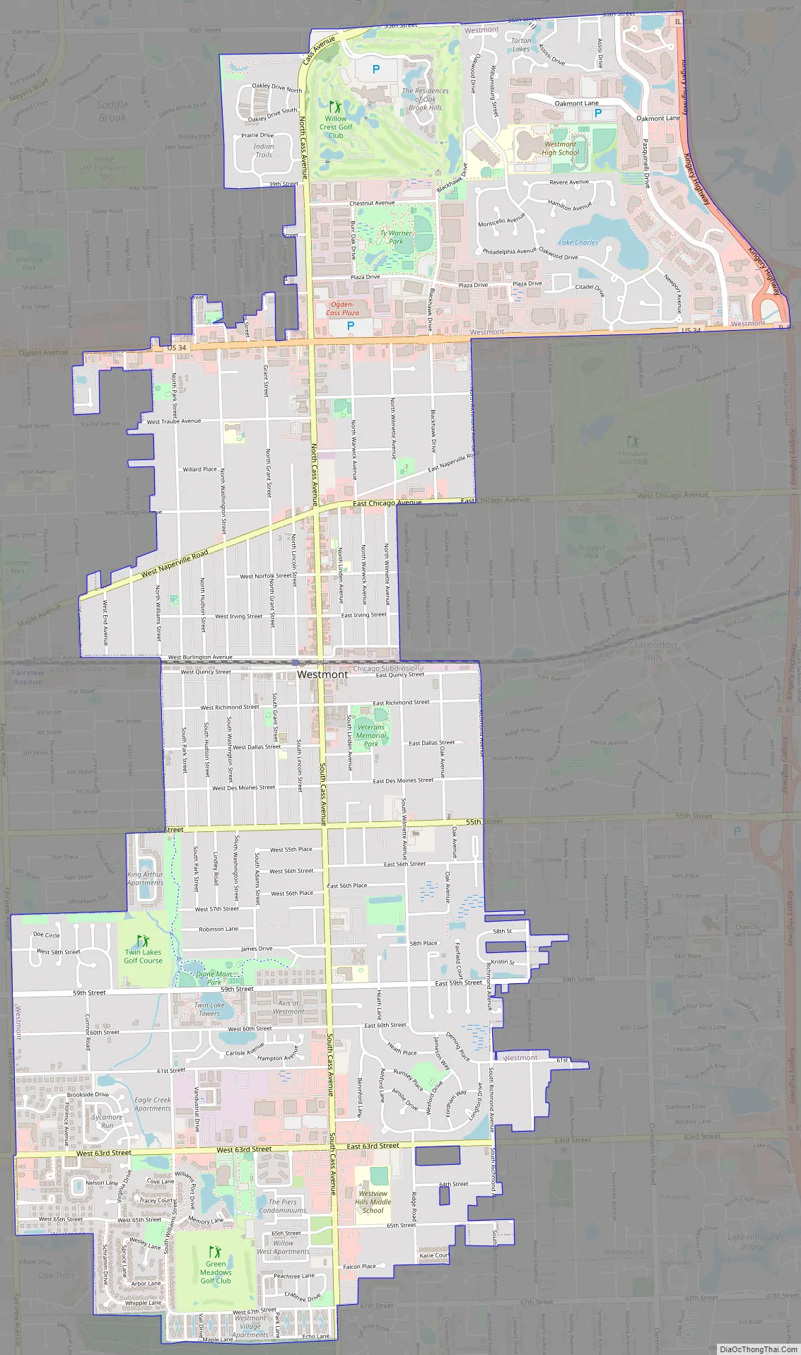
Westmont Road Map
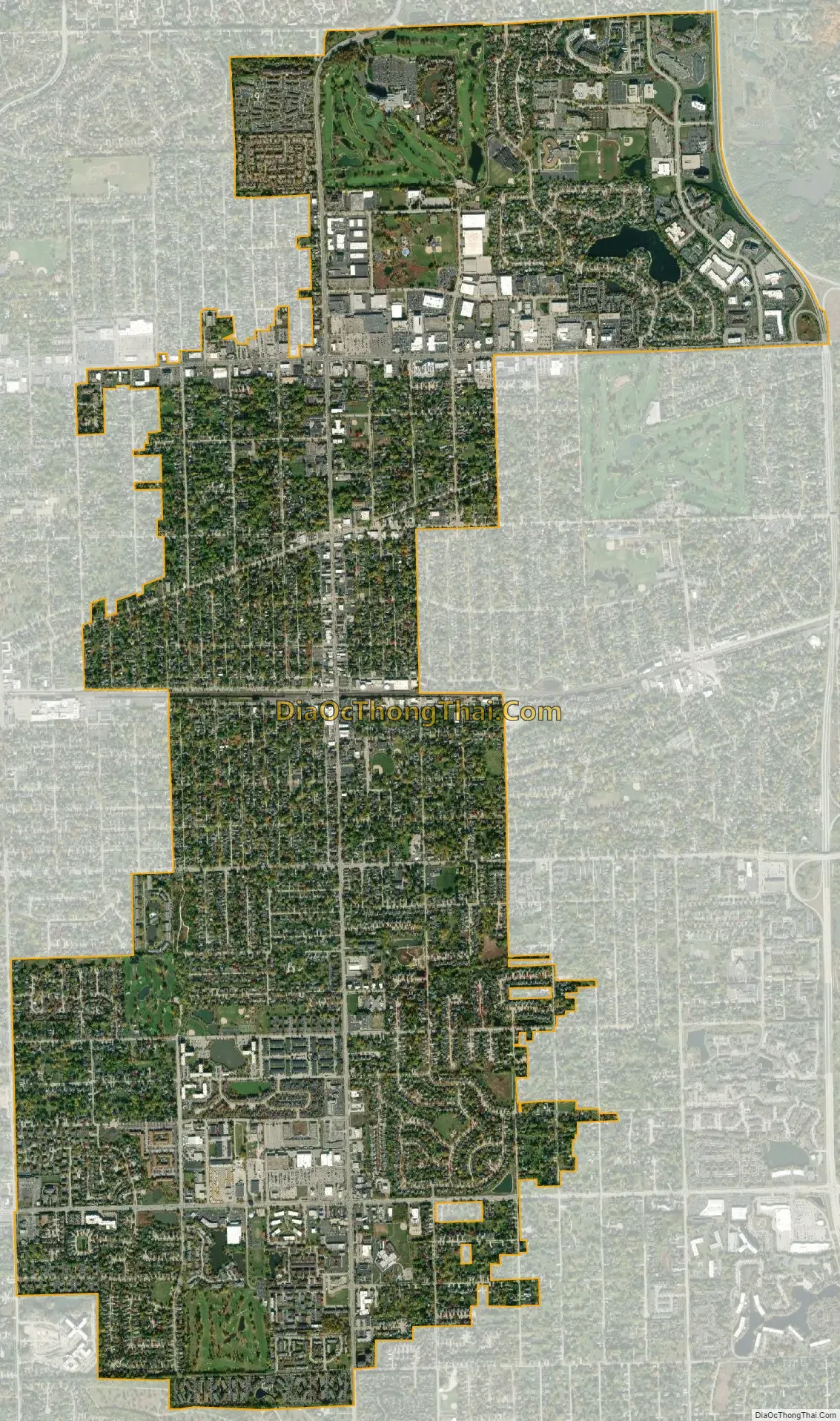
Westmont city Satellite Map
Geography
Westmont is located at 41°47′40″N 87°58′35″W / 41.79444°N 87.97639°W / 41.79444; -87.97639 (41.794480, -87.976433). It is bounded on the north by the Village of Oak Brook, on the east by the Village of Clarendon Hills, on the south by the City of Darien and on the west by the Village of Downers Grove. It is nearly wholly within Downers Grove Township.
According to the 2021 census gazetteer files, Westmont has a total area of 5.11 square miles (13.23 km), of which 5.00 square miles (12.95 km) (or 97.94%) is land and 0.11 square miles (0.28 km) (or 2.06%) is water.
See also
Map of Illinois State and its subdivision:- Adams
- Alexander
- Bond
- Boone
- Brown
- Bureau
- Calhoun
- Carroll
- Cass
- Champaign
- Christian
- Clark
- Clay
- Clinton
- Coles
- Cook
- Crawford
- Cumberland
- De Kalb
- De Witt
- Douglas
- Dupage
- Edgar
- Edwards
- Effingham
- Fayette
- Ford
- Franklin
- Fulton
- Gallatin
- Greene
- Grundy
- Hamilton
- Hancock
- Hardin
- Henderson
- Henry
- Iroquois
- Jackson
- Jasper
- Jefferson
- Jersey
- Jo Daviess
- Johnson
- Kane
- Kankakee
- Kendall
- Knox
- La Salle
- Lake
- Lake Michigan
- Lawrence
- Lee
- Livingston
- Logan
- Macon
- Macoupin
- Madison
- Marion
- Marshall
- Mason
- Massac
- McDonough
- McHenry
- McLean
- Menard
- Mercer
- Monroe
- Montgomery
- Morgan
- Moultrie
- Ogle
- Peoria
- Perry
- Piatt
- Pike
- Pope
- Pulaski
- Putnam
- Randolph
- Richland
- Rock Island
- Saint Clair
- Saline
- Sangamon
- Schuyler
- Scott
- Shelby
- Stark
- Stephenson
- Tazewell
- Union
- Vermilion
- Wabash
- Warren
- Washington
- Wayne
- White
- Whiteside
- Will
- Williamson
- Winnebago
- Woodford
- Alabama
- Alaska
- Arizona
- Arkansas
- California
- Colorado
- Connecticut
- Delaware
- District of Columbia
- Florida
- Georgia
- Hawaii
- Idaho
- Illinois
- Indiana
- Iowa
- Kansas
- Kentucky
- Louisiana
- Maine
- Maryland
- Massachusetts
- Michigan
- Minnesota
- Mississippi
- Missouri
- Montana
- Nebraska
- Nevada
- New Hampshire
- New Jersey
- New Mexico
- New York
- North Carolina
- North Dakota
- Ohio
- Oklahoma
- Oregon
- Pennsylvania
- Rhode Island
- South Carolina
- South Dakota
- Tennessee
- Texas
- Utah
- Vermont
- Virginia
- Washington
- West Virginia
- Wisconsin
- Wyoming