Winfield is an incorporated village located in Milton and Winfield Townships, DuPage County, Illinois, United States. The population was 9,080 at the 2010 census and as of 2019, the estimated population was 9,636.
Winfield is home to Central DuPage Hospital, one of the largest hospitals in the Chicago suburbs. Winfield has a Metra station on the Union Pacific/West Line, which provides regular commuter rail service to Chicago. Attractions adjacent to Winfield include the Forest Preserve District of DuPage County’s Kline Creek Farm, a living history farm located on the west side of County Farm Road between Geneva and St. Charles Roads; and the McCormick Foundation’s Cantigny Park, which includes public gardens, museums, golf courses, picnic grounds and hiking trails. Cantigny is located on the east side of Winfield Road, just south of Illinois Route 38, also known as Roosevelt Road. Winfield also enjoys parks and recreational services provided by the Winfield Park District. The Forest Preserve District of DuPage County also owns and operates several other open space areas surrounding Winfield. Winfield is considered to be among the safest towns in Illinois.
| Name: | Winfield village |
|---|---|
| LSAD Code: | 47 |
| LSAD Description: | village (suffix) |
| State: | Illinois |
| County: | DuPage County |
| Incorporated: | April 18, 1921 (1921-04-18) |
| Elevation: | 768 ft (234 m) |
| Total Area: | 3.13 sq mi (8.09 km²) |
| Land Area: | 3.09 sq mi (8.00 km²) |
| Water Area: | 0.04 sq mi (0.09 km²) |
| Total Population: | 9,835 |
| Population Density: | 3,182.85/sq mi (1,228.85/km²) |
| FIPS code: | 1782400 |
| GNISfeature ID: | 2399715 |
| Website: | www.villageofwinfield.com |
Online Interactive Map
Click on ![]() to view map in "full screen" mode.
to view map in "full screen" mode.
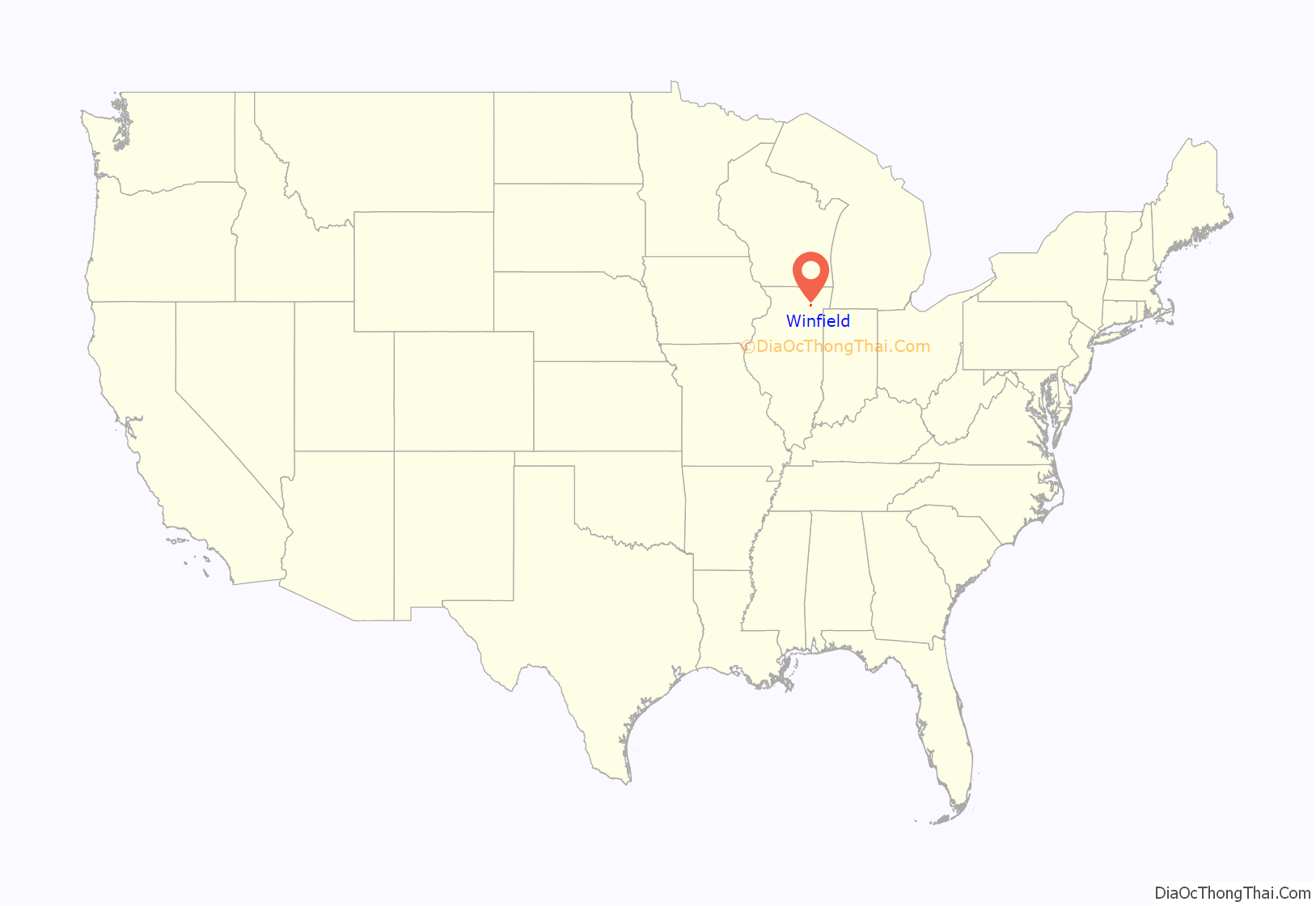
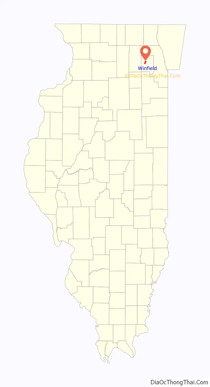
Winfield location map. Where is Winfield village?
History
Winfield originally tried to become an incorporated village in 1884 under the town name ‘Frederick Park’. However, the motion was denied as the town did not have 300 residents as was required for incorporation. When the village was finally incorporated in 1921, the town had a population of 310 people.
The earliest settlers, Erastus and Jude P. Gary, came to Winfield in 1832. Winfield was originally known as Gary’s Mill after these early settlers, and later, Fredericksburg, owing to a significant German-speaking population. Before 1850, most Winfield residents were migrants from New England; however, by 1860, half of the residents were from Germany and Alsace-Lorraine. Winfield retained a community of German-speaking farmers until the 1920s. In the late 1800s, the settlement’s name was changed again to Winfield after the war hero Winfield Scott.
Winfield was home to one of the oldest taverns in the Chicago suburbs, John’s Restaurant and Tavern (formerly John’s Buffet), founded in 1921 by immigrant John T Karwoski. It closed its doors in December 2017. John Karwoski was instrumental in the political and economic development of Winfield, and it was his guidance and leadership that took a fledgling prairie town clinging to existence after the railroad boom went bust, and turned it into a viable and livable village. Mr Karwoski became the first Chief of the all-volunteer Winfield Volunteer Fire Company in 1935. 45 years later, his son John Karwoski II was made Chief of the expanded Winfield Fire Protection District in 1980.
Winfield was served by The Winfield Glimpses newspaper from October 1947 to October 1976. The Glimpses changed its name to the Winfield Examiner in November 1976 and ran until February 1992. A full collection of these newspapers is available on microfilm at the Winfield Public Library.
Historical places
Winfield is also home to another remnant of the past, called Schmidt’s Pond. In the late 1800s, Peter Schmidt dug a pond to provide a place to harvest ice in the winter. Schmidt used the ice for his meat market, but also provided ice to the village in general. The property which is located between Park Street and Summit Avenue, just south of Town Center Winfield, also featured an ice house to store the harvested ice. While the ice house has since been turned into a private residence, the pond survives. The pond all but disappeared in the 1970s and 1980s due to lowering water tables, but has since returned, thanks in part to the village hooking up to Lake Michigan for its primary water use and a rising water table. The pond is home to many ducks, geese, muskrat, crayfish, frogs, toads and fish, and while the pond is on private property, it can be seen from Park Street and Summit Avenues. Numerous lots adjacent to Schmidt’s Pond today are open lots left this way intentionally for flood control purposes.
Hedges station is the oldest train depot in Illinois. It was built in 1849 on the west side of Church Street, where the police station is currently standing. In 1977, Winfield Township bought the station after all the owners had died. Their plan to demolish the building to construct a parking lot and more village offices was opposed by citizens who wanted the oldest building standing in Winfield to be turned into a historical site instead. After many arguments, the Township decided to move into another location. In 1981, Hedges station was moved to Winfield road, where it is currently located, and is now a museum.
In 1897, a rest home was constructed in Winfield. This rest home was owned by Jessie P. Forsythe until she retired in 1908 and sold it to Emanuel Mandel. In 1909, the home was reconstructed into the Chicago-Winfield Tuberculosis Sanitarium. As tuberculosis became a curable disease, the Sanitarium saw a decrease in patients and eventually all were transferred to Michael Reese in Chicago. Then, in 1962, the Sanitarium was purchased by the Central DuPage Hospital Association.
The Samuel and Eleanor Himmelfarb Home and Studio was constructed in the wooded outskirts of western Winfield, IL in 1942 by the modernist artists. The design was heavily influenced by the Usonian architectural styles of Frank Lloyd Wright.
St. John the Baptist Catholic Church was approved to be built on February 21, 1867. The residents of Winfield gathered their efforts and the church was erected later that year. The church even had its first baptism in 1867. On August 17, 1906, the church burned down in a thunder storm after it was struck by lightning. According to Louise Spanke, “only the altars, pews. stations of the cross, and communion rail could be saved.” The church was completely rebuilt within a year.
Samuel and Eleanor Himmelfarb Home and Studio, Winfield, Illinois, built 1942, National Register of Historical Places
Interior of St. John’s Catholic church
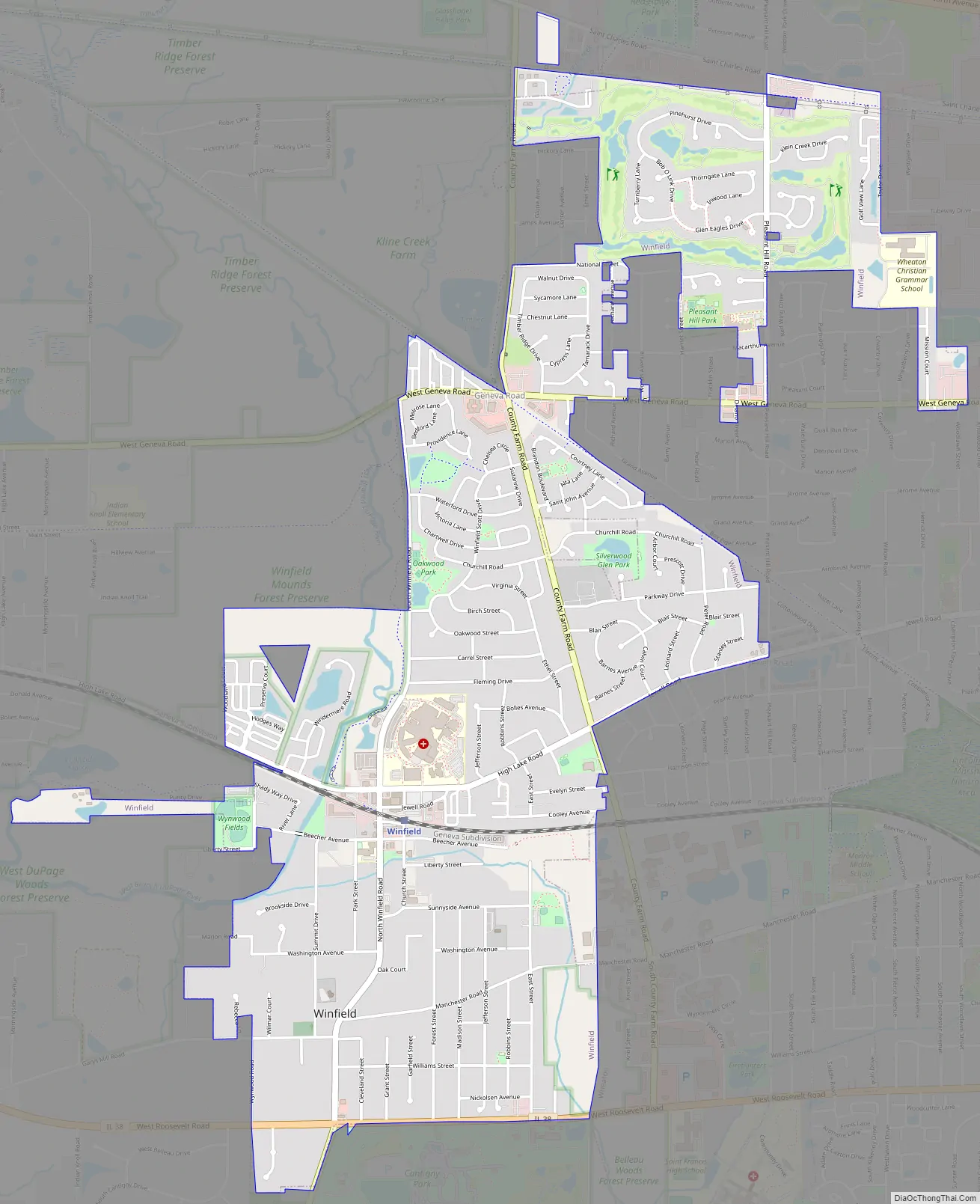
Winfield Road Map
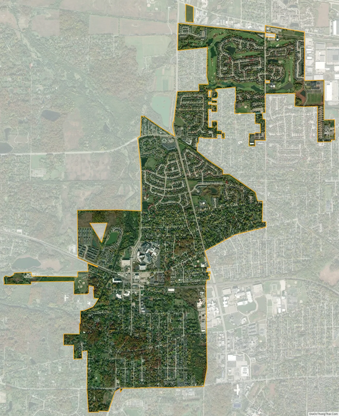
Winfield city Satellite Map
Geography
Winfield is located at 41°52′39″N 88°9′2″W / 41.87750°N 88.15056°W / 41.87750; -88.15056 (41.8776002, -88.1506695). Winfield is, by and large, surrounded by forests, including several DuPage County Forest Preserves on the north, west, and south. It borders Wheaton to the east, West Chicago to the west, Carol Stream to the north, and Warrenville and Naperville to the south.
According to the 2021 census gazetteer files, Winfield has a total area of 3.13 square miles (8.11 km), of which 3.09 square miles (8.00 km) (or 98.88%) is land and 0.04 square miles (0.10 km) (or 1.12%) is water.
In addition to the West Branch of the DuPage River, Klein Creek and Winfield Creek also flow through the village.
See also
Map of Illinois State and its subdivision:- Adams
- Alexander
- Bond
- Boone
- Brown
- Bureau
- Calhoun
- Carroll
- Cass
- Champaign
- Christian
- Clark
- Clay
- Clinton
- Coles
- Cook
- Crawford
- Cumberland
- De Kalb
- De Witt
- Douglas
- Dupage
- Edgar
- Edwards
- Effingham
- Fayette
- Ford
- Franklin
- Fulton
- Gallatin
- Greene
- Grundy
- Hamilton
- Hancock
- Hardin
- Henderson
- Henry
- Iroquois
- Jackson
- Jasper
- Jefferson
- Jersey
- Jo Daviess
- Johnson
- Kane
- Kankakee
- Kendall
- Knox
- La Salle
- Lake
- Lake Michigan
- Lawrence
- Lee
- Livingston
- Logan
- Macon
- Macoupin
- Madison
- Marion
- Marshall
- Mason
- Massac
- McDonough
- McHenry
- McLean
- Menard
- Mercer
- Monroe
- Montgomery
- Morgan
- Moultrie
- Ogle
- Peoria
- Perry
- Piatt
- Pike
- Pope
- Pulaski
- Putnam
- Randolph
- Richland
- Rock Island
- Saint Clair
- Saline
- Sangamon
- Schuyler
- Scott
- Shelby
- Stark
- Stephenson
- Tazewell
- Union
- Vermilion
- Wabash
- Warren
- Washington
- Wayne
- White
- Whiteside
- Will
- Williamson
- Winnebago
- Woodford
- Alabama
- Alaska
- Arizona
- Arkansas
- California
- Colorado
- Connecticut
- Delaware
- District of Columbia
- Florida
- Georgia
- Hawaii
- Idaho
- Illinois
- Indiana
- Iowa
- Kansas
- Kentucky
- Louisiana
- Maine
- Maryland
- Massachusetts
- Michigan
- Minnesota
- Mississippi
- Missouri
- Montana
- Nebraska
- Nevada
- New Hampshire
- New Jersey
- New Mexico
- New York
- North Carolina
- North Dakota
- Ohio
- Oklahoma
- Oregon
- Pennsylvania
- Rhode Island
- South Carolina
- South Dakota
- Tennessee
- Texas
- Utah
- Vermont
- Virginia
- Washington
- West Virginia
- Wisconsin
- Wyoming