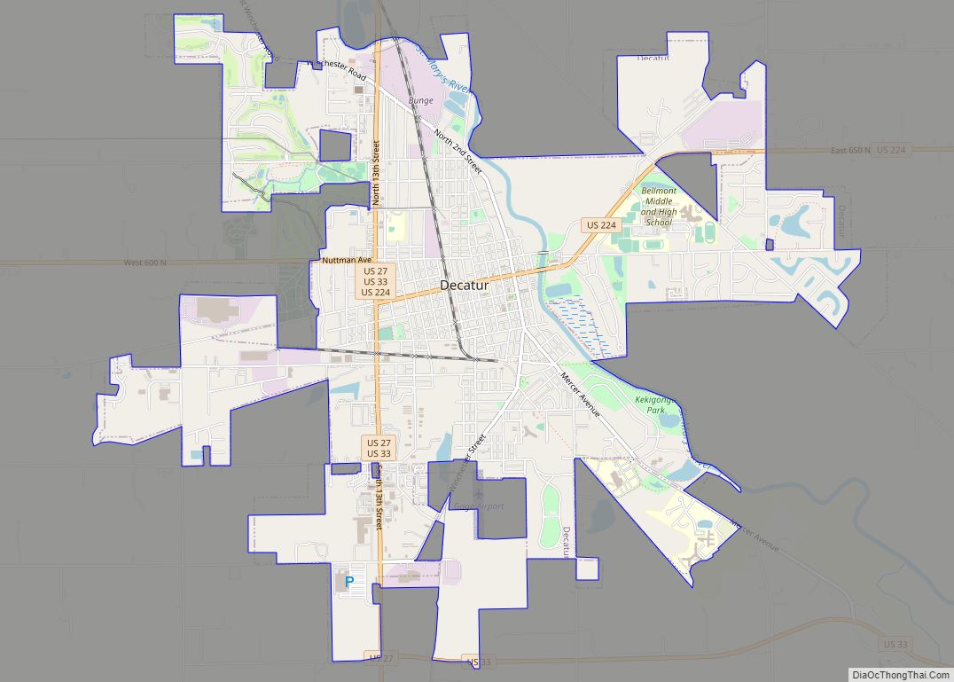
Decatur is a city in Root and Washington townships, Adams County, Indiana, United States. It is the county seat (and the largest community) of Adams County. Decatur is home to Adams Memorial Hospital, which was designated as one of the “Top 100” Critical Access Hospitals in the United States. The population of Decatur was 9,913 at the 2020 census.
| Name: | Decatur city |
|---|---|
| LSAD Code: | 25 |
| LSAD Description: | city (suffix) |
| State: | Indiana |
| County: | Adams County |
| Elevation: | 801 ft (244 m) |
| Total Area: | 6.11 sq mi (15.81 km²) |
| Land Area: | 6.10 sq mi (15.80 km²) |
| Water Area: | 0.01 sq mi (0.02 km²) |
| Total Population: | 9,913 |
| Population Density: | 1,625.08/sq mi (627.50/km²) |
| ZIP code: | 46733 |
| Area code: | 260 |
| FIPS code: | 1817074 |
| GNISfeature ID: | 0446543 |
| Website: | http://www.decaturin.org/ |
Online Interactive Map
Click on ![]() to view map in "full screen" mode.
to view map in "full screen" mode.
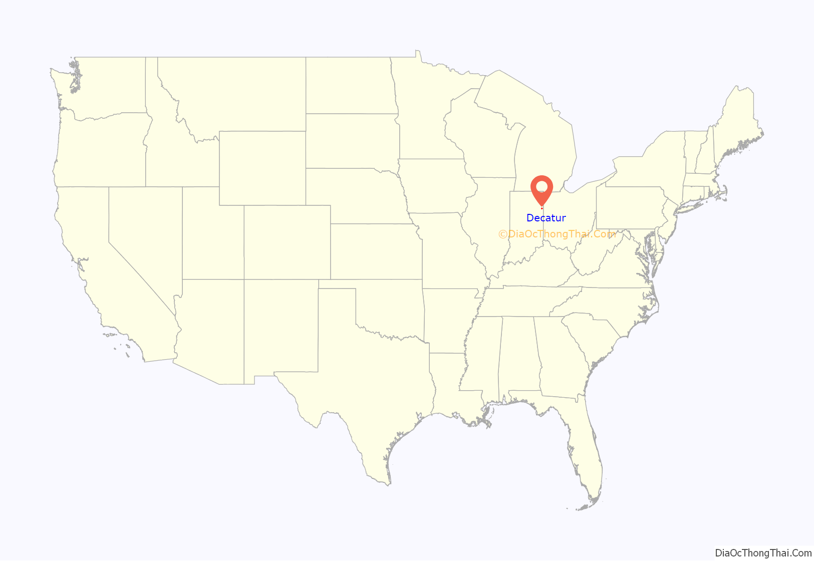
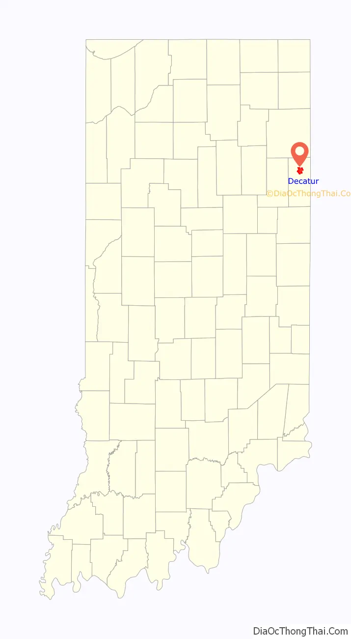
Decatur location map. Where is Decatur city?
History
The first non-Native American settlers arrived in what is now Decatur in 1835. They arrived as a result of the end of the Black Hawk War as well as the completion of the Erie Canal. They consisted entirely of settlers from New England. These were “Yankee” settlers, that is to say they were descended from the English Puritans who settled New England in the colonial era. They were primarily members of the Congregational Church though due to the Second Great Awakening many of them had converted to Methodism and some had become Baptists before coming to what is now Decatur. The Congregational Church subsequently has gone through many divisions and some factions are now known as the Church of Christ and Church of God. When the New England settlers arrived in what is now Decatur there was nothing but a dense virgin forest and wild prairie.
Decatur was founded in 1836. It was named for Stephen Decatur, Jr., one of the captains of the original six frigates of the US navy. A post office was established in Decatur in 1837.
After the Civil War, Decatur was known as a Sundown Town, where African Americans were discriminated against and eventually run out of the town completely in 1902. In a New York Times article published on July 14, 1902, the headline read, “Negro Driven Away,” and it recounted the story of the violent mob attacks which drove away African Americans from Decatur during the summer of 1902. The last line from the article explicitly concluded, “The anti-negroites declare that as Decatur is now cleared of Negroes they will keep it so, and the importation of any more will undoubtedly result in serious trouble.” A month before the last Black person was reportedly forced out of Decatur, the Indianapolis Freeman reported that 50 men began driving the Black people out because they “were determined that colored people should not live in the town.” Eventually African Americans began slowly settling in town, however, due to the sundown policies that persisted throughout much of the 1900s, the current demographics still indicate a low percentage of Black residents.
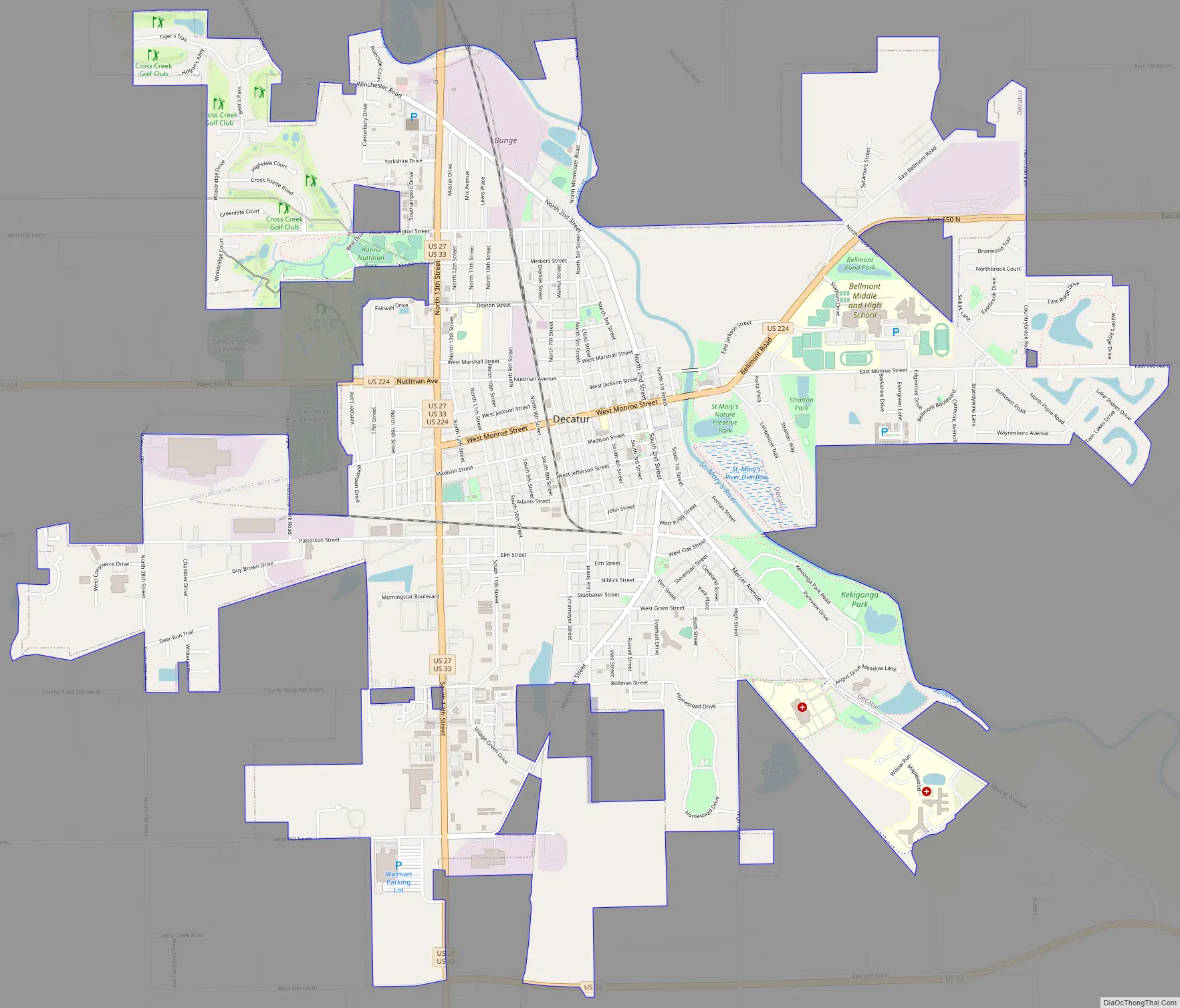
Decatur Road Map
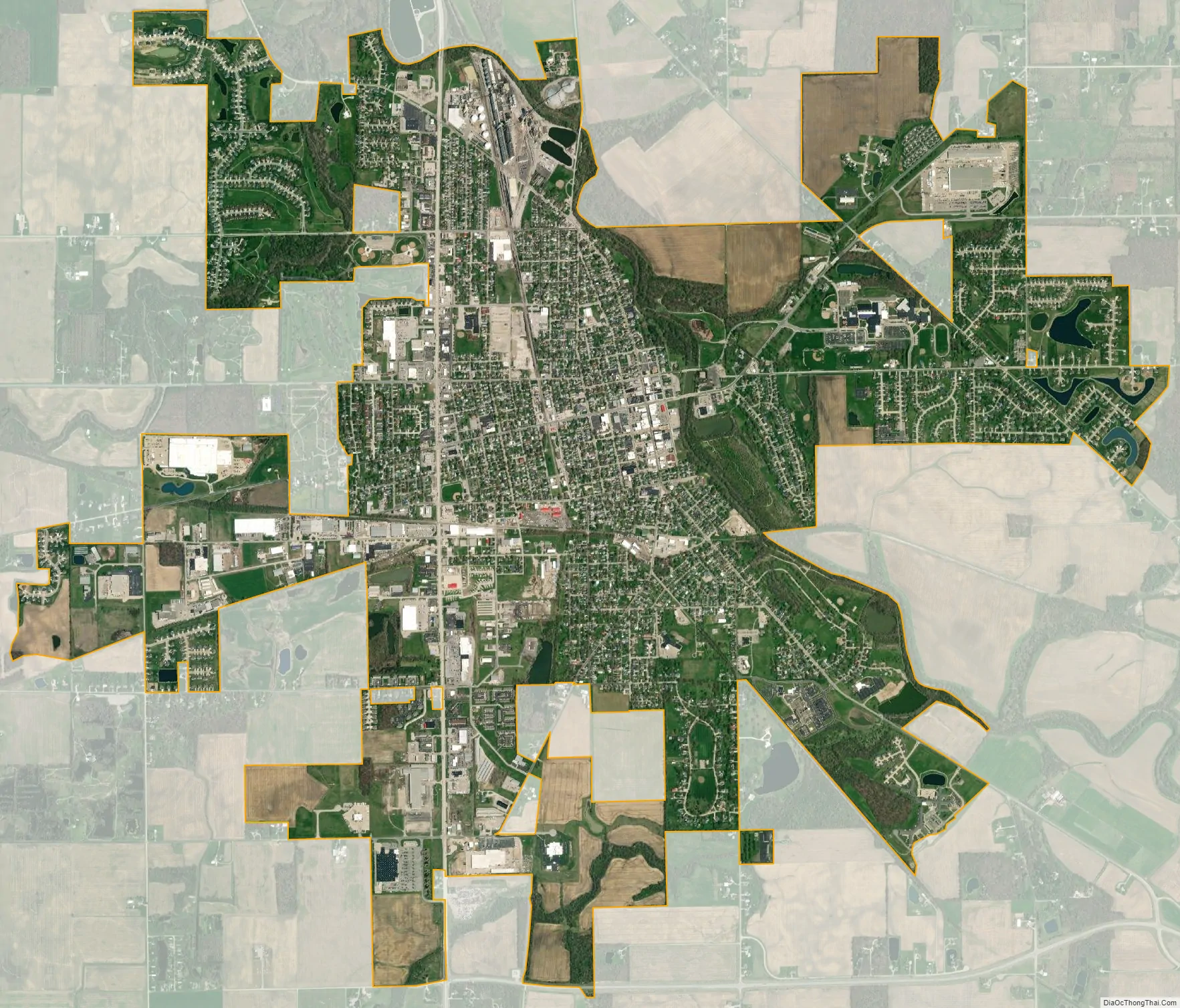
Decatur city Satellite Map
Geography
Decatur is located at 40°49′46″N 84°55′45″W / 40.82944°N 84.92917°W / 40.82944; -84.92917 (40.829581, -84.929185).
According to the 2010 United States Census, Decatur has a total area of 5.786 square miles (14.99 km), of which 5.78 square miles (14.97 km) (or 99.9%) is land and 0.006 square miles (0.02 km) (or 0.1%) is water.
See also
Map of Indiana State and its subdivision:- Adams
- Allen
- Bartholomew
- Benton
- Blackford
- Boone
- Brown
- Carroll
- Cass
- Clark
- Clay
- Clinton
- Crawford
- Daviess
- De Kalb
- Dearborn
- Decatur
- Delaware
- Dubois
- Elkhart
- Fayette
- Floyd
- Fountain
- Franklin
- Fulton
- Gibson
- Grant
- Greene
- Hamilton
- Hancock
- Harrison
- Hendricks
- Henry
- Howard
- Huntington
- Jackson
- Jasper
- Jay
- Jefferson
- Jennings
- Johnson
- Knox
- Kosciusko
- LaGrange
- Lake
- Lake Michigan
- LaPorte
- Lawrence
- Madison
- Marion
- Marshall
- Martin
- Miami
- Monroe
- Montgomery
- Morgan
- Newton
- Noble
- Ohio
- Orange
- Owen
- Parke
- Perry
- Pike
- Porter
- Posey
- Pulaski
- Putnam
- Randolph
- Ripley
- Rush
- Saint Joseph
- Scott
- Shelby
- Spencer
- Starke
- Steuben
- Sullivan
- Switzerland
- Tippecanoe
- Tipton
- Union
- Vanderburgh
- Vermillion
- Vigo
- Wabash
- Warren
- Warrick
- Washington
- Wayne
- Wells
- White
- Whitley
- Alabama
- Alaska
- Arizona
- Arkansas
- California
- Colorado
- Connecticut
- Delaware
- District of Columbia
- Florida
- Georgia
- Hawaii
- Idaho
- Illinois
- Indiana
- Iowa
- Kansas
- Kentucky
- Louisiana
- Maine
- Maryland
- Massachusetts
- Michigan
- Minnesota
- Mississippi
- Missouri
- Montana
- Nebraska
- Nevada
- New Hampshire
- New Jersey
- New Mexico
- New York
- North Carolina
- North Dakota
- Ohio
- Oklahoma
- Oregon
- Pennsylvania
- Rhode Island
- South Carolina
- South Dakota
- Tennessee
- Texas
- Utah
- Vermont
- Virginia
- Washington
- West Virginia
- Wisconsin
- Wyoming