Cape Girardeau (/dʒɪˈrɑːrdoʊ/ jirr-AR-doh, French: Cap-Girardeau [kap ʒiʁaʁdo] (listen); colloquially referred to as “Cape”) is a city in Cape Girardeau and Scott Counties in the U.S. state of Missouri. At the 2020 census, the population was 39,540. The city is one of two principal cities of the Cape Girardeau-Jackson, MO-IL Metropolitan Statistical Area, which encompasses Alexander County, Illinois, Bollinger County, Missouri and Cape Girardeau County, Missouri and has a population of 97,517. The city is the economic center of Southeast Missouri and also the home of Southeast Missouri State University. It is located approximately 100 miles (161 km) southeast of St. Louis and 150 miles (241 km) north of Memphis.
| Name: | Cape Girardeau city |
|---|---|
| LSAD Code: | 25 |
| LSAD Description: | city (suffix) |
| State: | Missouri |
| County: | Cape Girardeau County, Scott County |
| Founded: | 1793 |
| Elevation: | 371 ft (113 m) |
| Land Area: | 29.25 sq mi (75.76 km²) |
| Water Area: | 0.06 sq mi (0.15 km²) |
| Population Density: | 1,351.75/sq mi (521.91/km²) |
| Area code: | 573 |
| FIPS code: | 2911242 |
| GNISfeature ID: | 2393737 |
| Website: | cityofcapegirardeau.org |
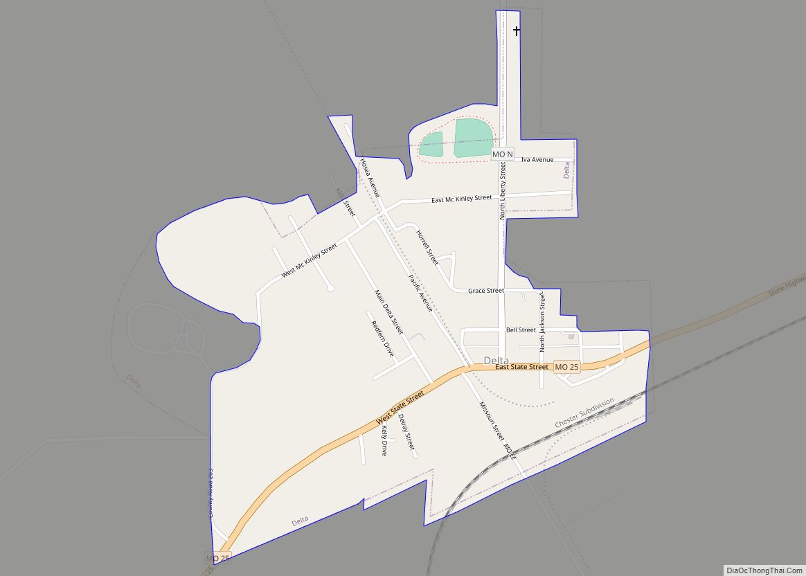
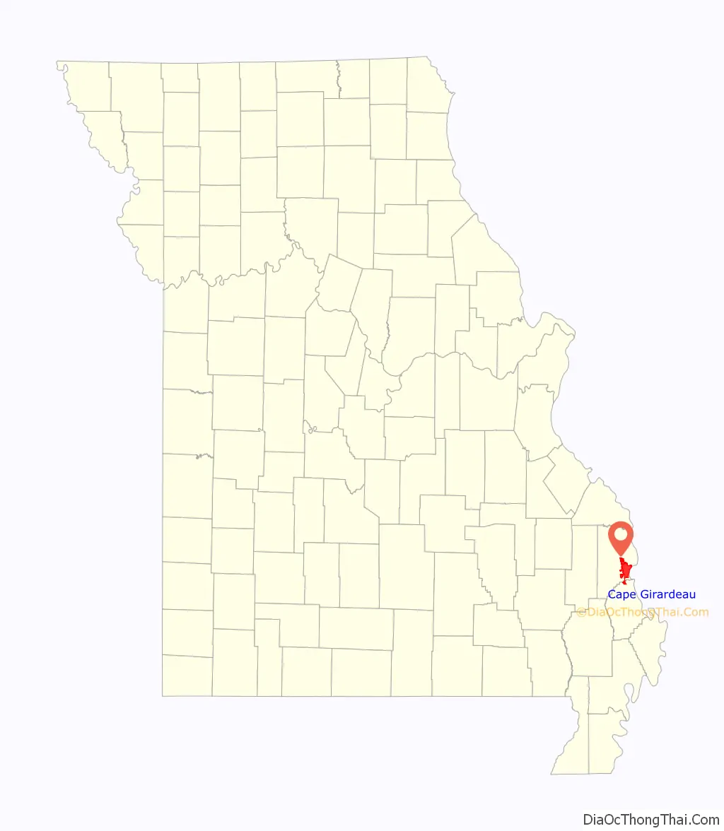
Online Interactive Map
Click on ![]() to view map in "full screen" mode.
to view map in "full screen" mode.
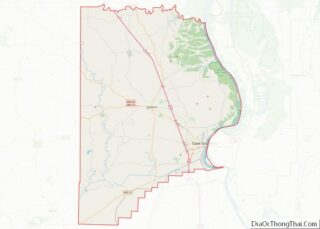
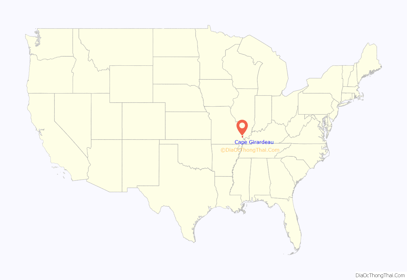
Cape Girardeau location map. Where is Cape Girardeau city?
History
The city is named after Jean Baptiste de Girardot, who established a temporary trading post in the area around 1733. He was a French soldier stationed at Kaskaskia between 1704 and 1720 in the French colony of La Louisiane. The “Cape” in the city name referred to a rock promontory overlooking the Mississippi River; it was later destroyed by railroad construction. As early as 1765, a bend in the Mississippi River, about 60 miles (97 km) south of the French village of Ste. Genevieve, had been referred to as Cape Girardot or Girardeau (both pronounced the same in French).
The settlement of Girardeau is said to date from 1793 when the Spanish government, which had acquired Louisiana in 1764 following the French defeat in the Seven Years’ War, granted Louis Lorimier, a French-Canadian, the right to establish a trading post. This gave him trading privileges and a large tract of land surrounding his post. Lorimier was made commandant of the district and prospered from the returns on his land sales and trade with indigenous peoples, such as the Ozark Bluff Dwellers and the Mississippian people.
Also in 1793, Baron Carondelet granted land near Cape Girardeau to the Black Bob Band of the Hathawekela Shawnee, who had migrated from across the Mississippi River. The Band became known as the Cape Girardeau Shawnee. They successfully resisted removal to Indian Territory with the rest of the Shawnee tribe until 1833.
In 1799, American settlers founded the first English school west of the Mississippi River in Cape Girardeau at a landmark called Mount Tabor, named by the settlers for the Biblical Mount Tabor.
The town of Cape Girardeau was incorporated in 1808, prior to Missouri statehood. It was reincorporated as a city in 1843. The advent of the steamboat in 1835 and related river trade stimulated the development of Cape Girardeau as the biggest port on the Mississippi River between St. Louis, Missouri and Memphis, Tennessee.
During the Civil War, the city was the site of the Battle of Cape Girardeau on April 26, 1863. The Union and Confederate armies engaged in a minor four-hour skirmish, each sustaining casualties generally believed to be in the low double-digits.
For years travelers had to use ferries to cross the Mississippi River from Cape Girardeau. In September 1928 a bridge was completed between Missouri and Illinois. Built to accommodate cars, it was 20 feet (6.1 m) wide under standards of the time.
The Old Federal Courthouse, located at Broadway and Fountain Streets and built in the late 1940s, was the subject of a U.S. Supreme Court case when it was being developed. In United States v. Carmack, 329 U.S. 230 (1946), the Court upheld the federal government’s authority under the Condemnation Act of 1888 to seize land owned by a state or locality.
In December 2003, the “Old Bridge” was succeeded by a new four-lane cable-stayed bridge crossing the Mississippi River at Cape Girardeau. Its official name is “The Bill Emerson Memorial Bridge.”, honoring former U.S. Rep. Bill Emerson (R-Mo.) The two towers of the bridge reach a height of approximately 91 metres (299 ft). The “Old Bridge” was demolished after the Emerson Bridge opened.
The City of Cape Girardeau was recognized in January 2008 by First Lady Laura Bush as a Preserve America Community for its work in surveying and protecting historic buildings.
The city is known to some as “The City of Roses” because of a 9-mile (14 km) stretch of highway that was once lined with dozens of rose bushes. Although there used to be many prominent rose gardens around the community, few of these gardens have been maintained. The city is also known as “Cape Girardeau: Where the River Turns a Thousand Tales,” due to the history of the town and the Mississippi River.
Historic landmarks
Numerous murals commemorate the city’s history. The largest is the Mississippi River Tales Mural, located on the city’s downtown floodwall. Covering nearly 18,000 square feet (1,700 m), it spans the length of the downtown shopping district and features 24 panels. Behind the floodwall lies the Riverfront Park of Cape Girardeau Missouri, where riverboats dock and visitors can view the Mississippi River.
There are 39 historic sites in Cape Girardeau that are listed on the National Register of Historic Places. Of these, eight are historic districts, such as Cape Girardeau Commercial Historic District, which was listed in 2000 and includes multiple contributing properties. The growth of the town can be documented through Sanborn maps, over 80 of which are available online. Other landmarks include the Fort D Historic Site and the Confederate War Memorial.
Among the city’s older cemeteries are Apple Creek Cemetery, Salem Cemetery, and Old Lorimier Cemetery.
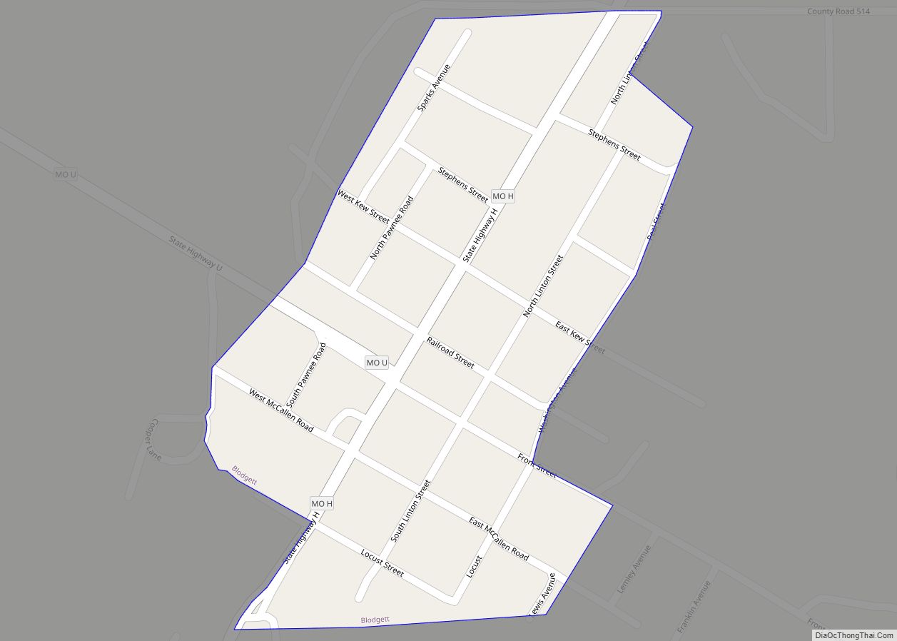
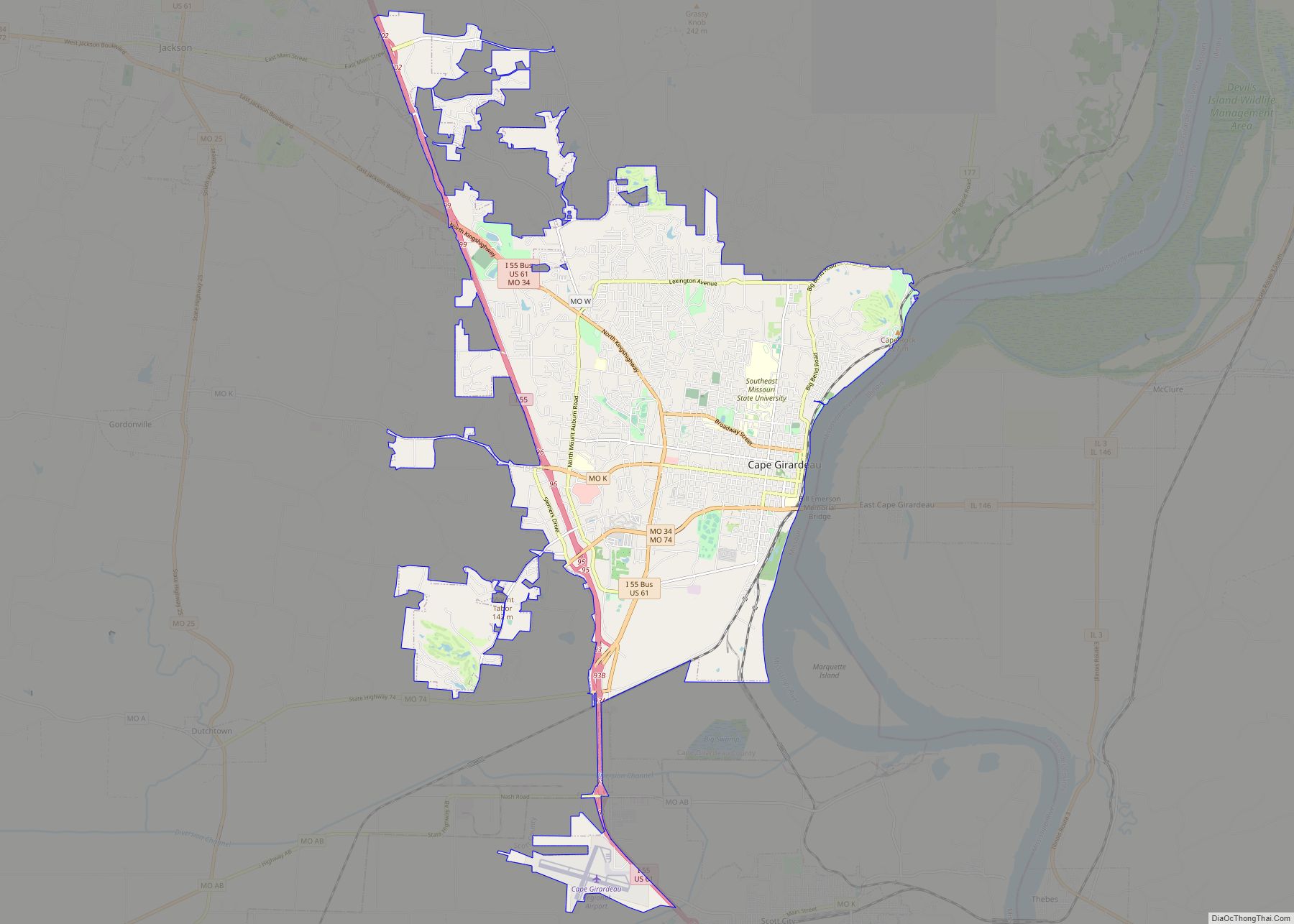
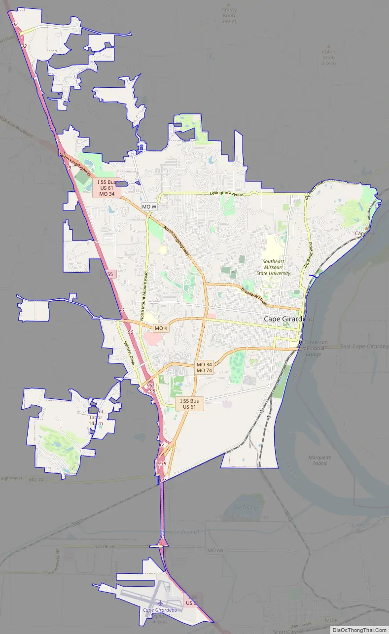
Cape Girardeau Road Map
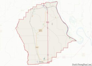
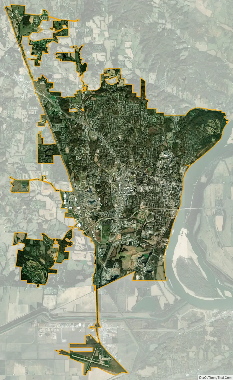
Cape Girardeau city Satellite Map
Geography
According to the United States Census Bureau, the city has a total area of 28.49 square miles (73.79 km), of which 28.43 square miles (73.63 km) is land and 0.06 square miles (0.16 km) is water. The “cape” that the city is named after no longer exists. A rock which remains from the previously existing cape can be seen on a promontory which overlooks the Mississippi River in Cape Rock Park.
Climate
Cape Girardeau has a humid subtropical climate (Köppen Cfa) with four distinct seasons and is located in USDA Plant Hardiness Zone 6b. Winter typically brings a mix of rain, sleet, and snow, with occasional heavy snowfall and icing. The city has a January daily average of 34.6 °F (1.4 °C) and averages 12.8 days annually with temperatures staying at or below freezing; the first and last freezes of the season on average fall on October 23 and April 7, respectively. Summer is typically hazy, hot, and humid with a July daily average of 79.3 °F (26.3 °C), and there is an average of 47 days a year with high temperatures at or above 90 °F (32 °C). The average annual precipitation is 47.91 inches (1,220 mm), with the rainiest season being spring. Extremes in temperature range from 107 °F (42 °C), which last occurred on June 29, 2012, down to −18 °F (−28 °C) on January 11, 1977.
See also
Map of Missouri State and its subdivision:- Adair
- Andrew
- Atchison
- Audrain
- Barry
- Barton
- Bates
- Benton
- Bollinger
- Boone
- Buchanan
- Butler
- Caldwell
- Callaway
- Camden
- Cape Girardeau
- Carroll
- Carter
- Cass
- Cedar
- Chariton
- Christian
- Clark
- Clay
- Clinton
- Cole
- Cooper
- Crawford
- Dade
- Dallas
- Daviess
- De Kalb
- Dent
- Douglas
- Dunklin
- Franklin
- Gasconade
- Gentry
- Greene
- Grundy
- Harrison
- Henry
- Hickory
- Holt
- Howard
- Howell
- Iron
- Jackson
- Jasper
- Jefferson
- Johnson
- Knox
- Laclede
- Lafayette
- Lawrence
- Lewis
- Lincoln
- Linn
- Livingston
- Macon
- Madison
- Maries
- Marion
- McDonald
- Mercer
- Miller
- Mississippi
- Moniteau
- Monroe
- Montgomery
- Morgan
- New Madrid
- Newton
- Nodaway
- Oregon
- Osage
- Ozark
- Pemiscot
- Perry
- Pettis
- Phelps
- Pike
- Platte
- Polk
- Pulaski
- Putnam
- Ralls
- Randolph
- Ray
- Reynolds
- Ripley
- Saint Charles
- Saint Clair
- Saint Francois
- Saint Louis
- Sainte Genevieve
- Saline
- Schuyler
- Scotland
- Scott
- Shannon
- Shelby
- Stoddard
- Stone
- Sullivan
- Taney
- Texas
- Vernon
- Warren
- Washington
- Wayne
- Webster
- Worth
- Wright
- Alabama
- Alaska
- Arizona
- Arkansas
- California
- Colorado
- Connecticut
- Delaware
- District of Columbia
- Florida
- Georgia
- Hawaii
- Idaho
- Illinois
- Indiana
- Iowa
- Kansas
- Kentucky
- Louisiana
- Maine
- Maryland
- Massachusetts
- Michigan
- Minnesota
- Mississippi
- Missouri
- Montana
- Nebraska
- Nevada
- New Hampshire
- New Jersey
- New Mexico
- New York
- North Carolina
- North Dakota
- Ohio
- Oklahoma
- Oregon
- Pennsylvania
- Rhode Island
- South Carolina
- South Dakota
- Tennessee
- Texas
- Utah
- Vermont
- Virginia
- Washington
- West Virginia
- Wisconsin
- Wyoming