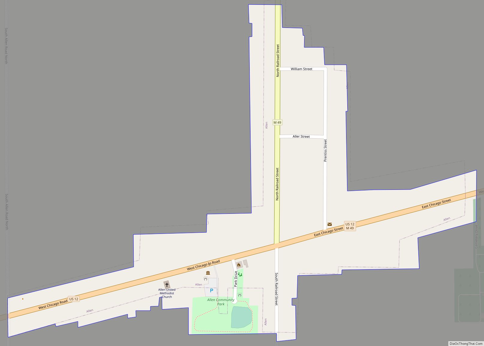
Allen is a village in Hillsdale County in the U.S. state of Michigan. The population was 201 at the 2020 census.
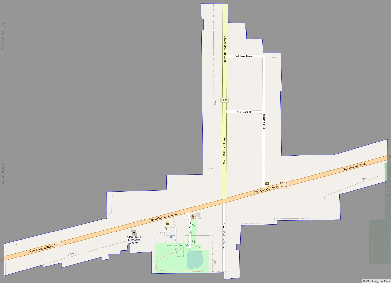
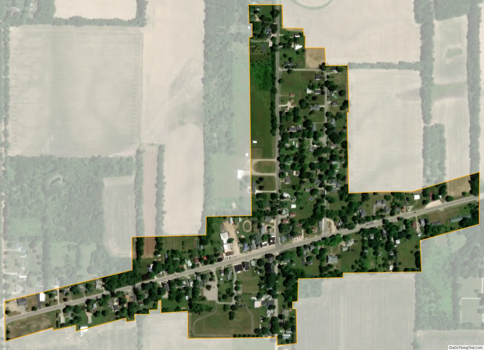
The village is within Allen Township at the junction of U.S. Route 12 and M-49. With a total land area of only 0.174 square miles (0.451 km), Allen is the fourth smallest village by land area in the state of Michigan and the fifth smallest municipality overall after Ahmeek, Copper City, Novi Township, and Eagle.
| Name: | Allen village |
|---|---|
| LSAD Code: | 47 |
| LSAD Description: | village (suffix) |
| State: | Michigan |
| County: | Hillsdale County |
| Incorporated: | 1950 |
| Elevation: | 1,076 ft (328 m) |
| Total Area: | 0.174 sq mi (0.451 km²) |
| Land Area: | 0.174 sq mi (0.451 km²) |
| Water Area: | 0.00 sq mi (0.00 km²) |
| Total Population: | 201 |
| Population Density: | 1,155.17/sq mi (446.62/km²) |
| Area code: | 517 |
| FIPS code: | 2601300 |
| GNISfeature ID: | 2397933 |
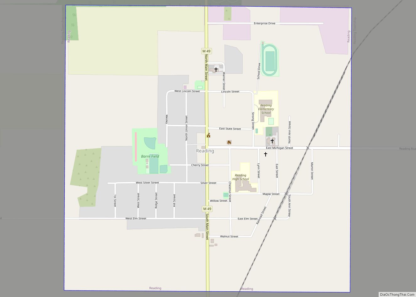
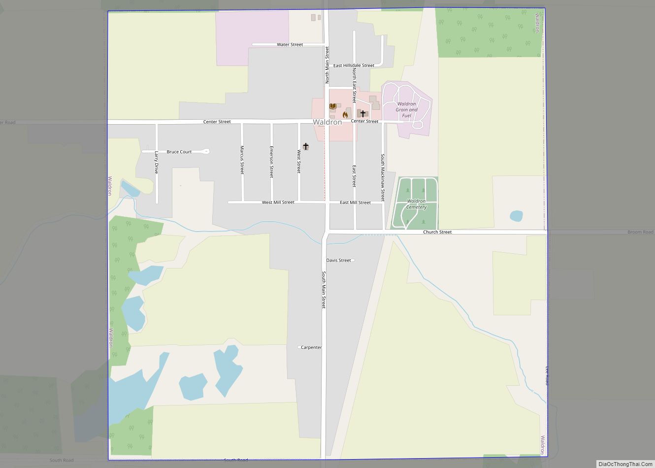
Online Interactive Map
Click on ![]() to view map in "full screen" mode.
to view map in "full screen" mode.
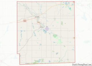
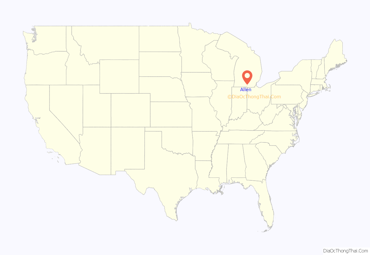
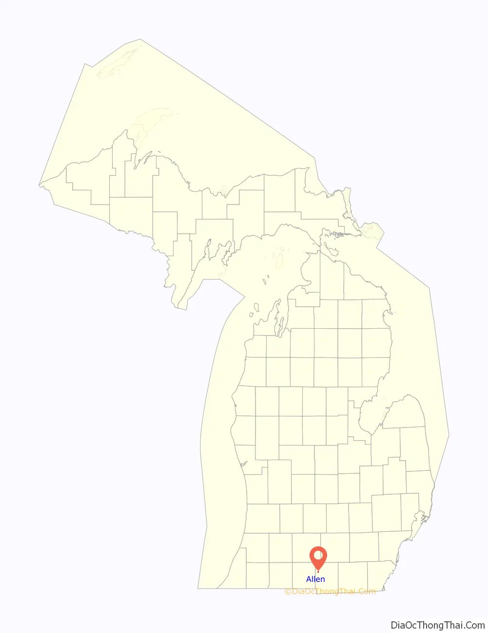
Allen location map. Where is Allen village?
History
The community was first settled by War of 1812 veteran Captain Moses Allen and his family in 1827. A post office under the name Sylvanus opened on July 13, 1830. It closed briefly from September 5, 1834 to September 9, 1835. The name of the office was changed to Allen in honor of Moses Allen on August 17, 1868. The community was thriving and was platted that same year, and Allen received a railway depot along the Lake Shore and Michigan Southern Railway. In 1950, Allen incorporated as a village.
Allen Road Map
Allen city Satellite Map
Geography
According to the U.S. Census Bureau, the village has a total area of 0.174 square miles (0.451 km), all land.
Major highways
- US 12 (W. Chicago Street) runs east–west through the center of the village.
- M-49 (N. Railroad Street) enters the village from the north and briefly runs concurrently with US 12.
See also
Map of Michigan State and its subdivision:- Alcona
- Alger
- Allegan
- Alpena
- Antrim
- Arenac
- Baraga
- Barry
- Bay
- Benzie
- Berrien
- Branch
- Calhoun
- Cass
- Charlevoix
- Cheboygan
- Chippewa
- Clare
- Clinton
- Crawford
- Delta
- Dickinson
- Eaton
- Emmet
- Genesee
- Gladwin
- Gogebic
- Grand Traverse
- Gratiot
- Hillsdale
- Houghton
- Huron
- Ingham
- Ionia
- Iosco
- Iron
- Isabella
- Jackson
- Kalamazoo
- Kalkaska
- Kent
- Keweenaw
- Lake
- Lake Hurron
- Lake Michigan
- Lake St. Clair
- Lake Superior
- Lapeer
- Leelanau
- Lenawee
- Livingston
- Luce
- Mackinac
- Macomb
- Manistee
- Marquette
- Mason
- Mecosta
- Menominee
- Midland
- Missaukee
- Monroe
- Montcalm
- Montmorency
- Muskegon
- Newaygo
- Oakland
- Oceana
- Ogemaw
- Ontonagon
- Osceola
- Oscoda
- Otsego
- Ottawa
- Presque Isle
- Roscommon
- Saginaw
- Saint Clair
- Saint Joseph
- Sanilac
- Schoolcraft
- Shiawassee
- Tuscola
- Van Buren
- Washtenaw
- Wayne
- Wexford
- Alabama
- Alaska
- Arizona
- Arkansas
- California
- Colorado
- Connecticut
- Delaware
- District of Columbia
- Florida
- Georgia
- Hawaii
- Idaho
- Illinois
- Indiana
- Iowa
- Kansas
- Kentucky
- Louisiana
- Maine
- Maryland
- Massachusetts
- Michigan
- Minnesota
- Mississippi
- Missouri
- Montana
- Nebraska
- Nevada
- New Hampshire
- New Jersey
- New Mexico
- New York
- North Carolina
- North Dakota
- Ohio
- Oklahoma
- Oregon
- Pennsylvania
- Rhode Island
- South Carolina
- South Dakota
- Tennessee
- Texas
- Utah
- Vermont
- Virginia
- Washington
- West Virginia
- Wisconsin
- Wyoming