Allen Park is a city in Wayne County in the U.S. state of Michigan. As of the 2020 Census, the population was 28,638.
Ford Motor Company is an integral part of the community. Many of the company’s offices and facilities lie within the city limits. Since 2002, Allen Park is the practice home of the Detroit Lions football team and is also the site of the team’s headquarters. The city is known for its tree-lined streets, brick houses, and the Fairlane Green Shopping Center that opened in 2006. The city was once recognized in Money Magazine’s list of America’s Best Small Cities. Allen Park is part of the collection of communities known as Downriver.
Allen Park is home to the Uniroyal Giant Tire, the largest non-production tire scale model ever built, and one of the world’s largest roadside attractions. Originally a Ferris wheel at the 1964 New York World’s Fair, the structure was moved to Allen Park in 1966.
| Name: | Allen Park city |
|---|---|
| LSAD Code: | 25 |
| LSAD Description: | city (suffix) |
| State: | Michigan |
| County: | Wayne County |
| Incorporated: | 1927 (village) 1957 (city) |
| Elevation: | 594 ft (181 m) |
| Land Area: | 7.00 sq mi (18.12 km²) |
| Water Area: | 0.02 sq mi (0.04 km²) |
| Population Density: | 4,094.07/sq mi (1,580.82/km²) |
| Area code: | 313 |
| FIPS code: | 2601380 |
| GNISfeature ID: | 0619983 |
Online Interactive Map
Click on ![]() to view map in "full screen" mode.
to view map in "full screen" mode.
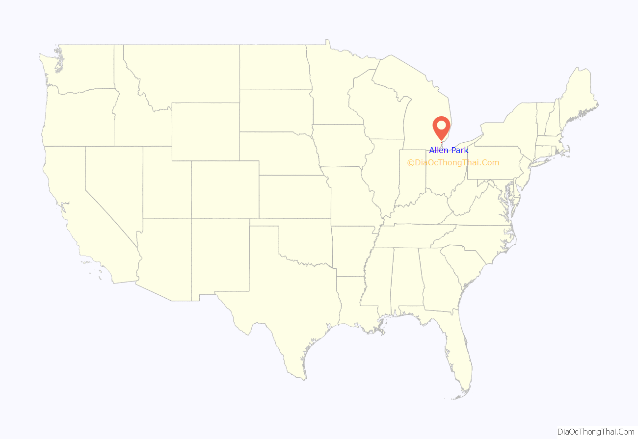
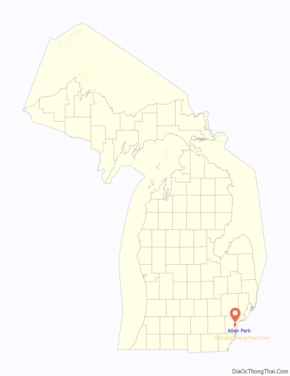
Allen Park location map. Where is Allen Park city?
History
Allen Park was incorporated as a village in 1927, and as a city in 1957. It was named after Lewis Allen, a well-to-do lawyer and lumberman whose 276½ acres of land (primarily in Ecorse Township) included holdings in what are now Allen Park and Melvindale. Hubert Champaign (for whom Champaign Park is named) and Edward Pepper were two other early residents of the area.
In 1950 Allen Park did not include the part of the city directly west of Melvindale; that area was still part of Ecorse Township.
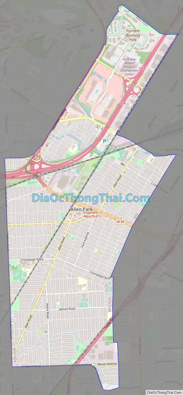
Allen Park Road Map
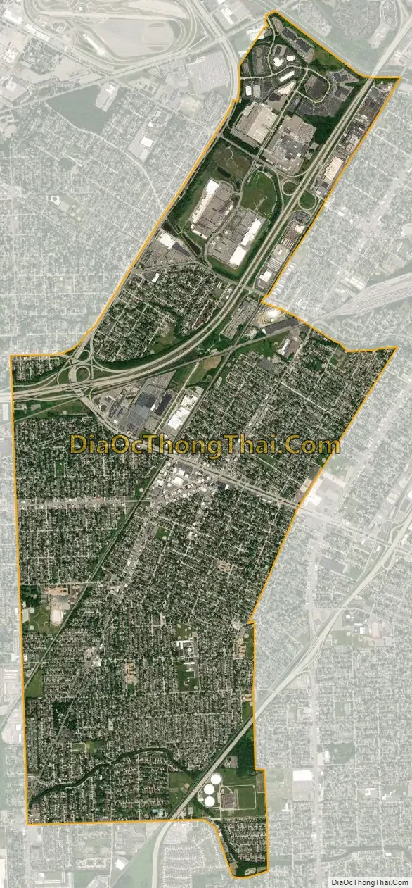
Allen Park city Satellite Map
Geography
According to the United States Census Bureau, the city has a total area of 7.05 square miles (18.26 km), of which 7.00 square miles (18.13 km) is land and 0.05 square miles (0.13 km) (0.71%) is water.
Boundaries
Allen Park borders Southgate to the South, Lincoln Park to the east, Melvindale to the northeast, Dearborn to the north, Dearborn Heights to the northwest, and Taylor to the west.
Major Roads
- I-75 runs through the southeast corner of Allen Park between Goddard Road and the Lincoln Park border.
- I-94 runs through the northern portion of Allen Park between Pelham Road and the Rouge River.
- M-39, Southfield Road, is an eight-lane boulevard that travels in a northwest–southeast direction between the Lincoln Park border and I-94. It becomes the Southfield Freeway and curves to the northeast after the I-94 interchange.
See also
Map of Michigan State and its subdivision:- Alcona
- Alger
- Allegan
- Alpena
- Antrim
- Arenac
- Baraga
- Barry
- Bay
- Benzie
- Berrien
- Branch
- Calhoun
- Cass
- Charlevoix
- Cheboygan
- Chippewa
- Clare
- Clinton
- Crawford
- Delta
- Dickinson
- Eaton
- Emmet
- Genesee
- Gladwin
- Gogebic
- Grand Traverse
- Gratiot
- Hillsdale
- Houghton
- Huron
- Ingham
- Ionia
- Iosco
- Iron
- Isabella
- Jackson
- Kalamazoo
- Kalkaska
- Kent
- Keweenaw
- Lake
- Lake Hurron
- Lake Michigan
- Lake St. Clair
- Lake Superior
- Lapeer
- Leelanau
- Lenawee
- Livingston
- Luce
- Mackinac
- Macomb
- Manistee
- Marquette
- Mason
- Mecosta
- Menominee
- Midland
- Missaukee
- Monroe
- Montcalm
- Montmorency
- Muskegon
- Newaygo
- Oakland
- Oceana
- Ogemaw
- Ontonagon
- Osceola
- Oscoda
- Otsego
- Ottawa
- Presque Isle
- Roscommon
- Saginaw
- Saint Clair
- Saint Joseph
- Sanilac
- Schoolcraft
- Shiawassee
- Tuscola
- Van Buren
- Washtenaw
- Wayne
- Wexford
- Alabama
- Alaska
- Arizona
- Arkansas
- California
- Colorado
- Connecticut
- Delaware
- District of Columbia
- Florida
- Georgia
- Hawaii
- Idaho
- Illinois
- Indiana
- Iowa
- Kansas
- Kentucky
- Louisiana
- Maine
- Maryland
- Massachusetts
- Michigan
- Minnesota
- Mississippi
- Missouri
- Montana
- Nebraska
- Nevada
- New Hampshire
- New Jersey
- New Mexico
- New York
- North Carolina
- North Dakota
- Ohio
- Oklahoma
- Oregon
- Pennsylvania
- Rhode Island
- South Carolina
- South Dakota
- Tennessee
- Texas
- Utah
- Vermont
- Virginia
- Washington
- West Virginia
- Wisconsin
- Wyoming


