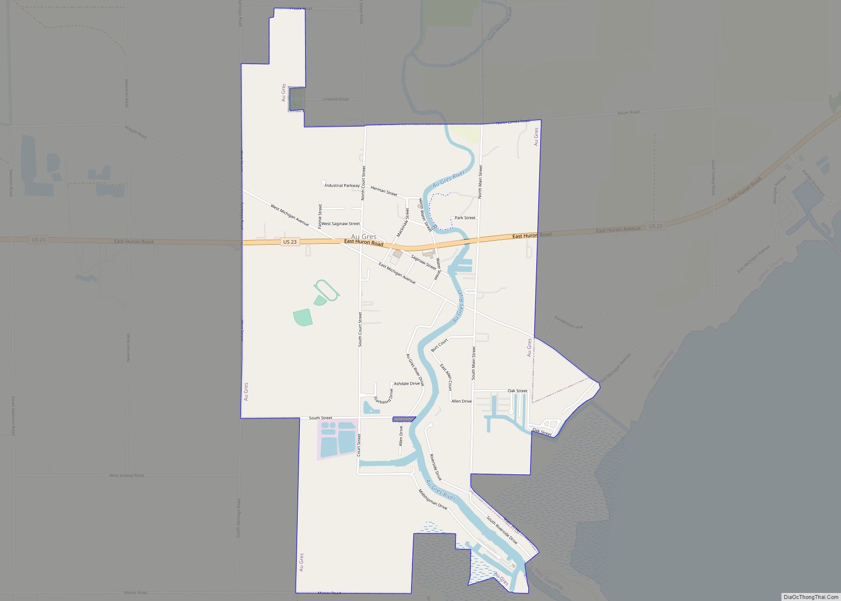
Au Gres (/ˈɔːɡreɪ/ AW-gray) is a city in Arenac County in the U.S. state of Michigan. The population was 945 at the 2020 census.
| Name: | Au Gres city |
|---|---|
| LSAD Code: | 25 |
| LSAD Description: | city (suffix) |
| State: | Michigan |
| County: | Arenac County |
| Incorporated: | 1905 |
| Elevation: | 587 ft (179 m) |
| Total Area: | 2.38 sq mi (6.16 km²) |
| Land Area: | 2.28 sq mi (5.90 km²) |
| Water Area: | 0.10 sq mi (0.26 km²) |
| Total Population: | 945 |
| Population Density: | 414.84/sq mi (160.20/km²) |
| Area code: | 989 |
| FIPS code: | 2604120 |
| GNISfeature ID: | 0620321 |
Online Interactive Map
Click on ![]() to view map in "full screen" mode.
to view map in "full screen" mode.
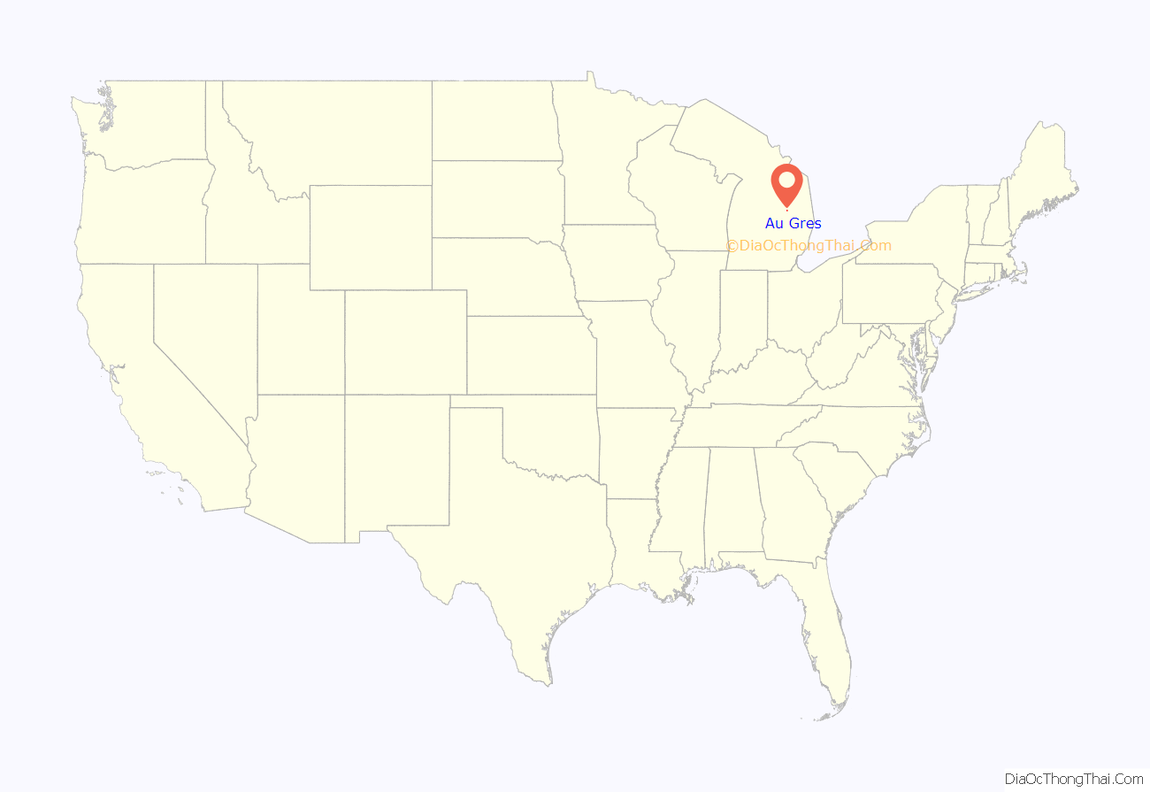
Au Gres location map. Where is Au Gres city?

History
French explorers named the location Point Au Gres, which stuck on map as late as 1828. Au Gres means “gritty stone” in the area, from which the river and the location takes its name. It was first settled in 1862 temporarily by workers on the Saginaw-Au Sable State Road when they reach the location. The first permanent settler was John Edward Bradley, who built the Bradley House in 1866. On August 8, 1867, the location, which was still a part of Bay County, was granted a post office with Bradley as the first postmaster. The post office was closed from March 2, 1874 until April 30, 1874.
The community was incorporated as a city in 1905.
Au Gres Road Map
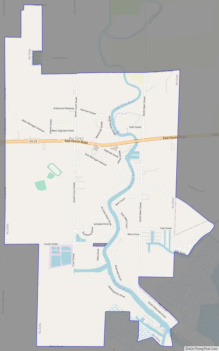
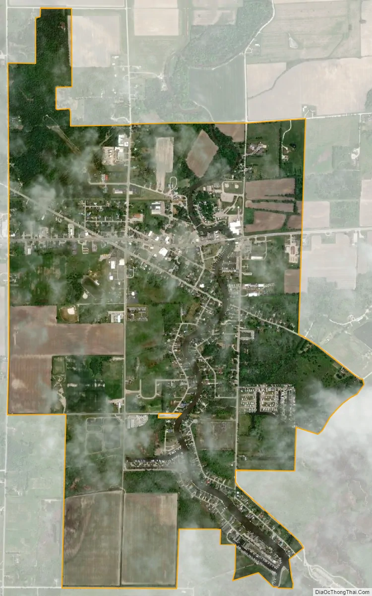
Au Gres city Satellite Map
Geography
According to the United States Census Bureau, the city has a total area of 2.33 square miles (6.03 km), of which 2.23 square miles (5.78 km) is land and 0.10 square miles (0.26 km) is water.
See also
Map of Michigan State and its subdivision:- Alcona
- Alger
- Allegan
- Alpena
- Antrim
- Arenac
- Baraga
- Barry
- Bay
- Benzie
- Berrien
- Branch
- Calhoun
- Cass
- Charlevoix
- Cheboygan
- Chippewa
- Clare
- Clinton
- Crawford
- Delta
- Dickinson
- Eaton
- Emmet
- Genesee
- Gladwin
- Gogebic
- Grand Traverse
- Gratiot
- Hillsdale
- Houghton
- Huron
- Ingham
- Ionia
- Iosco
- Iron
- Isabella
- Jackson
- Kalamazoo
- Kalkaska
- Kent
- Keweenaw
- Lake
- Lake Hurron
- Lake Michigan
- Lake St. Clair
- Lake Superior
- Lapeer
- Leelanau
- Lenawee
- Livingston
- Luce
- Mackinac
- Macomb
- Manistee
- Marquette
- Mason
- Mecosta
- Menominee
- Midland
- Missaukee
- Monroe
- Montcalm
- Montmorency
- Muskegon
- Newaygo
- Oakland
- Oceana
- Ogemaw
- Ontonagon
- Osceola
- Oscoda
- Otsego
- Ottawa
- Presque Isle
- Roscommon
- Saginaw
- Saint Clair
- Saint Joseph
- Sanilac
- Schoolcraft
- Shiawassee
- Tuscola
- Van Buren
- Washtenaw
- Wayne
- Wexford
- Alabama
- Alaska
- Arizona
- Arkansas
- California
- Colorado
- Connecticut
- Delaware
- District of Columbia
- Florida
- Georgia
- Hawaii
- Idaho
- Illinois
- Indiana
- Iowa
- Kansas
- Kentucky
- Louisiana
- Maine
- Maryland
- Massachusetts
- Michigan
- Minnesota
- Mississippi
- Missouri
- Montana
- Nebraska
- Nevada
- New Hampshire
- New Jersey
- New Mexico
- New York
- North Carolina
- North Dakota
- Ohio
- Oklahoma
- Oregon
- Pennsylvania
- Rhode Island
- South Carolina
- South Dakota
- Tennessee
- Texas
- Utah
- Vermont
- Virginia
- Washington
- West Virginia
- Wisconsin
- Wyoming