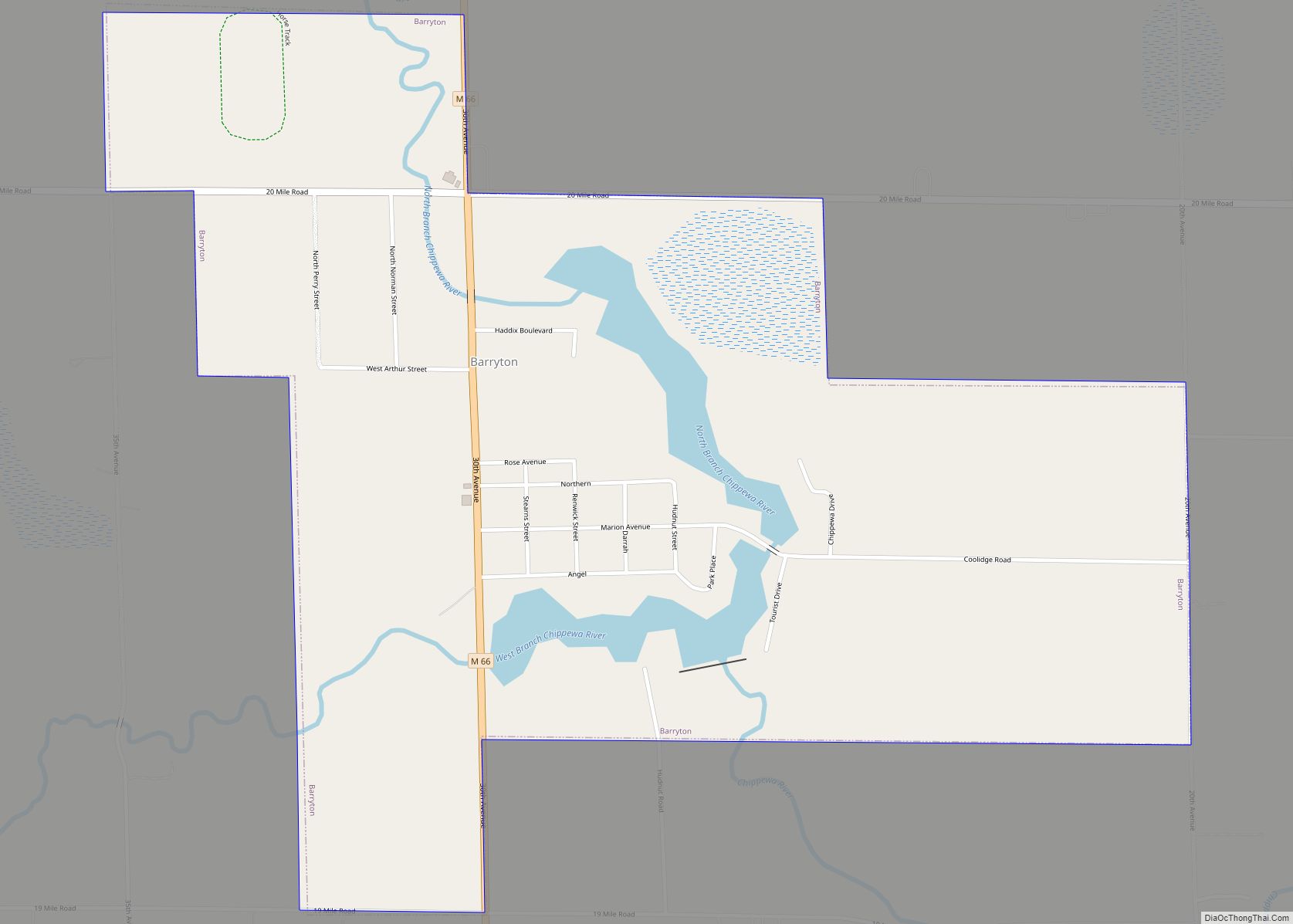
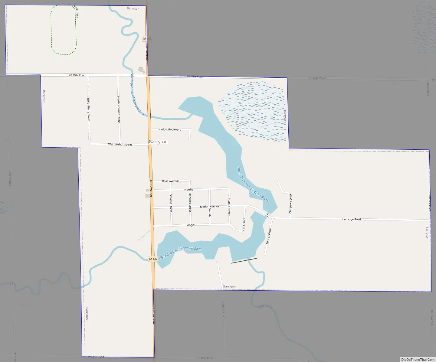
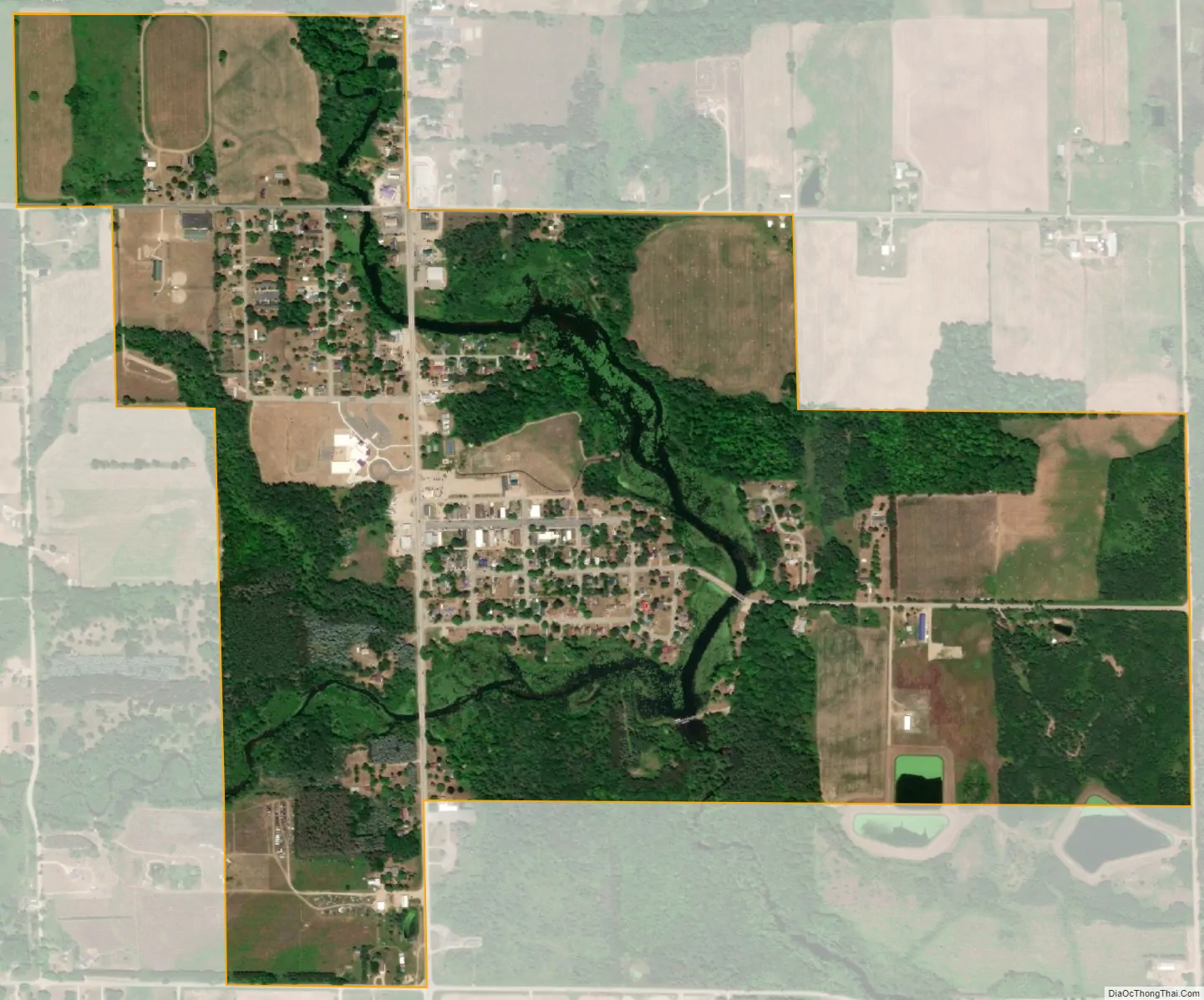
Barryton (/bɛər.ətən/ BAIR-ə-tən) is a village in Mecosta County in the U.S. state of Michigan. The population was 355 at the 2010 census. The village is located in Fork Township on M-66. It was established in 1894.
| Name: | Barryton village |
|---|---|
| LSAD Code: | 47 |
| LSAD Description: | village (suffix) |
| State: | Michigan |
| County: | Mecosta County |
| Elevation: | 981 ft (299 m) |
| Total Area: | 1.03 sq mi (2.68 km²) |
| Land Area: | 0.96 sq mi (2.48 km²) |
| Water Area: | 0.08 sq mi (0.20 km²) |
| Total Population: | 405 |
| Population Density: | 423.20/sq mi (163.33/km²) |
| ZIP code: | 49305 |
| Area code: | 989 |
| FIPS code: | 2605580 |
| GNISfeature ID: | 2398039 |
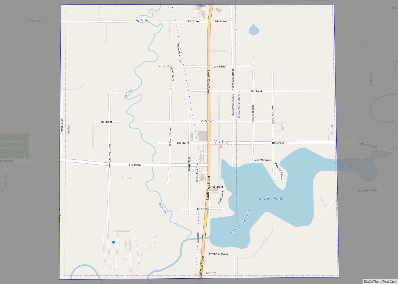
Online Interactive Map
Click on ![]() to view map in "full screen" mode.
to view map in "full screen" mode.
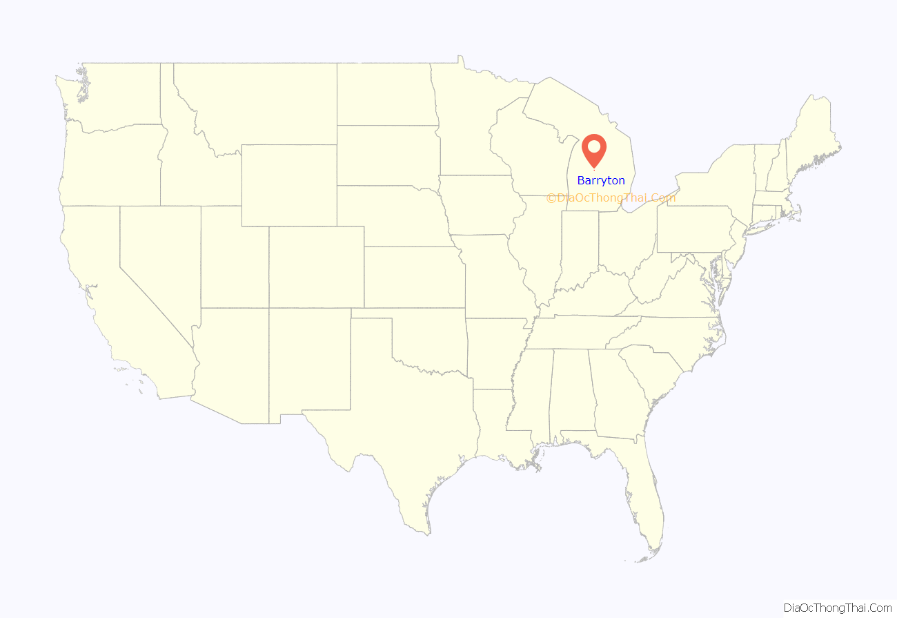
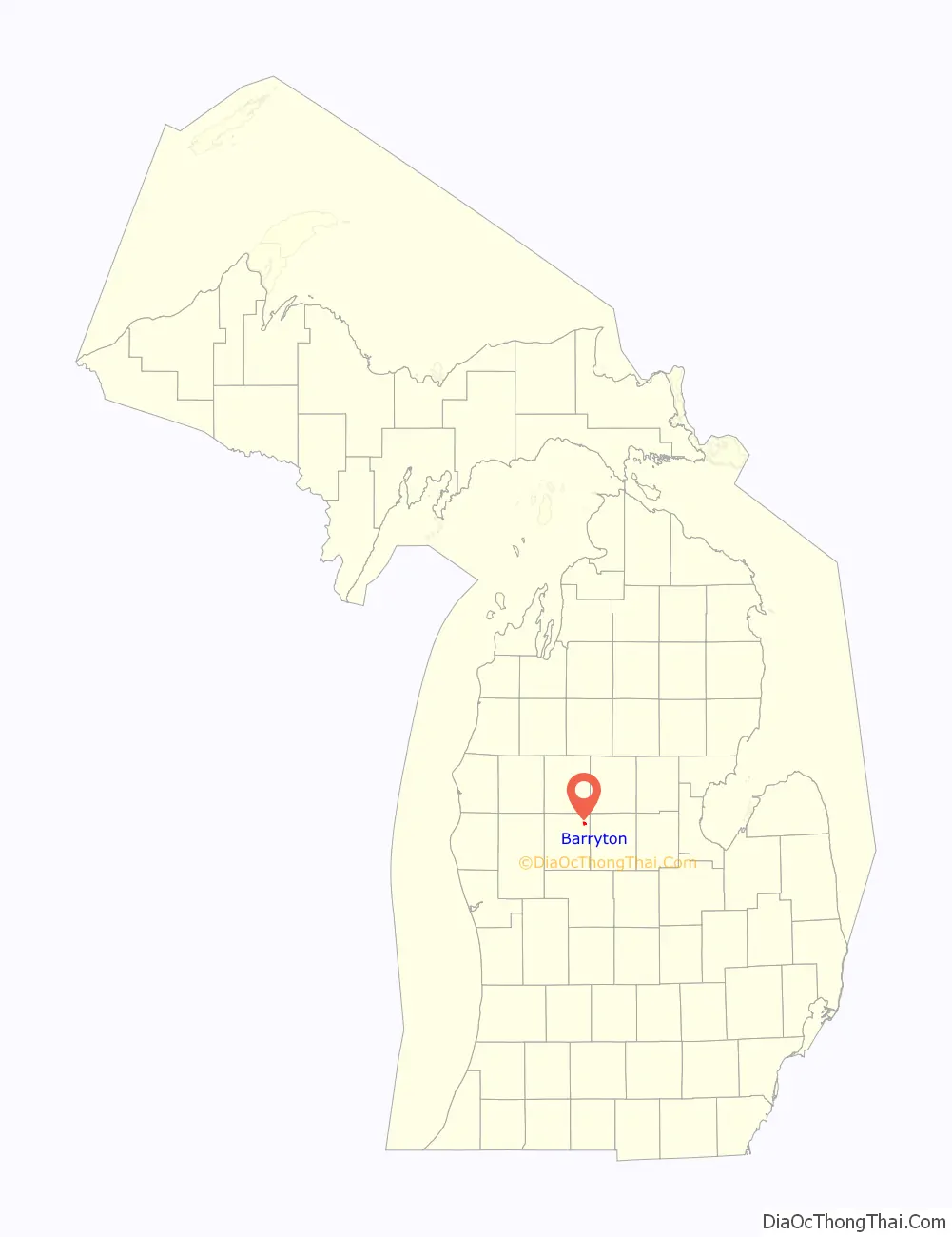
Barryton location map. Where is Barryton village?
History
The village of Barryton was established in 1894
In 2020, a petition was started to dissolve the village of Barryton. The petition gained enough signatures to be placed on the ballot for the 2020 election. The measure was subsequently defeated. If it had succeeded, it would have been the first village to ever voluntarily disincorporate in the State of Michigan.
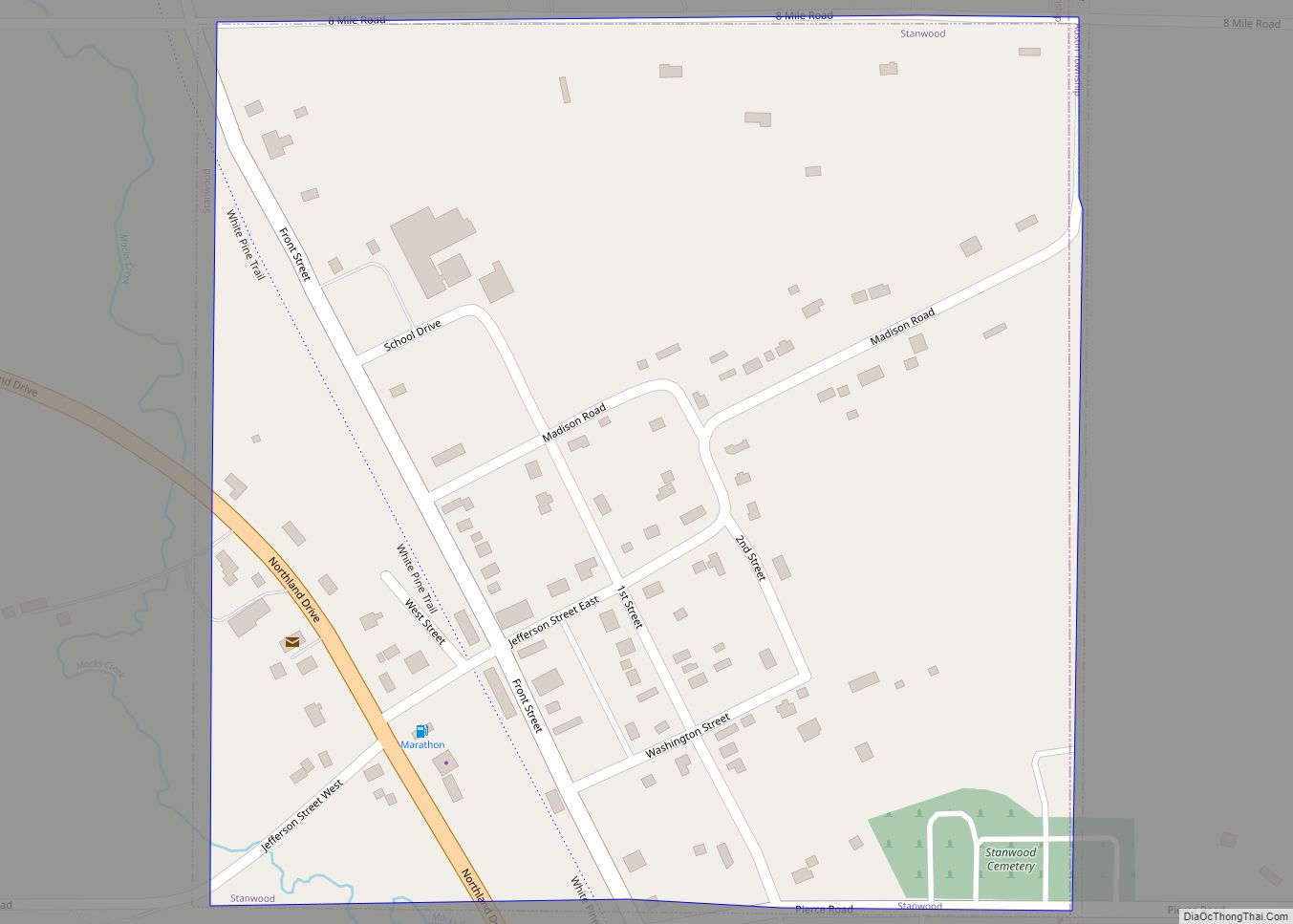
Barryton Road Map
Barryton city Satellite Map
Geography
According to the United States Census Bureau, the village has a total area of 1.04 square miles (2.69 km), of which 0.96 square miles (2.49 km) is land and 0.08 square miles (0.21 km) is water.
Major highway
- M-66 runs north-south through the village of Barryton.
See also
Map of Michigan State and its subdivision:- Alcona
- Alger
- Allegan
- Alpena
- Antrim
- Arenac
- Baraga
- Barry
- Bay
- Benzie
- Berrien
- Branch
- Calhoun
- Cass
- Charlevoix
- Cheboygan
- Chippewa
- Clare
- Clinton
- Crawford
- Delta
- Dickinson
- Eaton
- Emmet
- Genesee
- Gladwin
- Gogebic
- Grand Traverse
- Gratiot
- Hillsdale
- Houghton
- Huron
- Ingham
- Ionia
- Iosco
- Iron
- Isabella
- Jackson
- Kalamazoo
- Kalkaska
- Kent
- Keweenaw
- Lake
- Lake Hurron
- Lake Michigan
- Lake St. Clair
- Lake Superior
- Lapeer
- Leelanau
- Lenawee
- Livingston
- Luce
- Mackinac
- Macomb
- Manistee
- Marquette
- Mason
- Mecosta
- Menominee
- Midland
- Missaukee
- Monroe
- Montcalm
- Montmorency
- Muskegon
- Newaygo
- Oakland
- Oceana
- Ogemaw
- Ontonagon
- Osceola
- Oscoda
- Otsego
- Ottawa
- Presque Isle
- Roscommon
- Saginaw
- Saint Clair
- Saint Joseph
- Sanilac
- Schoolcraft
- Shiawassee
- Tuscola
- Van Buren
- Washtenaw
- Wayne
- Wexford
- Alabama
- Alaska
- Arizona
- Arkansas
- California
- Colorado
- Connecticut
- Delaware
- District of Columbia
- Florida
- Georgia
- Hawaii
- Idaho
- Illinois
- Indiana
- Iowa
- Kansas
- Kentucky
- Louisiana
- Maine
- Maryland
- Massachusetts
- Michigan
- Minnesota
- Mississippi
- Missouri
- Montana
- Nebraska
- Nevada
- New Hampshire
- New Jersey
- New Mexico
- New York
- North Carolina
- North Dakota
- Ohio
- Oklahoma
- Oregon
- Pennsylvania
- Rhode Island
- South Carolina
- South Dakota
- Tennessee
- Texas
- Utah
- Vermont
- Virginia
- Washington
- West Virginia
- Wisconsin
- Wyoming