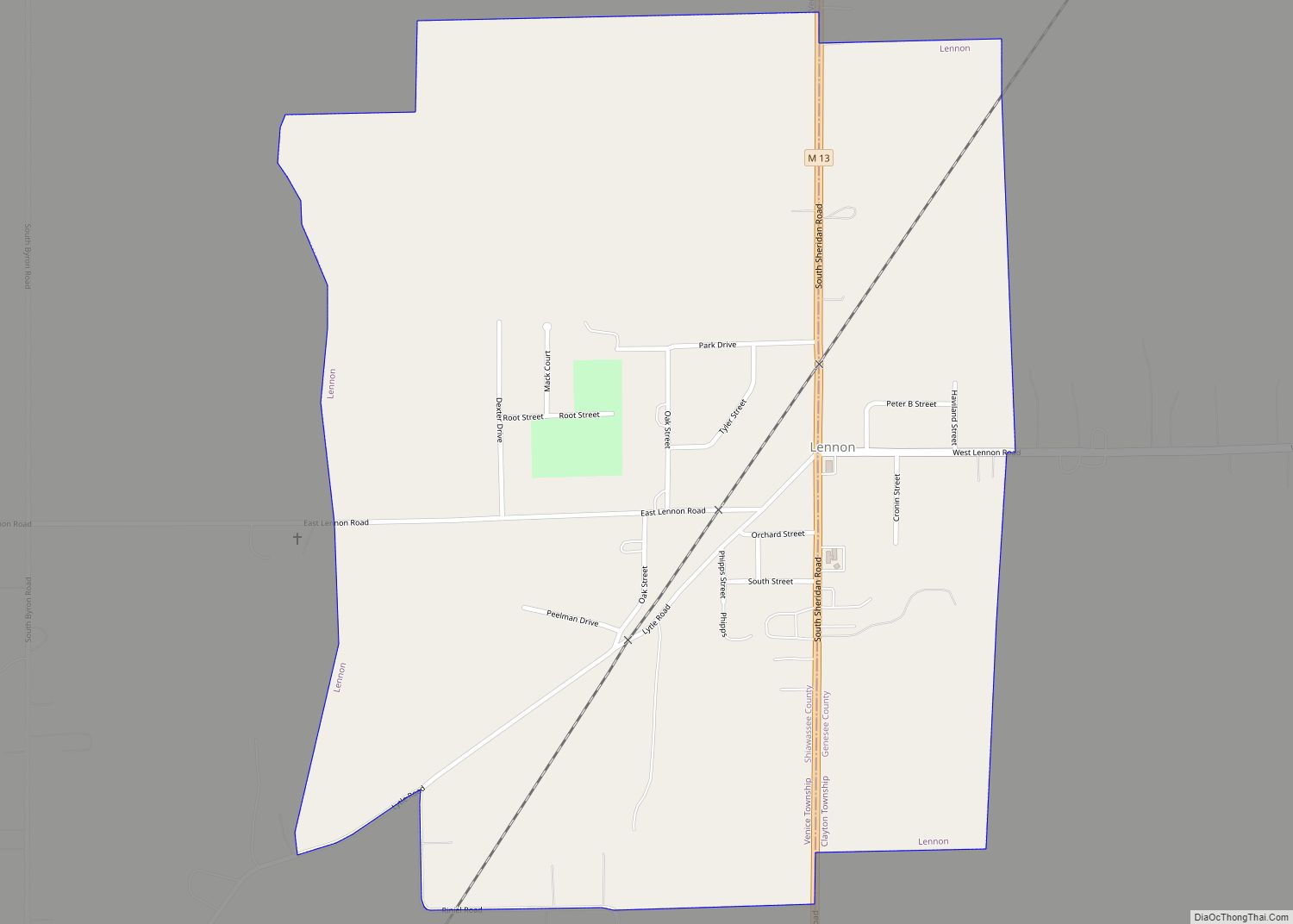
Byron is a village in Shiawassee County in the U.S. state of Michigan. The population was 581 at the 2010 census. The village is located within Burns Township.
| Name: | Byron village |
|---|---|
| LSAD Code: | 47 |
| LSAD Description: | village (suffix) |
| State: | Michigan |
| County: | Shiawassee County |
| Founded: | 1824 |
| Incorporated: | 1873 |
| Elevation: | 830 ft (250 m) |
| Total Area: | 0.76 sq mi (1.97 km²) |
| Land Area: | 0.71 sq mi (1.83 km²) |
| Water Area: | 0.06 sq mi (0.14 km²) |
| Total Population: | 545 |
| Population Density: | 771.95/sq mi (297.94/km²) |
| Area code: | 810 |
| FIPS code: | 2612260 |
| GNISfeature ID: | 2397517 |
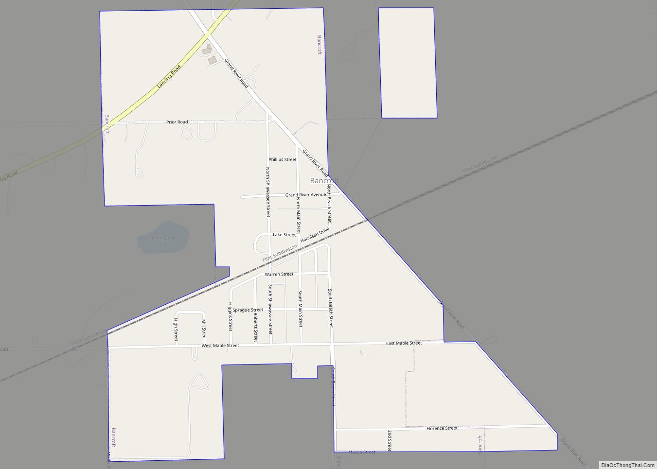
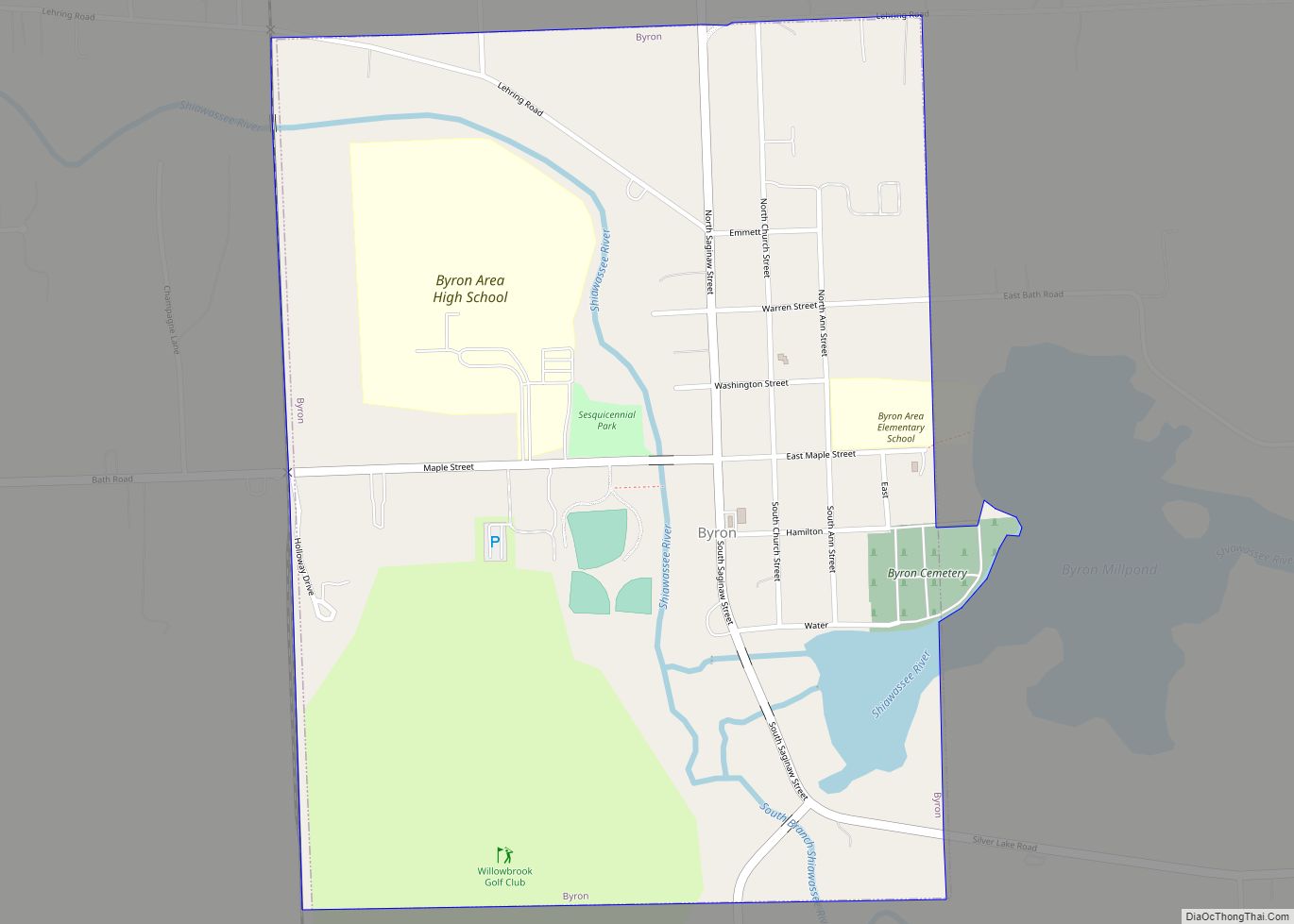
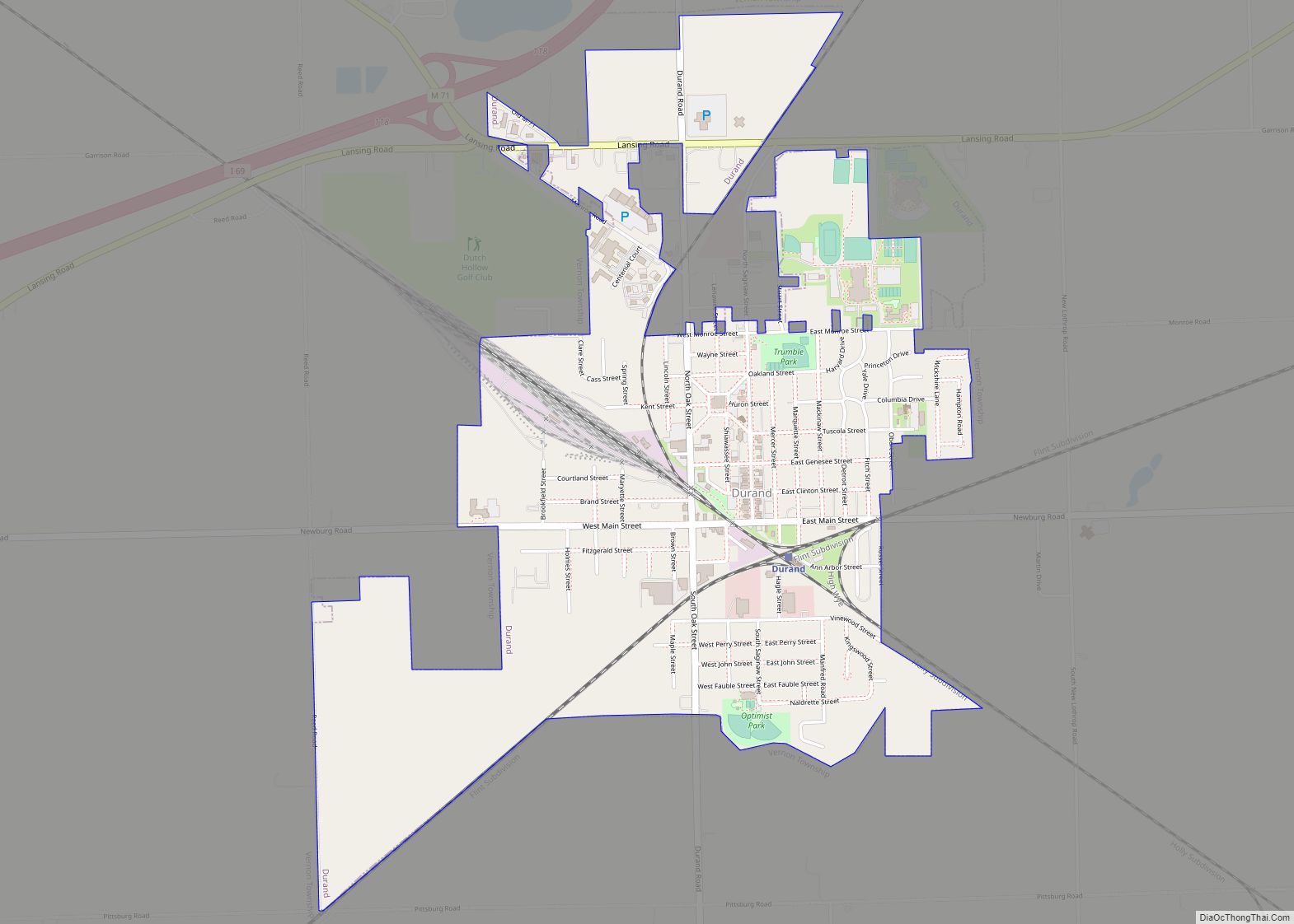
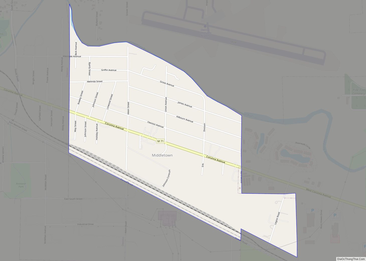
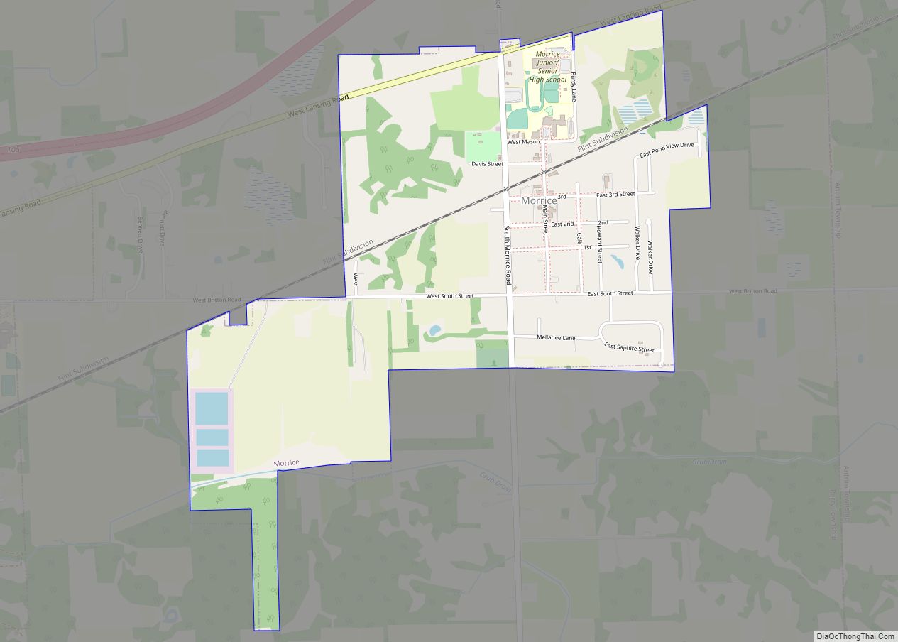
Online Interactive Map
Click on ![]() to view map in "full screen" mode.
to view map in "full screen" mode.
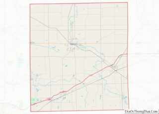
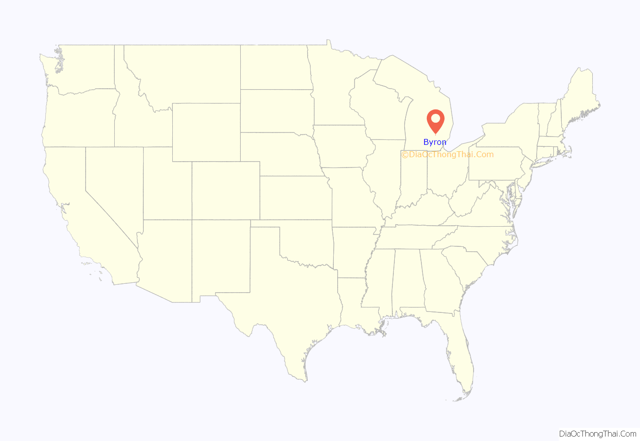
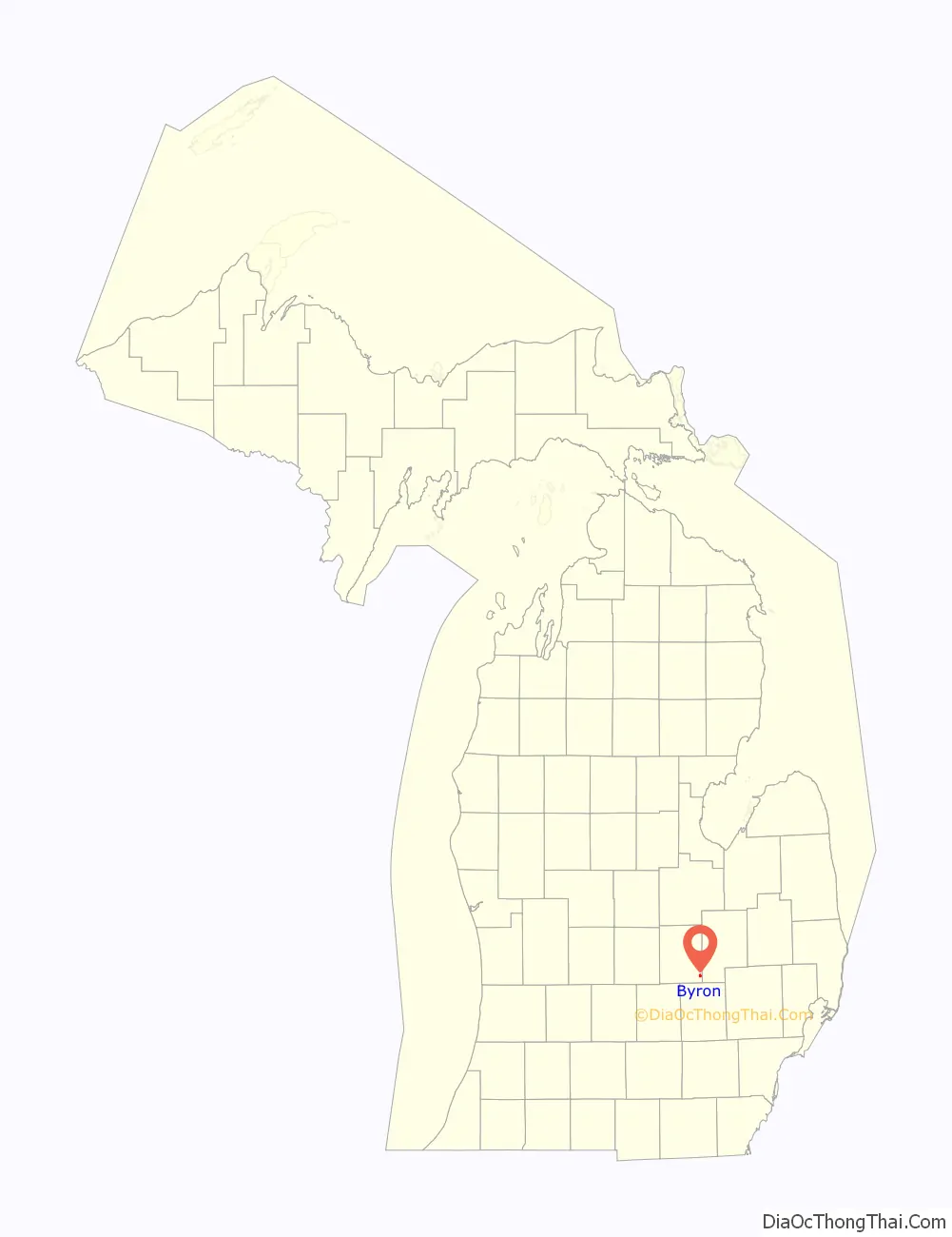
Byron location map. Where is Byron village?
History
Founded in 1824, Byron received its first postmaster in 1837. One of the only towns in the county, Byron was the last stop on a stagecoach run from Detroit that ran west along what is now Rose Center road and Silver Lake road. The Village of Byron was incorporated in 1873. The Toledo, Ann Arbor & Northern Michigan Railway was built through Byron following the pledge of a $15,001. bonus and the right of way, in 1885.
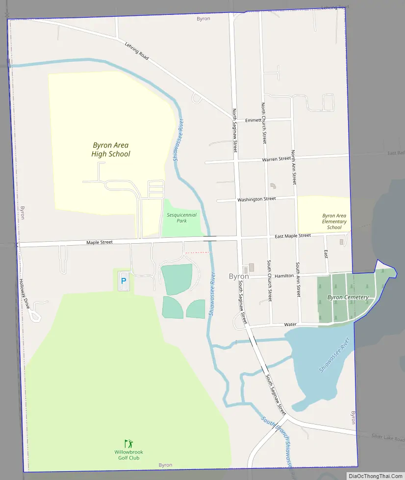
Byron Road Map
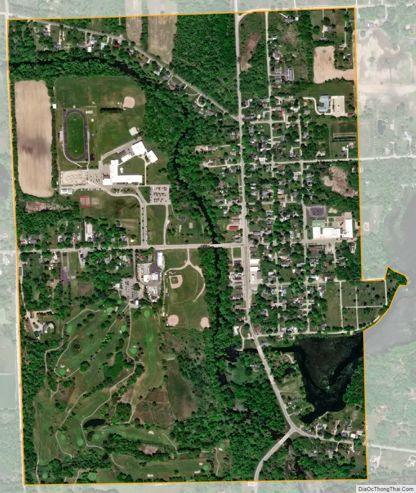
Byron city Satellite Map
Geography
According to the United States Census Bureau, the village has a total area of 0.75 square miles (1.94 km), of which 0.70 square miles (1.81 km) is land and 0.05 square miles (0.13 km) (7.14%) is water.
See also
Map of Michigan State and its subdivision:- Alcona
- Alger
- Allegan
- Alpena
- Antrim
- Arenac
- Baraga
- Barry
- Bay
- Benzie
- Berrien
- Branch
- Calhoun
- Cass
- Charlevoix
- Cheboygan
- Chippewa
- Clare
- Clinton
- Crawford
- Delta
- Dickinson
- Eaton
- Emmet
- Genesee
- Gladwin
- Gogebic
- Grand Traverse
- Gratiot
- Hillsdale
- Houghton
- Huron
- Ingham
- Ionia
- Iosco
- Iron
- Isabella
- Jackson
- Kalamazoo
- Kalkaska
- Kent
- Keweenaw
- Lake
- Lake Hurron
- Lake Michigan
- Lake St. Clair
- Lake Superior
- Lapeer
- Leelanau
- Lenawee
- Livingston
- Luce
- Mackinac
- Macomb
- Manistee
- Marquette
- Mason
- Mecosta
- Menominee
- Midland
- Missaukee
- Monroe
- Montcalm
- Montmorency
- Muskegon
- Newaygo
- Oakland
- Oceana
- Ogemaw
- Ontonagon
- Osceola
- Oscoda
- Otsego
- Ottawa
- Presque Isle
- Roscommon
- Saginaw
- Saint Clair
- Saint Joseph
- Sanilac
- Schoolcraft
- Shiawassee
- Tuscola
- Van Buren
- Washtenaw
- Wayne
- Wexford
- Alabama
- Alaska
- Arizona
- Arkansas
- California
- Colorado
- Connecticut
- Delaware
- District of Columbia
- Florida
- Georgia
- Hawaii
- Idaho
- Illinois
- Indiana
- Iowa
- Kansas
- Kentucky
- Louisiana
- Maine
- Maryland
- Massachusetts
- Michigan
- Minnesota
- Mississippi
- Missouri
- Montana
- Nebraska
- Nevada
- New Hampshire
- New Jersey
- New Mexico
- New York
- North Carolina
- North Dakota
- Ohio
- Oklahoma
- Oregon
- Pennsylvania
- Rhode Island
- South Carolina
- South Dakota
- Tennessee
- Texas
- Utah
- Vermont
- Virginia
- Washington
- West Virginia
- Wisconsin
- Wyoming