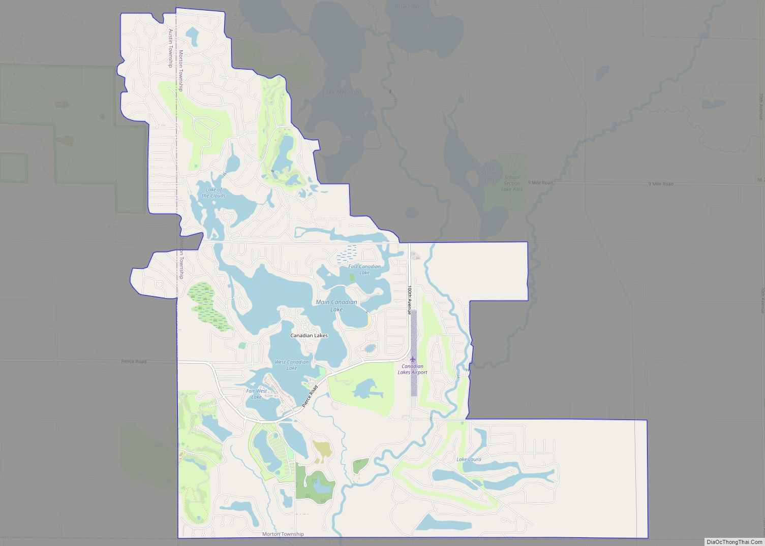
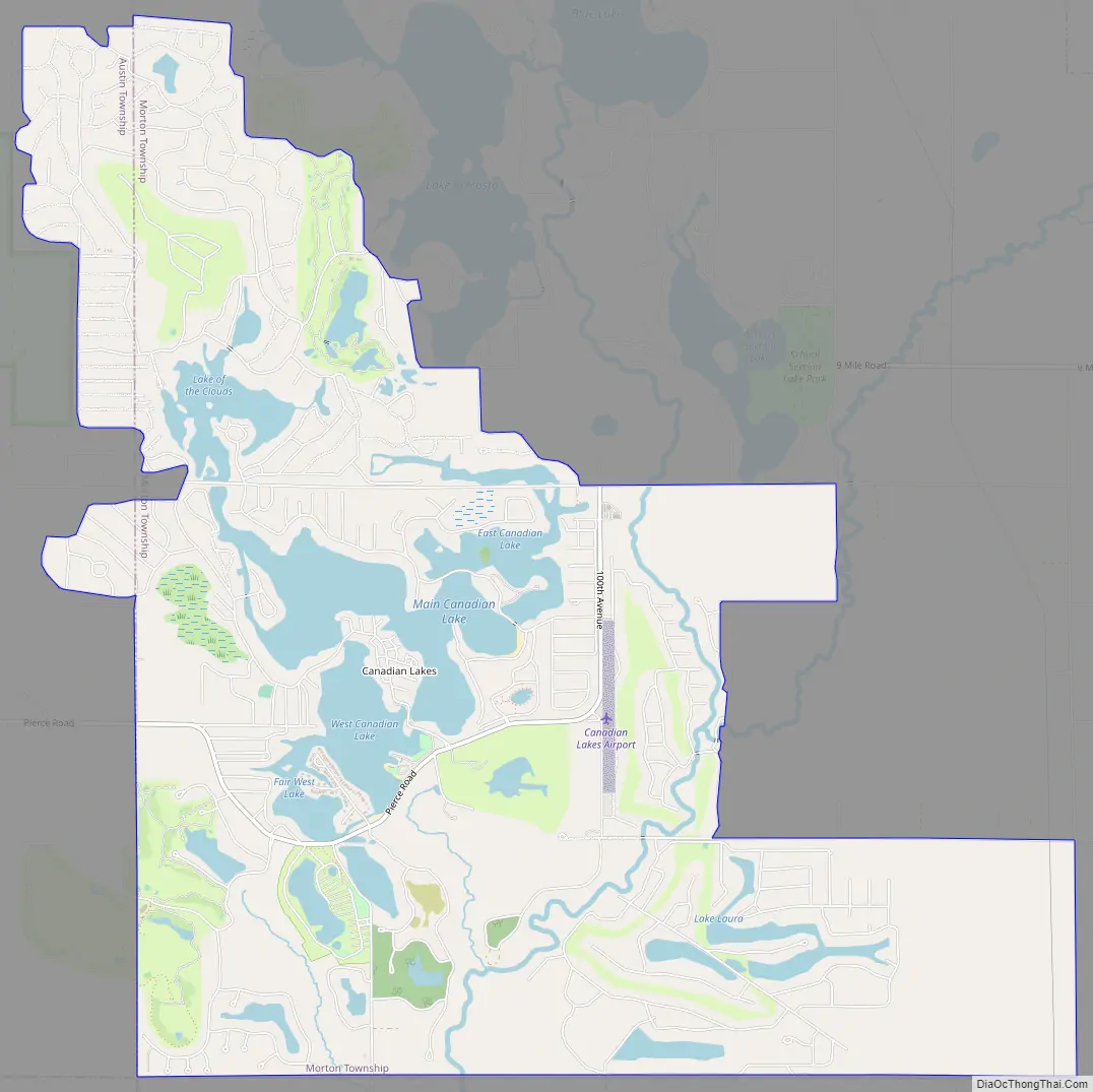
Canadian Lakes is an unincorporated community in Mecosta County in the U.S. state of Michigan. The area is mostly within the southwest portion of Morton Township, southwest of Mecosta and east of Stanwood.
For statistical reporting, the U.S. Census Bureau has defined a census-designated place (CDP) with the same name. As of the 2000 census, the CDP population was 1,922. The area defined by the CDP includes small portions in eastern Austin Township.
Most of the area is served by the Stanwood ZIP code 49346, although “Canadian Lakes, Michigan”, is an acceptable name for mail delivery by the post office. Small portions of the area defined by the CDP are served by other postal delivery areas. A small portion in the southern area of the CDP along the Little Muskegon River is served by the Lakeview ZIP code, 48850. A small area in the eastern part of the CDP is served by the Mecosta ZIP code, 49332.
An area by the same name Canadian Lakes, exists in Ballarat, Victoria , Australia
| Name: | Canadian Lakes CDP |
|---|---|
| LSAD Code: | 57 |
| LSAD Description: | CDP (suffix) |
| State: | Michigan |
| County: | Mecosta County |
| Elevation: | 965 ft (294§ m) |
| Total Area: | 11.58 sq mi (30.00 km²) |
| Land Area: | 10.33 sq mi (26.76 km²) |
| Water Area: | 1.25 sq mi (3.25 km²) |
| Total Population: | 3,202 |
| Population Density: | 309.94/sq mi (119.66/km²) |
| ZIP code: | 49346 |
| Area code: | 231 |
| FIPS code: | 2613010 |
| GNISfeature ID: | 1852242 |
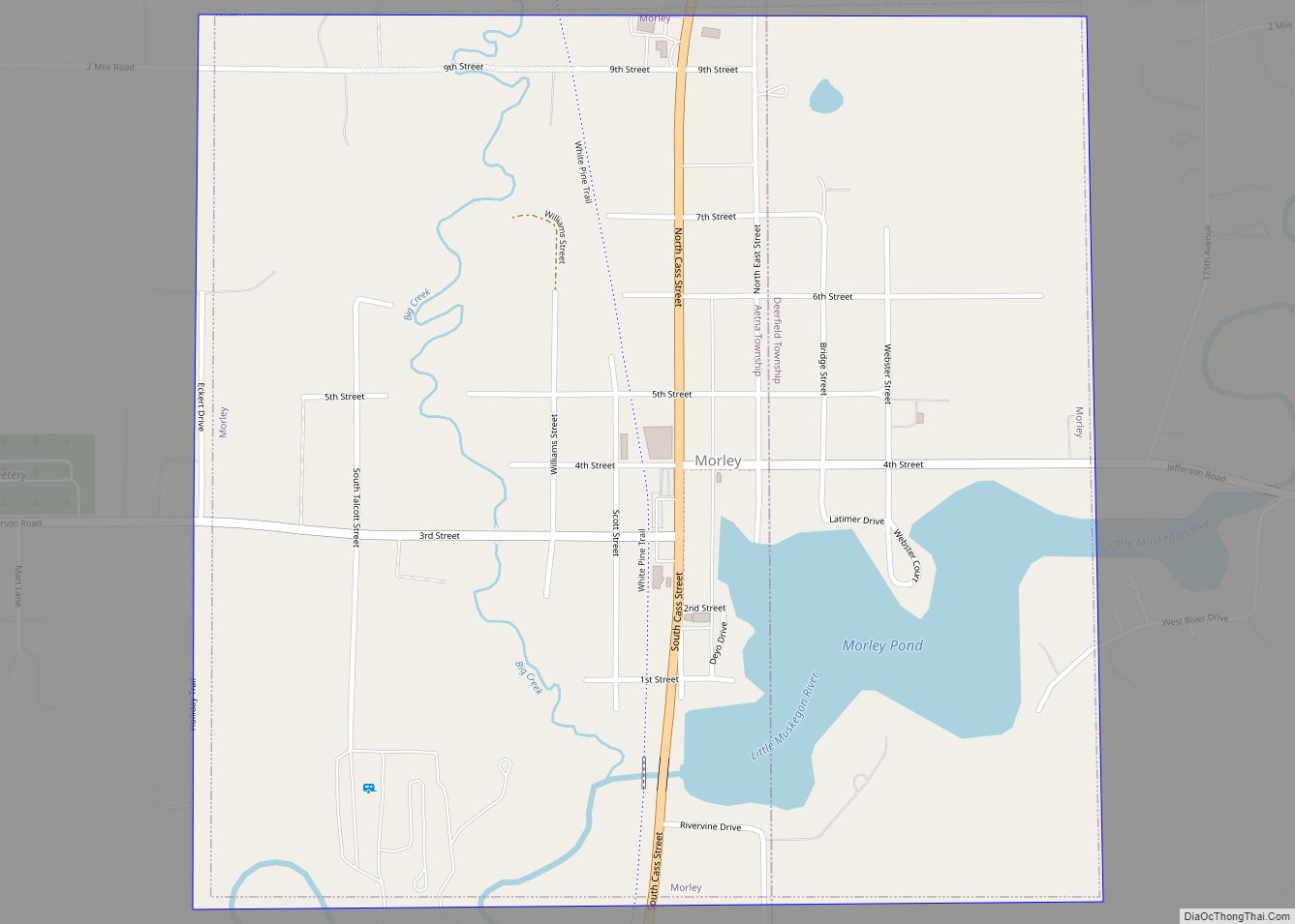
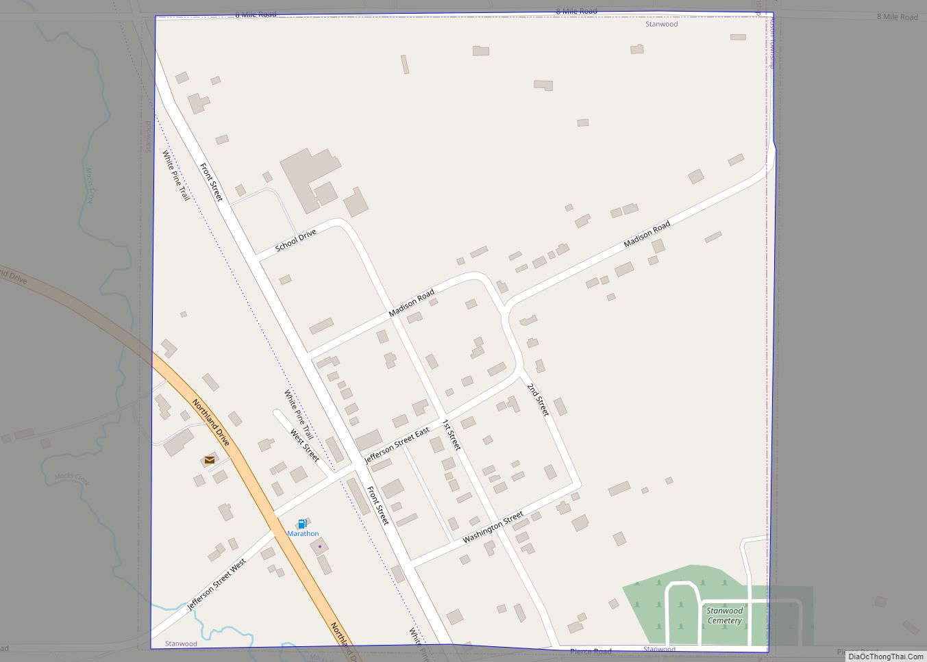
Online Interactive Map
Click on ![]() to view map in "full screen" mode.
to view map in "full screen" mode.
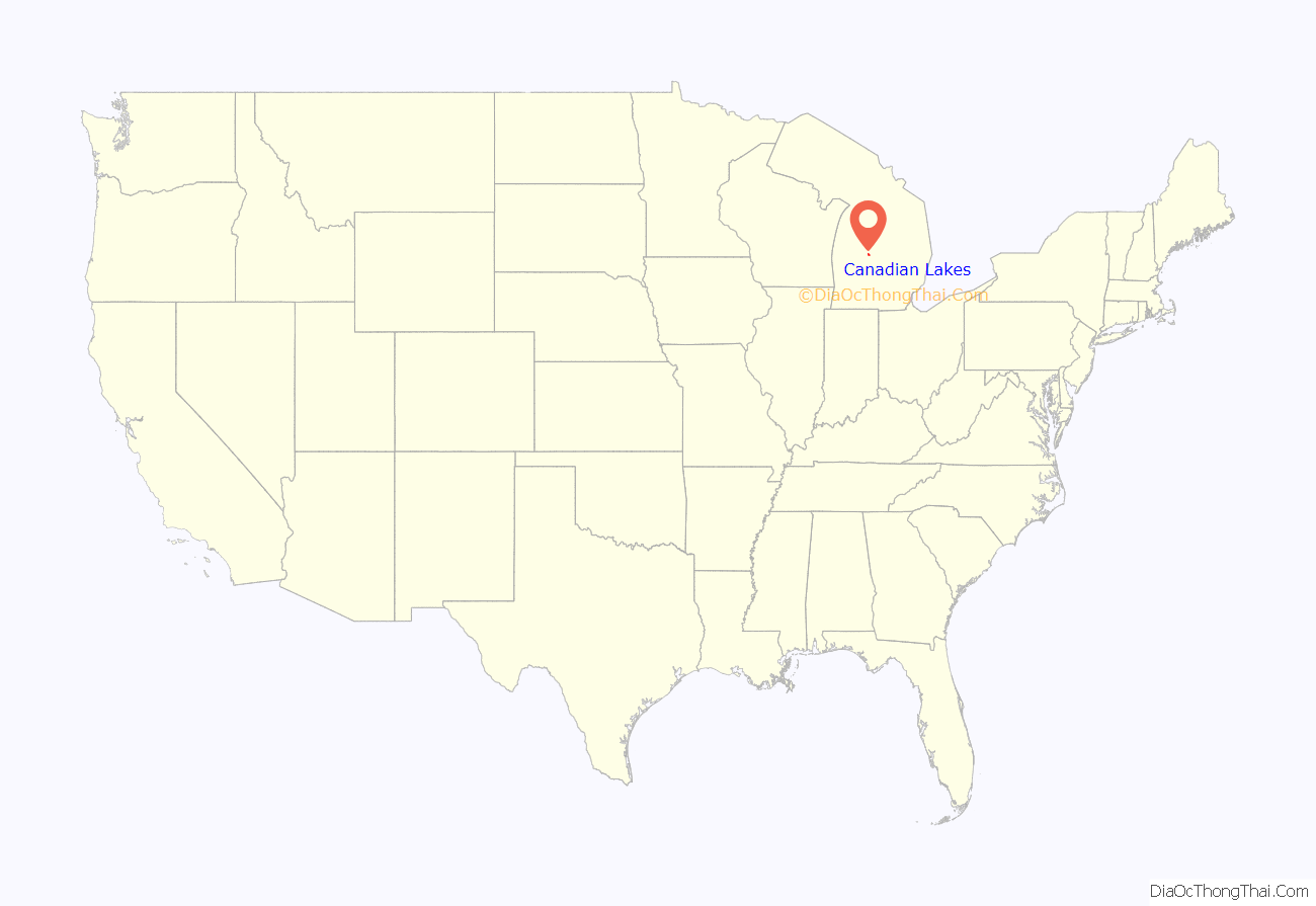
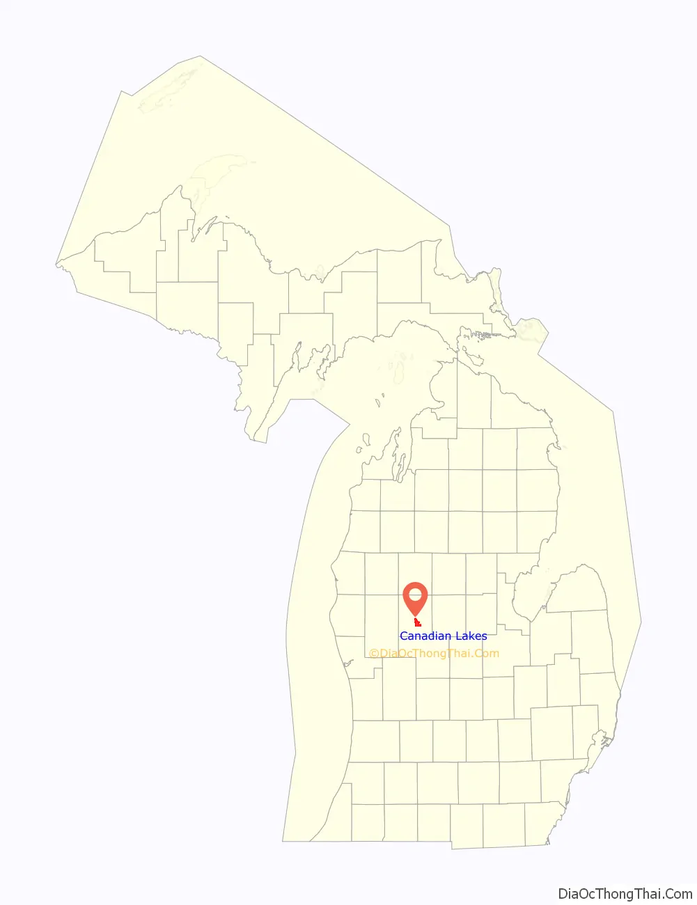
Canadian Lakes location map. Where is Canadian Lakes CDP?
Canadian Lakes Road Map
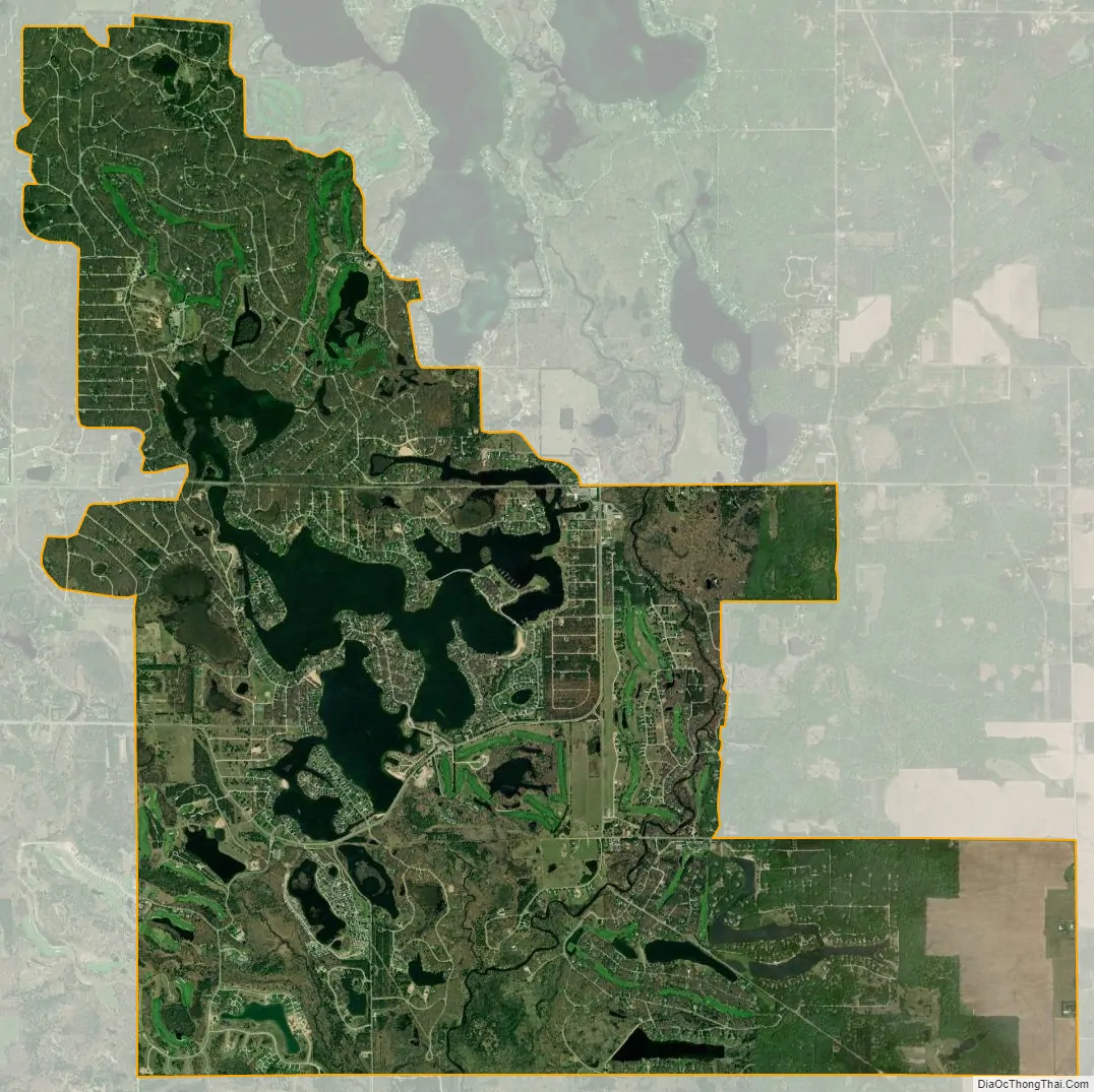
Canadian Lakes city Satellite Map
Geography
According to the United States Census Bureau, the community has a total area of 10.7 square miles (28 km), of which 9.5 square miles (25 km) is land and 1.2 square miles (3.1 km) (10.88%) is water.
See also
Map of Michigan State and its subdivision:- Alcona
- Alger
- Allegan
- Alpena
- Antrim
- Arenac
- Baraga
- Barry
- Bay
- Benzie
- Berrien
- Branch
- Calhoun
- Cass
- Charlevoix
- Cheboygan
- Chippewa
- Clare
- Clinton
- Crawford
- Delta
- Dickinson
- Eaton
- Emmet
- Genesee
- Gladwin
- Gogebic
- Grand Traverse
- Gratiot
- Hillsdale
- Houghton
- Huron
- Ingham
- Ionia
- Iosco
- Iron
- Isabella
- Jackson
- Kalamazoo
- Kalkaska
- Kent
- Keweenaw
- Lake
- Lake Hurron
- Lake Michigan
- Lake St. Clair
- Lake Superior
- Lapeer
- Leelanau
- Lenawee
- Livingston
- Luce
- Mackinac
- Macomb
- Manistee
- Marquette
- Mason
- Mecosta
- Menominee
- Midland
- Missaukee
- Monroe
- Montcalm
- Montmorency
- Muskegon
- Newaygo
- Oakland
- Oceana
- Ogemaw
- Ontonagon
- Osceola
- Oscoda
- Otsego
- Ottawa
- Presque Isle
- Roscommon
- Saginaw
- Saint Clair
- Saint Joseph
- Sanilac
- Schoolcraft
- Shiawassee
- Tuscola
- Van Buren
- Washtenaw
- Wayne
- Wexford
- Alabama
- Alaska
- Arizona
- Arkansas
- California
- Colorado
- Connecticut
- Delaware
- District of Columbia
- Florida
- Georgia
- Hawaii
- Idaho
- Illinois
- Indiana
- Iowa
- Kansas
- Kentucky
- Louisiana
- Maine
- Maryland
- Massachusetts
- Michigan
- Minnesota
- Mississippi
- Missouri
- Montana
- Nebraska
- Nevada
- New Hampshire
- New Jersey
- New Mexico
- New York
- North Carolina
- North Dakota
- Ohio
- Oklahoma
- Oregon
- Pennsylvania
- Rhode Island
- South Carolina
- South Dakota
- Tennessee
- Texas
- Utah
- Vermont
- Virginia
- Washington
- West Virginia
- Wisconsin
- Wyoming