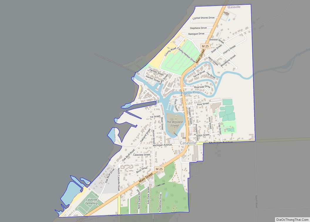
Caseville is a city in Huron County in the U.S. state of Michigan, located at the mouth of the Pigeon River on Saginaw Bay of Lake Huron. The population was 652 at the 2020 census. The city is surrounded by Caseville Township. A popular destination for summer tourists, it sponsors the 10-day Cheeseburger in Caseville festival, a tribute to Jimmy Buffett’s song “Cheeseburger in Paradise”. It has been also called the “Perch Capital of Michigan” for its extraordinary catches of the native fish yellow “perch”.
| Name: | Caseville city |
|---|---|
| LSAD Code: | 25 |
| LSAD Description: | city (suffix) |
| State: | Michigan |
| County: | Huron County |
| Incorporated: | 1896 (village) 2010 (city) |
| Elevation: | 600 ft (183 m) |
| Total Area: | 1.15 sq mi (2.97 km²) |
| Land Area: | 1.12 sq mi (2.90 km²) |
| Water Area: | 0.03 sq mi (0.08 km²) |
| Total Population: | 652 |
| Population Density: | 582.66/sq mi (225.02/km²) |
| Area code: | 989 |
| FIPS code: | 2613760 |
| GNISfeature ID: | 0622835 |
Online Interactive Map
Click on ![]() to view map in "full screen" mode.
to view map in "full screen" mode.
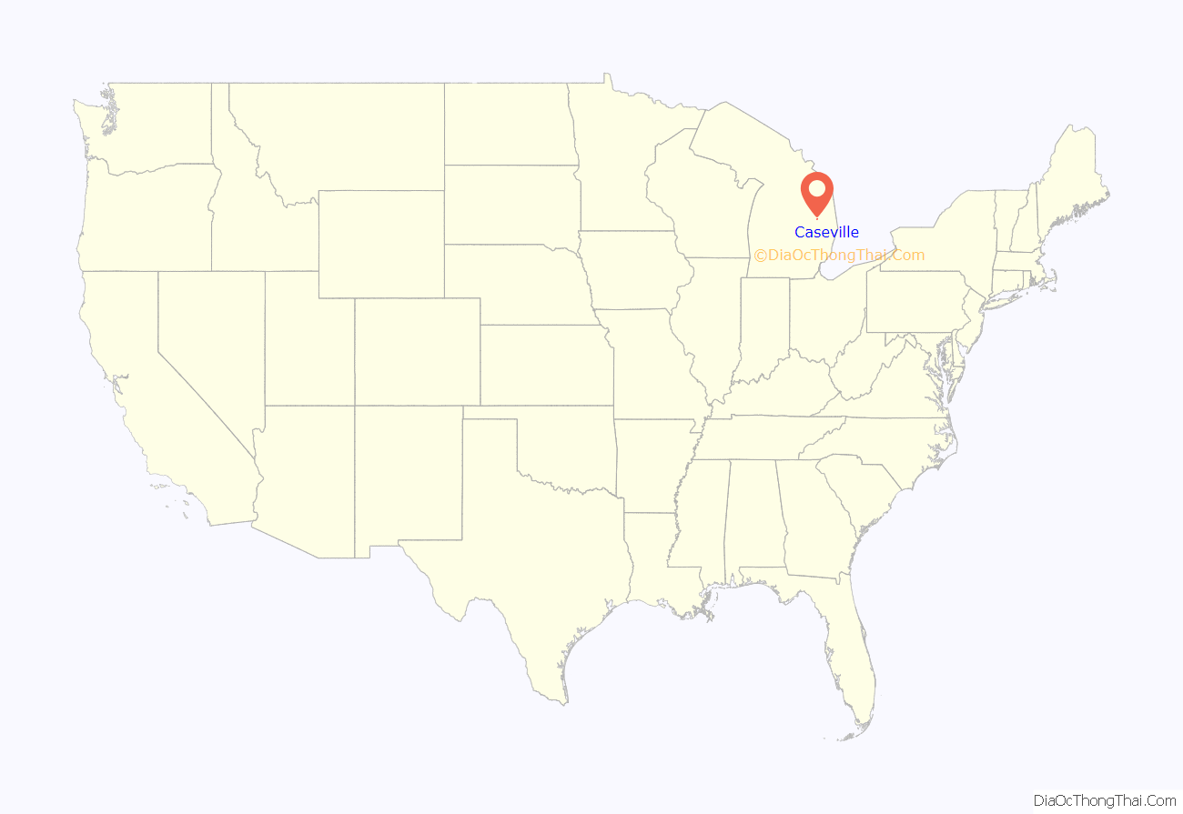
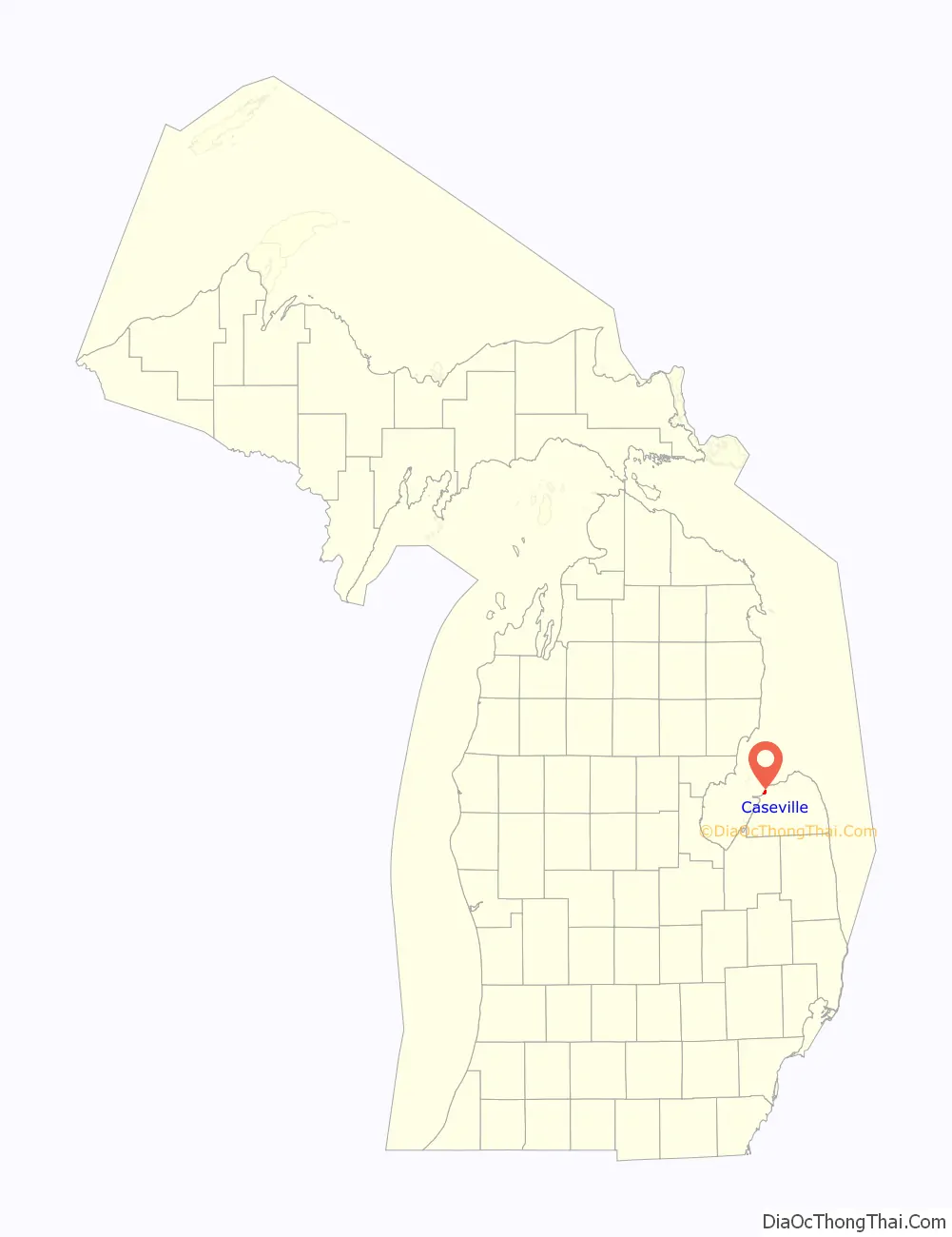
Caseville location map. Where is Caseville city?
History
Caseville was settled by European Americans beginning with settler Reuben Dodge in 1836. They first called it Pigeon River Settlement, as it developed at the mouth of the river of that name, which leads to Saginaw Bay. Later, it was known as Port Elizabeth and Elizabethtown for the wife of William Rattle, who was agent for major landowner Leonard Case. The town developed through lumbering, with timber shipped via the lake to markets. Ship building and salt manufacturing were also early industries.
In 1856, Francis Crawford purchased 20 thousand acres from Case around the community. That same year the community assume the Caseville name. A post office opened here on January 28, 1863 with Crawford as postmaster. In 1896, Caseville was incorporated by the legislature as a village.
The Cheeseburger in Caseville festival was first held in 1999 over three days on a weekend. By 2004, the festival had grown into a 10-day event.
In 2010, Caseville became a city. A detachment effort to return three sections of the city back to the Caseville Township was underway in 2016.
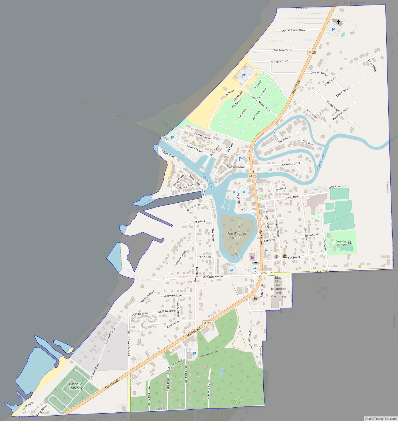
Caseville Road Map
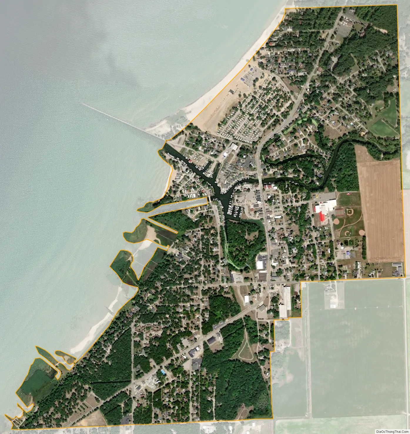
Caseville city Satellite Map
Geography
- According to the United States Census Bureau, the village has a total area of 1.13 square miles (2.93 km), of which 1.10 square miles (2.85 km) is land and 0.03 square miles (0.08 km) is water. The town developed along the Pigeon River, creating a municipal harbor to support shipping through Saginaw Bay and the Great Lakes.
- It is located in the Thumb of Michigan, a subregion of the Flint/Tri-Cities area.
See also
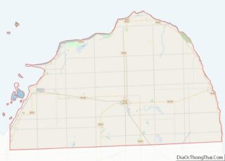
Map of Michigan State and its subdivision:- Alcona
- Alger
- Allegan
- Alpena
- Antrim
- Arenac
- Baraga
- Barry
- Bay
- Benzie
- Berrien
- Branch
- Calhoun
- Cass
- Charlevoix
- Cheboygan
- Chippewa
- Clare
- Clinton
- Crawford
- Delta
- Dickinson
- Eaton
- Emmet
- Genesee
- Gladwin
- Gogebic
- Grand Traverse
- Gratiot
- Hillsdale
- Houghton
- Huron
- Ingham
- Ionia
- Iosco
- Iron
- Isabella
- Jackson
- Kalamazoo
- Kalkaska
- Kent
- Keweenaw
- Lake
- Lake Hurron
- Lake Michigan
- Lake St. Clair
- Lake Superior
- Lapeer
- Leelanau
- Lenawee
- Livingston
- Luce
- Mackinac
- Macomb
- Manistee
- Marquette
- Mason
- Mecosta
- Menominee
- Midland
- Missaukee
- Monroe
- Montcalm
- Montmorency
- Muskegon
- Newaygo
- Oakland
- Oceana
- Ogemaw
- Ontonagon
- Osceola
- Oscoda
- Otsego
- Ottawa
- Presque Isle
- Roscommon
- Saginaw
- Saint Clair
- Saint Joseph
- Sanilac
- Schoolcraft
- Shiawassee
- Tuscola
- Van Buren
- Washtenaw
- Wayne
- Wexford
- Alabama
- Alaska
- Arizona
- Arkansas
- California
- Colorado
- Connecticut
- Delaware
- District of Columbia
- Florida
- Georgia
- Hawaii
- Idaho
- Illinois
- Indiana
- Iowa
- Kansas
- Kentucky
- Louisiana
- Maine
- Maryland
- Massachusetts
- Michigan
- Minnesota
- Mississippi
- Missouri
- Montana
- Nebraska
- Nevada
- New Hampshire
- New Jersey
- New Mexico
- New York
- North Carolina
- North Dakota
- Ohio
- Oklahoma
- Oregon
- Pennsylvania
- Rhode Island
- South Carolina
- South Dakota
- Tennessee
- Texas
- Utah
- Vermont
- Virginia
- Washington
- West Virginia
- Wisconsin
- Wyoming