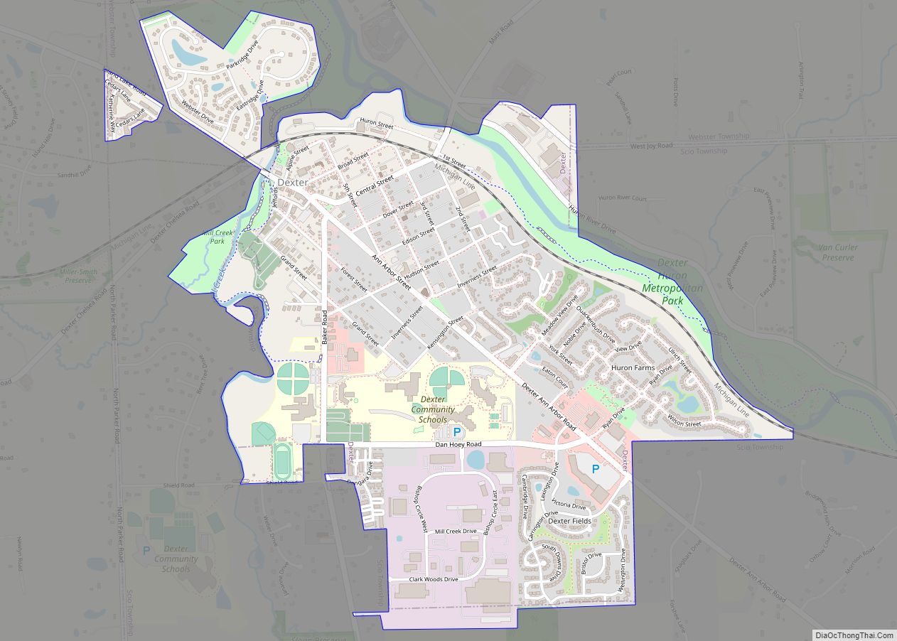
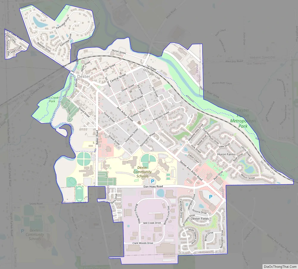
The City of Dexter is a city situated in Washtenaw County, Michigan, in the United States. As of the 2021 Census, the city’s population was recorded at 6,644. Residential areas in Dexter include the original settlements along the Baker Road, Central Street, and Dexter-Ann Arbor Road corridors, as well as newer subdivisions and condominiums in both the eastern and western parts of town.
Originally established in 1830 as The Village of Dexter, named after Samuel W. Dexter, the city was officially incorporated as a city on November 20, 2014.
The city is located next to several rivers and trails, including the Border-to-Border Trail. With-in city limits is The Dexter Cider Mill, one of the oldest cider mills in the state of Michigan, a farmers market, and various other local businesses.
| Name: | Dexter city |
|---|---|
| LSAD Code: | 25 |
| LSAD Description: | city (suffix) |
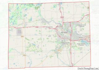
| State: | Michigan |
| County: | Washtenaw County |
| Incorporated: | 1830 (village) 2014 (city) |
| Elevation: | 869 ft (265 m) |
| Total Area: | 1.97 sq mi (5.09 km²) |
| Land Area: | 1.94 sq mi (5.03 km²) |
| Water Area: | 0.03 sq mi (0.06 km²) |
| Total Population: | 4,500 |
| Population Density: | 2,316.01/sq mi (894.13/km²) |
| Area code: | 734 |
| FIPS code: | 2622160 |
| GNISfeature ID: | 0624624 |
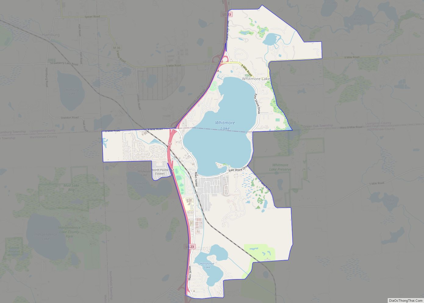
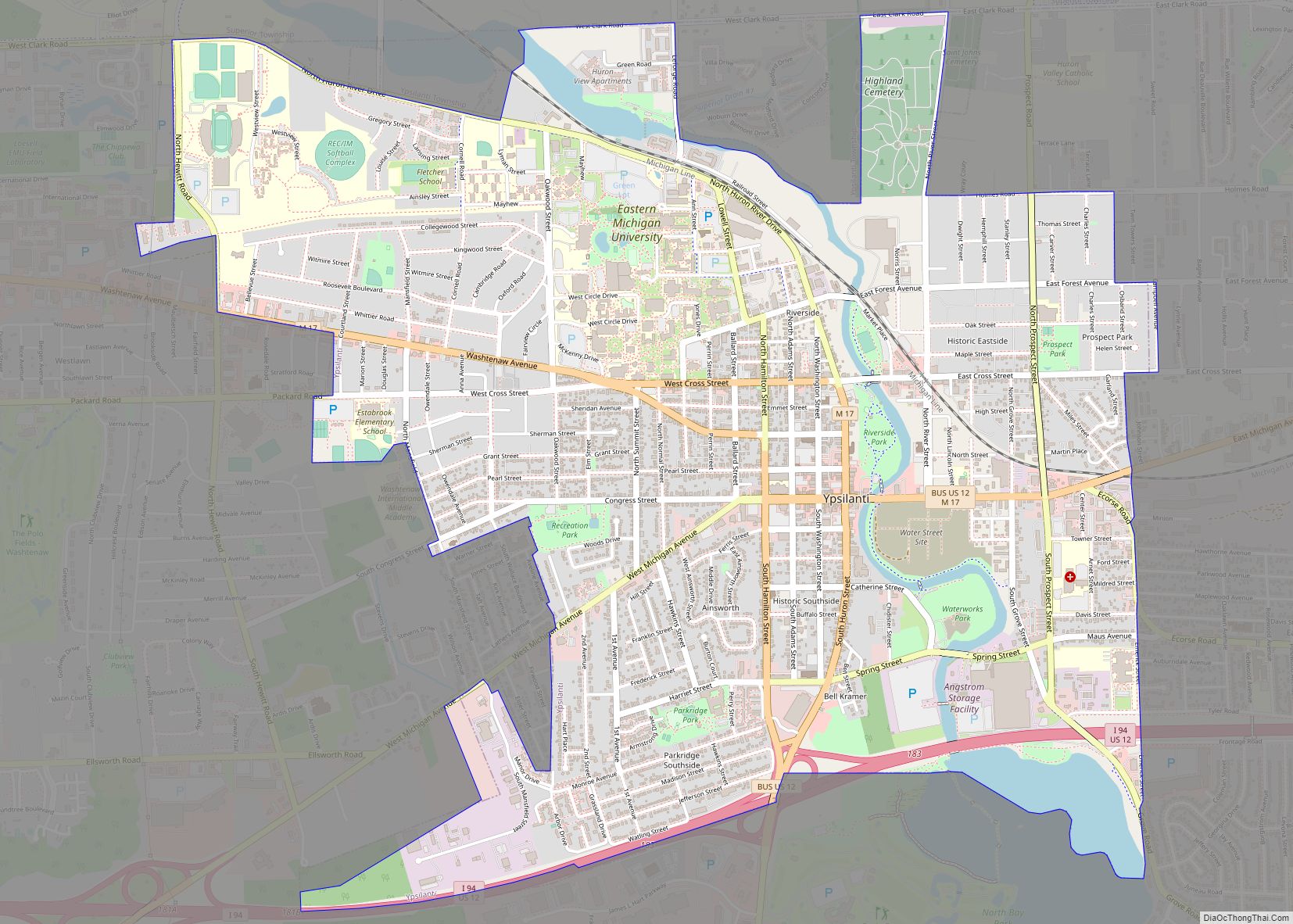
Online Interactive Map
Click on ![]() to view map in "full screen" mode.
to view map in "full screen" mode.
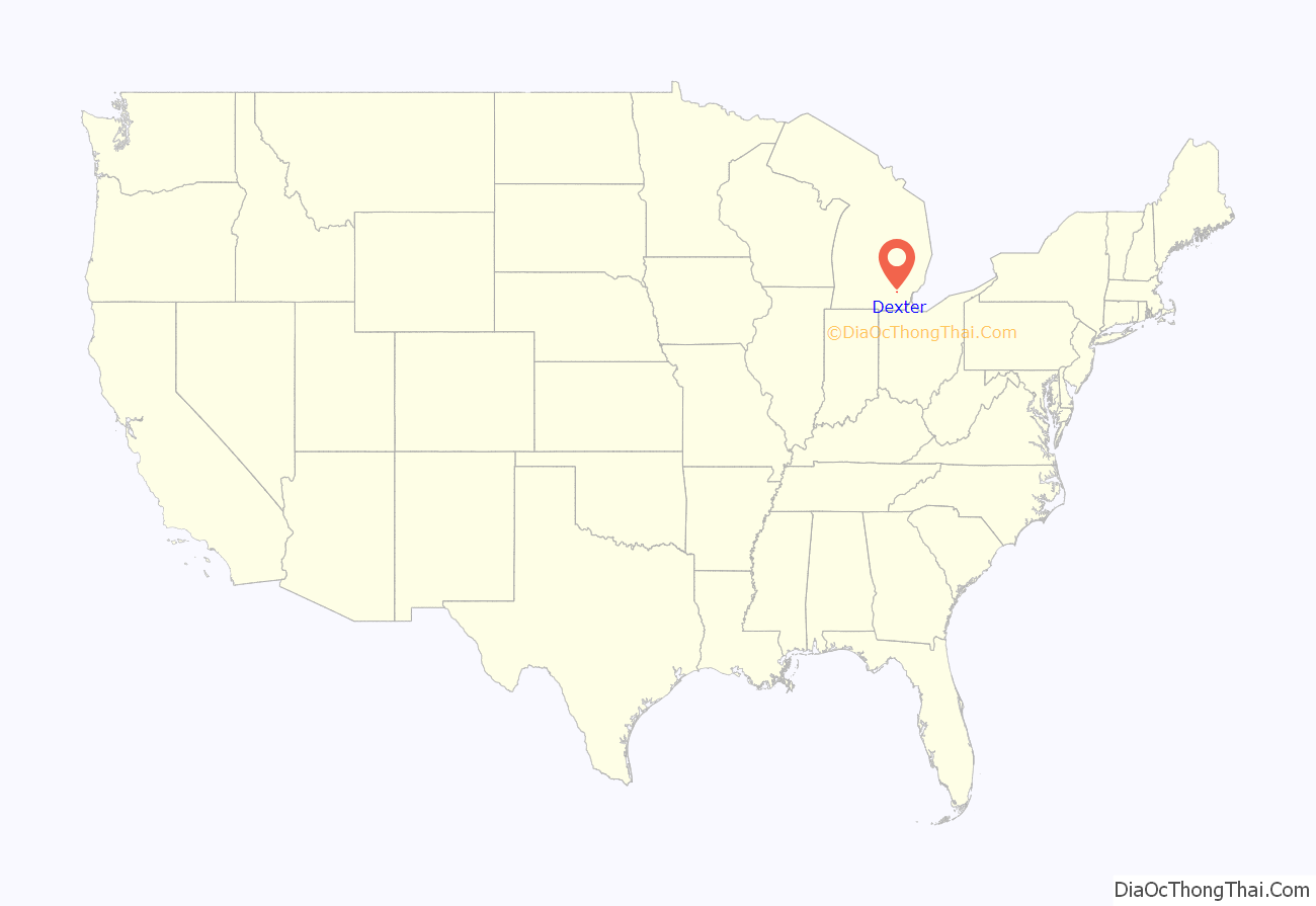
Dexter location map. Where is Dexter city?
History
The area was first settled in 1824, 13 years before Michigan became a state, when land speculator Samuel W. Dexter purchased a large tract of land and originated the village. It was known as “Mill Creek Settlement” until the village was platted in 1830, when its name was officially changed to Dexter.
Mill Creek and the Huron River, which form much of the western and northeastern boundaries of the city, respectively, have long been valuable resources to Dexter. A sawmill was built in 1827, a woolen mill in 1838, a grist mill in 1844, and a cider mill in 1886. After being appointed County Court Justice in 1826, Judge Dexter reportedly established a post office in his home, shuttling mail between there and Ann Arbor on horseback.
The founder of the original village, Samuel W. Dexter served as the chief justice of the Washtenaw County Court as well as being elected a University of Michigan regent. His home just northwest of the city overlooking Mill Creek was built in the early 1840s in Greek Revival architecture and is a recognizable landmark in the area. Samuel Dexter called it Gordon Hall to honor his mother’s family. Gordon Hall was built by Calvin T. Fillmore, an architect and builder in the area. Calvin was a brother of president Millard Fillmore. Samuel Dexter was a staunch abolitionist, and it is nearly certain that Gordon Hall was a stop on the Underground Railroad (amongst other evidence, Gordon Hall contained secret areas in the basement, accessible only through hidden doorways).
Gordon Hall and 70 acres (280,000 m) of surrounding property was gifted to the University of Michigan in 1950 by Katharine Dexter McCormick. (In 2006, the property was purchased by the Dexter Area Historical Society and Museum, with the goal of preserving and restoring the home).
On March 20, 1966, the Dexter area experienced “one of the most infamous of all UFO sightings in history” when local truck driver Frank Mannor spotted a glowing object near his home. Astronomer J. Allen Hynek visited Dexter and declared the object was probably caused by “swamp gas,” a term which has since become closely affiliated with UFO sightings. Hynek’s swamp gas theory prompted then-Michigan Congressman (and future president) Gerald R. Ford to call for a thorough Congressional investigation of “the rash of reported sightings of unidentified flying objects in southern Michigan”.
On Thursday, March 15, 2012, Dexter was struck by a large EF3 tornado causing substantial damage to local houses and businesses, yet no injuries were reported.
On November 4, 2014, Dexter residents voted to adopt a new charter, officially turning the former village into a city.
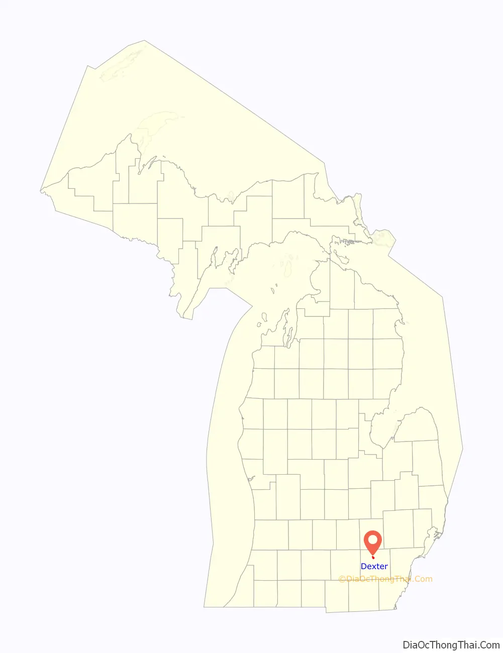
Dexter Road Map
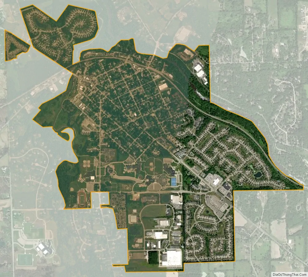
Dexter city Satellite Map
Geography
According to the U.S. Census Bureau, the city has a total area of 1.97 square miles (5.10 km), of which 1.94 square miles (5.02 km) is land and 0.03 square miles (0.08 km) (1.52%) is water.
Dexter is located along the Huron River and contains small portions of two metro parks: Hudson Mills Metropark and Dexter–Huron Metropark. The Border-to-Border Trail runs through the city.
See also
Map of Michigan State and its subdivision:- Alcona
- Alger
- Allegan
- Alpena
- Antrim
- Arenac
- Baraga
- Barry
- Bay
- Benzie
- Berrien
- Branch
- Calhoun
- Cass
- Charlevoix
- Cheboygan
- Chippewa
- Clare
- Clinton
- Crawford
- Delta
- Dickinson
- Eaton
- Emmet
- Genesee
- Gladwin
- Gogebic
- Grand Traverse
- Gratiot
- Hillsdale
- Houghton
- Huron
- Ingham
- Ionia
- Iosco
- Iron
- Isabella
- Jackson
- Kalamazoo
- Kalkaska
- Kent
- Keweenaw
- Lake
- Lake Hurron
- Lake Michigan
- Lake St. Clair
- Lake Superior
- Lapeer
- Leelanau
- Lenawee
- Livingston
- Luce
- Mackinac
- Macomb
- Manistee
- Marquette
- Mason
- Mecosta
- Menominee
- Midland
- Missaukee
- Monroe
- Montcalm
- Montmorency
- Muskegon
- Newaygo
- Oakland
- Oceana
- Ogemaw
- Ontonagon
- Osceola
- Oscoda
- Otsego
- Ottawa
- Presque Isle
- Roscommon
- Saginaw
- Saint Clair
- Saint Joseph
- Sanilac
- Schoolcraft
- Shiawassee
- Tuscola
- Van Buren
- Washtenaw
- Wayne
- Wexford
- Alabama
- Alaska
- Arizona
- Arkansas
- California
- Colorado
- Connecticut
- Delaware
- District of Columbia
- Florida
- Georgia
- Hawaii
- Idaho
- Illinois
- Indiana
- Iowa
- Kansas
- Kentucky
- Louisiana
- Maine
- Maryland
- Massachusetts
- Michigan
- Minnesota
- Mississippi
- Missouri
- Montana
- Nebraska
- Nevada
- New Hampshire
- New Jersey
- New Mexico
- New York
- North Carolina
- North Dakota
- Ohio
- Oklahoma
- Oregon
- Pennsylvania
- Rhode Island
- South Carolina
- South Dakota
- Tennessee
- Texas
- Utah
- Vermont
- Virginia
- Washington
- West Virginia
- Wisconsin
- Wyoming