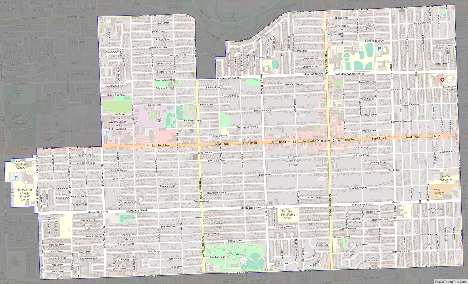
Garden City is a city in Wayne County of the U.S. state of Michigan. As of the 2010 census, the city population was 27,692. The city is part of the Metro Detroit region and is approximately 10 miles (16.1 km) west of the city of Detroit. M-153 (Ford Road) runs east–west through the center of the city.
| Name: | Garden City city |
|---|---|
| LSAD Code: | 25 |
| LSAD Description: | city (suffix) |
| State: | Michigan |
| County: | Wayne County |
| Incorporated: | 1927 (village) 1933 (city) |
| Elevation: | 633 ft (193 m) |
| Land Area: | 5.86 sq mi (15.18 km²) |
| Water Area: | 0.00 sq mi (0.00 km²) |
| Population Density: | 4,669.96/sq mi (1,803.21/km²) |
| Area code: | 734 |
| FIPS code: | 2631420 |
| GNISfeature ID: | 0626632 |
Online Interactive Map
Click on ![]() to view map in "full screen" mode.
to view map in "full screen" mode.
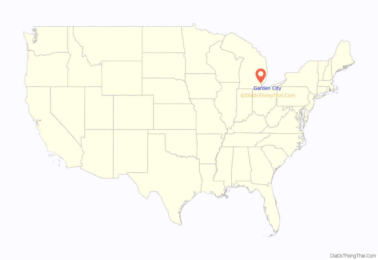
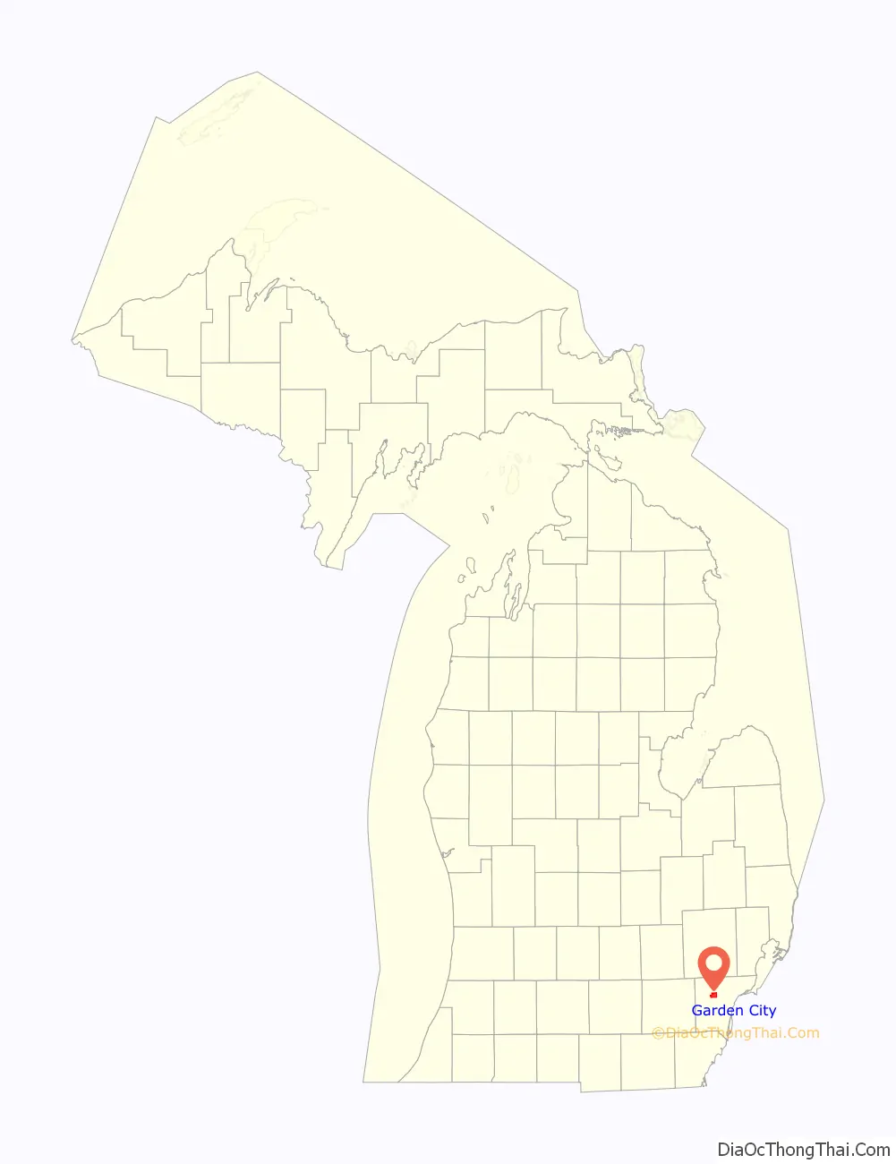
Garden City location map. Where is Garden City city?
History
The origins of Garden City started with the transfer of the property to John Lathers from Andrew Jackson for 160 acres (0.65 km) in October 1835. The city was patterned after the “garden city” concept that became popular in England during the 19th century, with most home sites sectioned off into 1-acre (4,000 m) plots to allow adequate farming area to support the family with fruit and vegetables. Most sites are now considerably smaller, some as small as 40 feet by 135 feet, with little room for gardening of fruits and vegetables, though the city maintains some large lots where an extra street has not been placed between two of the older streets, such as between some parts of Bock Street and John Hauk Street where Donnelly Avenue does not cut through.
In June 1927, Garden City became a village within Nankin Township, with Arnold Folker as Village President. Six years later the village became the city of Garden City. Areas of interest in Garden City include the first Kmart store (opened 1962, closed in early 2017), the first Little Caesars (opened May 1959, closed in October 2018), located at 32594 Cherry Hill Road, and the first dine-in McDonald’s in Michigan. The Folker Building, a gray stone structure located at the southeast corner of Ford and Middlebelt Roads, at what is considered downtown Garden City, was the first city hall. It later contained Orin Jewelers and other retail establishments. A new city hall was eventually constructed on Middlebelt Road between Ford and Warren Roads. The honeymoon cottage of Henry Ford and his wife, Clara Jane Bryant, was moved here from Dearborn in 1952.
Garden City Road Map
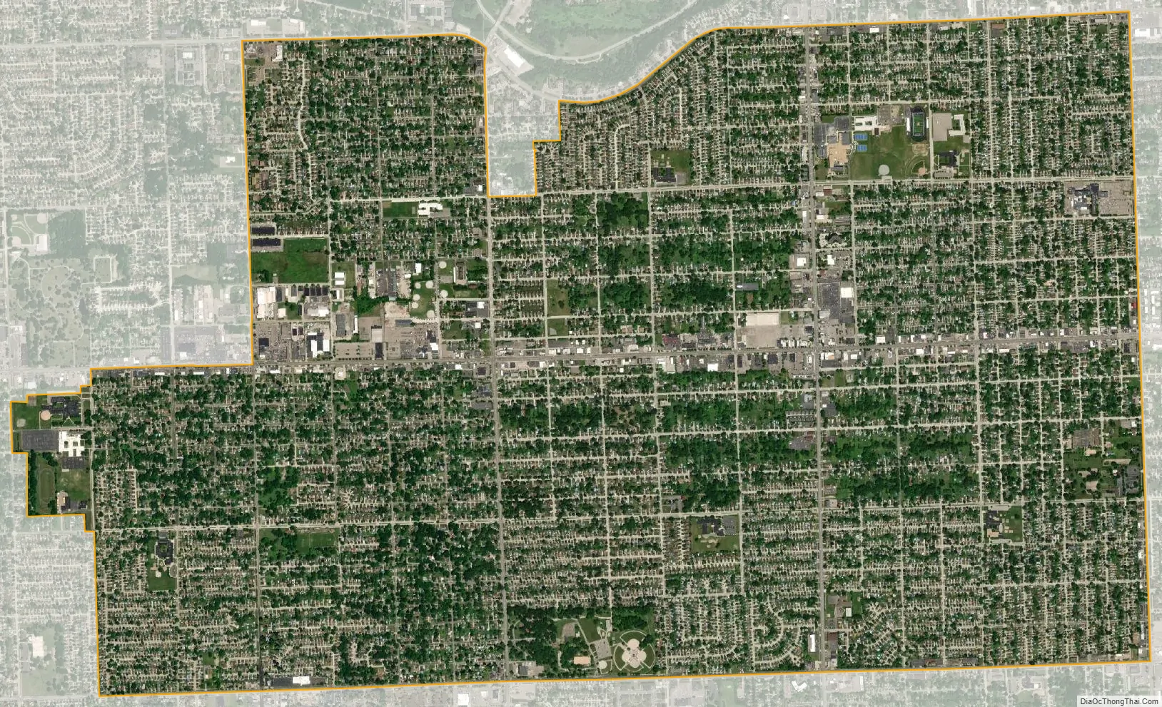
Garden City city Satellite Map
Geography
According to the United States Census Bureau, the city has a total area of 5.87 square miles (15.20 km), all land.
See also
Map of Michigan State and its subdivision:- Alcona
- Alger
- Allegan
- Alpena
- Antrim
- Arenac
- Baraga
- Barry
- Bay
- Benzie
- Berrien
- Branch
- Calhoun
- Cass
- Charlevoix
- Cheboygan
- Chippewa
- Clare
- Clinton
- Crawford
- Delta
- Dickinson
- Eaton
- Emmet
- Genesee
- Gladwin
- Gogebic
- Grand Traverse
- Gratiot
- Hillsdale
- Houghton
- Huron
- Ingham
- Ionia
- Iosco
- Iron
- Isabella
- Jackson
- Kalamazoo
- Kalkaska
- Kent
- Keweenaw
- Lake
- Lake Hurron
- Lake Michigan
- Lake St. Clair
- Lake Superior
- Lapeer
- Leelanau
- Lenawee
- Livingston
- Luce
- Mackinac
- Macomb
- Manistee
- Marquette
- Mason
- Mecosta
- Menominee
- Midland
- Missaukee
- Monroe
- Montcalm
- Montmorency
- Muskegon
- Newaygo
- Oakland
- Oceana
- Ogemaw
- Ontonagon
- Osceola
- Oscoda
- Otsego
- Ottawa
- Presque Isle
- Roscommon
- Saginaw
- Saint Clair
- Saint Joseph
- Sanilac
- Schoolcraft
- Shiawassee
- Tuscola
- Van Buren
- Washtenaw
- Wayne
- Wexford
- Alabama
- Alaska
- Arizona
- Arkansas
- California
- Colorado
- Connecticut
- Delaware
- District of Columbia
- Florida
- Georgia
- Hawaii
- Idaho
- Illinois
- Indiana
- Iowa
- Kansas
- Kentucky
- Louisiana
- Maine
- Maryland
- Massachusetts
- Michigan
- Minnesota
- Mississippi
- Missouri
- Montana
- Nebraska
- Nevada
- New Hampshire
- New Jersey
- New Mexico
- New York
- North Carolina
- North Dakota
- Ohio
- Oklahoma
- Oregon
- Pennsylvania
- Rhode Island
- South Carolina
- South Dakota
- Tennessee
- Texas
- Utah
- Vermont
- Virginia
- Washington
- West Virginia
- Wisconsin
- Wyoming


