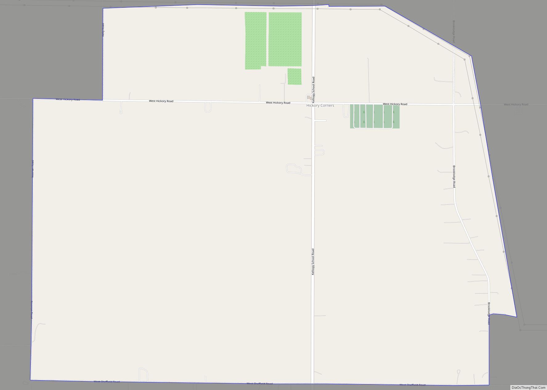
Hickory Corners is a census-designated place (CDP) in Barry Township in Barry County, Michigan, United States. The population was 313 at the 2020 census.
| Name: | Hickory Corners CDP |
|---|---|
| LSAD Code: | 57 |
| LSAD Description: | CDP (suffix) |
| State: | Michigan |
| County: | Barry County |
| Elevation: | 947 ft (289 m) |
| Total Area: | 2.08 sq mi (5.38 km²) |
| Land Area: | 2.07 sq mi (5.36 km²) |
| Water Area: | 0.01 sq mi (0.01 km²) |
| Total Population: | 313 |
| Population Density: | 151.21/sq mi (58.37/km²) |
| ZIP code: | 49060 |
| Area code: | 269 |
| FIPS code: | 2637960 |
| GNISfeature ID: | 0628188 |
Online Interactive Map
Click on ![]() to view map in "full screen" mode.
to view map in "full screen" mode.
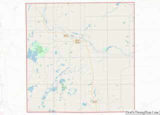
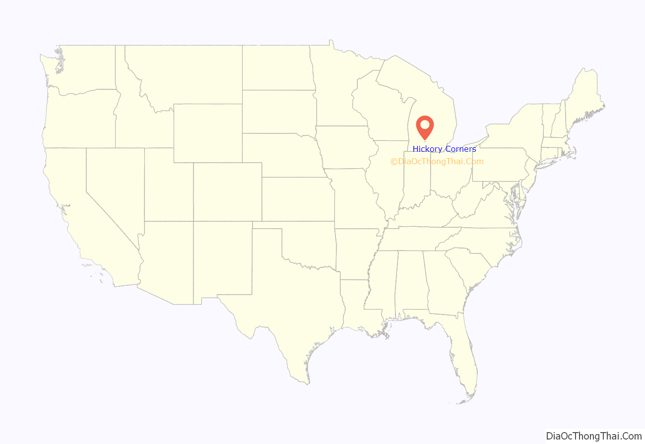
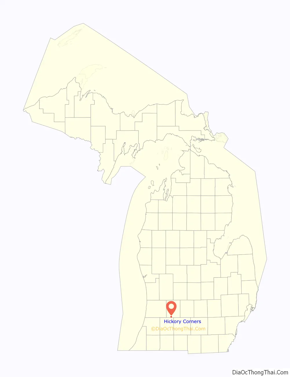
Hickory Corners location map. Where is Hickory Corners CDP?
History
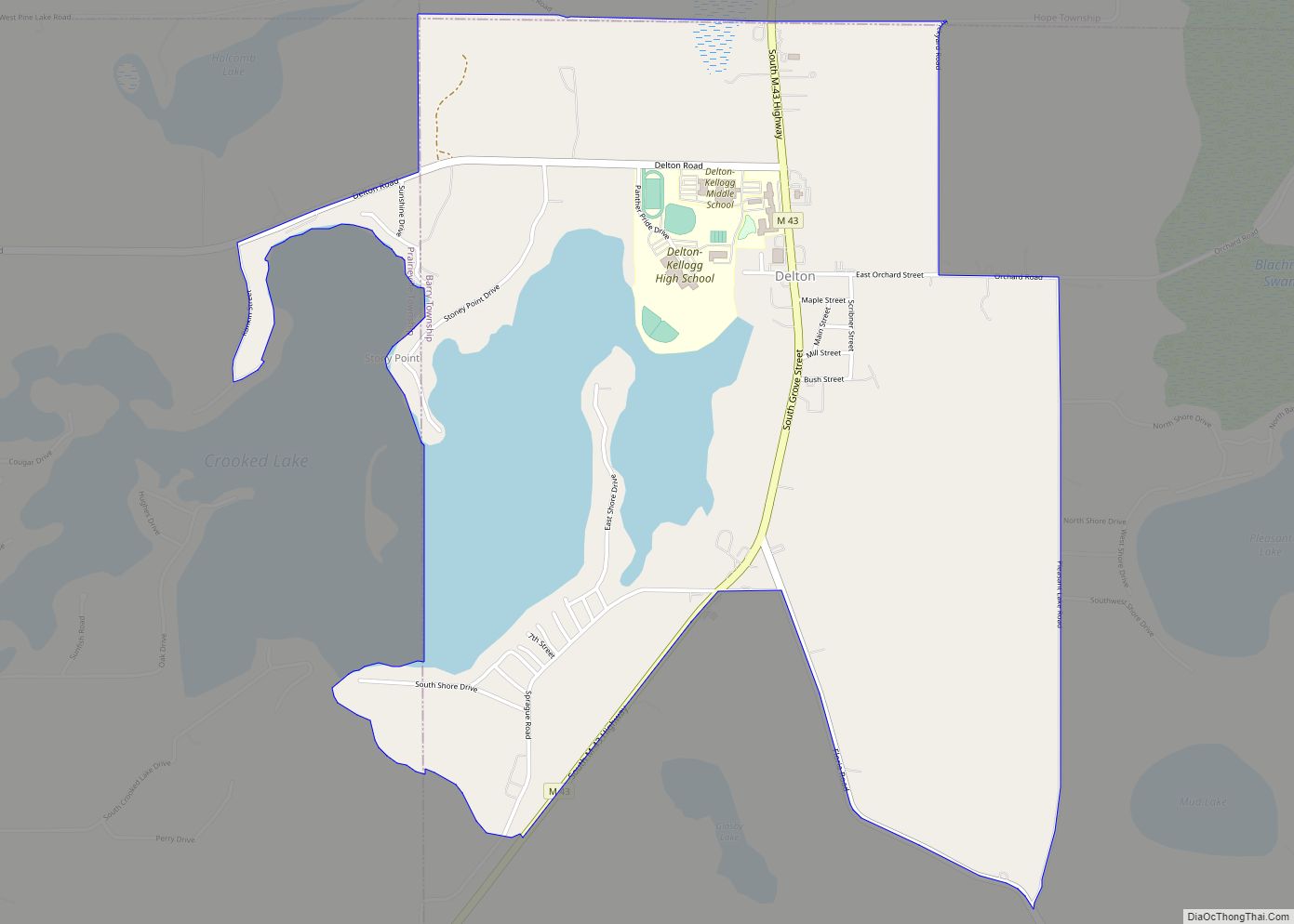
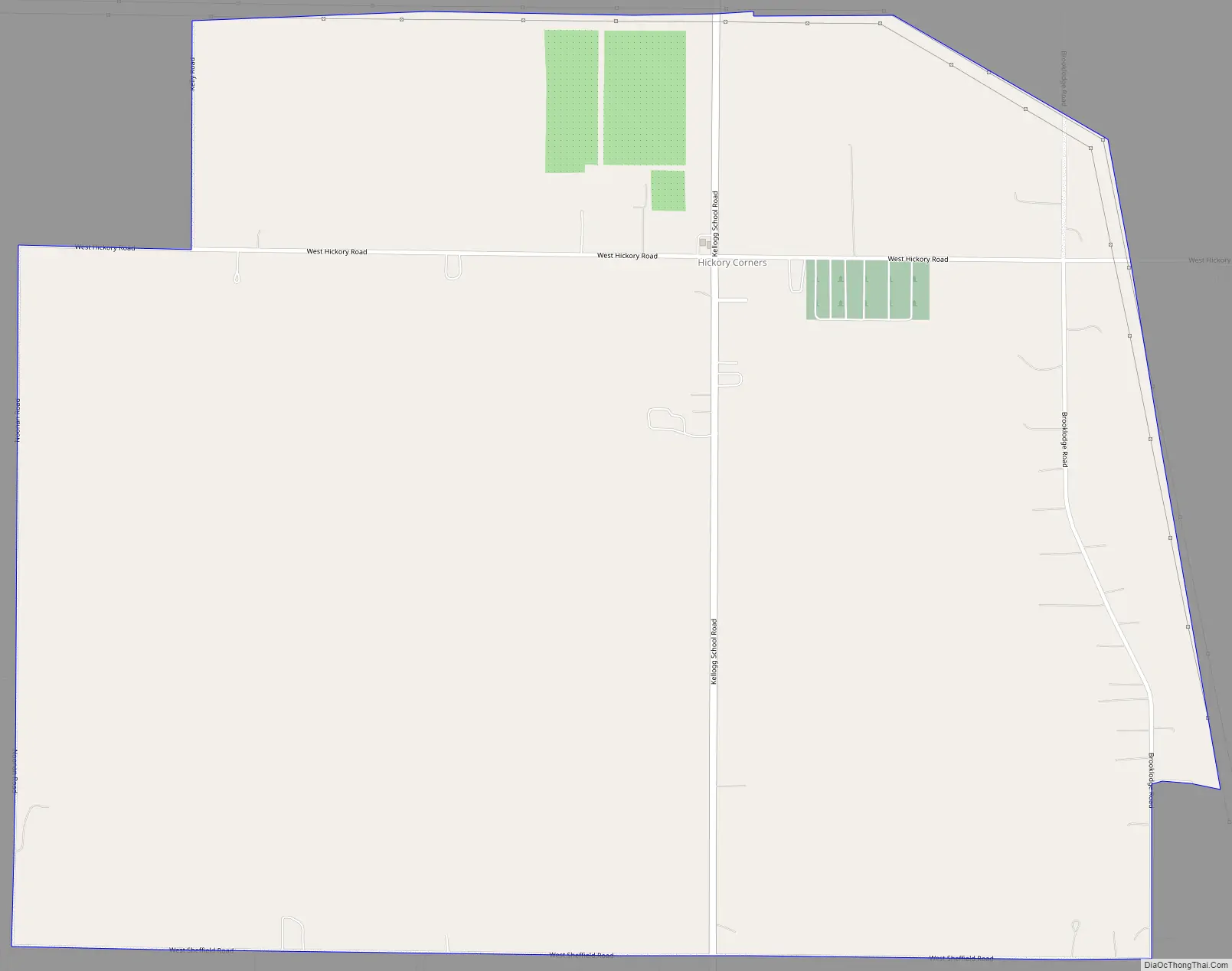
The first settler, the Rev. Moses Lawrence, built his home in 1834 on the shore of Lawrence Lake about a half mile east of the present town. In 1837, surveyors found a large hickory tree in the center of section 28, from which the settlement took its name. Solomon C. Hall built the first house in the town and became the first postmaster in July 1844.
Hickory Corners Road Map
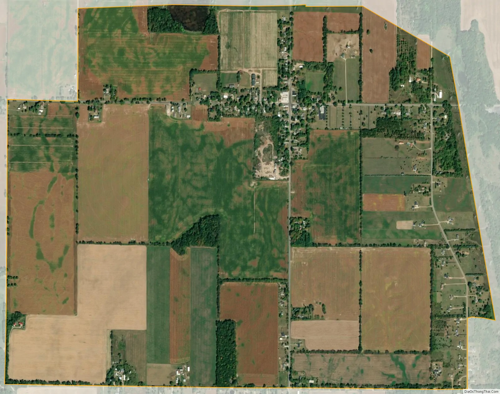
Hickory Corners city Satellite Map
Geography
Hickory Corners is located in southwestern Barry County at the intersection of Kellogg School Road and West Hickory Road. It is 1.5 miles (2.4 km) north of the southern boundary of Barry County with Kalamazoo County and 2.5 miles (4.0 km) east of state highway M-43.
According to the United States Census Bureau, the Hickory Corners CDP has a total area of 2.1 square miles (5.4 km), of which 0.004 square miles (0.01 km), or 0.28%, is water.
See also
Map of Michigan State and its subdivision:- Alcona
- Alger
- Allegan
- Alpena
- Antrim
- Arenac
- Baraga
- Barry
- Bay
- Benzie
- Berrien
- Branch
- Calhoun
- Cass
- Charlevoix
- Cheboygan
- Chippewa
- Clare
- Clinton
- Crawford
- Delta
- Dickinson
- Eaton
- Emmet
- Genesee
- Gladwin
- Gogebic
- Grand Traverse
- Gratiot
- Hillsdale
- Houghton
- Huron
- Ingham
- Ionia
- Iosco
- Iron
- Isabella
- Jackson
- Kalamazoo
- Kalkaska
- Kent
- Keweenaw
- Lake
- Lake Hurron
- Lake Michigan
- Lake St. Clair
- Lake Superior
- Lapeer
- Leelanau
- Lenawee
- Livingston
- Luce
- Mackinac
- Macomb
- Manistee
- Marquette
- Mason
- Mecosta
- Menominee
- Midland
- Missaukee
- Monroe
- Montcalm
- Montmorency
- Muskegon
- Newaygo
- Oakland
- Oceana
- Ogemaw
- Ontonagon
- Osceola
- Oscoda
- Otsego
- Ottawa
- Presque Isle
- Roscommon
- Saginaw
- Saint Clair
- Saint Joseph
- Sanilac
- Schoolcraft
- Shiawassee
- Tuscola
- Van Buren
- Washtenaw
- Wayne
- Wexford
- Alabama
- Alaska
- Arizona
- Arkansas
- California
- Colorado
- Connecticut
- Delaware
- District of Columbia
- Florida
- Georgia
- Hawaii
- Idaho
- Illinois
- Indiana
- Iowa
- Kansas
- Kentucky
- Louisiana
- Maine
- Maryland
- Massachusetts
- Michigan
- Minnesota
- Mississippi
- Missouri
- Montana
- Nebraska
- Nevada
- New Hampshire
- New Jersey
- New Mexico
- New York
- North Carolina
- North Dakota
- Ohio
- Oklahoma
- Oregon
- Pennsylvania
- Rhode Island
- South Carolina
- South Dakota
- Tennessee
- Texas
- Utah
- Vermont
- Virginia
- Washington
- West Virginia
- Wisconsin
- Wyoming