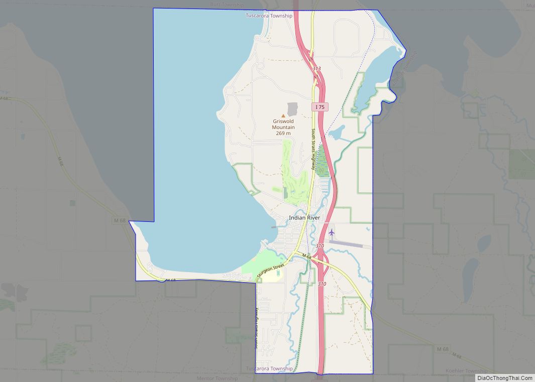
| Name: | Indian River CDP |
|---|---|
| LSAD Code: | 57 |
| LSAD Description: | CDP (suffix) |
| State: | Michigan |
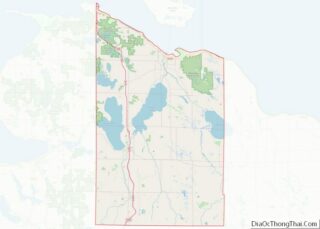
| County: | Cheboygan County |
| Elevation: | 614 ft (187 m) |
| Total Area: | 20.29 sq mi (52.54 km²) |
| Land Area: | 12.93 sq mi (33.48 km²) |
| Water Area: | 7.36 sq mi (19.06 km²) |
| Total Population: | 1,950 |
| Population Density: | 150.85/sq mi (58.24/km²) |
| Area code: | 231 |
| FIPS code: | 2640480 |
| GNISfeature ID: | 0629015 |
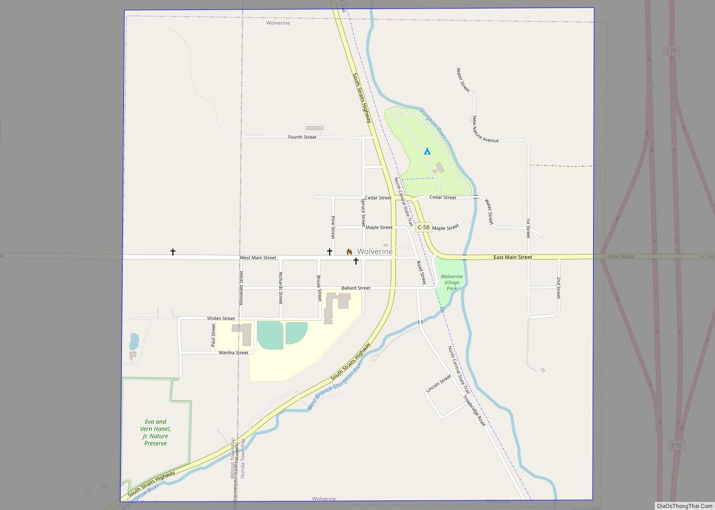
Online Interactive Map
Click on ![]() to view map in "full screen" mode.
to view map in "full screen" mode.
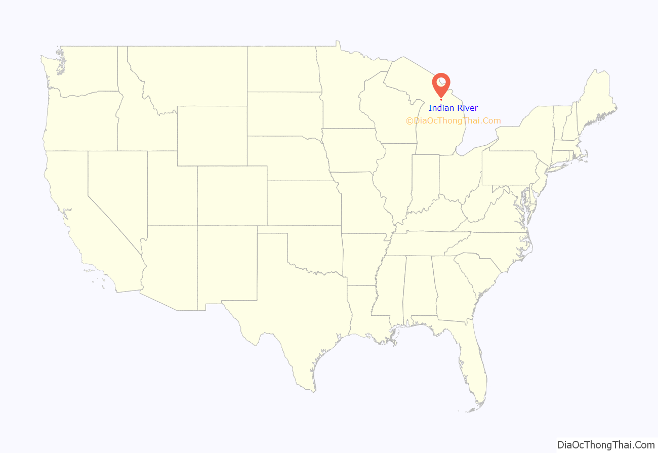
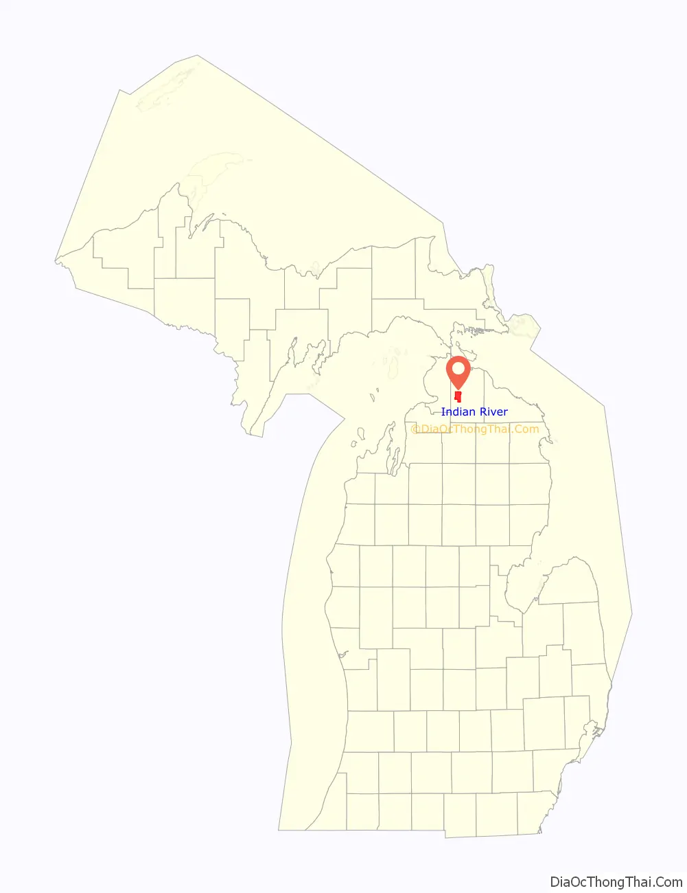
Indian River location map. Where is Indian River CDP?
History
The area of Indian River was first settled as early as 1876. The community was founded two years later by land owner Floyd Martin and surveyed and platted by Oliver Hayden by 1880. The new settlement was named after the Indian River, which flows through the community. A post office was established on September 22, 1879.
The North Central State Trail goes through the town. The National Shrine of the Cross in the Woods, an open-air sanctuary, is located in Indian River and dedicated to Kateri Tekakwitha, the first Native American saint.
Indian River Road Map
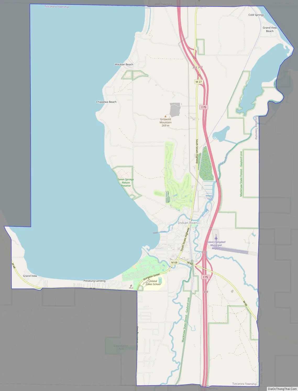
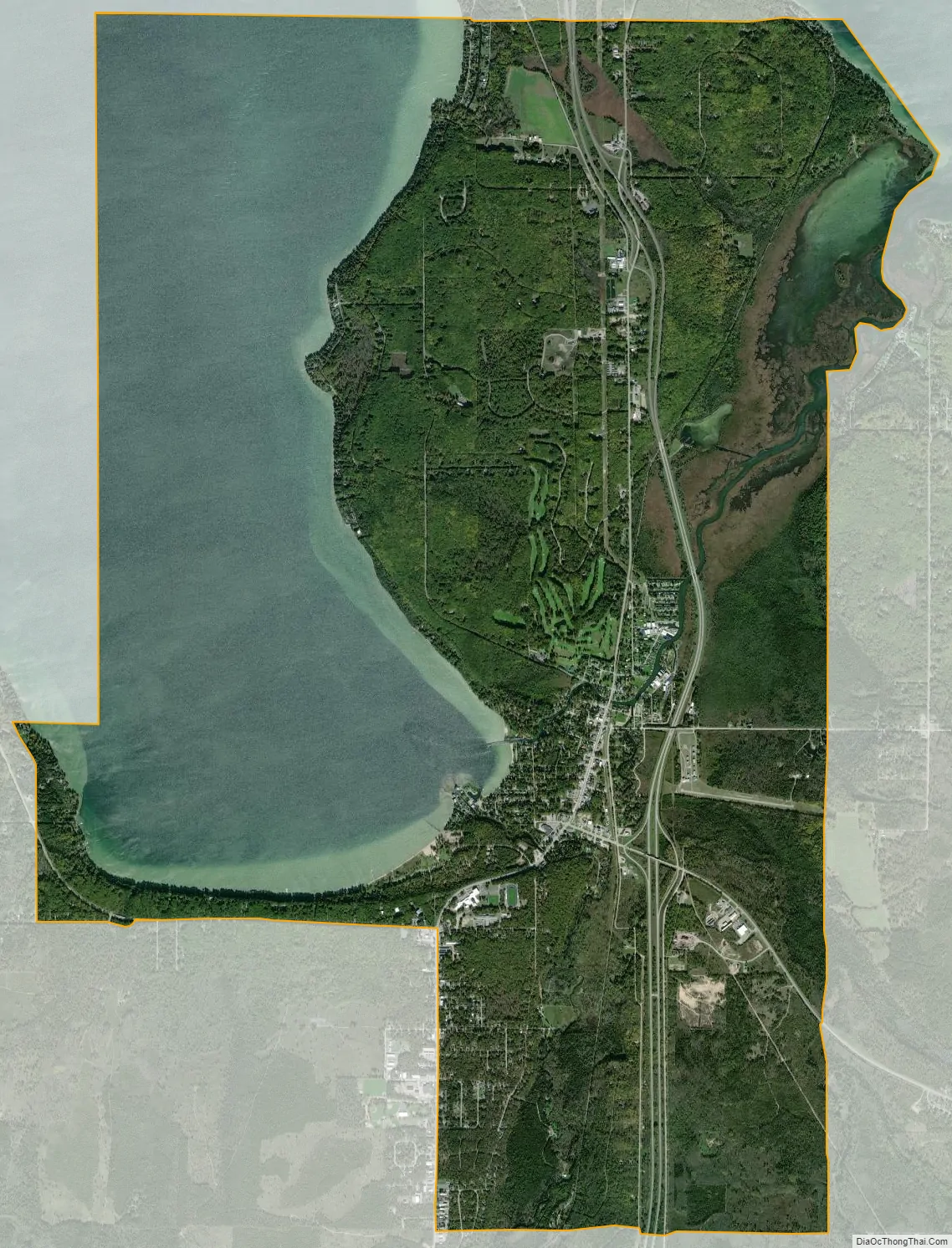
Indian River city Satellite Map
Geography
According to the U.S. Census Bureau, the CDP has a total area of 20.29 square miles (52.55 km), of which 12.93 square miles (33.49 km) is land and 7.36 square miles (19.06 km) (36.27%) is water.
Indian River is situated along the course of the Indian River, which connects Burt Lake and Mullett Lake. The Sturgeon River also drains into Burt Lake within the community. Burt Lake State Park is located within the community on the southeastern shores of Burt Lake.
Major highways
- I-75 runs south–north through the center of the community.
- M-68 runs through the southern portion of the community.
- M-72 has its southern terminus at I-75 within Indian River.
See also
Map of Michigan State and its subdivision:- Alcona
- Alger
- Allegan
- Alpena
- Antrim
- Arenac
- Baraga
- Barry
- Bay
- Benzie
- Berrien
- Branch
- Calhoun
- Cass
- Charlevoix
- Cheboygan
- Chippewa
- Clare
- Clinton
- Crawford
- Delta
- Dickinson
- Eaton
- Emmet
- Genesee
- Gladwin
- Gogebic
- Grand Traverse
- Gratiot
- Hillsdale
- Houghton
- Huron
- Ingham
- Ionia
- Iosco
- Iron
- Isabella
- Jackson
- Kalamazoo
- Kalkaska
- Kent
- Keweenaw
- Lake
- Lake Hurron
- Lake Michigan
- Lake St. Clair
- Lake Superior
- Lapeer
- Leelanau
- Lenawee
- Livingston
- Luce
- Mackinac
- Macomb
- Manistee
- Marquette
- Mason
- Mecosta
- Menominee
- Midland
- Missaukee
- Monroe
- Montcalm
- Montmorency
- Muskegon
- Newaygo
- Oakland
- Oceana
- Ogemaw
- Ontonagon
- Osceola
- Oscoda
- Otsego
- Ottawa
- Presque Isle
- Roscommon
- Saginaw
- Saint Clair
- Saint Joseph
- Sanilac
- Schoolcraft
- Shiawassee
- Tuscola
- Van Buren
- Washtenaw
- Wayne
- Wexford
- Alabama
- Alaska
- Arizona
- Arkansas
- California
- Colorado
- Connecticut
- Delaware
- District of Columbia
- Florida
- Georgia
- Hawaii
- Idaho
- Illinois
- Indiana
- Iowa
- Kansas
- Kentucky
- Louisiana
- Maine
- Maryland
- Massachusetts
- Michigan
- Minnesota
- Mississippi
- Missouri
- Montana
- Nebraska
- Nevada
- New Hampshire
- New Jersey
- New Mexico
- New York
- North Carolina
- North Dakota
- Ohio
- Oklahoma
- Oregon
- Pennsylvania
- Rhode Island
- South Carolina
- South Dakota
- Tennessee
- Texas
- Utah
- Vermont
- Virginia
- Washington
- West Virginia
- Wisconsin
- Wyoming