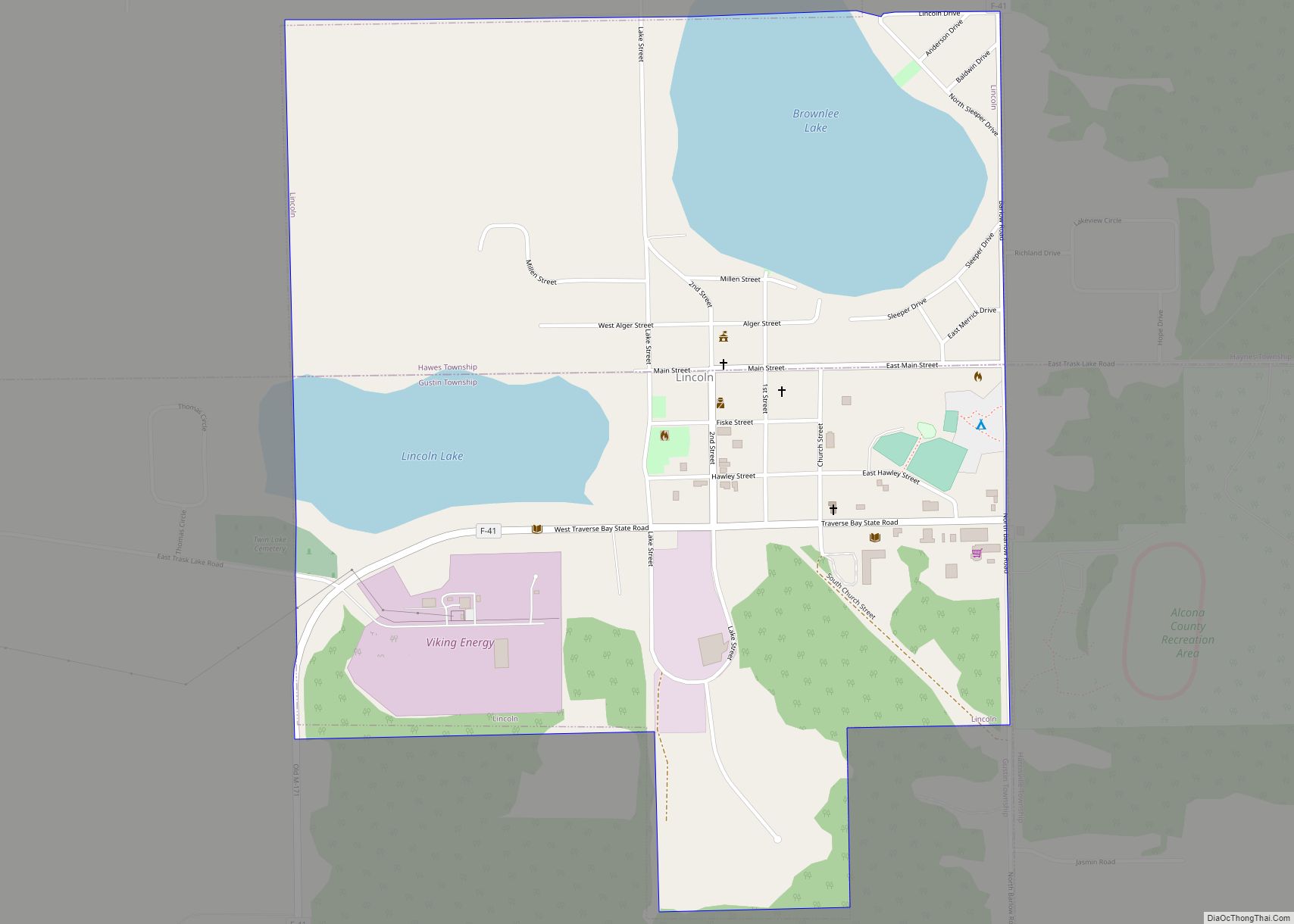
Lincoln is a village in Alcona County in the U.S. state of Michigan. The population was 305 at the 2020 census.
The village is situated on the boundary between Gustin Township on the south and Hawes Township on the north. The Lincoln 48742 ZIP Code covers a much larger area extending into the townships of Alcona, Caledonia, and Haynes.
| Name: | Lincoln village |
|---|---|
| LSAD Code: | 47 |
| LSAD Description: | village (suffix) |
| State: | Michigan |
| County: | Alcona County |
| Incorporated: | 1907 |
| Elevation: | 814 ft (248 m) |
| Total Area: | 1.06 sq mi (2.74 km²) |
| Land Area: | 0.82 sq mi (2.13 km²) |
| Water Area: | 0.23 sq mi (0.60 km²) 20.95% |
| Total Population: | 305 |
| Population Density: | 370.15/sq mi (142.99/km²) |
| Area code: | 989 |
| FIPS code: | 2647560 |
| GNISfeature ID: | 0630440 |
Online Interactive Map
Click on ![]() to view map in "full screen" mode.
to view map in "full screen" mode.
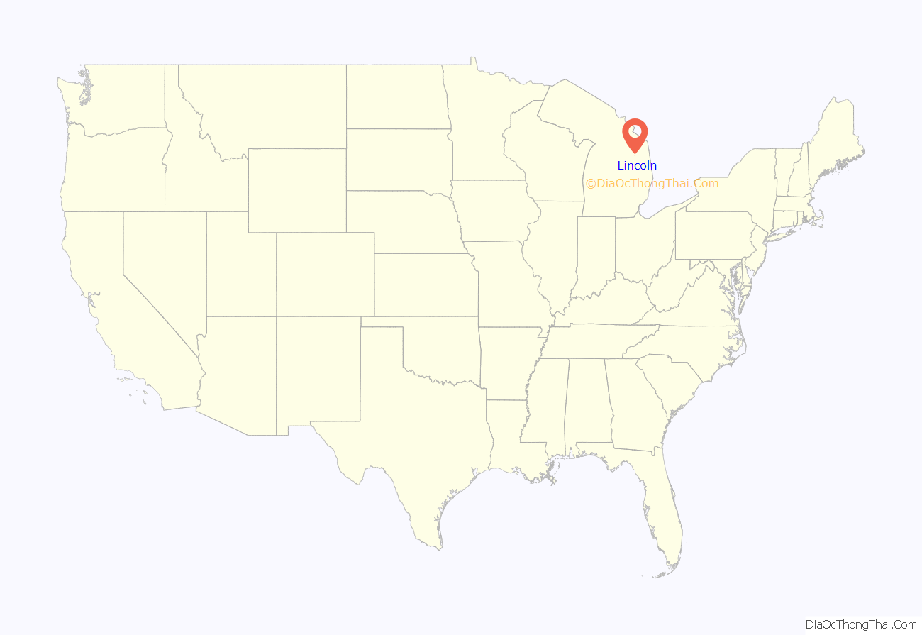
Lincoln location map. Where is Lincoln village?
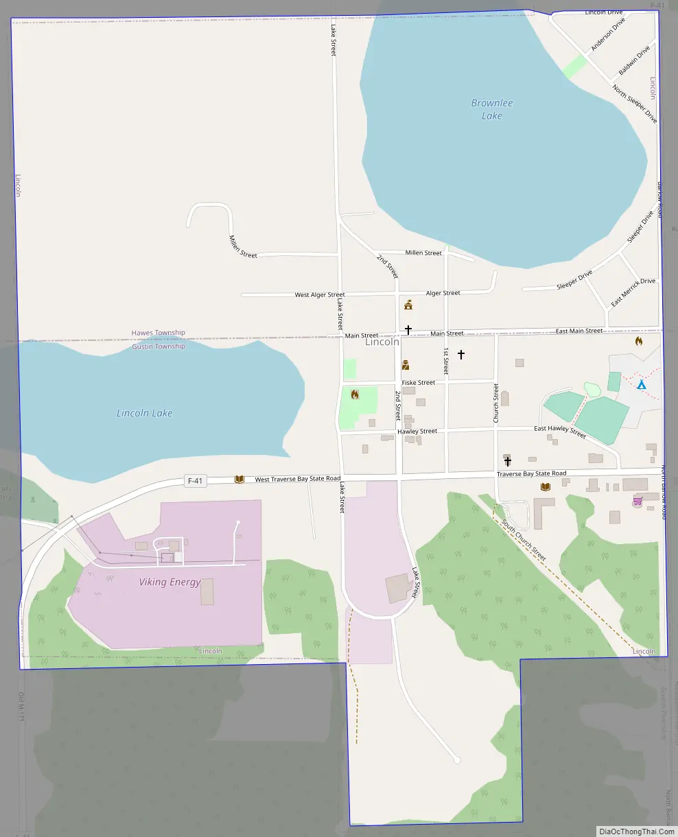
Lincoln Road Map
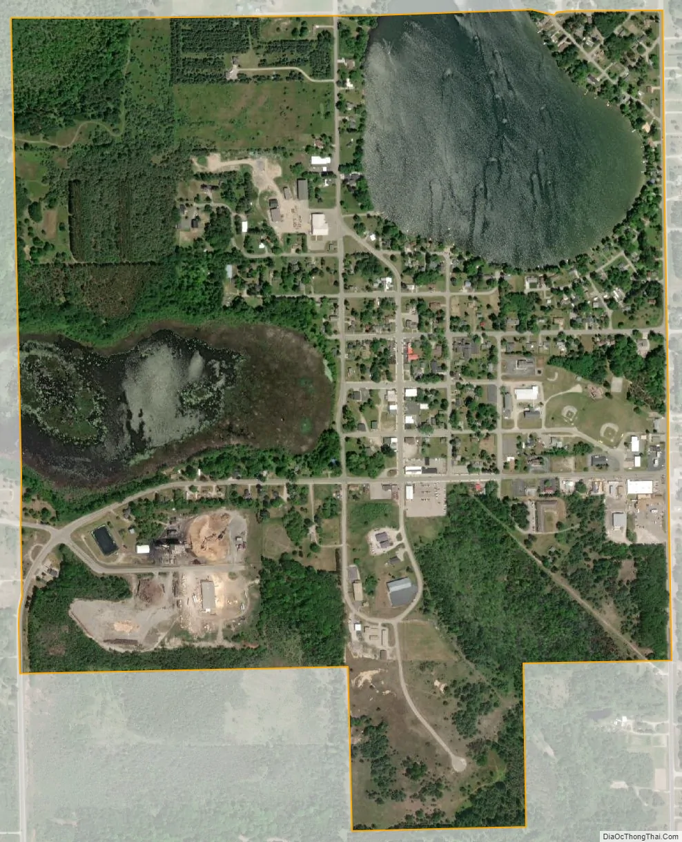
Lincoln city Satellite Map
Geography
According to the U.S. Census Bureau, the village has a total area of 1.05 square miles (2.72 km), of which 0.83 square miles (2.15 km) is land and 0.22 square miles (0.57 km) (20.95%) is water.
The village’s large water area consists of shorelines along Brownlee Lake and Lincoln Lake.
Major highways
- F-41 is a county-designated highway that runs through the village of Lincoln.
See also
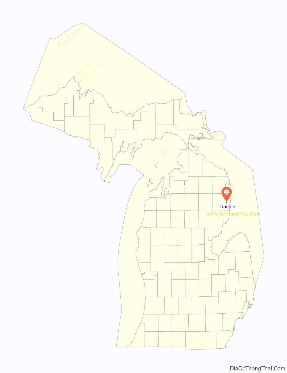
Map of Michigan State and its subdivision:- Alcona
- Alger
- Allegan
- Alpena
- Antrim
- Arenac
- Baraga
- Barry
- Bay
- Benzie
- Berrien
- Branch
- Calhoun
- Cass
- Charlevoix
- Cheboygan
- Chippewa
- Clare
- Clinton
- Crawford
- Delta
- Dickinson
- Eaton
- Emmet
- Genesee
- Gladwin
- Gogebic
- Grand Traverse
- Gratiot
- Hillsdale
- Houghton
- Huron
- Ingham
- Ionia
- Iosco
- Iron
- Isabella
- Jackson
- Kalamazoo
- Kalkaska
- Kent
- Keweenaw
- Lake
- Lake Hurron
- Lake Michigan
- Lake St. Clair
- Lake Superior
- Lapeer
- Leelanau
- Lenawee
- Livingston
- Luce
- Mackinac
- Macomb
- Manistee
- Marquette
- Mason
- Mecosta
- Menominee
- Midland
- Missaukee
- Monroe
- Montcalm
- Montmorency
- Muskegon
- Newaygo
- Oakland
- Oceana
- Ogemaw
- Ontonagon
- Osceola
- Oscoda
- Otsego
- Ottawa
- Presque Isle
- Roscommon
- Saginaw
- Saint Clair
- Saint Joseph
- Sanilac
- Schoolcraft
- Shiawassee
- Tuscola
- Van Buren
- Washtenaw
- Wayne
- Wexford
- Alabama
- Alaska
- Arizona
- Arkansas
- California
- Colorado
- Connecticut
- Delaware
- District of Columbia
- Florida
- Georgia
- Hawaii
- Idaho
- Illinois
- Indiana
- Iowa
- Kansas
- Kentucky
- Louisiana
- Maine
- Maryland
- Massachusetts
- Michigan
- Minnesota
- Mississippi
- Missouri
- Montana
- Nebraska
- Nevada
- New Hampshire
- New Jersey
- New Mexico
- New York
- North Carolina
- North Dakota
- Ohio
- Oklahoma
- Oregon
- Pennsylvania
- Rhode Island
- South Carolina
- South Dakota
- Tennessee
- Texas
- Utah
- Vermont
- Virginia
- Washington
- West Virginia
- Wisconsin
- Wyoming