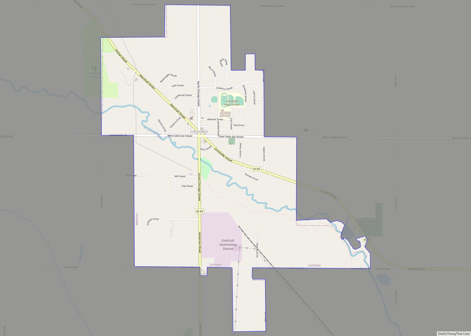
Litchfield is a city in Hillsdale County in the U.S. state of Michigan. The population was 1,399 at the 2020 census.
The city is surrounded by Litchfield Township, but the two are administered autonomously.
| Name: | Litchfield city |
|---|---|
| LSAD Code: | 25 |
| LSAD Description: | city (suffix) |
| State: | Michigan |
| County: | Hillsdale County |
| Incorporated: | 1877 (village) 1970 (city) |
| Elevation: | 1,024 ft (312 m) |
| Total Area: | 2.81 sq mi (7.28 km²) |
| Land Area: | 2.78 sq mi (7.20 km²) |
| Water Area: | 0.04 sq mi (0.10 km²) |
| Total Population: | 1,399 |
| Population Density: | 503.96/sq mi (194.55/km²) |
| Area code: | 517 |
| FIPS code: | 2647980 |
| GNISfeature ID: | 0630540 |
Online Interactive Map
Click on ![]() to view map in "full screen" mode.
to view map in "full screen" mode.
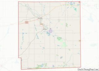
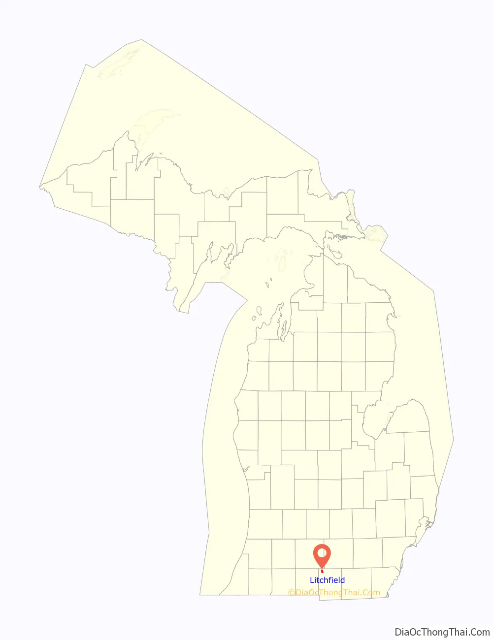
Litchfield location map. Where is Litchfield city?

History
The area was first settled by Henry Stevens in 1834. It was platted in 1836 by Hervey Smith and his son David, and the community was named Smithsville. Hervey became the first postmaster when the post office opened on February 3, 1837. The post office was named Columbus, and it was renamed to Litchfield on August 12, 1837. Stevens proposed the name after Litchfield, Connecticut, where many of the early settlers originated. Litchfield incorporated as a village in 1877. The village was part of Litchfield Township until it incorporated as a city in 1970.
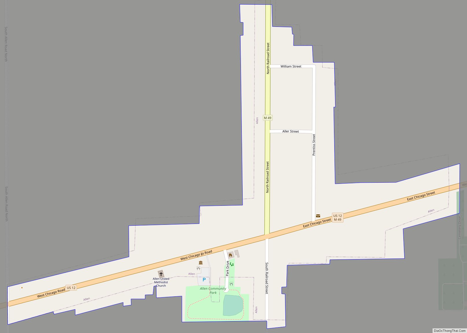
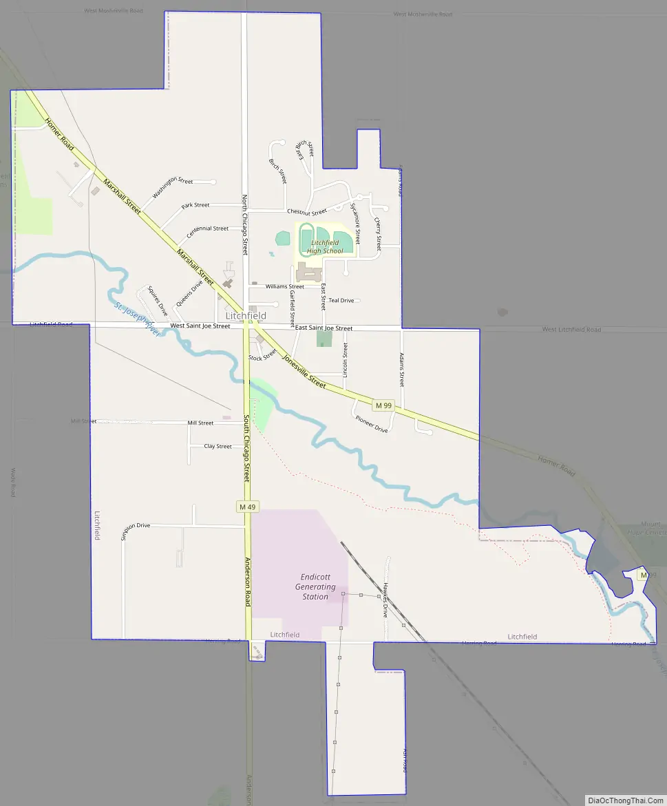
Litchfield Road Map
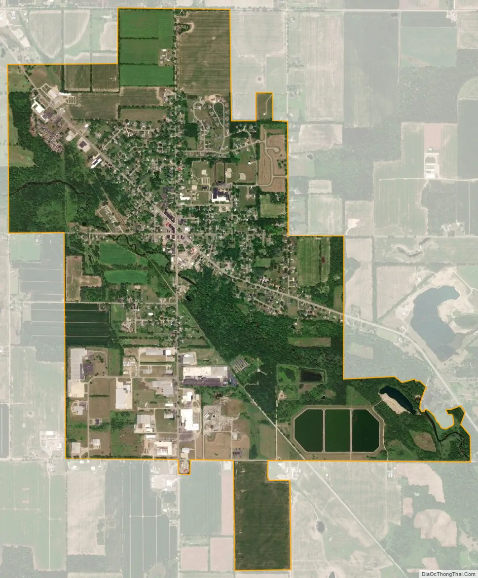
Litchfield city Satellite Map
Geography
According to the U.S. Census Bureau, the city has a total area of 2.81 square miles (7.28 km), of which 2.78 square miles (7.20 km) is land and 0.04 square miles (0.10 km) (1.42%) is water.
The St. Joseph River flows through the city. The North Country Trail also runs through the center of the city.
Major highways
- M-49 (S. Chicago Street) enters the city from the south and has its northern terminus at M-99.
- M-99 runs through the downtown area of the city.
See also
Map of Michigan State and its subdivision:- Alcona
- Alger
- Allegan
- Alpena
- Antrim
- Arenac
- Baraga
- Barry
- Bay
- Benzie
- Berrien
- Branch
- Calhoun
- Cass
- Charlevoix
- Cheboygan
- Chippewa
- Clare
- Clinton
- Crawford
- Delta
- Dickinson
- Eaton
- Emmet
- Genesee
- Gladwin
- Gogebic
- Grand Traverse
- Gratiot
- Hillsdale
- Houghton
- Huron
- Ingham
- Ionia
- Iosco
- Iron
- Isabella
- Jackson
- Kalamazoo
- Kalkaska
- Kent
- Keweenaw
- Lake
- Lake Hurron
- Lake Michigan
- Lake St. Clair
- Lake Superior
- Lapeer
- Leelanau
- Lenawee
- Livingston
- Luce
- Mackinac
- Macomb
- Manistee
- Marquette
- Mason
- Mecosta
- Menominee
- Midland
- Missaukee
- Monroe
- Montcalm
- Montmorency
- Muskegon
- Newaygo
- Oakland
- Oceana
- Ogemaw
- Ontonagon
- Osceola
- Oscoda
- Otsego
- Ottawa
- Presque Isle
- Roscommon
- Saginaw
- Saint Clair
- Saint Joseph
- Sanilac
- Schoolcraft
- Shiawassee
- Tuscola
- Van Buren
- Washtenaw
- Wayne
- Wexford
- Alabama
- Alaska
- Arizona
- Arkansas
- California
- Colorado
- Connecticut
- Delaware
- District of Columbia
- Florida
- Georgia
- Hawaii
- Idaho
- Illinois
- Indiana
- Iowa
- Kansas
- Kentucky
- Louisiana
- Maine
- Maryland
- Massachusetts
- Michigan
- Minnesota
- Mississippi
- Missouri
- Montana
- Nebraska
- Nevada
- New Hampshire
- New Jersey
- New Mexico
- New York
- North Carolina
- North Dakota
- Ohio
- Oklahoma
- Oregon
- Pennsylvania
- Rhode Island
- South Carolina
- South Dakota
- Tennessee
- Texas
- Utah
- Vermont
- Virginia
- Washington
- West Virginia
- Wisconsin
- Wyoming