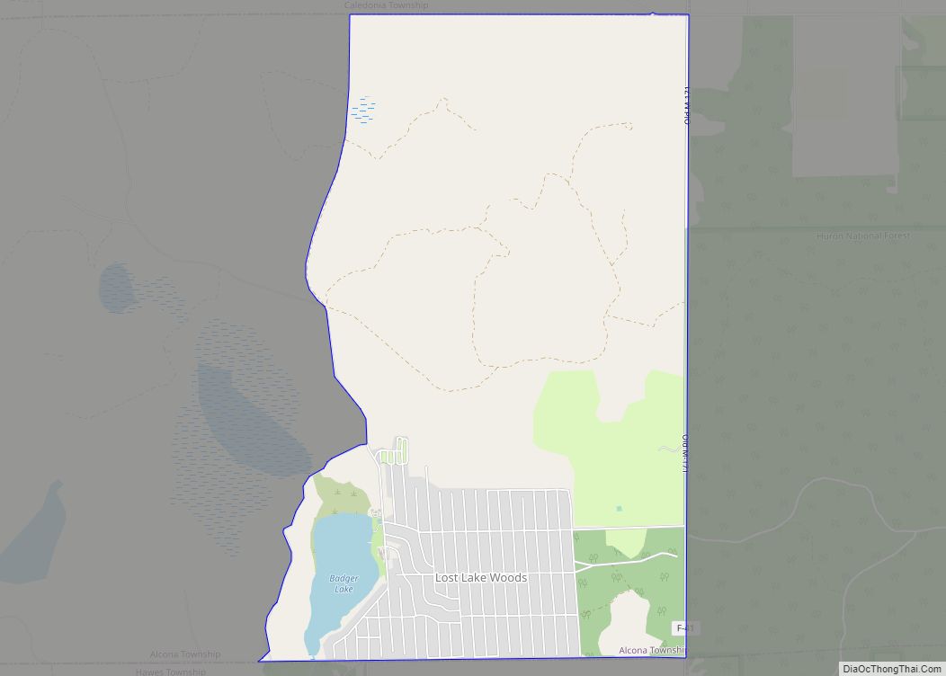
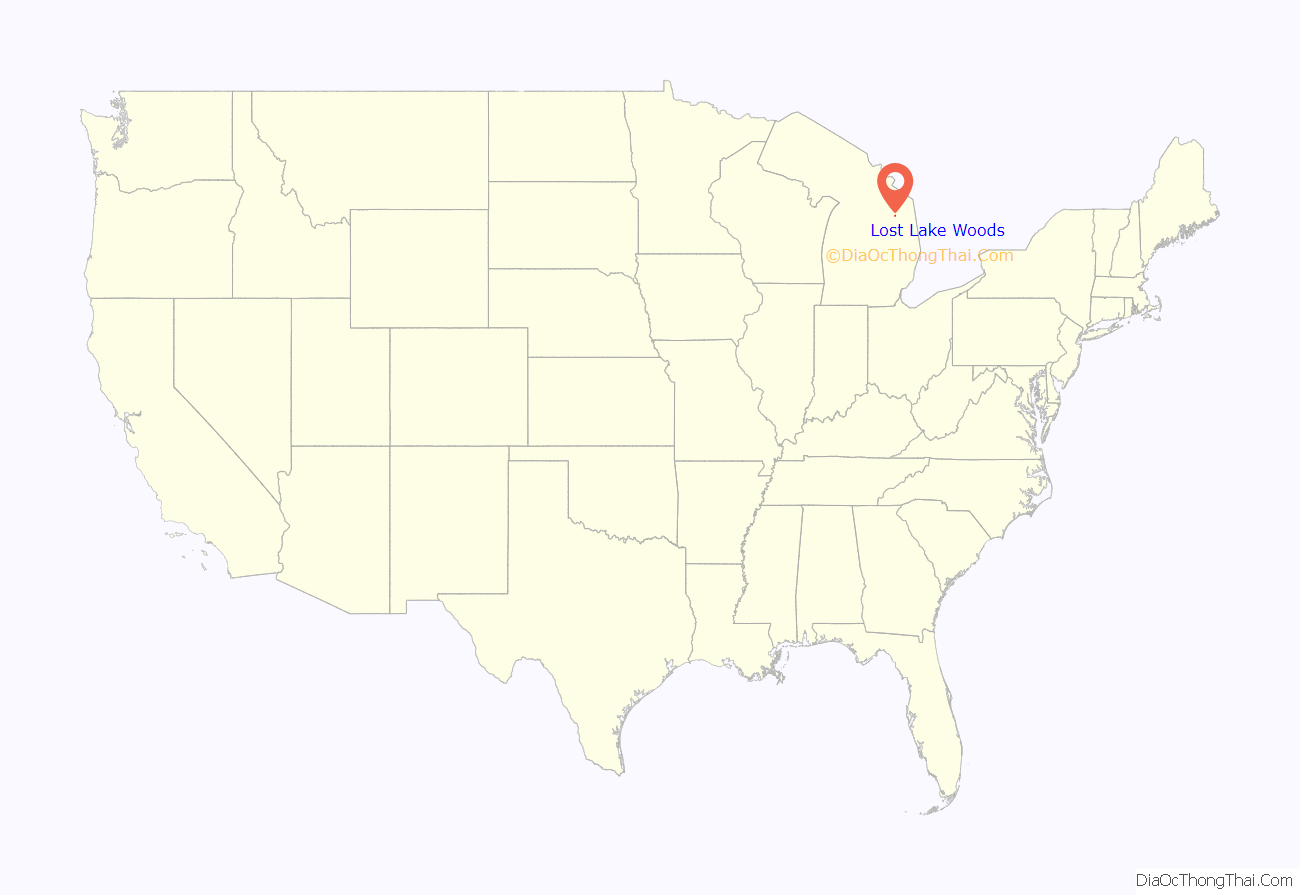
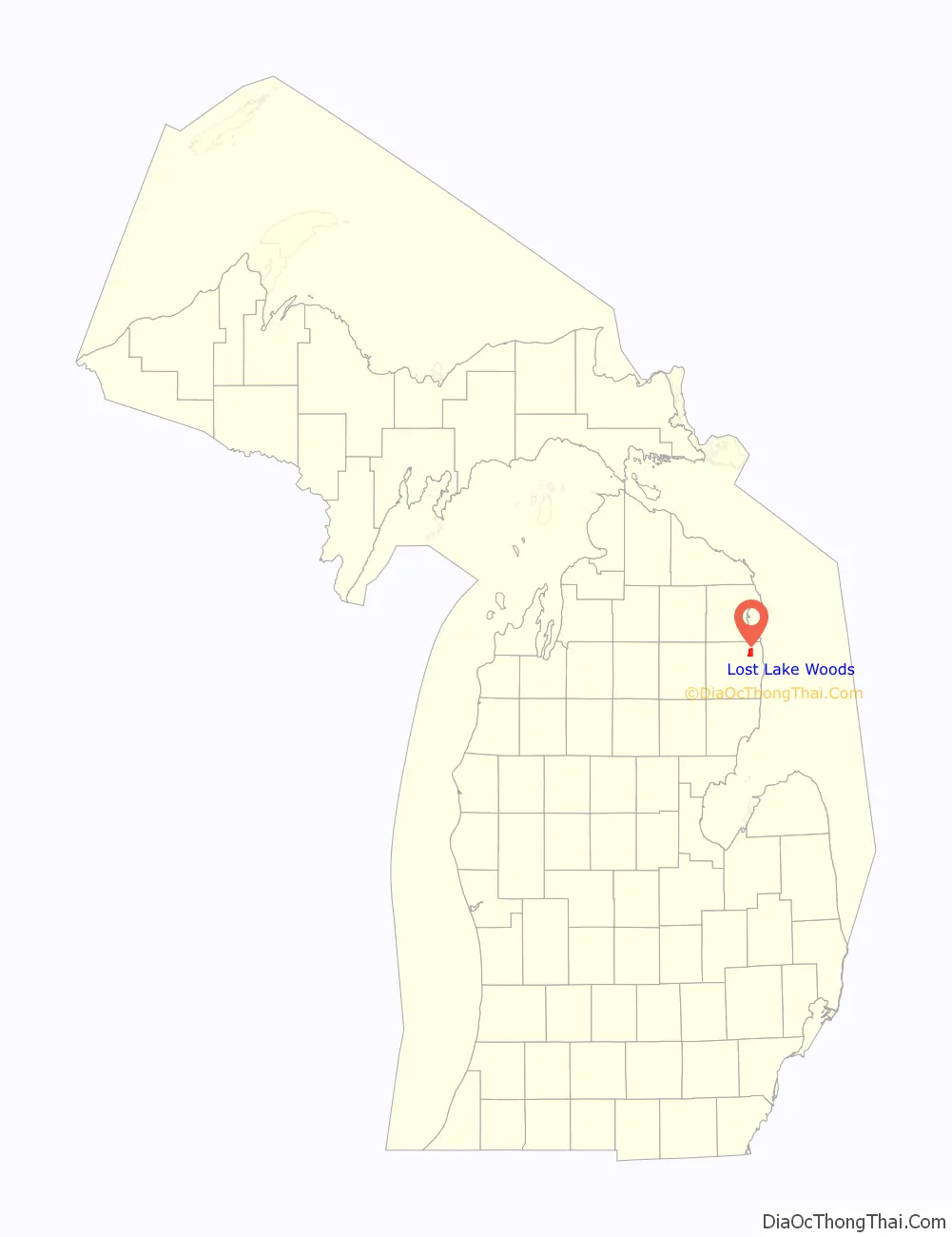
Lost Lake Woods is an unincorporated community and census-designated place (CDP) in Alcona County in the U.S. state of Michigan. The population was 367 at the 2020 census. It is located within Alcona Township.
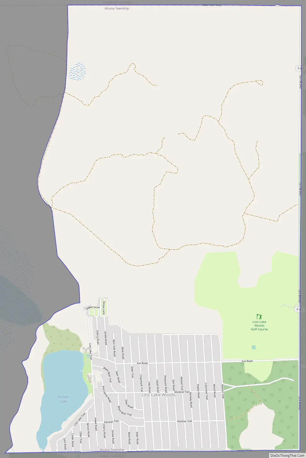
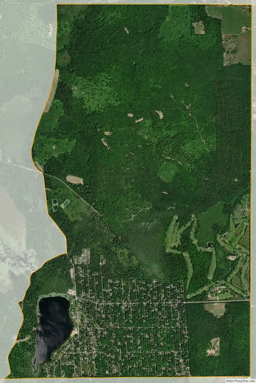
Lost Lake Woods is a private community with control of over 11,000 acres (45 km) of woodlands. Entry into the community is strictly for members and guests only. It is located just north of the village of Lincoln.
| Name: | Lost Lake Woods CDP |
|---|---|
| LSAD Code: | 57 |
| LSAD Description: | CDP (suffix) |
| State: | Michigan |
| County: | Alcona County |
| Elevation: | 860 ft (262 m) |
| Total Area: | 5.19 sq mi (13.43 km²) |
| Land Area: | 5.05 sq mi (13.07 km²) |
| Water Area: | 0.14 sq mi (0.36 km²) |
| Total Population: | 367 |
| Population Density: | 72.73/sq mi (28.08/km²) |
| Area code: | 989 |
| FIPS code: | 2649450 |
| GNISfeature ID: | 1620636 |
Online Interactive Map
Click on ![]() to view map in "full screen" mode.
to view map in "full screen" mode.
Lost Lake Woods location map. Where is Lost Lake Woods CDP?
Lost Lake Woods Road Map
Lost Lake Woods city Satellite Map
Geography
According to the U.S. Census Bureau, the CDP has a total area of 5.19 square miles (13.44 km), of which 5.05 square miles (13.08 km) is land and 0.14 square miles (0.36 km) (2.70%) is water.
Major highways
- F-41 is a county-designated highway that forms the eastern boundary of the CDP.
See also
Map of Michigan State and its subdivision:- Alcona
- Alger
- Allegan
- Alpena
- Antrim
- Arenac
- Baraga
- Barry
- Bay
- Benzie
- Berrien
- Branch
- Calhoun
- Cass
- Charlevoix
- Cheboygan
- Chippewa
- Clare
- Clinton
- Crawford
- Delta
- Dickinson
- Eaton
- Emmet
- Genesee
- Gladwin
- Gogebic
- Grand Traverse
- Gratiot
- Hillsdale
- Houghton
- Huron
- Ingham
- Ionia
- Iosco
- Iron
- Isabella
- Jackson
- Kalamazoo
- Kalkaska
- Kent
- Keweenaw
- Lake
- Lake Hurron
- Lake Michigan
- Lake St. Clair
- Lake Superior
- Lapeer
- Leelanau
- Lenawee
- Livingston
- Luce
- Mackinac
- Macomb
- Manistee
- Marquette
- Mason
- Mecosta
- Menominee
- Midland
- Missaukee
- Monroe
- Montcalm
- Montmorency
- Muskegon
- Newaygo
- Oakland
- Oceana
- Ogemaw
- Ontonagon
- Osceola
- Oscoda
- Otsego
- Ottawa
- Presque Isle
- Roscommon
- Saginaw
- Saint Clair
- Saint Joseph
- Sanilac
- Schoolcraft
- Shiawassee
- Tuscola
- Van Buren
- Washtenaw
- Wayne
- Wexford
- Alabama
- Alaska
- Arizona
- Arkansas
- California
- Colorado
- Connecticut
- Delaware
- District of Columbia
- Florida
- Georgia
- Hawaii
- Idaho
- Illinois
- Indiana
- Iowa
- Kansas
- Kentucky
- Louisiana
- Maine
- Maryland
- Massachusetts
- Michigan
- Minnesota
- Mississippi
- Missouri
- Montana
- Nebraska
- Nevada
- New Hampshire
- New Jersey
- New Mexico
- New York
- North Carolina
- North Dakota
- Ohio
- Oklahoma
- Oregon
- Pennsylvania
- Rhode Island
- South Carolina
- South Dakota
- Tennessee
- Texas
- Utah
- Vermont
- Virginia
- Washington
- West Virginia
- Wisconsin
- Wyoming