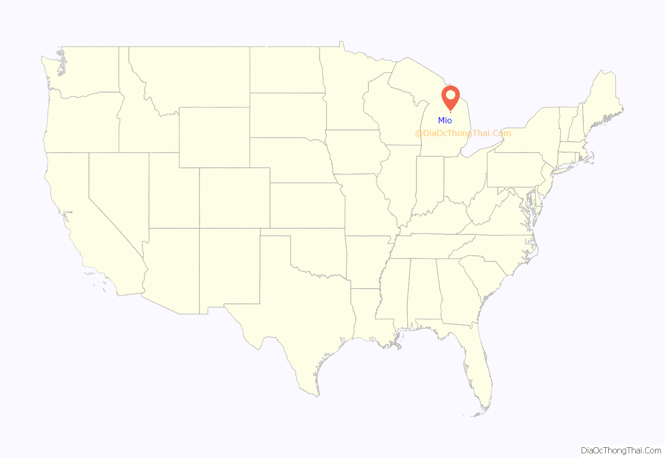
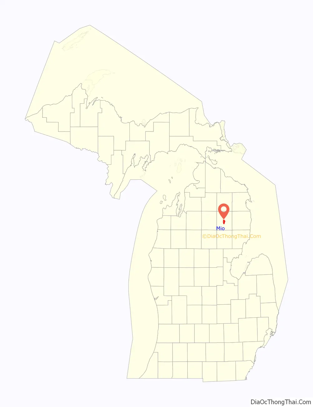
Mio (/ˈmaɪoʊ/ MY-oh) is an unincorporated community and census-designated place (CDP) in Oscoda County in the U.S. state of Michigan. It is the county seat of Oscoda County. The population of the CDP was 1,690 at the 2020 census.
Mio is situated along the boundary between Mentor Township on the east, Big Creek Township on the west, and Elmer Township to the northwest. As an unincorporated community, Mio has no legal autonomy as an incorporated municipality.
| Name: | Mio CDP |
|---|---|
| LSAD Code: | 57 |
| LSAD Description: | CDP (suffix) |
| State: | Michigan |
| County: | Oscoda County |
| Founded: | 1881 |
| Elevation: | 1,020 ft (311 m) |
| Total Area: | 8.98 sq mi (23.26 km²) |
| Land Area: | 8.37 sq mi (21.67 km²) |
| Water Area: | 0.61 sq mi (1.59 km²) |
| Total Population: | 1,690 |
| Population Density: | 201.98/sq mi (77.99/km²) |
| Area code: | 989 |
| FIPS code: | 2654660 |
| GNISfeature ID: | 1620853 |
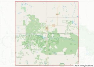
Online Interactive Map
Click on ![]() to view map in "full screen" mode.
to view map in "full screen" mode.
Mio location map. Where is Mio CDP?
History
The community was founded in 1881 and was originally called “Mioe”, in honor of Marla Deyarmond, the wife of town founder Henry Deyarmond. Other founders included Colige Comins, Reirlo Fosdick, and John Randall. A post office named Mioe opened May 3, 1882. The name changed to Mio on November 21, 1883.
State high temperature record
Mio holds the state record for the highest recorded temperature, when it reached 112 °F (44 °C) on July 13, 1936. An identical temperature was also recorded on the same day in the village of Stanwood, in Mecosta County.
PBB contamination event
In 1973, a polybrominated biphenyl (PBB) contamination event caused farmers in the area to destroy their herds. This event occurred when a dock worker accidentally shipped five hundred pounds of fire retardant Fire Master instead of the feed supplement Nutrimaster, leading to the contamination of various farm animals, including cows, pigs, chickens, and sheep. Shortly after, the farmers noticed deformities and sickness among their livestock and newborn calves. More than 35,000 cows were found to be contaminated and had to be destroyed. Out of these, 1,300 were dumped into a clay-lined pit in Mio. As of 2014, PBB is still detectable in the blood tests of some people in this area.
Detroit-area hunters murdered
For nearly eighteen years, Mio was thrust into the local and national media spotlight due to a case involving two Detroit-area hunters who went missing in the fall of 1985. Progress in the investigation was stymied by area residents’ refusal to help, citing fears of violent reprisal. On November 21, 1985, childhood friends David Tyll and Brian Ognjan were beaten to death with baseball bats outside of a local bar. The case was eventually cracked in 2003, when two brothers, Raymond and Donald Duvall, both from South Branch, in Iosco County, were convicted of murdering the pair near Mio. It was rumored that the murderers had disposed of the bodies by feeding them to pigs. When the two brothers were sentenced to life in prison without parole, Tyll’s father said, “They took my son. It doesn’t bring him back, but it’s something.” A true account of the crimes was detailed in Darker Than Night, a 2006 book by Tom Henderson.
Historical markers
There are two historical markers in Mio.
- Mio Hydroelectric Plant was built in 1916 on the lower Au Sable River. William W. Tefft, a Consumers Power civil and hydraulic engineer, invented and patented the so-called “conduit spillway”, which channels excessive flow through channels built into the plant. This was the first plant to use it, and it is cheaper than other forms of spillways.
- Oscoda County Courthouse was built in 1888. It was destroyed by a fire on May 5, 2016. Construction of a new building officially began on May 20, 2019, and was completed in February 2020.
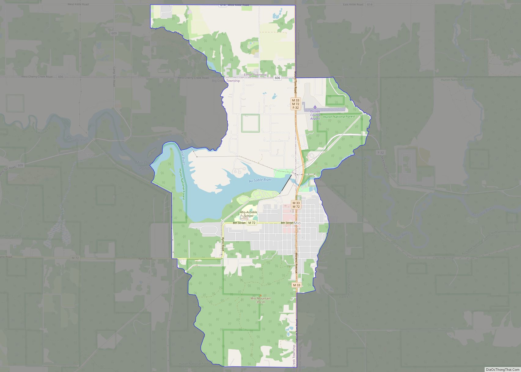
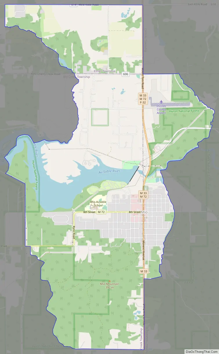
Mio Road Map
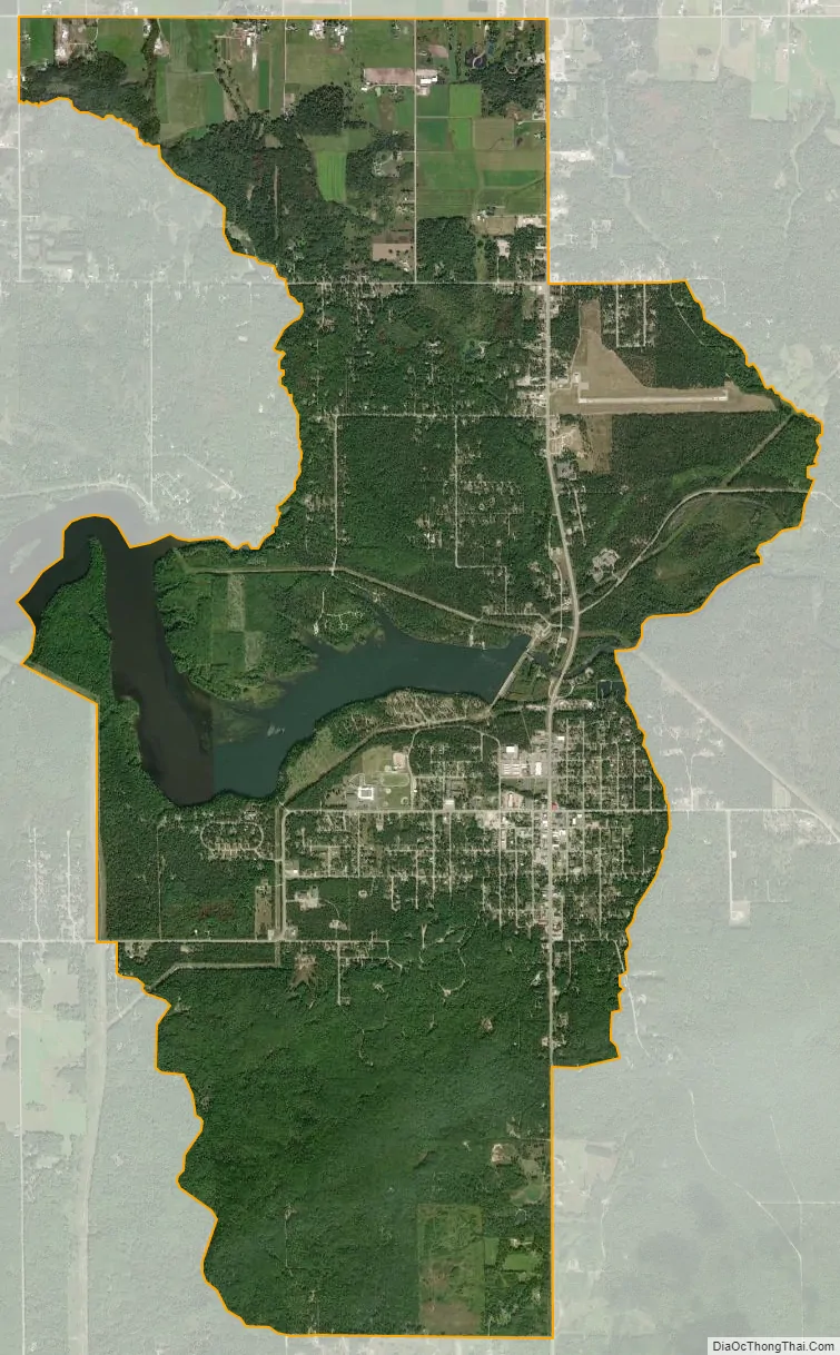
Mio city Satellite Map
Geography
According to the United States Census Bureau, the CDP had a total area of 8.98 square miles (23.3 km), of which 8.37 square miles (21.7 km) is land and 0.61 square miles (1.6 km) (6.79%) is water.
The Mio post office, with ZIP Code 48647, also serves the northern portions of Mentor Township and the northeastern part of Big Creek Township, as well as a large area of eastern and southern Elmer Township and smaller portions of western Clinton Township and Comins Township.
Geographic features
Mio, part of Northern Michigan, is situated in the Au Sable River Valley. It is surrounded by the Huron National Forest and near the Rifle River State Recreation Area. The area is part of the Au Sable State Forest, specifically the Grayling Forest Management Unit (Alcona, Crawford, Oscoda, and northern Iosco counties). Much of the area sits on the Grayling outwash plain. The Oscoda County Park is minutes away.
Record high temperature
On July 13, 1936, Mio recorded a daily high temperature of 112 °F (44 °C), which is the highest temperature ever recorded in the state of Michigan.
See also
Map of Michigan State and its subdivision:- Alcona
- Alger
- Allegan
- Alpena
- Antrim
- Arenac
- Baraga
- Barry
- Bay
- Benzie
- Berrien
- Branch
- Calhoun
- Cass
- Charlevoix
- Cheboygan
- Chippewa
- Clare
- Clinton
- Crawford
- Delta
- Dickinson
- Eaton
- Emmet
- Genesee
- Gladwin
- Gogebic
- Grand Traverse
- Gratiot
- Hillsdale
- Houghton
- Huron
- Ingham
- Ionia
- Iosco
- Iron
- Isabella
- Jackson
- Kalamazoo
- Kalkaska
- Kent
- Keweenaw
- Lake
- Lake Hurron
- Lake Michigan
- Lake St. Clair
- Lake Superior
- Lapeer
- Leelanau
- Lenawee
- Livingston
- Luce
- Mackinac
- Macomb
- Manistee
- Marquette
- Mason
- Mecosta
- Menominee
- Midland
- Missaukee
- Monroe
- Montcalm
- Montmorency
- Muskegon
- Newaygo
- Oakland
- Oceana
- Ogemaw
- Ontonagon
- Osceola
- Oscoda
- Otsego
- Ottawa
- Presque Isle
- Roscommon
- Saginaw
- Saint Clair
- Saint Joseph
- Sanilac
- Schoolcraft
- Shiawassee
- Tuscola
- Van Buren
- Washtenaw
- Wayne
- Wexford
- Alabama
- Alaska
- Arizona
- Arkansas
- California
- Colorado
- Connecticut
- Delaware
- District of Columbia
- Florida
- Georgia
- Hawaii
- Idaho
- Illinois
- Indiana
- Iowa
- Kansas
- Kentucky
- Louisiana
- Maine
- Maryland
- Massachusetts
- Michigan
- Minnesota
- Mississippi
- Missouri
- Montana
- Nebraska
- Nevada
- New Hampshire
- New Jersey
- New Mexico
- New York
- North Carolina
- North Dakota
- Ohio
- Oklahoma
- Oregon
- Pennsylvania
- Rhode Island
- South Carolina
- South Dakota
- Tennessee
- Texas
- Utah
- Vermont
- Virginia
- Washington
- West Virginia
- Wisconsin
- Wyoming