Montgomery is a village in Hillsdale County in the U.S. state of Michigan. The population was 322 at the 2020 census. The village is located within Camden Township.
| Name: | Montgomery village |
|---|---|
| LSAD Code: | 47 |
| LSAD Description: | village (suffix) |
| State: | Michigan |
| County: | Hillsdale County |
| Incorporated: | 1906 |
| Elevation: | 1,050 ft (320 m) |
| Total Area: | 1.00 sq mi (2.60 km²) |
| Land Area: | 1.00 sq mi (2.60 km²) |
| Water Area: | 0.00 sq mi (0.00 km²) |
| Total Population: | 322 |
| Population Density: | 322.00/sq mi (124.32/km²) |
| Area code: | 517 |
| FIPS code: | 2655220 |
| GNISfeature ID: | 0632603 |
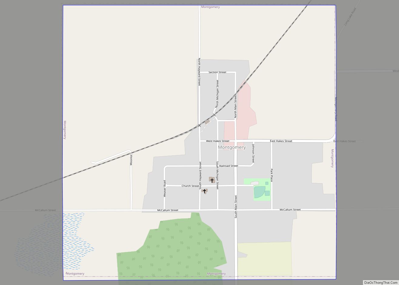
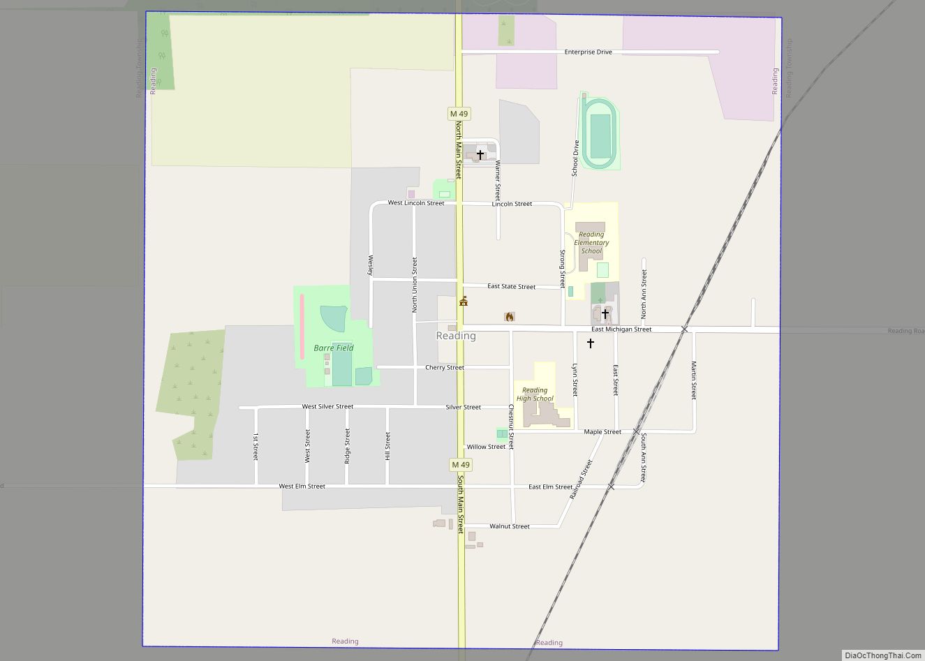
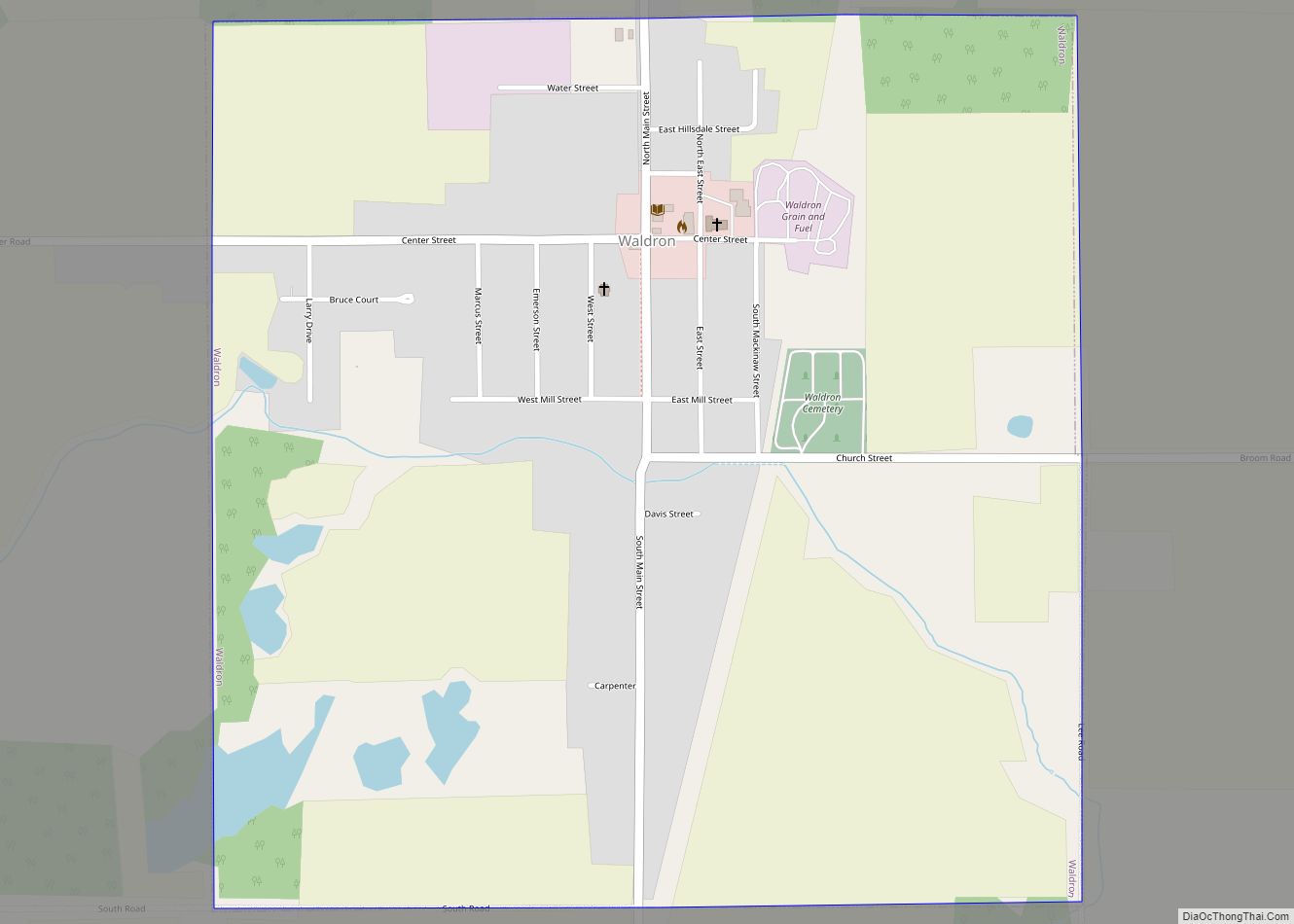
Online Interactive Map
Click on ![]() to view map in "full screen" mode.
to view map in "full screen" mode.
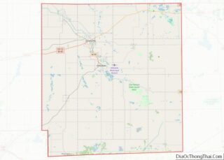
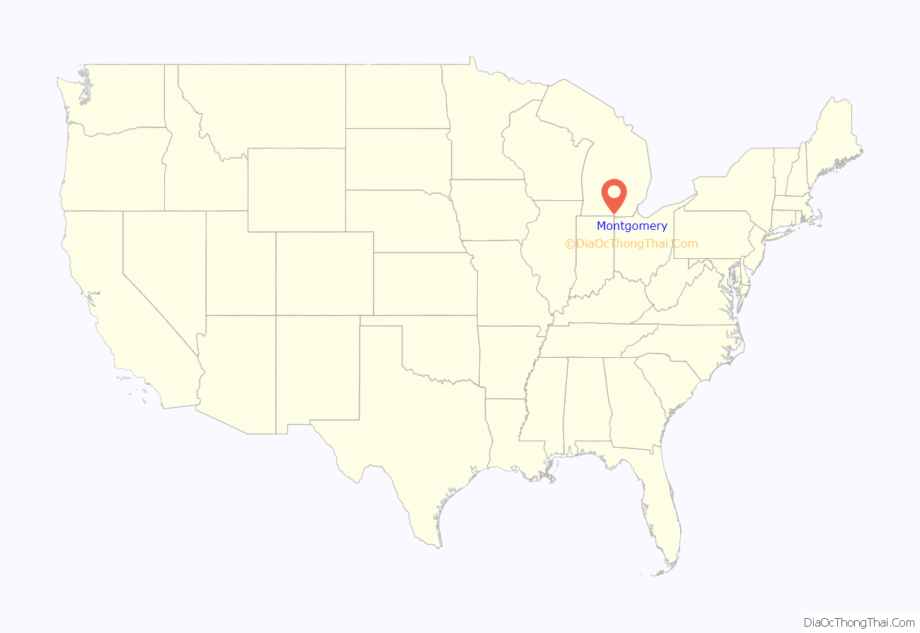
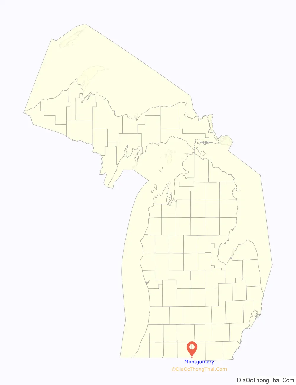
Montgomery location map. Where is Montgomery village?
History
The community was first settled as early as 1870 by several farmers who moved to the area prior to the expansion of the railroad that came by the next year. In 1871, the community was known simply as the Station. When the farmers went to Hillsdale to have their community officially platted, the county clerk, William Montgomery, said he would record it for free in exchange for naming the new community after him. The farmers agreed, and the community received a post office named Montgomery on December 20, 1871. Montgomery incorporated a village in 1906.
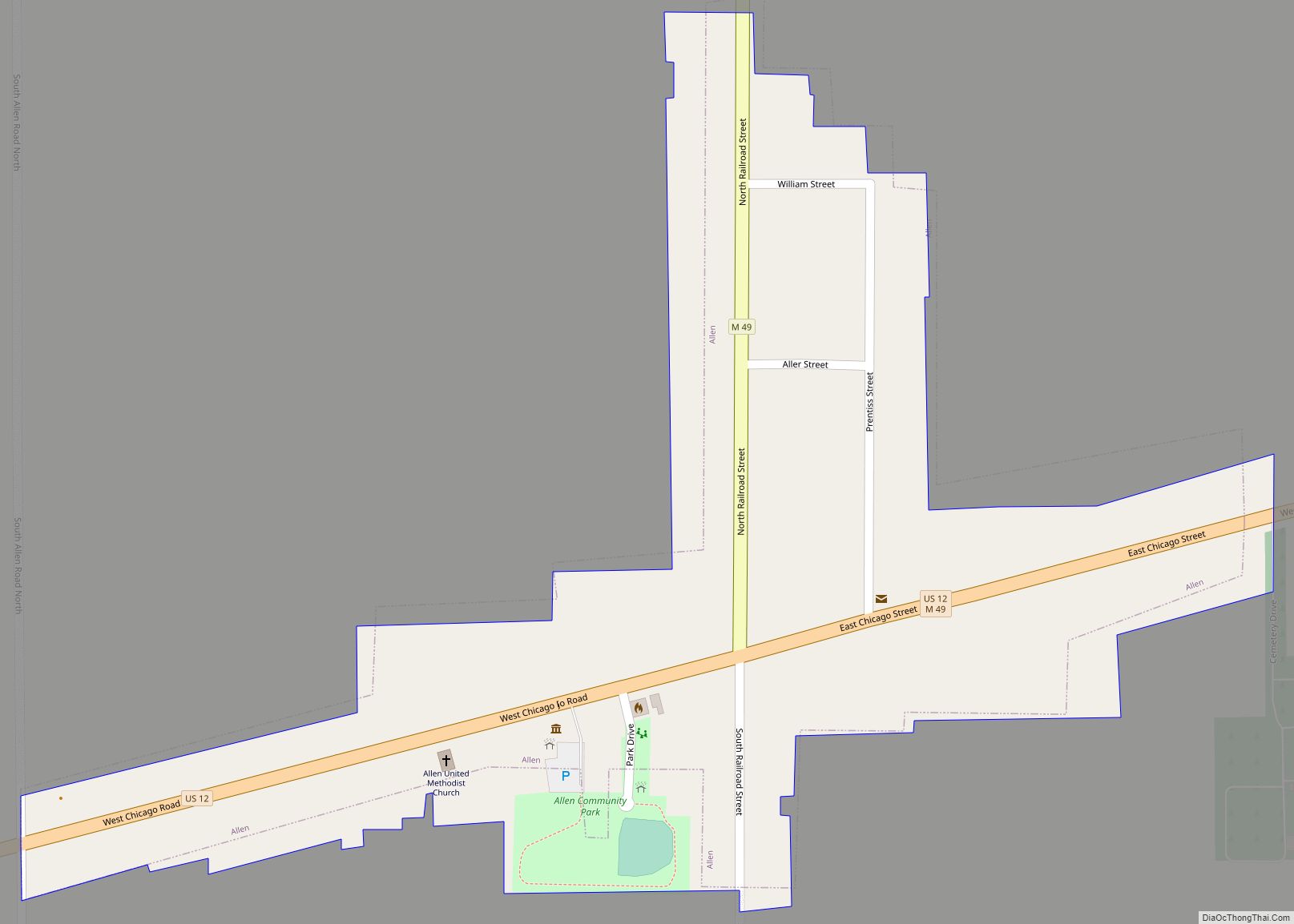
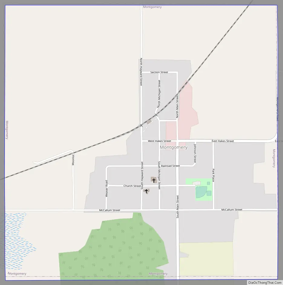
Montgomery Road Map
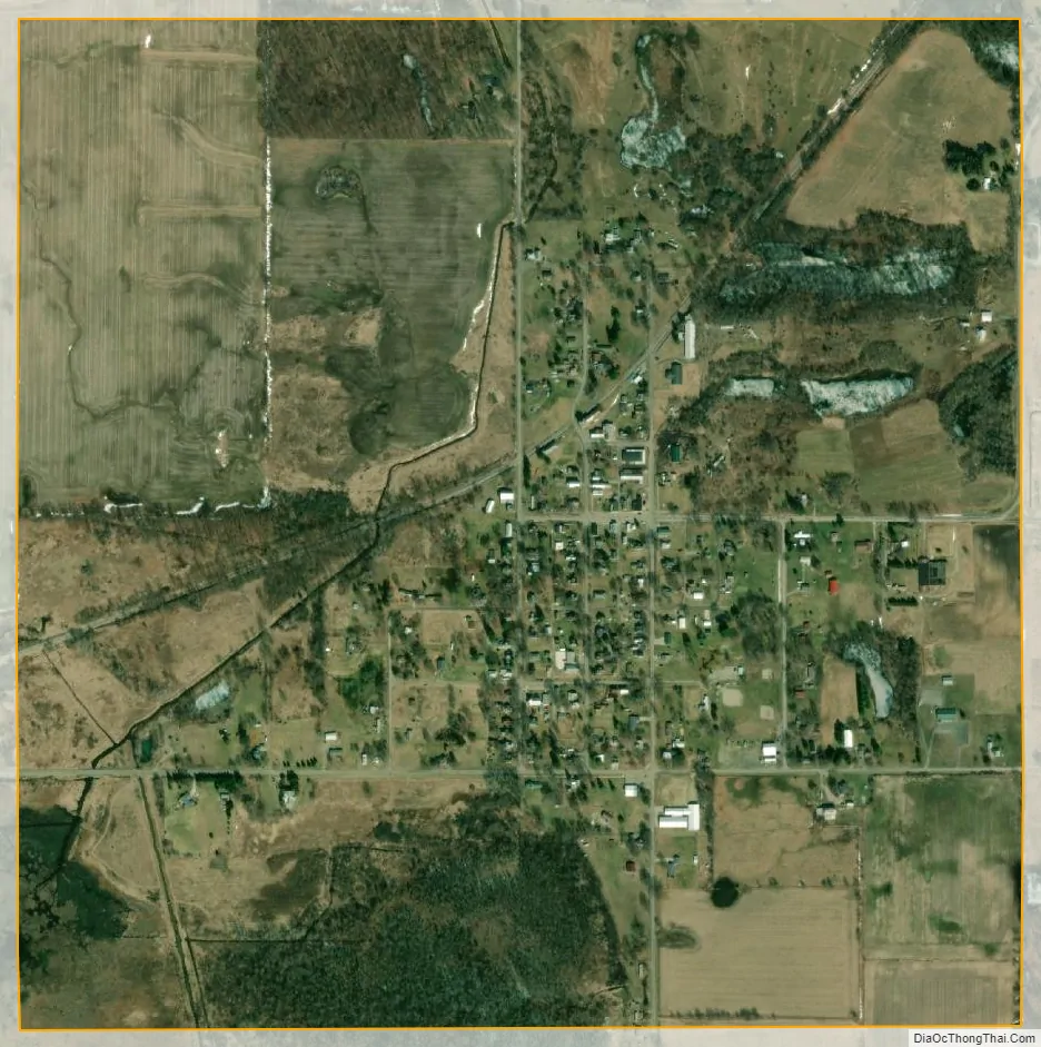
Montgomery city Satellite Map
Geography
According to the U.S. Census Bureau, the village has a total area of 1.00 square mile (2.59 km), all land.
See also
Map of Michigan State and its subdivision:- Alcona
- Alger
- Allegan
- Alpena
- Antrim
- Arenac
- Baraga
- Barry
- Bay
- Benzie
- Berrien
- Branch
- Calhoun
- Cass
- Charlevoix
- Cheboygan
- Chippewa
- Clare
- Clinton
- Crawford
- Delta
- Dickinson
- Eaton
- Emmet
- Genesee
- Gladwin
- Gogebic
- Grand Traverse
- Gratiot
- Hillsdale
- Houghton
- Huron
- Ingham
- Ionia
- Iosco
- Iron
- Isabella
- Jackson
- Kalamazoo
- Kalkaska
- Kent
- Keweenaw
- Lake
- Lake Hurron
- Lake Michigan
- Lake St. Clair
- Lake Superior
- Lapeer
- Leelanau
- Lenawee
- Livingston
- Luce
- Mackinac
- Macomb
- Manistee
- Marquette
- Mason
- Mecosta
- Menominee
- Midland
- Missaukee
- Monroe
- Montcalm
- Montmorency
- Muskegon
- Newaygo
- Oakland
- Oceana
- Ogemaw
- Ontonagon
- Osceola
- Oscoda
- Otsego
- Ottawa
- Presque Isle
- Roscommon
- Saginaw
- Saint Clair
- Saint Joseph
- Sanilac
- Schoolcraft
- Shiawassee
- Tuscola
- Van Buren
- Washtenaw
- Wayne
- Wexford
- Alabama
- Alaska
- Arizona
- Arkansas
- California
- Colorado
- Connecticut
- Delaware
- District of Columbia
- Florida
- Georgia
- Hawaii
- Idaho
- Illinois
- Indiana
- Iowa
- Kansas
- Kentucky
- Louisiana
- Maine
- Maryland
- Massachusetts
- Michigan
- Minnesota
- Mississippi
- Missouri
- Montana
- Nebraska
- Nevada
- New Hampshire
- New Jersey
- New Mexico
- New York
- North Carolina
- North Dakota
- Ohio
- Oklahoma
- Oregon
- Pennsylvania
- Rhode Island
- South Carolina
- South Dakota
- Tennessee
- Texas
- Utah
- Vermont
- Virginia
- Washington
- West Virginia
- Wisconsin
- Wyoming