Negaunee (/nəˈɡɔːni/ nə-GAW-nee or locally /ˈnəˈɡɒni/ nə-GAH-nee) is a city in Marquette County in the U.S. state of Michigan. The population was 4,627 at the 2020 census. The city is located at the southwest corner of Negaunee Township, which is administratively separate, in the Upper Peninsula. The city is home to a luge track. The name Negaunee comes from an Anishinabemowin (Ojibwa) word nigani, meaning “foremost, in advance, leading,” which was determined to be the closest Ojibwa translation for “pioneer”. Within the city limits is Teal Lake.
| Name: | Negaunee city |
|---|---|
| LSAD Code: | 25 |
| LSAD Description: | city (suffix) |
| State: | Michigan |
| County: | Marquette County |
| Founded: | 1846 |
| Incorporated: | 1865 (village) 1873 (city) |
| Elevation: | 1,371 ft (418 m) |
| Total Area: | 14.34 sq mi (37.14 km²) |
| Land Area: | 13.44 sq mi (34.82 km²) |
| Water Area: | 0.89 sq mi (2.32 km²) |
| Total Population: | 4,627 |
| Population Density: | 344.17/sq mi (132.88/km²) |
| Area code: | 906 |
| FIPS code: | 2656860 |
| GNISfeature ID: | 0633261 |
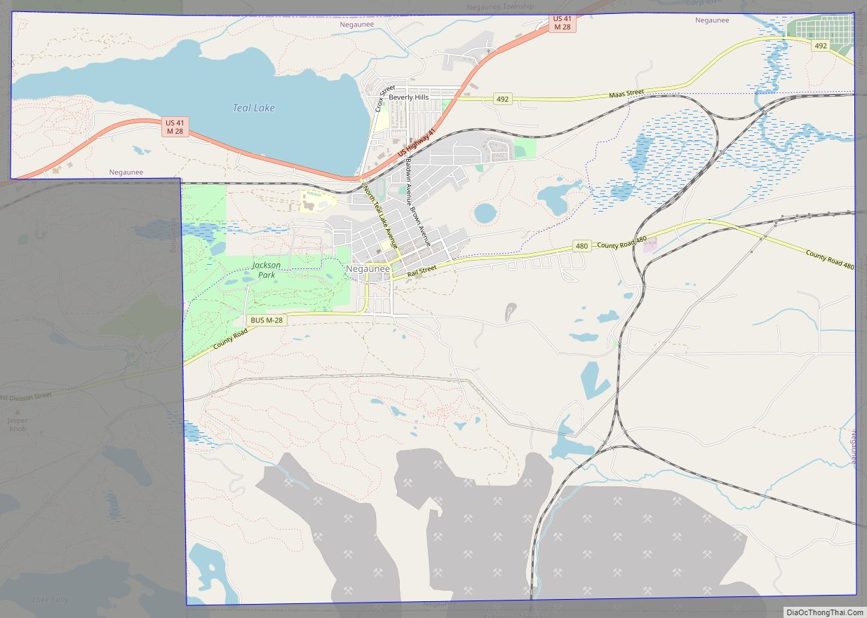
Online Interactive Map
Click on ![]() to view map in "full screen" mode.
to view map in "full screen" mode.
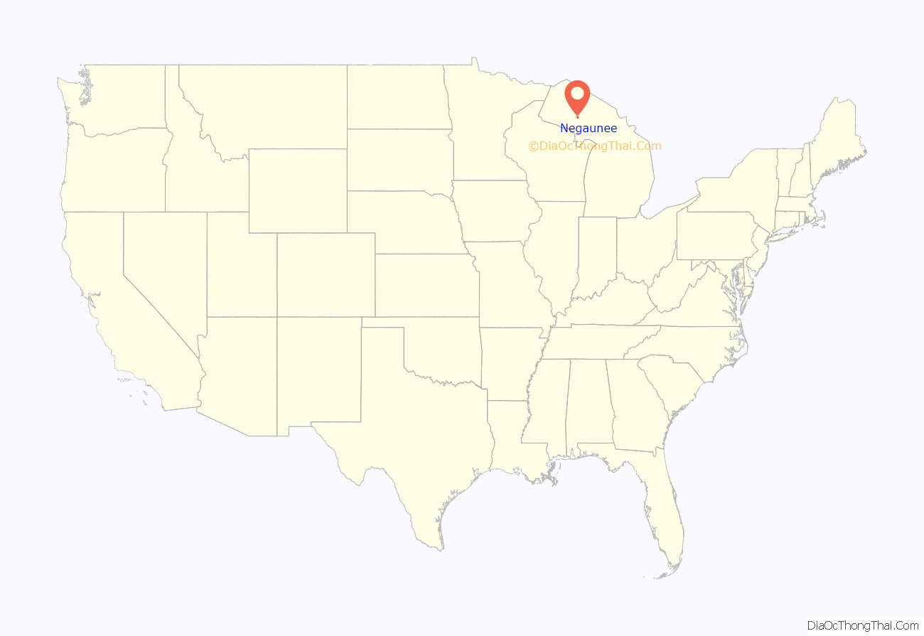
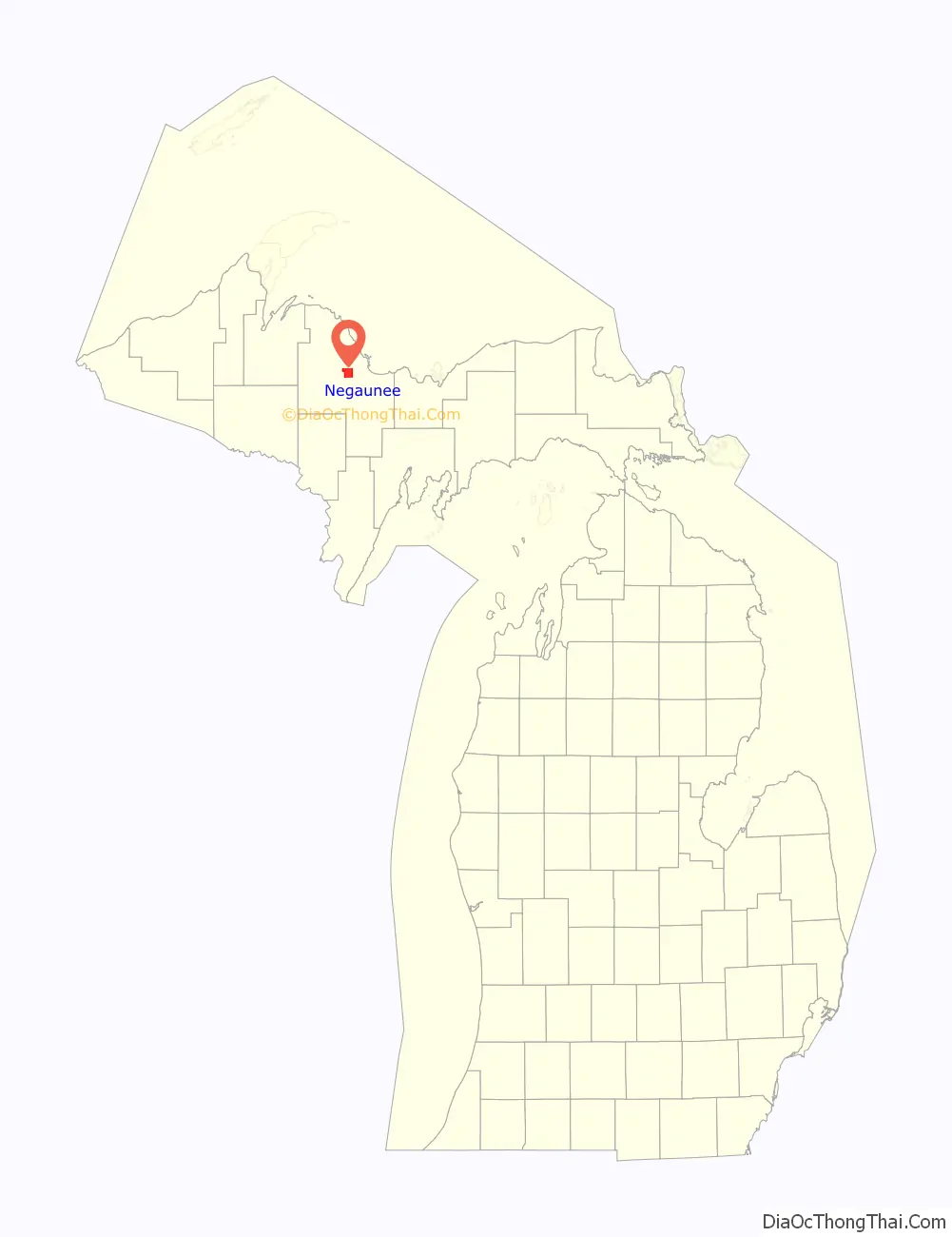
Negaunee location map. Where is Negaunee city?
History
The city was built after the discovery of the Marquette Iron Range during the early 19th century. The Jackson Mine was established in 1845 to mine the ore for shipment to iron forges; the first such forge to operate in the Lake Superior basin was set up in Negaunee during this period. In 1858, the community was given a post office. In 1865, Negaunee was incorporated as a village and reincorporated as a city in 1873. As mining operations expanded, many immigrants helped settle the area, bringing with them rich traditions that remain today. Due to extensive underground mining roughly half the city was abandoned in the early 20th century due to risk of cave-in. The city closed its trolley system in 1927. The Jackson Mine ceased all operations within the city limits in the 1940s.
On January 16, 1952, Negaunee became the smallest city to ever host an NBA game. The Milwaukee Hawks beat the Baltimore Bullets 77-71. Baltimore’s Don Barksdale led all scorers with 24 points. Negaunee is still the smallest city to ever host any of the four major North American professional sports.
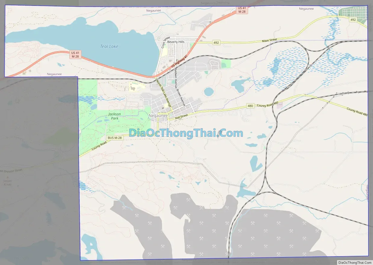
Negaunee Road Map
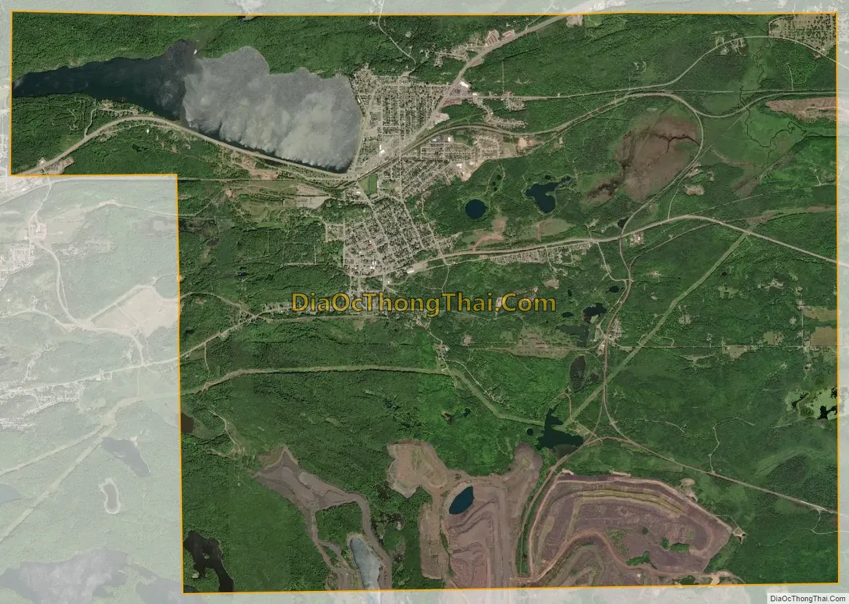
Negaunee city Satellite Map
Geography
Negaunee sits on the eastern shore of Teal Lake, all of which is considered within the city borders. According to the United States Census Bureau, the city has a total area of 14.45 square miles (37.43 km), of which 13.56 square miles (35.12 km) is land and 0.89 square miles (2.31 km) is water.
See also
Map of Michigan State and its subdivision:- Alcona
- Alger
- Allegan
- Alpena
- Antrim
- Arenac
- Baraga
- Barry
- Bay
- Benzie
- Berrien
- Branch
- Calhoun
- Cass
- Charlevoix
- Cheboygan
- Chippewa
- Clare
- Clinton
- Crawford
- Delta
- Dickinson
- Eaton
- Emmet
- Genesee
- Gladwin
- Gogebic
- Grand Traverse
- Gratiot
- Hillsdale
- Houghton
- Huron
- Ingham
- Ionia
- Iosco
- Iron
- Isabella
- Jackson
- Kalamazoo
- Kalkaska
- Kent
- Keweenaw
- Lake
- Lake Hurron
- Lake Michigan
- Lake St. Clair
- Lake Superior
- Lapeer
- Leelanau
- Lenawee
- Livingston
- Luce
- Mackinac
- Macomb
- Manistee
- Marquette
- Mason
- Mecosta
- Menominee
- Midland
- Missaukee
- Monroe
- Montcalm
- Montmorency
- Muskegon
- Newaygo
- Oakland
- Oceana
- Ogemaw
- Ontonagon
- Osceola
- Oscoda
- Otsego
- Ottawa
- Presque Isle
- Roscommon
- Saginaw
- Saint Clair
- Saint Joseph
- Sanilac
- Schoolcraft
- Shiawassee
- Tuscola
- Van Buren
- Washtenaw
- Wayne
- Wexford
- Alabama
- Alaska
- Arizona
- Arkansas
- California
- Colorado
- Connecticut
- Delaware
- District of Columbia
- Florida
- Georgia
- Hawaii
- Idaho
- Illinois
- Indiana
- Iowa
- Kansas
- Kentucky
- Louisiana
- Maine
- Maryland
- Massachusetts
- Michigan
- Minnesota
- Mississippi
- Missouri
- Montana
- Nebraska
- Nevada
- New Hampshire
- New Jersey
- New Mexico
- New York
- North Carolina
- North Dakota
- Ohio
- Oklahoma
- Oregon
- Pennsylvania
- Rhode Island
- South Carolina
- South Dakota
- Tennessee
- Texas
- Utah
- Vermont
- Virginia
- Washington
- West Virginia
- Wisconsin
- Wyoming