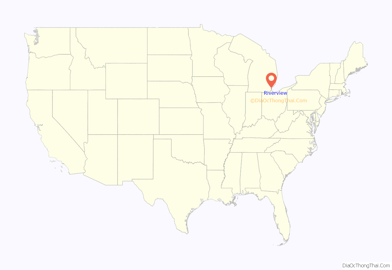
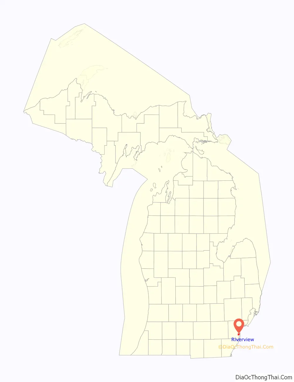
Riverview is a city in Wayne County in the U.S. state of Michigan. The population was 12,486 at the 2010 census.
Riverview is a suburb of Metro Detroit about 6 miles (9.7 km) south of the southern border of Detroit along the Detroit River. Riverview was incorporated as a village within Monguagon Township in 1923 and later incorporated as a city in 1959.
| Name: | Riverview city |
|---|---|
| LSAD Code: | 25 |
| LSAD Description: | city (suffix) |
| State: | Michigan |
| County: | Wayne County |
| Incorporated: | 1923 (village) 1959 (city) |
| Elevation: | 600 ft (183 m) |
| Land Area: | 4.57 sq mi (11.85 km²) |
| Water Area: | 0.09 sq mi (0.24 km²) |
| Population Density: | 2,730.65/sq mi (1,054.35/km²) |
| Area code: | 734 |
| FIPS code: | 2668880 |
| GNISfeature ID: | 0636018 |
Online Interactive Map
Click on ![]() to view map in "full screen" mode.
to view map in "full screen" mode.
Riverview location map. Where is Riverview city?
History
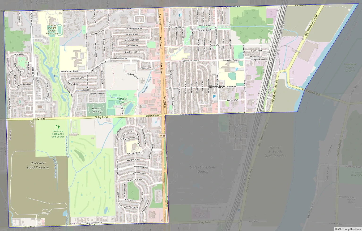
The August 9, 1812 Battle of Monguagon between Americans and a British-Indian coalition took place in today’s Riverview. Native Americans were led by the famous Shawnee warrior Tecumseh, who was wounded in the engagement. The Americans gained a tactical victory at Monguagon but suffered a strategic defeat when US forces returned to Detroit after the fight without reopening their supply line to Ohio. Much of the location remains undeveloped in a green area bounded by Pennsylvania Road to the north, Colvin Street to the south, Electric Avenue to the east, and Vreeland Park to the west, which is also part of the battlefield.
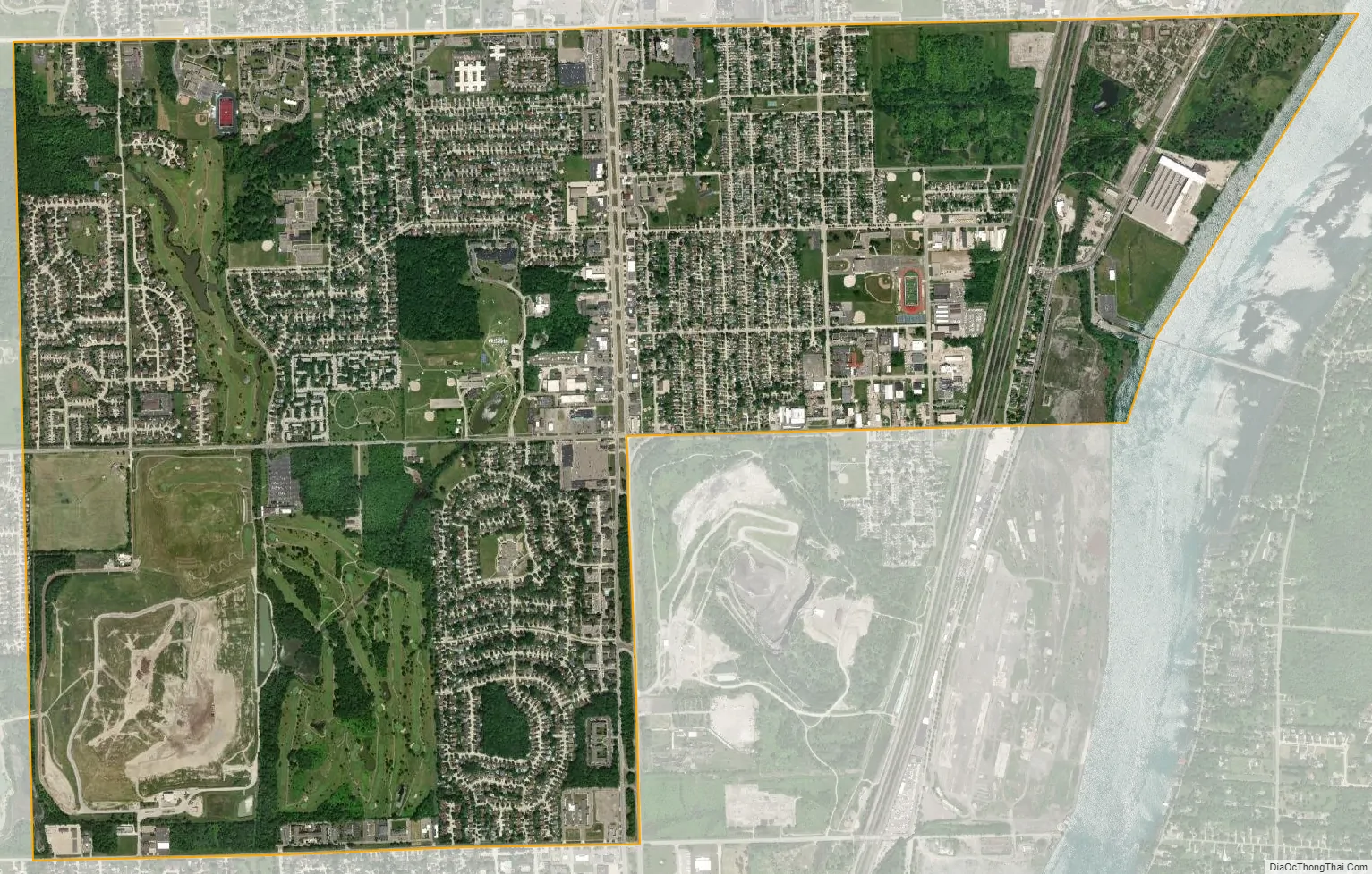
In 1950, Riverview only stretched as far west as the western end of Trenton’s two northern boundaries. The rest of what is today Riverview was still part of the unincorporated Monguagon Township at that point. In the 1950s and 1960s, during the Cold War, the Department of Defense (through the United States Army) operated Nike missile launch site D-54 on the site of what is now Young Patriot’s Park. The IFC (integrated fire control) site was on the site of what is now Rivergate Nursing Home and Terrace.
Riverview Road Map
Riverview city Satellite Map
Geography
According to the United States Census Bureau, the city has a total area of 4.48 square miles (11.60 km), of which 4.39 square miles (11.37 km) is land and 0.09 square miles (0.23 km) is water.
See also
Map of Michigan State and its subdivision:- Alcona
- Alger
- Allegan
- Alpena
- Antrim
- Arenac
- Baraga
- Barry
- Bay
- Benzie
- Berrien
- Branch
- Calhoun
- Cass
- Charlevoix
- Cheboygan
- Chippewa
- Clare
- Clinton
- Crawford
- Delta
- Dickinson
- Eaton
- Emmet
- Genesee
- Gladwin
- Gogebic
- Grand Traverse
- Gratiot
- Hillsdale
- Houghton
- Huron
- Ingham
- Ionia
- Iosco
- Iron
- Isabella
- Jackson
- Kalamazoo
- Kalkaska
- Kent
- Keweenaw
- Lake
- Lake Hurron
- Lake Michigan
- Lake St. Clair
- Lake Superior
- Lapeer
- Leelanau
- Lenawee
- Livingston
- Luce
- Mackinac
- Macomb
- Manistee
- Marquette
- Mason
- Mecosta
- Menominee
- Midland
- Missaukee
- Monroe
- Montcalm
- Montmorency
- Muskegon
- Newaygo
- Oakland
- Oceana
- Ogemaw
- Ontonagon
- Osceola
- Oscoda
- Otsego
- Ottawa
- Presque Isle
- Roscommon
- Saginaw
- Saint Clair
- Saint Joseph
- Sanilac
- Schoolcraft
- Shiawassee
- Tuscola
- Van Buren
- Washtenaw
- Wayne
- Wexford
- Alabama
- Alaska
- Arizona
- Arkansas
- California
- Colorado
- Connecticut
- Delaware
- District of Columbia
- Florida
- Georgia
- Hawaii
- Idaho
- Illinois
- Indiana
- Iowa
- Kansas
- Kentucky
- Louisiana
- Maine
- Maryland
- Massachusetts
- Michigan
- Minnesota
- Mississippi
- Missouri
- Montana
- Nebraska
- Nevada
- New Hampshire
- New Jersey
- New Mexico
- New York
- North Carolina
- North Dakota
- Ohio
- Oklahoma
- Oregon
- Pennsylvania
- Rhode Island
- South Carolina
- South Dakota
- Tennessee
- Texas
- Utah
- Vermont
- Virginia
- Washington
- West Virginia
- Wisconsin
- Wyoming


