Romulus is a city in Wayne County in the U.S. state of Michigan. The population was 23,989 at the 2010 census. Romulus is a western suburb of Metro Detroit and is also considered part of the Downriver collection of communities. It is most notable as the location of the Detroit Metropolitan Airport, a major hub for Delta Air Lines.
| Name: | Romulus city |
|---|---|
| LSAD Code: | 25 |
| LSAD Description: | city (suffix) |
| State: | Michigan |
| County: | Wayne County |
| Incorporated: | 1970 |
| Elevation: | 659 ft (201 m) |
| Land Area: | 35.61 sq mi (92.22 km²) |
| Water Area: | 0.34 sq mi (0.89 km²) |
| Population Density: | 707.09/sq mi (273.01/km²) |
| Area code: | 734 |
| FIPS code: | 2669420 |
| GNISfeature ID: | 0636147 |
Online Interactive Map
Click on ![]() to view map in "full screen" mode.
to view map in "full screen" mode.
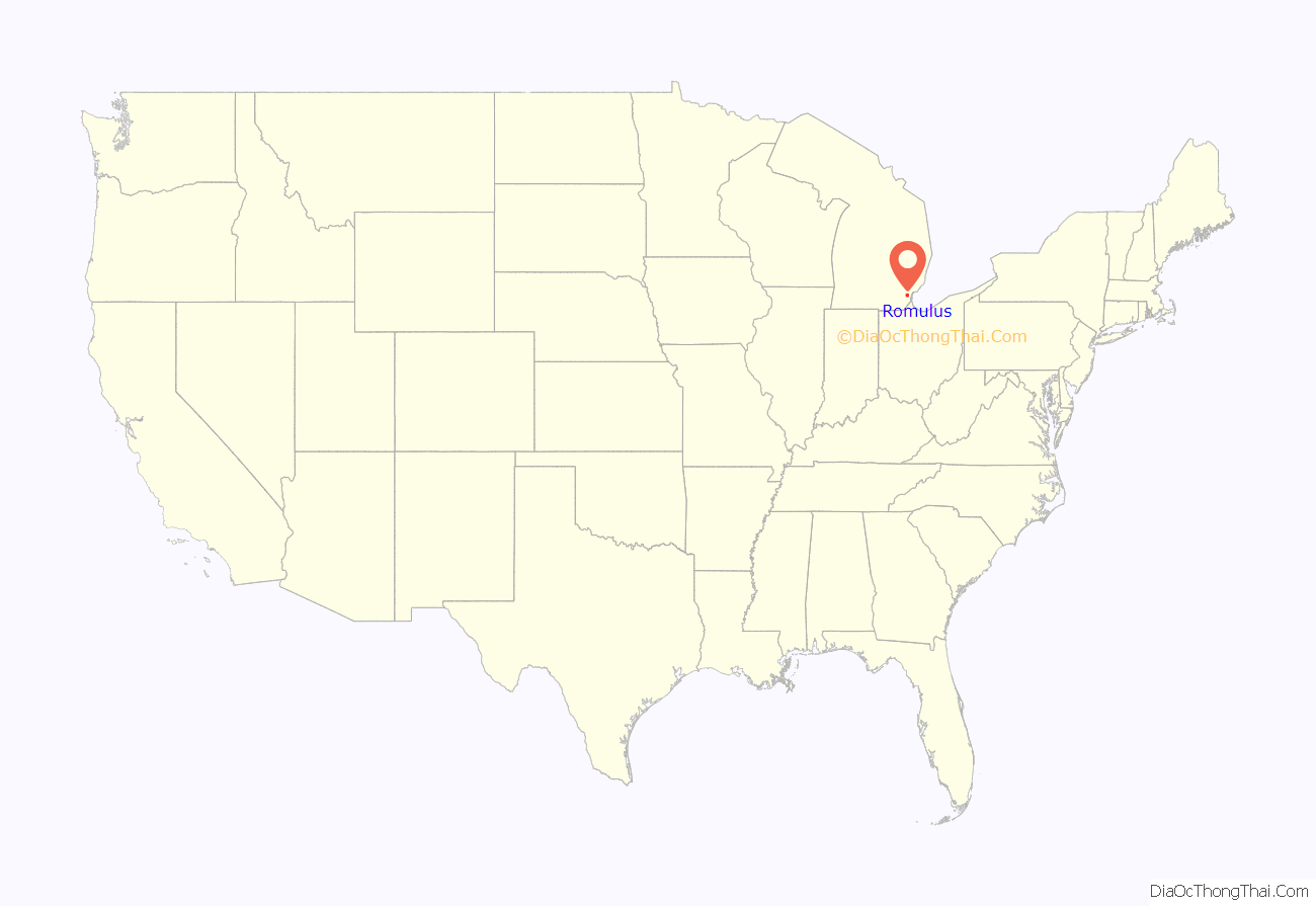
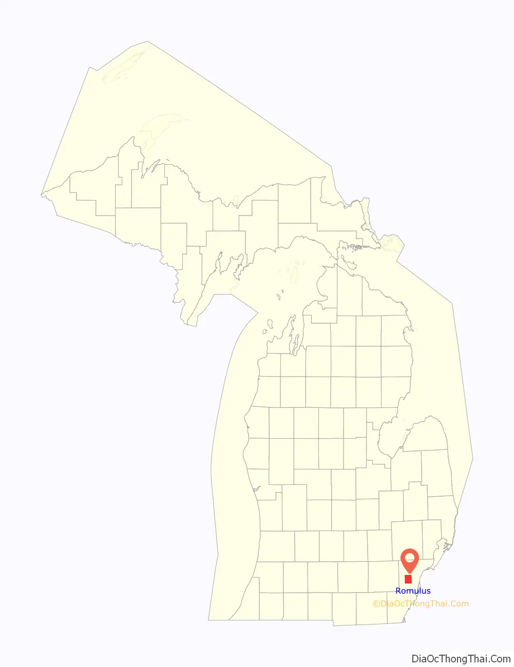
Romulus location map. Where is Romulus city?
History
The first white settler in Romulus was Samuel Polyne, a French-Canadian, who settled on section 2 in 1826, though he left soon after the township was organized in 1835.
The first settler in the village proper (prior to the 1865 annexation of the whole village and township into one city) was Samuel McMath, who moved from New York state to the area in 1827. He improved land and planned to bring his family to settle there, but he died before he could carry out this plan.
Solomon Whitaker, Charles and Joseph Pulcifer located in the area in 1830, and in 1833, Jenks Pullen and his six sons settled at what became known as “Pullen’s Corners” (located in section 19 at the intersection of Ozga and Goddard roads, now commonly called “Five Points”). Pullen’s Corners was platted in 1836. The community later took on the name of the township.
The township of Romulus was set off from a part of Huron Township by an act of the Michigan Territorial Council on March 17, 1835, and the first township meeting was held on April 16, 1835, two years before the State of Michigan was admitted in to the Union (1837), in the house of Joseph T. Pullen. The first supervisor was David J. Pullen. The township’s name was changed to “Wayne” on March 19, 1845, but was changed back to Romulus on January 16, 1848.
Romulus incorporated as a city in 1970.
Village of Romulus
The village of Romulus was platted on the Lansing B. Misner estate in 1871.
Underground Railroad stops
Romulus was a stop of the Underground Railroad in the 1800s when slaves fled the inhumane conditions of plantations in the South for the free states of the North. There were two stops in Romulus and those structures are still intact to this day.
- Samuel Kingsley Home is a famous historic landmark in Romulus. During slave times, Samuel R. Kingsley lived in a house on Ozga Rd near Pullens Corners, what is today known as Five Points. He hid slaves in an underground cellar. Today, the house is located on Hunt Street across from the Romulus Historical Museum. The address to the house was 37426 S. Huron River Drive.
- The White Church at the Pullens Corner / Five Points was also an underground railroad stop. Today, the church, which is now called 5 Points Church, still sits at the corner.
Preston
Preston was located in the north-east part of Romulus. It had a post office from 1899 to 1906.
Airliner incidents
On August 16, 1987, Detroit Metro Airport in Romulus was the site of the Northwest Airlines Flight 255 disaster, in which the plane crashed into an overpass bridge and exploded just seconds after taking off. The crash killed all but one of the 155 passengers and crew and two more people on the roadway. A memorial for the victims is at the crash site at the Interstate 94 and Middlebelt Road interchange.
On December 25, 2009, another Northwest plane, Flight 253, suffered an unsuccessful bombing attempt as it approached Metro Airport. Nigerian man Umar Farouk Abdulmutallab from Al-Qaeda in the Arabian Peninsula was convicted of eight criminal counts and sentenced to four life sentences plus 50 years without parole.
Chemical plant explosion
On August 9, 2005 at approximately 9:30 PM, the EQ Recovery Plant caught fire. Citizens within 1 to 1+1/3 miles (1.6 to 2.1 km) radius were forced to evacuate their homes. Romulus and Wayne fire crews and crews from neighboring communities managed to put out the fire after letting it burn down a little bit. Chemical-filled smoke filled the sky, causing respiratory problems. Many citizens from both Romulus and Wayne were taken to Oakwood Annapolis Hospital (now Beaumont Hospital-Wayne), about two miles from the explosion site. No one was injured.
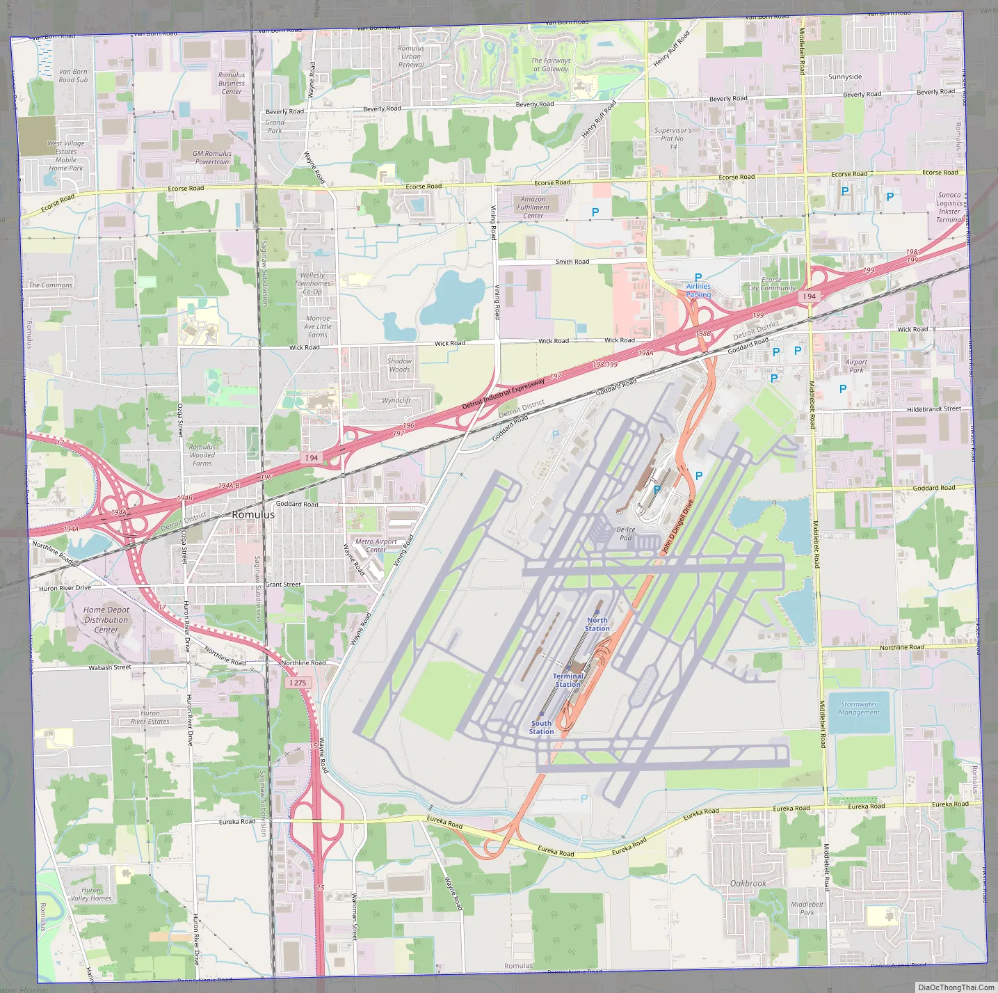
Romulus Road Map
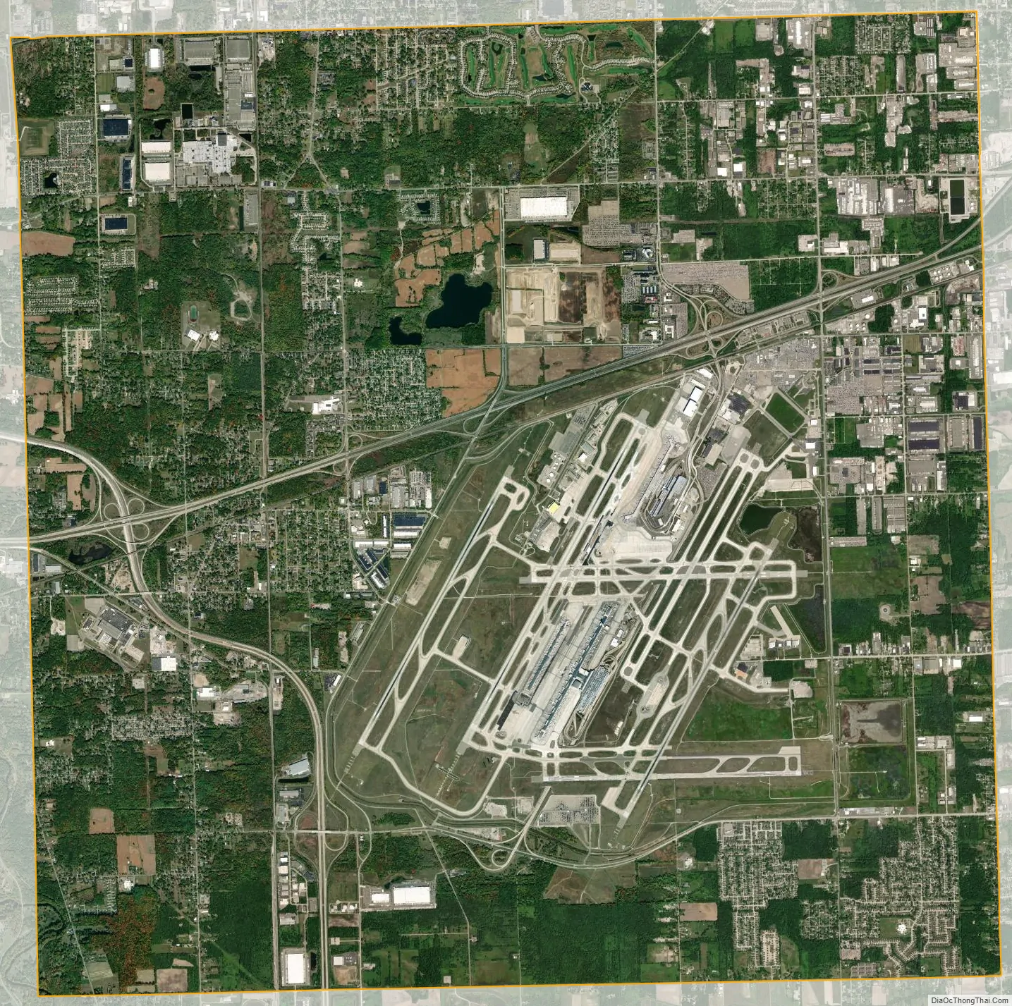
Romulus city Satellite Map
Geography
According to the United States Census Bureau, the city has a total area of 35.95 square miles (93.11 km), of which 35.61 square miles (92.23 km) is land and 0.35 square miles (0.91 km) (0.95%) is water.
Romulus is in the south-central portion of Wayne County. Interstate 94 (I-94) and I-275 run through the city.
The City of Romulus is bordered to the north by Van Born Road, to the south by Pennsylvania Road, to the east by Inkster Road, and to the west by Hannan Road.
See also
Map of Michigan State and its subdivision:- Alcona
- Alger
- Allegan
- Alpena
- Antrim
- Arenac
- Baraga
- Barry
- Bay
- Benzie
- Berrien
- Branch
- Calhoun
- Cass
- Charlevoix
- Cheboygan
- Chippewa
- Clare
- Clinton
- Crawford
- Delta
- Dickinson
- Eaton
- Emmet
- Genesee
- Gladwin
- Gogebic
- Grand Traverse
- Gratiot
- Hillsdale
- Houghton
- Huron
- Ingham
- Ionia
- Iosco
- Iron
- Isabella
- Jackson
- Kalamazoo
- Kalkaska
- Kent
- Keweenaw
- Lake
- Lake Hurron
- Lake Michigan
- Lake St. Clair
- Lake Superior
- Lapeer
- Leelanau
- Lenawee
- Livingston
- Luce
- Mackinac
- Macomb
- Manistee
- Marquette
- Mason
- Mecosta
- Menominee
- Midland
- Missaukee
- Monroe
- Montcalm
- Montmorency
- Muskegon
- Newaygo
- Oakland
- Oceana
- Ogemaw
- Ontonagon
- Osceola
- Oscoda
- Otsego
- Ottawa
- Presque Isle
- Roscommon
- Saginaw
- Saint Clair
- Saint Joseph
- Sanilac
- Schoolcraft
- Shiawassee
- Tuscola
- Van Buren
- Washtenaw
- Wayne
- Wexford
- Alabama
- Alaska
- Arizona
- Arkansas
- California
- Colorado
- Connecticut
- Delaware
- District of Columbia
- Florida
- Georgia
- Hawaii
- Idaho
- Illinois
- Indiana
- Iowa
- Kansas
- Kentucky
- Louisiana
- Maine
- Maryland
- Massachusetts
- Michigan
- Minnesota
- Mississippi
- Missouri
- Montana
- Nebraska
- Nevada
- New Hampshire
- New Jersey
- New Mexico
- New York
- North Carolina
- North Dakota
- Ohio
- Oklahoma
- Oregon
- Pennsylvania
- Rhode Island
- South Carolina
- South Dakota
- Tennessee
- Texas
- Utah
- Vermont
- Virginia
- Washington
- West Virginia
- Wisconsin
- Wyoming


