Sault Ste. Marie (/ˌsuː seɪnt məˈriː/ SOO-saynt-mə-REE) is a city in the Upper Peninsula of the U.S. state of Michigan. It is the county seat of Chippewa County and is the only city within the county. With a population of 13,337 at the 2020 census, it is the second-most populated city in the Upper Peninsula, behind Marquette. It is the primary city of the Sault Ste. Marie, MI Micropolitan Statistical Area, which encompasses all of Chippewa County and had a population of 36,785 at the 2020 census. Sault Ste. Marie was settled by Europeans in 1668, making it the oldest city in Michigan.
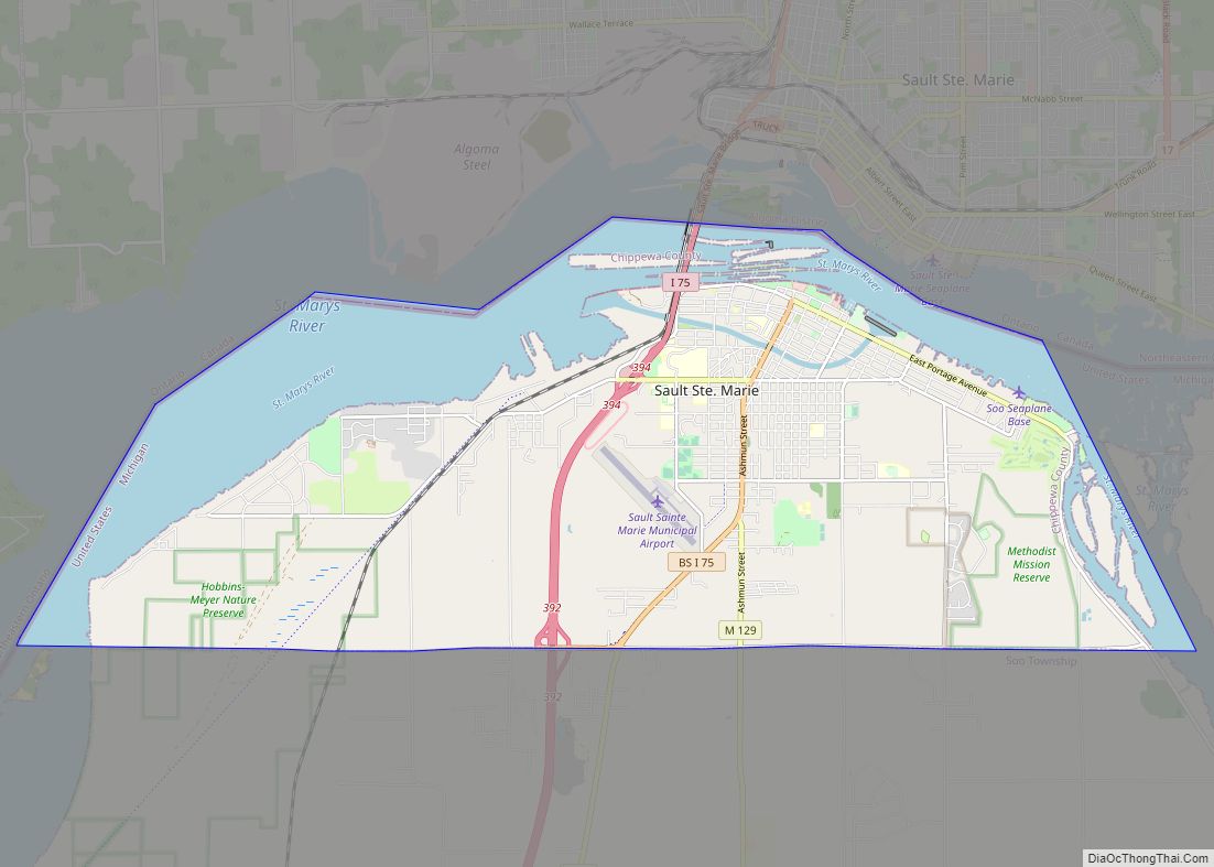
Sault Ste. Marie is located along the St. Marys River, which flows from Lake Superior to Lake Huron and forms part of the United States–Canada border. Across the St. Marys River is the larger Sault Ste. Marie, Ontario. The two cities are connected by the Sault Ste. Marie International Bridge. Between the two cities are the Soo Locks, a set of locks allowing ship travel between Lake Superior and the Lower Great Lakes.
Sault Ste. Marie is home to Lake Superior State University.
| Name: | Sault Ste. Marie city |
|---|---|
| LSAD Code: | 25 |
| LSAD Description: | city (suffix) |
| State: | Michigan |
| County: | Chippewa County |
| Incorporated: | 1879 (village) 1887 (city) |
| Elevation: | 617 ft (188 m) |
| Total Area: | 20.02 sq mi (51.86 km²) |
| Land Area: | 14.76 sq mi (38.22 km²) |
| Water Area: | 5.27 sq mi (13.64 km²) 26.74% |
| Total Population: | 13,337 |
| Population Density: | 903.77/sq mi (348.95/km²) |
| Area code: | 906 |
| FIPS code: | 2671740 |
| GNISfeature ID: | 637276 |
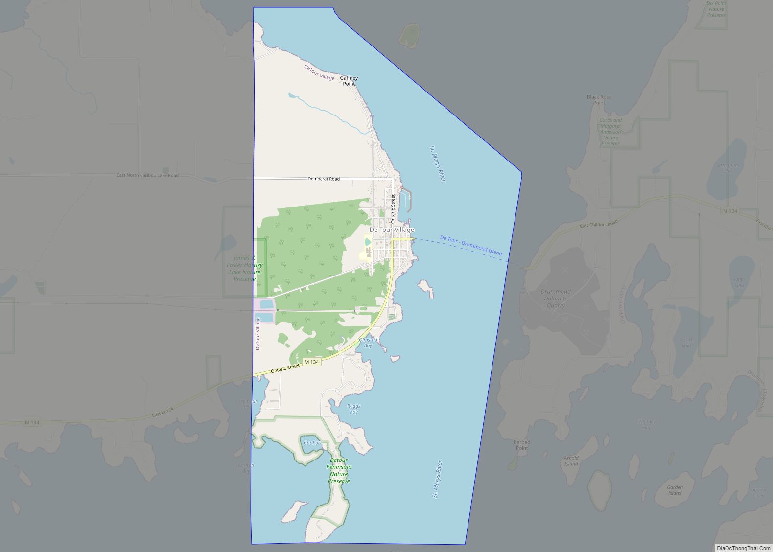
Online Interactive Map
Click on ![]() to view map in "full screen" mode.
to view map in "full screen" mode.
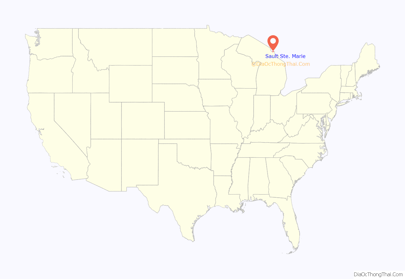
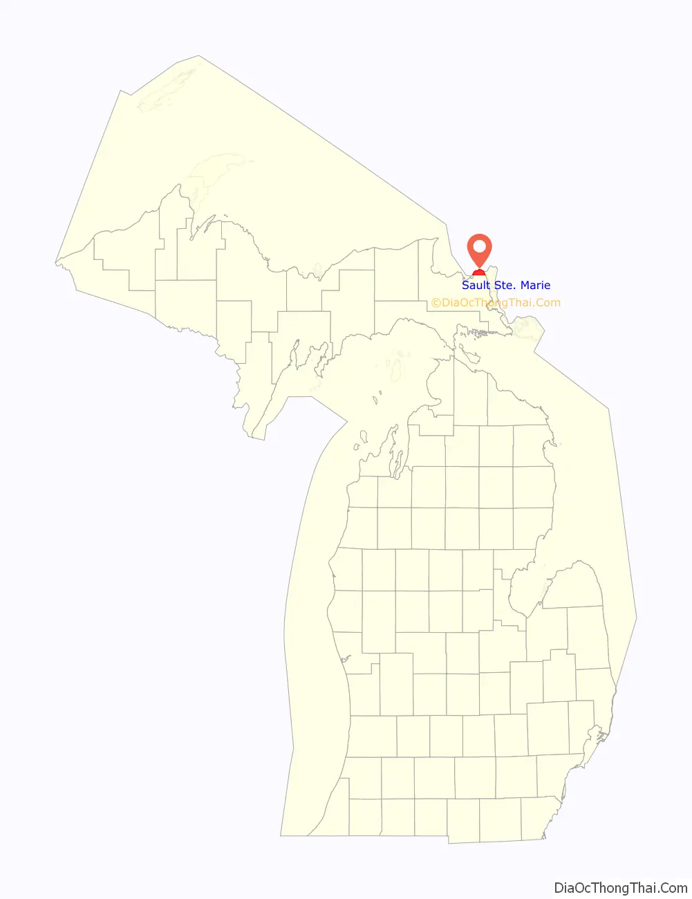
Sault Ste. Marie location map. Where is Sault Ste. Marie city?
History
For centuries, Oc̣eṭi Ṡakowiƞ (Dakota, Lakota, Nakoda), or Sioux, people lived in the area. Around the 1300s, the Anishinaabe (Ojibwe) began to move in from the East Coast, gradually pushing the Oc̣eṭi Ṡakowiƞ westward. They called the area Baawitigong (“at the cascading rapids”), after the rapids of St. Marys River. French colonists renamed the region Saulteaux (“rapids” in French). The Oc̣eṭi Ṡakowiƞ came to call the Anishinaabe “Ḣaḣaṭuƞwaƞ”, or “Dwellers of the Falls.”
In 1668, French missionaries Claude Dablon and Jacques Marquette founded a Jesuit mission at this site. Sault Ste. Marie developed as one of oldest European city in the United States west of the Appalachian Mountains, and the oldest permanent European settlement in Michigan. On June 4, 1671, Simon-François Daumont de Saint-Lusson, a colonial agent, was dispatched from Quebec to the distant tribes, proposing a congress of Indian nations at the Falls of St. Mary between Lake Huron and Lake Superior. Trader Nicolas Perrot helped attract the principal chiefs, and representatives of 14 Indigenous nations were invited for the elaborate ceremony. The French officials proclaimed France’s appropriation of the immense territory surrounding Lake Superior in the name of King Louis XIV.
In the 18th century, the settlement became an important center of the fur trade, when it was a post for the British-owned North West Company, based in Montreal. The fur trader John Johnston, a Scots-Irish immigrant from Belfast, was considered the first European settler in 1790. He married a high-ranking Ojibwe woman named Ozhaguscodaywayquay, the daughter of a prominent chief, Waubojeeg. She also became known as Susan Johnston. Their marriage was one of many alliances in the northern areas between high-ranking European traders and Ojibwe. The family was prominent among Native Americans, First Nations, and Europeans from both Canada and the United States. They had eight children who learned fluent Ojibwe, English and French. The Johnstons entertained a variety of trappers, explorers, traders, and government officials, especially during the years before the War of 1812 between Britain and the United States.
For more than 140 years, the settlement was a single community under French colonial, and later, British colonial rule. After the War of 1812, a US–UK Joint Boundary Commission finally fixed the border in 1817 between the Michigan Territory of the US and the British Province of Upper Canada to follow the river in this area. Whereas traders had formerly moved freely through the whole area, the United States forbade Canadian traders from operating in the United States, which reduced their trade and disrupted the area’s economy. The American and Canadian communities of Sault Ste. Marie were each incorporated as independent municipalities toward the end of the 19th century.
As a result of the fur trade, the settlement attracted Ojibwe and Ottawa, Métis, and ethnic Europeans of various nationalities. It was a two-tiered society, with fur traders (who had capital) and their families and upper-class Ojibwe in the upper echelon. In the aftermath of the War of 1812, however, the community’s society changed markedly.
The U.S. built Fort Brady near the settlement, introducing new troops and settlers, mostly Anglo-American. The UK and the US settled on a new northern boundary in 1817, dividing the US and Canada along St. Mary’s River. The US prohibited British fur traders from operating in the United States. After completion of the Erie Canal in New York State in 1825 (expanded in 1832), the number of settlers migrating to Ohio and Michigan increased dramatically from New York and New England, bringing with them the Yankee culture of the Northern Tier. Their numbers overwhelmed the cosmopolitan culture of the earlier settlers. They practiced more discrimination against Native Americans and Métis.
The falls proved a choke point for shipping between the Great Lakes. Early ships traveling to and from Lake Superior were portaged around the rapids in a lengthy process (much like moving a house) that could take weeks. Later, only the cargoes were unloaded, hauled around the rapids, and then loaded onto other ships waiting below the rapids. The first American lock, the State Lock, was built in 1855; it was instrumental in improving shipping. The lock has been expanded and improved over the years.
In 1900, Northwestern Leather Company opened a tannery in Sault Ste. Marie. The tannery was founded to process leather for the upper parts of shoes, which was finer than that for soles. After the factory closed in 1958, the property was sold to Filborn Limestone, a subsidiary of Algoma Steel Corporation.
In March 1938 during the Great Depression, Sophia Nolte Pullar bequeathed $70,000 for construction of the Pullar Community Building, which opened in 1939. This building held an indoor ice rink composed of artificial ice, then a revolutionary concept. The ice rink is still owned by the city.
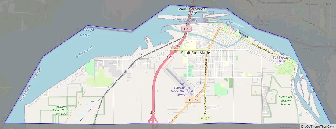
Sault Ste. Marie Road Map
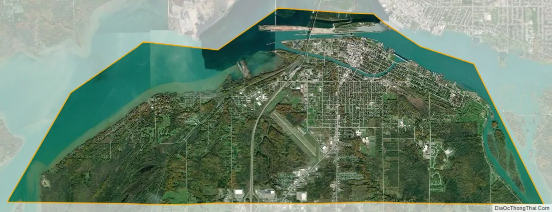
Sault Ste. Marie city Satellite Map
Geography
The city is located at 46°49’N 84°35’W.
According to the United States Census Bureau, the city has an area of 20.16 square miles (52.21 km), of which 14.77 square miles (38.25 km) is land and 5.39 square miles (13.96 km) is water. The city’s downtown is on an island, formed by the Sault Ste. Marie Power Canal to the south and the St. Mary’s River and Soo Locks to the north.
Climate
Under the Köppen climate classification, Sault Ste. Marie has a humid continental climate (Dfb) with cold, snowy winters and warm summers. Sault Ste. Marie is one of the snowiest places in Michigan, receiving an average of 120 inches (3.0 m) of snow per winter season, with a record year when 209 inches (5.3 m) fell. 62 inches (1.6 m) of snow fell in one five-day snowstorm, including 28 inches (71 cm) in 24 hours, in December 1995. During this time, the city proper experienced a far greater level of snowfall than the farmlands past the canal and riverfront due to lake-effect snow. This caused the 1437th MRBC National Guard local armory to be mobilized for disaster relief in order to remove hundreds of tons of snow which effectively blockaded people within their own homes. Precipitation measured as equivalent rainfall, Sault Ste. Marie receives an annual average of 33 inches (840 mm). Its immediate region is the cloudiest in Michigan’s Upper Peninsula, having over 200 cloudy days a year.
Temperatures in Sault Ste. Marie have varied between a record low of −36 °F (−38 °C) and a record high of 98 °F (37 °C). Monthly average temperatures range from 13 °F (−11 °C) in January to 64 °F (18 °C) in July. On average, only two out of every five years reaches 90 °F (32 °C), while there are 85.5 days annually where the high remains at or below freezing and 26.5 nights with a low of 0 °F (−18 °C) or colder.
Average monthly precipitation is lowest in February, and highest in September and October. This autumn maximum in precipitation, unusual for humid continental climates, owes to this area’s Great Lakes location. From May through July (usually the year’s wettest months in most of the upper Midwestern United States, away from large bodies of water), the lake waters surrounding Sault Ste. Marie are cooler than nearby land areas. This tends to stabilize the atmosphere, suppressing precipitation (especially showers and thunderstorms) somewhat, in May, June and July. In autumn, the lakes are releasing their stored heat from the summer, making them warmer than the surrounding land, and increasingly frequent and strong polar and Arctic air outbreaks pick up warmth and moisture during their over-water passage, resulting in clouds and instability showers. In Sault Ste. Marie, this phenomenon peaks in September and October, making these the wettest months of the year. Also noteworthy is that in Sault Ste. Marie, the year’s third wettest month, on average, is November, and not any summer month.
Satellite image from June 2007.
Sault Ste. Marie, Michigan Saint Marys Falls Hydropower Plant generation station.
Astronaut photograph of Sault Ste. Marie.
- ^ Mean monthly maxima and minima (i.e. the highest and lowest temperature readings during an entire month or year) calculated based on data at said location from 1991 to 2020.
See also
Map of Michigan State and its subdivision:- Alcona
- Alger
- Allegan
- Alpena
- Antrim
- Arenac
- Baraga
- Barry
- Bay
- Benzie
- Berrien
- Branch
- Calhoun
- Cass
- Charlevoix
- Cheboygan
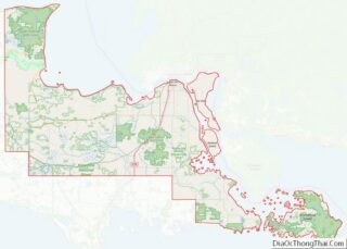
- Chippewa
- Clare
- Clinton
- Crawford
- Delta
- Dickinson
- Eaton
- Emmet
- Genesee
- Gladwin
- Gogebic
- Grand Traverse
- Gratiot
- Hillsdale
- Houghton
- Huron
- Ingham
- Ionia
- Iosco
- Iron
- Isabella
- Jackson
- Kalamazoo
- Kalkaska
- Kent
- Keweenaw
- Lake
- Lake Hurron
- Lake Michigan
- Lake St. Clair
- Lake Superior
- Lapeer
- Leelanau
- Lenawee
- Livingston
- Luce
- Mackinac
- Macomb
- Manistee
- Marquette
- Mason
- Mecosta
- Menominee
- Midland
- Missaukee
- Monroe
- Montcalm
- Montmorency
- Muskegon
- Newaygo
- Oakland
- Oceana
- Ogemaw
- Ontonagon
- Osceola
- Oscoda
- Otsego
- Ottawa
- Presque Isle
- Roscommon
- Saginaw
- Saint Clair
- Saint Joseph
- Sanilac
- Schoolcraft
- Shiawassee
- Tuscola
- Van Buren
- Washtenaw
- Wayne
- Wexford
- Alabama
- Alaska
- Arizona
- Arkansas
- California
- Colorado
- Connecticut
- Delaware
- District of Columbia
- Florida
- Georgia
- Hawaii
- Idaho
- Illinois
- Indiana
- Iowa
- Kansas
- Kentucky
- Louisiana
- Maine
- Maryland
- Massachusetts
- Michigan
- Minnesota
- Mississippi
- Missouri
- Montana
- Nebraska
- Nevada
- New Hampshire
- New Jersey
- New Mexico
- New York
- North Carolina
- North Dakota
- Ohio
- Oklahoma
- Oregon
- Pennsylvania
- Rhode Island
- South Carolina
- South Dakota
- Tennessee
- Texas
- Utah
- Vermont
- Virginia
- Washington
- West Virginia
- Wisconsin
- Wyoming