Wayne is a city in Wayne County in the U.S. state of Michigan. The population was 17,593 at the 2010 census. Wayne has a long history of automotive and transportation related manufacturing. Ford Motor Company currently has two plants in Wayne: Wayne Stamping & Assembly and the Michigan Assembly Plant, formerly known as the Michigan Truck Plant.
| Name: | Wayne city |
|---|---|
| LSAD Code: | 25 |
| LSAD Description: | city (suffix) |
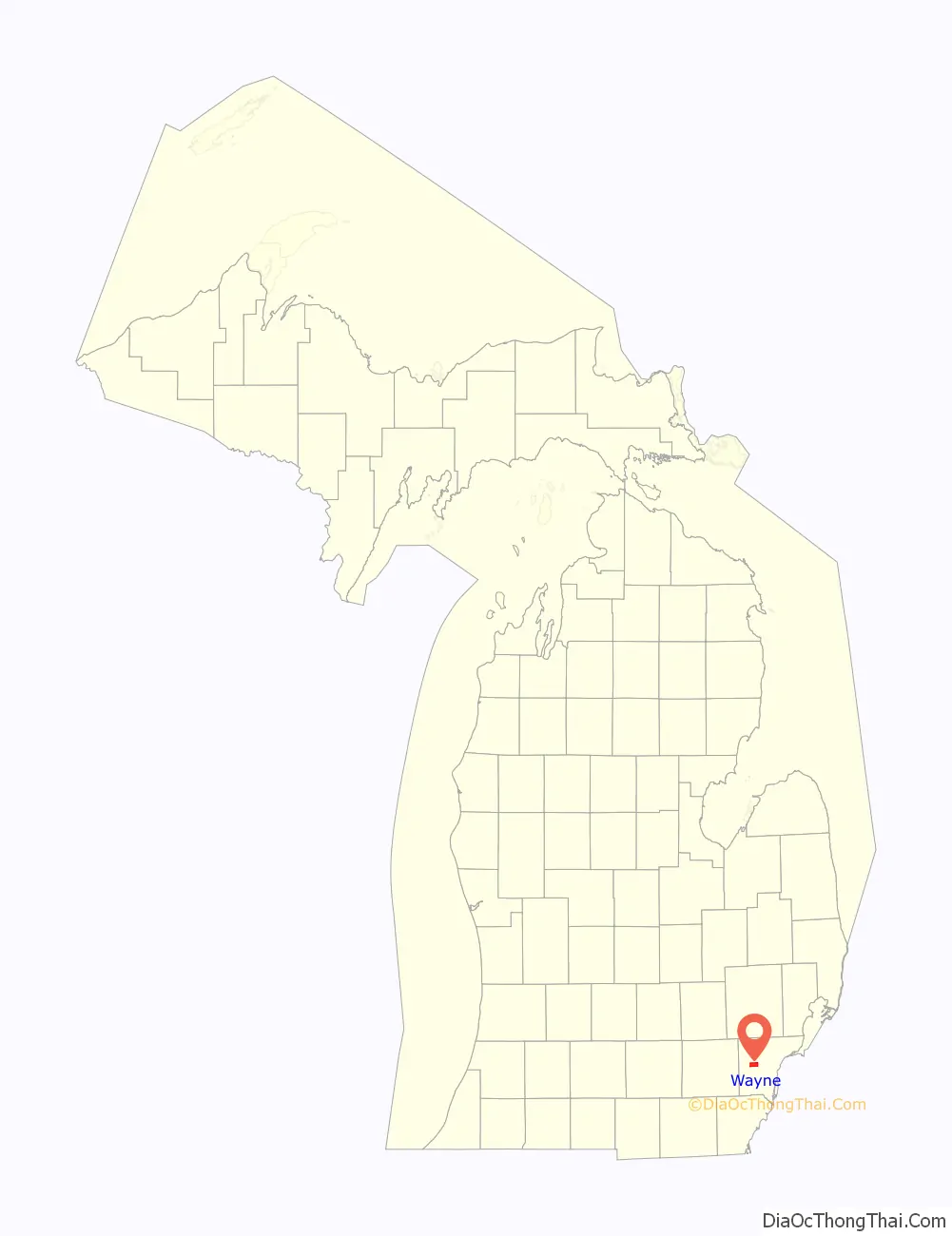
| State: | Michigan |
| County: | Wayne County |
| Incorporated: | 1869 (village) 1960 (city) |
| Elevation: | 656 ft (200 m) |
| Land Area: | 6.02 sq mi (15.59 km²) |
| Water Area: | 0.00 sq mi (0.00 km²) |
| Population Density: | 2,942.36/sq mi (1,136.10/km²) |
| Area code: | 734 |
| FIPS code: | 2684940 |
| GNISfeature ID: | 1615901 |
Online Interactive Map
Click on ![]() to view map in "full screen" mode.
to view map in "full screen" mode.
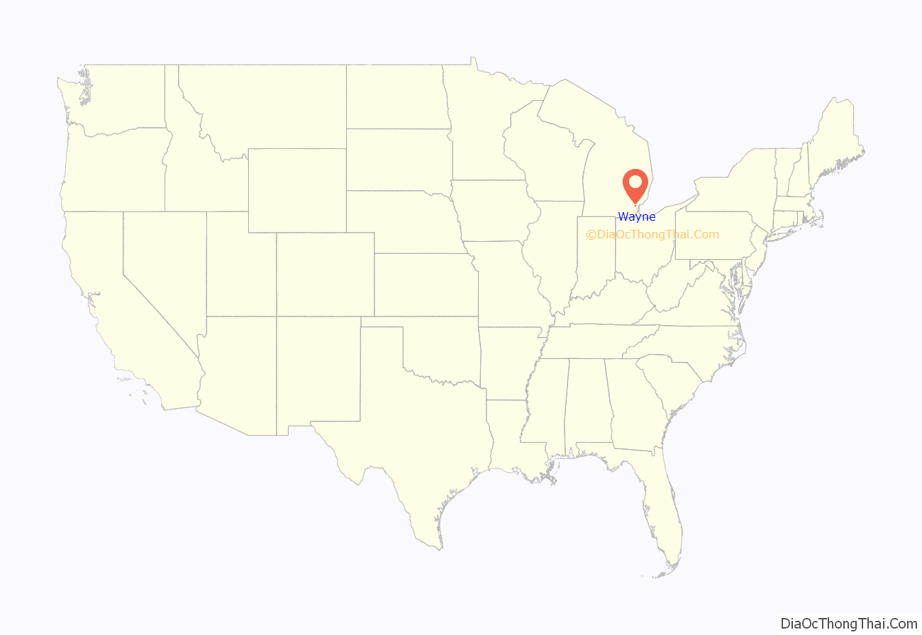
Wayne location map. Where is Wayne city?
History
The site of Wayne was crossed by the Sauk Trail, and due to this, the area was visited by Potawatomi and French fur traders for years before permanent settlement. The first settler was George M. Johnson, who built a small log cabin on 80 acres of land in 1824 (a state historical marker can now be found at the site). The cabin served as a tavern for travelers along the trail, by then known as the Chicago Road. The area soon became known as Johnson’s Tavern. After a few years, the tavern was sold to Stephen G. Simmons, who continued to operate the business until he murdered his wife while in a drunken rage. Simmons was arrested and taken to Detroit, where he was tried and hanged September 24, 1830. He became the last person to be executed in Michigan, as the territory abolished capital punishment shortly thereafter.
In 1832, Ezra Derby bought the tavern and land from the Simmons heirs and began establishing a settlement. Derby built a sawmill, store, mill, blacksmith shop and the first frame dwelling for himself. In 1834, a plat was recorded in Detroit with lots and a town square under the name Derby’s Corners. In 1836, the name of the settlement was changed to Wayne, in honor of Revolutionary War General Anthony Wayne. Soon a small hamlet began to develop, which was accelerated by the arrival of the Michigan Central Railroad in 1838. The Chicago Road that ran through Wayne was paved with oak logs in 1850, becoming the Detroit and Saline Plank Road. In 1867 it was changed to its current name of Michigan Avenue. In 1869, Wayne was incorporated as a village with a population of about 800 people. (In 1960 Wayne officially became a city.)
Many major industries have located in the village over the years. The Prouty and Glass Carriage Factory was the first, moving from Detroit in 1888. At the time, this made Wayne the largest carriage and sleigh producer in the country. In 1899, the Detroit interurban railroad (a streetcar system connecting Detroit to outlying towns) reached Wayne and ran until 1929. Ray Harroun, winner of the first Indianapolis 500, built the Harroun motor car in Wayne from 1916 to 1921. The Gotfredson Truck was produced from 1924 to 1927, and The Graham-Paige car company made vehicles in Wayne from 1928 to 1936. Stinson Aircraft was also located at the nearby Detroit Industrial Airport and produced small planes from 1926 to 1948. The Michigan Assembly Plant was built in 1957, and the Gar-Wood company built garbage trucks and hydraulic equipment from 1947 to 1972. Other major companies located in Wayne include Unistrut, which was invented in Wayne, and Wayne Industries.
The population and industrial production around Wayne significantly increased after World War II.
The 1960s saw a period of urban renewal in downtown Wayne, as the city sought to compete with its neighbors. Michigan Avenue had gone from a divided highway to a two-way undivided route between Pershing and 4th Streets, with Main Street to the south serving as an unofficial business route connecting to Michigan Avenue at both ends. As part of the redevelopment of the downtown area, Michigan Avenue received new eastbound lanes, routed one block south of Main Street along Norris Street, with the original undivided route retaining westbound traffic. Wayne Road was subsequently reconstructed to eliminate its original staggered intersection at the now-westbound Michigan Avenue, continuing along the former Washington Street alignment before turning 45 degrees to cross the new eastbound Michigan. Main Street’s connections to Michigan Avenue were cut off, with the street now only running from Williams Street to Wayne Road, with a segment incorporated into the parking lot of the Town Square Plaza shopping center. The redevelopment ultimately did not result in the kind of growth the city had hoped for, though; in particular, the undersized Town Square Plaza could not compete with the larger Westland Shopping Center a few miles north.
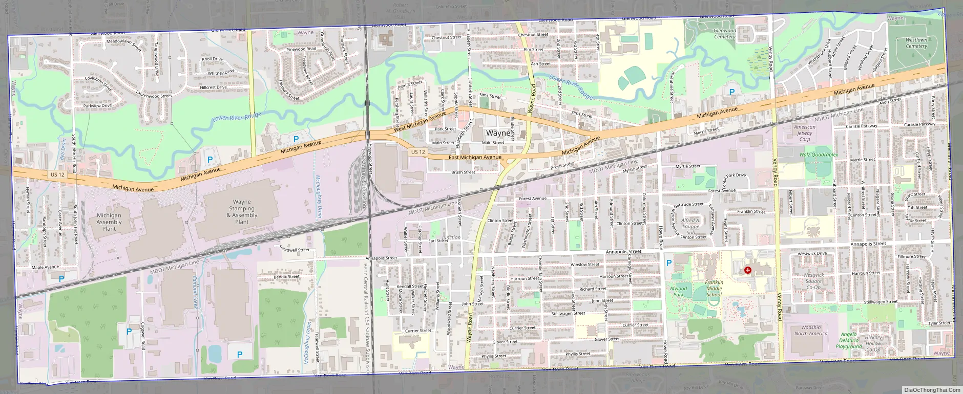
Wayne Road Map
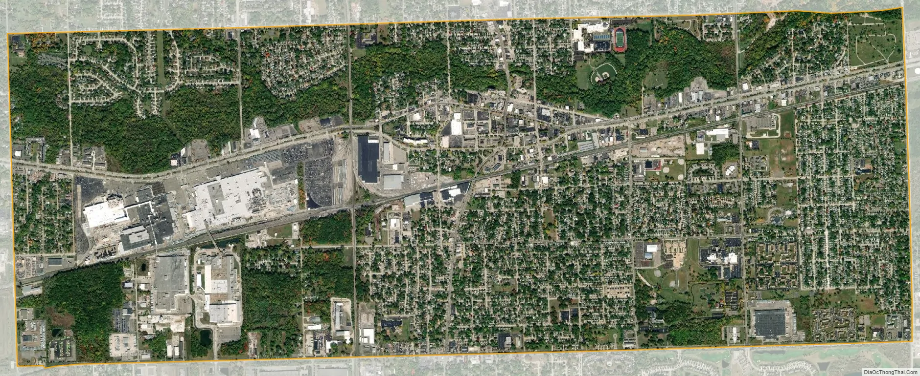
Wayne city Satellite Map
Geography
The city, located on the Lower River Rouge which bisects the city, is bound on the north by Glenwood Road, the west by Hannan Road, the south by Van Born Road, and on the east by Merriman Road.
According to the United States Census Bureau, the city has a total area of 6.02 square miles (15.59 km), all land.
See also
Map of Michigan State and its subdivision:- Alcona
- Alger
- Allegan
- Alpena
- Antrim
- Arenac
- Baraga
- Barry
- Bay
- Benzie
- Berrien
- Branch
- Calhoun
- Cass
- Charlevoix
- Cheboygan
- Chippewa
- Clare
- Clinton
- Crawford
- Delta
- Dickinson
- Eaton
- Emmet
- Genesee
- Gladwin
- Gogebic
- Grand Traverse
- Gratiot
- Hillsdale
- Houghton
- Huron
- Ingham
- Ionia
- Iosco
- Iron
- Isabella
- Jackson
- Kalamazoo
- Kalkaska
- Kent
- Keweenaw
- Lake
- Lake Hurron
- Lake Michigan
- Lake St. Clair
- Lake Superior
- Lapeer
- Leelanau
- Lenawee
- Livingston
- Luce
- Mackinac
- Macomb
- Manistee
- Marquette
- Mason
- Mecosta
- Menominee
- Midland
- Missaukee
- Monroe
- Montcalm
- Montmorency
- Muskegon
- Newaygo
- Oakland
- Oceana
- Ogemaw
- Ontonagon
- Osceola
- Oscoda
- Otsego
- Ottawa
- Presque Isle
- Roscommon
- Saginaw
- Saint Clair
- Saint Joseph
- Sanilac
- Schoolcraft
- Shiawassee
- Tuscola
- Van Buren
- Washtenaw
- Wayne
- Wexford
- Alabama
- Alaska
- Arizona
- Arkansas
- California
- Colorado
- Connecticut
- Delaware
- District of Columbia
- Florida
- Georgia
- Hawaii
- Idaho
- Illinois
- Indiana
- Iowa
- Kansas
- Kentucky
- Louisiana
- Maine
- Maryland
- Massachusetts
- Michigan
- Minnesota
- Mississippi
- Missouri
- Montana
- Nebraska
- Nevada
- New Hampshire
- New Jersey
- New Mexico
- New York
- North Carolina
- North Dakota
- Ohio
- Oklahoma
- Oregon
- Pennsylvania
- Rhode Island
- South Carolina
- South Dakota
- Tennessee
- Texas
- Utah
- Vermont
- Virginia
- Washington
- West Virginia
- Wisconsin
- Wyoming


