Wyandotte (/ˈwaɪəndɒt/ WY-ən-dot) is a city in Wayne County in the U.S. state of Michigan. The population was 25,058 at the 2020 census.
Wyandotte is located in southeastern Michigan, approximately 11 miles (18 km) south of Detroit on the Detroit River, and it is part of the collection of communities known as Downriver. Wyandotte is bounded by Southgate to the west, Lincoln Park to the northwest, Riverview to the south, Grosse Ile Township to the southeast, Ecorse to the north, and LaSalle, Ontario on the east. Wyandotte is a sister city to Komaki, Japan, and each year delegates from Komaki come to Wyandotte to tour the city.
| Name: | Wyandotte city |
|---|---|
| LSAD Code: | 25 |
| LSAD Description: | city (suffix) |
| State: | Michigan |
| County: | Wayne County |
| Founded: | 1854 |
| Incorporated: | 1867 |
| Elevation: | 581 ft (177 m) |
| Land Area: | 5.29 sq mi (13.71 km²) |
| Water Area: | 1.69 sq mi (4.37 km²) |
| Population Density: | 4,697.47/sq mi (1,813.61/km²) |
| Area code: | 734 |
| FIPS code: | 2688900 |
| GNISfeature ID: | 1616849 |
Online Interactive Map
Click on ![]() to view map in "full screen" mode.
to view map in "full screen" mode.
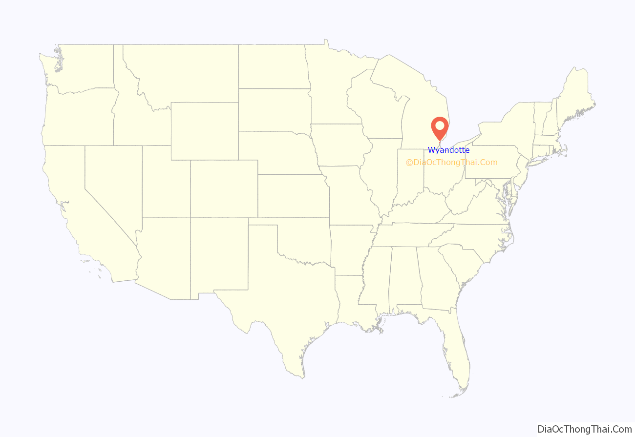
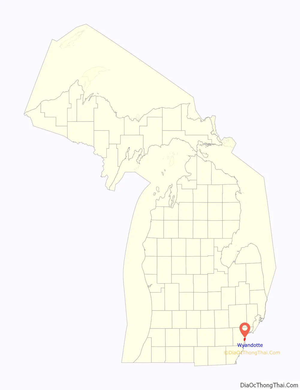
Wyandotte location map. Where is Wyandotte city?
History
The site where Wyandotte sits today in the 18th century was a small village called by the native Indians “Maquaqua” and by the local French “Monguagon”. This Native American tribe was known as the Wyandot or Wendat, and were part of the Huron nation originally from the Georgian Bay area of Canada. Except for the intervening colonial war activities, when the Wyandots were forced through circumstances and treaty commitments with the Potawatomi living in the Ecorse area to engage in war against the English, the Wyandot Indians lived in peace with the few white farmers, exchanging products and favors.
It was from near here, along the banks of Ecorse Creek, now a northern boundary of the present-day city, that Chief Pontiac plotted his failed attack against the British garrisoned Fort of Detroit, in 1763. The center of the village was nearly parallel to Biddle Avenue between Oak Street and Eureka Road near the river and its sandy beach, which was a welcome feature to the local tribesmen, as their main mode of transportation to the fort in Detroit was by birch bark canoe. The tribe was considered peaceable and friendly with the British, the remaining French in the area, and the newly arrived Americans.
In 1818, the Wyandot signed a treaty with the U.S. government relinquishing this land, some moving to an area near Flat Rock, Michigan, then to Ohio, Kansas and finally Oklahoma; however, most of the Native Americans who lived in what is now Wyandotte, moved across the Detroit River to Anderdon, Windsor, Ontario, where their descendants live still today. The name somewhat lives on as Wyandotte County, Kansas.
Contemporary citizens have named Major Biddle the first white settler in Wyandotte, though there had been white farmers living in the territory before he established his home here. Major John Biddle had purchased 2,200 acres (9 km) of land from the federal government in 1818. The wooded section by the river inspired the Major to become a farmer much in the manner of George Washington at Mount Vernon. He also built a summer estate. The buildings were completed around 1835, and he named his estate “Wyandotte” after the Indians who were still living in the area.
John S. Van Alstyne, general manager for Eber Ward of both the Eureka Iron & Steel Works and the associated Wyandotte Rolling Mills, laid out the master plan for the city. This plan was frequently called the “Philadelphia Plan”, with streets laid out on a north–south and east–west grid. The streets of the village were modeled after those in Philadelphia, which originated with William Penn. The focal point became the Detroit River, and the first street parallel became Front Street. This street was eventually extended and renamed Van Alstyne Boulevard in 1921. Streets running parallel to this Front Street were named according to numbers from First to the extent of the territory involved. Streets running horizontal to the numbered streets were named for trees and plants.
Founded as a village of Ecorse Township in 1854, Wyandotte was incorporated as a city, and granted a charter by the State of Michigan, on December 12, 1866, with the first city election held in April 1867, thus making it the oldest incorporated city in Wayne County other than Detroit. On April 8, 1867, the Village of Wyandotte was incorporated as a home rule city. A community named New Jerusalem consisting of immigrants from multiple nations was founded in the 1890s in what is now Wyandotte. It was incorporated as a village with the name of Glenwood in 1900. In 1901 a post office was established here with the name of Bacon since there was already a Glenwood post office in Wayne Township, Cass County, Michigan. Wyandotte annexed the community in 1905. The community of Ford City was founded as a village in 1902. It was named for John B. Ford who ran the Michigan Alkali Company there. In 1922 it merged with Wyandotte. On April 14, 1924, a large section of Ecorse Township was annexed to Wyandotte.
Wyandotte has been influenced by many nationalities, most notably the German, Polish, Irish and Italian communities. Wyandotte was also a sundown town, resulting in a troubled history with African Americans.
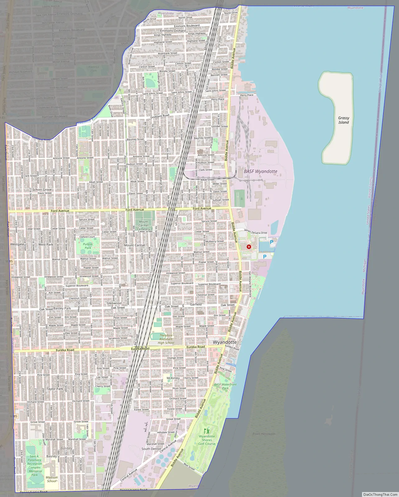
Wyandotte Road Map
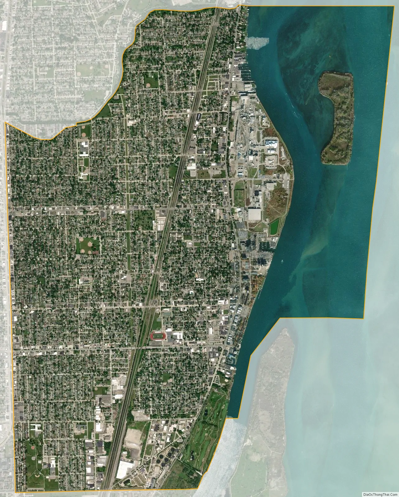
Wyandotte city Satellite Map
Geography
According to the United States Census Bureau, the city has a total area of 7.01 square miles (18.16 km), of which 5.27 square miles (13.65 km) is land and 1.74 square miles (4.51 km) is water.
The city is 10 miles (16 km) southwest of Downtown Detroit. The Detroit River forms the eastern boundary of the city, and the uninhabited Grassy Island is administered by the city. The Ecorse River also forms a small northern boundary of the city.
See also
Map of Michigan State and its subdivision:- Alcona
- Alger
- Allegan
- Alpena
- Antrim
- Arenac
- Baraga
- Barry
- Bay
- Benzie
- Berrien
- Branch
- Calhoun
- Cass
- Charlevoix
- Cheboygan
- Chippewa
- Clare
- Clinton
- Crawford
- Delta
- Dickinson
- Eaton
- Emmet
- Genesee
- Gladwin
- Gogebic
- Grand Traverse
- Gratiot
- Hillsdale
- Houghton
- Huron
- Ingham
- Ionia
- Iosco
- Iron
- Isabella
- Jackson
- Kalamazoo
- Kalkaska
- Kent
- Keweenaw
- Lake
- Lake Hurron
- Lake Michigan
- Lake St. Clair
- Lake Superior
- Lapeer
- Leelanau
- Lenawee
- Livingston
- Luce
- Mackinac
- Macomb
- Manistee
- Marquette
- Mason
- Mecosta
- Menominee
- Midland
- Missaukee
- Monroe
- Montcalm
- Montmorency
- Muskegon
- Newaygo
- Oakland
- Oceana
- Ogemaw
- Ontonagon
- Osceola
- Oscoda
- Otsego
- Ottawa
- Presque Isle
- Roscommon
- Saginaw
- Saint Clair
- Saint Joseph
- Sanilac
- Schoolcraft
- Shiawassee
- Tuscola
- Van Buren
- Washtenaw
- Wayne
- Wexford
- Alabama
- Alaska
- Arizona
- Arkansas
- California
- Colorado
- Connecticut
- Delaware
- District of Columbia
- Florida
- Georgia
- Hawaii
- Idaho
- Illinois
- Indiana
- Iowa
- Kansas
- Kentucky
- Louisiana
- Maine
- Maryland
- Massachusetts
- Michigan
- Minnesota
- Mississippi
- Missouri
- Montana
- Nebraska
- Nevada
- New Hampshire
- New Jersey
- New Mexico
- New York
- North Carolina
- North Dakota
- Ohio
- Oklahoma
- Oregon
- Pennsylvania
- Rhode Island
- South Carolina
- South Dakota
- Tennessee
- Texas
- Utah
- Vermont
- Virginia
- Washington
- West Virginia
- Wisconsin
- Wyoming


