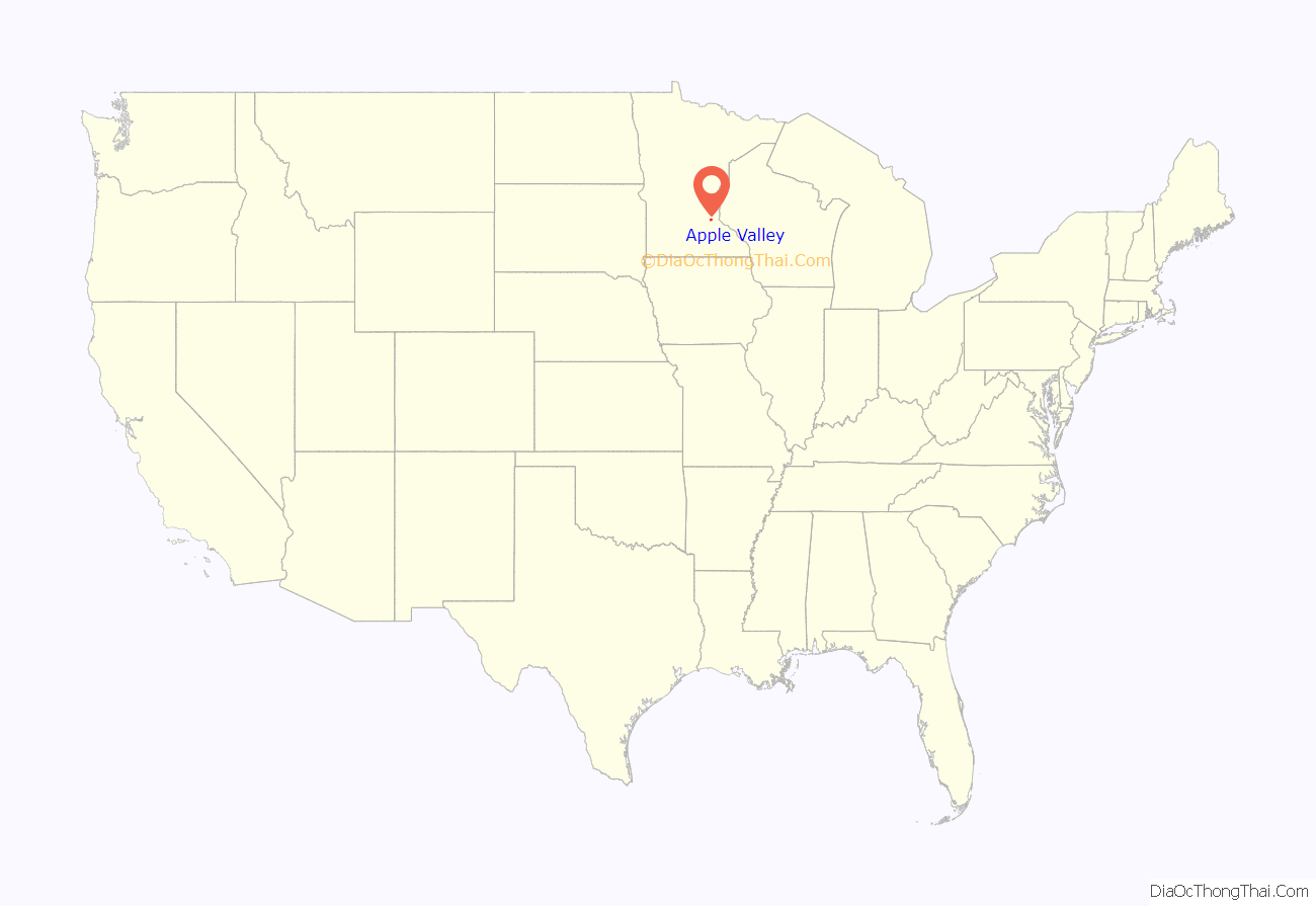
Apple Valley is a city in northwestern Dakota County in the State of Minnesota, and a suburb of the Twin Cities. The population was 56,374 at the 2020 census, making it the 17th most populous city in Minnesota. In 2014, Money.com named Apple Valley the 17th best place to live in the United States, up from 20th in 2010, 24th in 2008 and 28th in 2007.
| Name: | Apple Valley city |
|---|---|
| LSAD Code: | 25 |
| LSAD Description: | city (suffix) |
| State: | Minnesota |
| County: | Dakota County |
| Incorporated: | 1969 |
| Elevation: | 955 ft (289 m) |
| Land Area: | 16.87 sq mi (43.69 km²) |
| Water Area: | 0.68 sq mi (1.76 km²) |
| Population Density: | 3,341.47/sq mi (1,290.18/km²) |
| ZIP code: | 55124 |
| Area code: | 952 |
| FIPS code: | 2701900 |
| GNISfeature ID: | 0639415 |
| Website: | ci.apple-valley.mn.us |
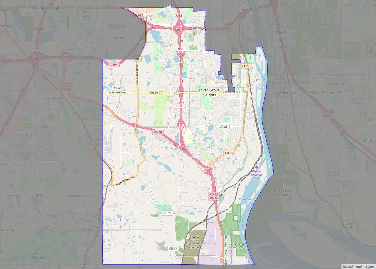
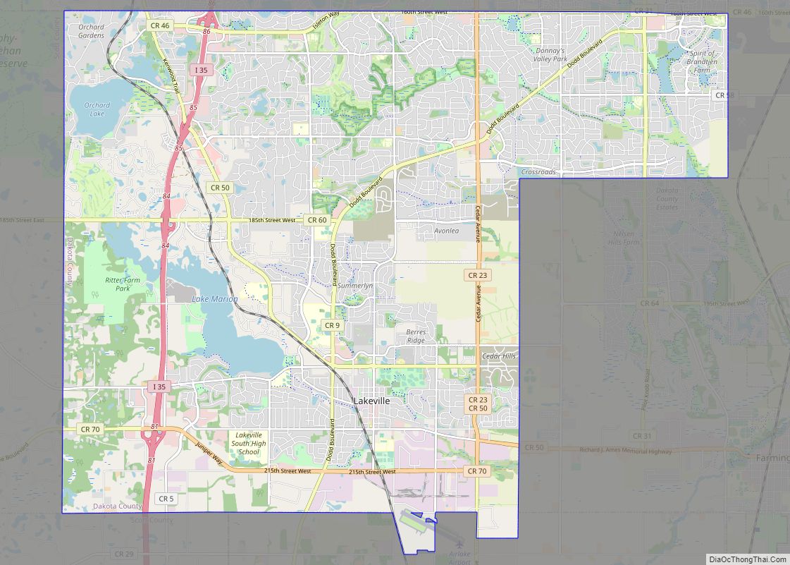
Online Interactive Map
Click on ![]() to view map in "full screen" mode.
to view map in "full screen" mode.
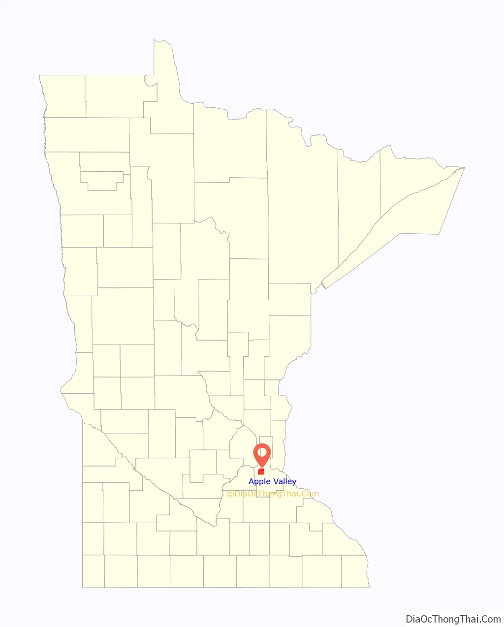
Apple Valley location map. Where is Apple Valley city?
History
The area that became Apple Valley was first established in 1858 as Lebanon Township, and remained a farming community for nearly a century. In the mid-1950s, residential developments started replacing farmland. Orrin Thompson, a real estate developer, was responsible for the city’s early development. He contracted a company to determine where the next growth in the Twin Cities would be. It was 0.5 miles (1 km) from County Road 42 and Cedar Avenue. Thompson bought the first houses and streets from the Brobacks, who built the city’s first four houses. The firm that selected this area was in Apple Valley, California, so Thompson took that name for the development. An alternate explanation for the name change exists, however. According to local developer Henry Broback, Lebanon Township was renamed Apple Valley because “…when you drive east on (County Road) 42 and turn to enter Lebanon, it reminded them of Apple Valley, California, which was a nice community.”
Voters in the township voted to incorporate in the 1968 general election. They also selected the name Apple Valley over the name Lebanon Valley by a vote of 1376 to 757.
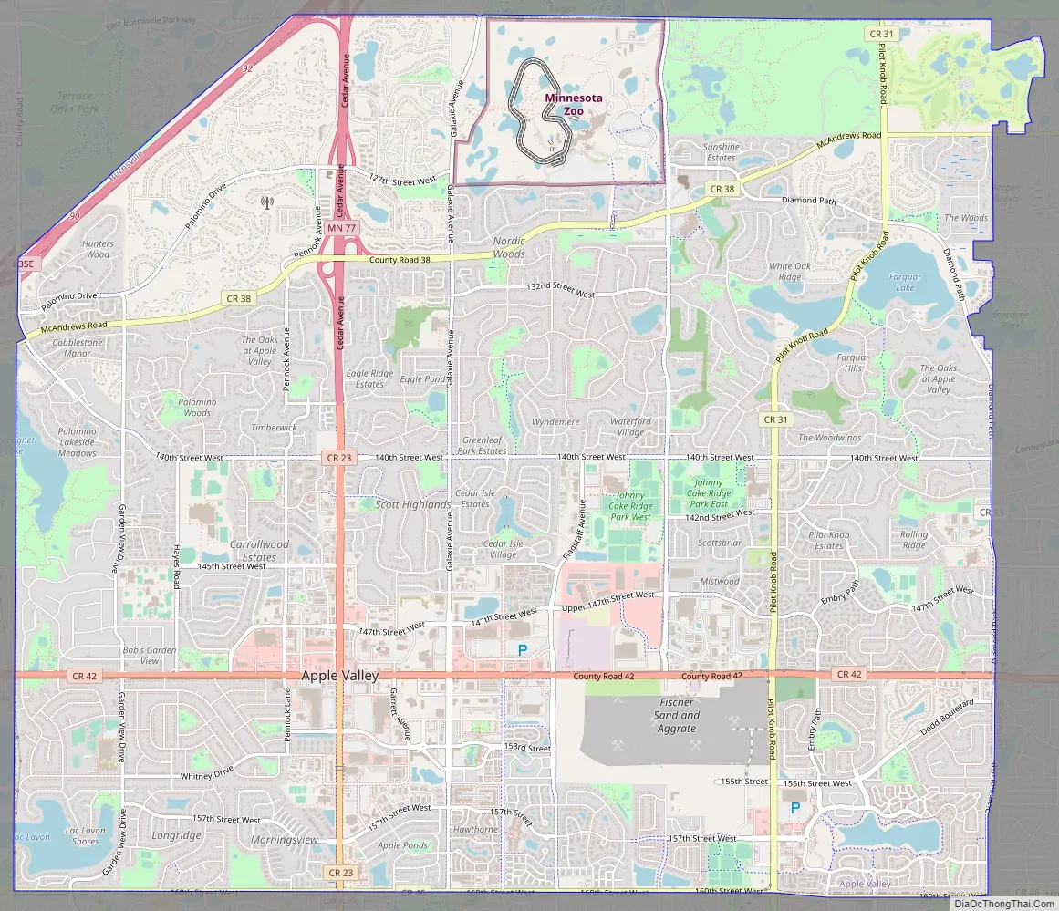
Apple Valley Road Map
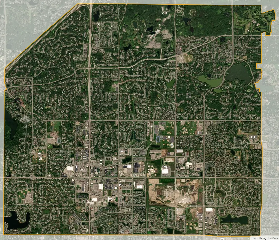
Apple Valley city Satellite Map
Geography
According to the United States Census Bureau, the city has a total area of 17.57 square miles (45.51 km), of which 16.86 square miles (43.67 km) is land and 0.71 square miles (1.84 km) is water. The city’s geography is rolling, with elevation from the lowest to the highest points in the city varying by one hundred feet (thirty metres) or more. The downtown area and its adjacent residential district (which formed the original core of the city when it was incorporated) are in a shallow valley.
See also
Map of Minnesota State and its subdivision:- Aitkin
- Anoka
- Becker
- Beltrami
- Benton
- Big Stone
- Blue Earth
- Brown
- Carlton
- Carver
- Cass
- Chippewa
- Chisago
- Clay
- Clearwater
- Cook
- Cottonwood
- Crow Wing
- Dakota
- Dodge
- Douglas
- Faribault
- Fillmore
- Freeborn
- Goodhue
- Grant
- Hennepin
- Houston
- Hubbard
- Isanti
- Itasca
- Jackson
- Kanabec
- Kandiyohi
- Kittson
- Koochiching
- Lac qui Parle
- Lake
- Lake of the Woods
- Lake Superior
- Le Sueur
- Lincoln
- Lyon
- Mahnomen
- Marshall
- Martin
- McLeod
- Meeker
- Mille Lacs
- Morrison
- Mower
- Murray
- Nicollet
- Nobles
- Norman
- Olmsted
- Otter Tail
- Pennington
- Pine
- Pipestone
- Polk
- Pope
- Ramsey
- Red Lake
- Redwood
- Renville
- Rice
- Rock
- Roseau
- Saint Louis
- Scott
- Sherburne
- Sibley
- Stearns
- Steele
- Stevens
- Swift
- Todd
- Traverse
- Wabasha
- Wadena
- Waseca
- Washington
- Watonwan
- Wilkin
- Winona
- Wright
- Yellow Medicine
- Alabama
- Alaska
- Arizona
- Arkansas
- California
- Colorado
- Connecticut
- Delaware
- District of Columbia
- Florida
- Georgia
- Hawaii
- Idaho
- Illinois
- Indiana
- Iowa
- Kansas
- Kentucky
- Louisiana
- Maine
- Maryland
- Massachusetts
- Michigan
- Minnesota
- Mississippi
- Missouri
- Montana
- Nebraska
- Nevada
- New Hampshire
- New Jersey
- New Mexico
- New York
- North Carolina
- North Dakota
- Ohio
- Oklahoma
- Oregon
- Pennsylvania
- Rhode Island
- South Carolina
- South Dakota
- Tennessee
- Texas
- Utah
- Vermont
- Virginia
- Washington
- West Virginia
- Wisconsin
- Wyoming