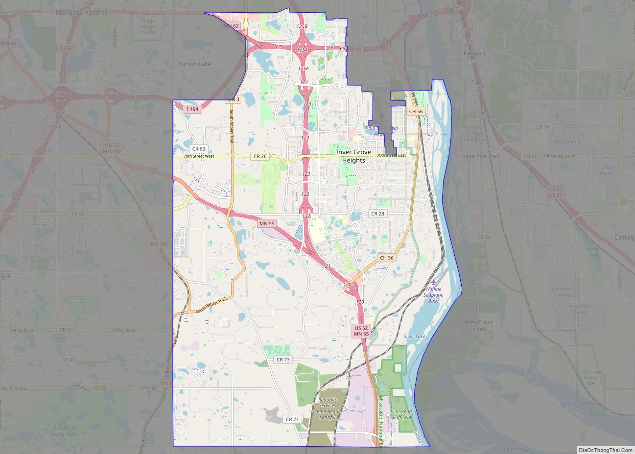
Inver Grove Heights is a city in Dakota County, Minnesota, United States. The population was 35,801 at the 2020 census. The city was formed on March 9, 1965, with the merger of the village of Inver Grove and Inver Grove Township.
It is one of 186 cities and townships in the seven-county Minneapolis-Saint Paul metropolitan area. Inver Grove Heights is 9 miles (14 km) southeast of Saint Paul; nearby communities are South St. Paul, West St. Paul, Sunfish Lake, Eagan, Newport, and Saint Paul Park (the last two across the Mississippi River).
| Name: | Inver Grove Heights city |
|---|---|
| LSAD Code: | 25 |
| LSAD Description: | city (suffix) |
| State: | Minnesota |
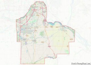
| County: | Dakota County |
| Incorporated: | March 9, 1965 |
| Elevation: | 879 ft (268 m) |
| Total Area: | 30.22 sq mi (78.27 km²) |
| Land Area: | 27.85 sq mi (72.14 km²) |
| Water Area: | 2.37 sq mi (6.13 km²) |
| Total Population: | 35,801 |
| Population Density: | 1,285.31/sq mi (496.25/km²) |
| ZIP code: | 55076, 55077 |
| Area code: | 651 |
| FIPS code: | 2731076 |
| GNISfeature ID: | 0645437 |
| Website: | ighmn.gov |
Online Interactive Map
Click on ![]() to view map in "full screen" mode.
to view map in "full screen" mode.
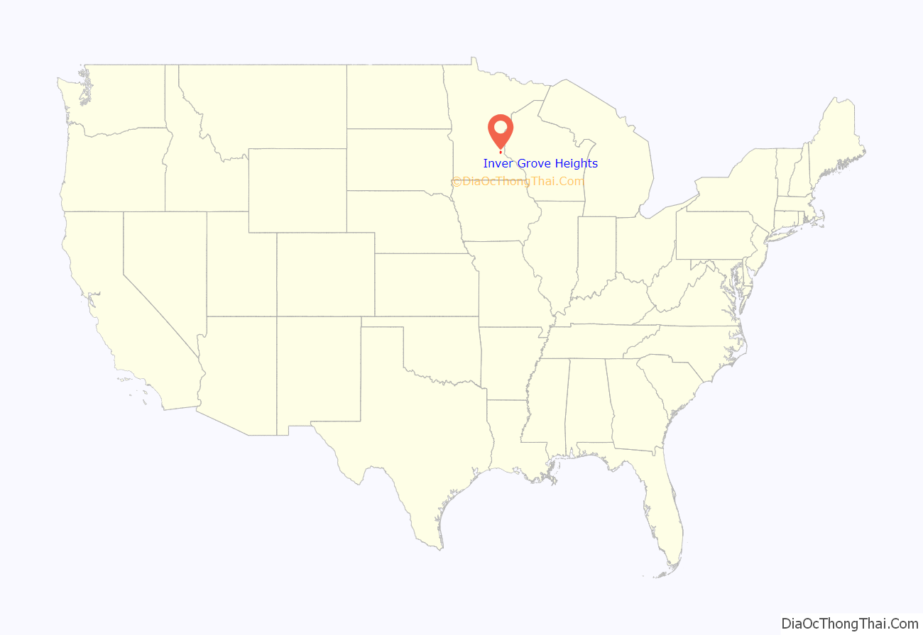
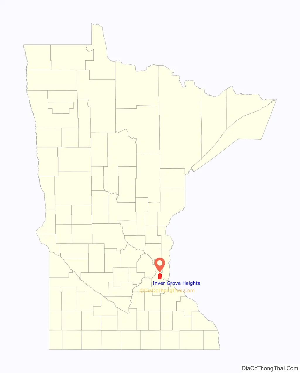
Inver Grove Heights location map. Where is Inver Grove Heights city?
History
After the signing of the Treaty of Traverse des Sioux in 1851, settlers from Ireland and Germany quickly staked claims in the rolling countryside west of the Mississippi River. Those of Irish descent farmed the eastern part of the community, while Germans cleared the wooded land to the west for their farms. French and English settlers built their homes along the river. The township of Inver Grove Heights was named after the Irish fishing village of Inver and the German town of Grove. Records show that 240 farms, four churches, and four school districts were founded by 1880. On March 9, 1965, the village of Inver Grove and Inver Grove Township merged to form Inver Grove Heights.
Historic sites in Inver Grove Heights include:
- Chief Medicine Bottle’s Village: formed in 1836, became Pine Bend village and post office
- Mendota-Wabasha Road: a military road laid out by John S. Potter in 1853. Rich Valley Road now follows the old military road.
- District 7 School: Dakota County’s first public school, established in 1854
- Salem United Methodist Church, organized in 1854
- Old Emanuel Lutheran Church, site of first log church in 1854; services and church school were in German
- Church of St. Patrick: Catholic church parish established on January 9, 1856
- Salem Evangelical Church: First congregation in Minnesota of the Evangelical Association of North America was organized here on March 2, 1857
- Josiah Burwell’s House: where Inver Grove Township was first organized in 1858, at Rich Valley Road and 102nd Street
- Reuben Freeman House of eight gables: built in 1876 to one-up the House of Seven Gables
- Inver Grove Town Hall: first town hall building, built in 1878
- Inver Grove Village railway depot: built in 1886
- Rock Island Swing Bridge: Built in 1894, the double-decker swing bridge spanned the Mississippi River between Inver Grove Heights and St. Paul Park. Closed to rail traffic in 1980 and to road traffic in 1999, it opened as Swing Bridge park in 2011.
- Duke’s Restaurant: built in 1906 as Pierkarski’s butcher shop; restaurant offered food to railway workers; later became Jersey’s Bar
- B-52 Crash Site: on September 16, 1958, a U.S. Air force B-52D bomber crashed while on a Cold War training mission originating from Loring Air Force Base, Limestone, Maine. Seven crewmen gave their lives for their country; marker on Broderick near West Loop Court
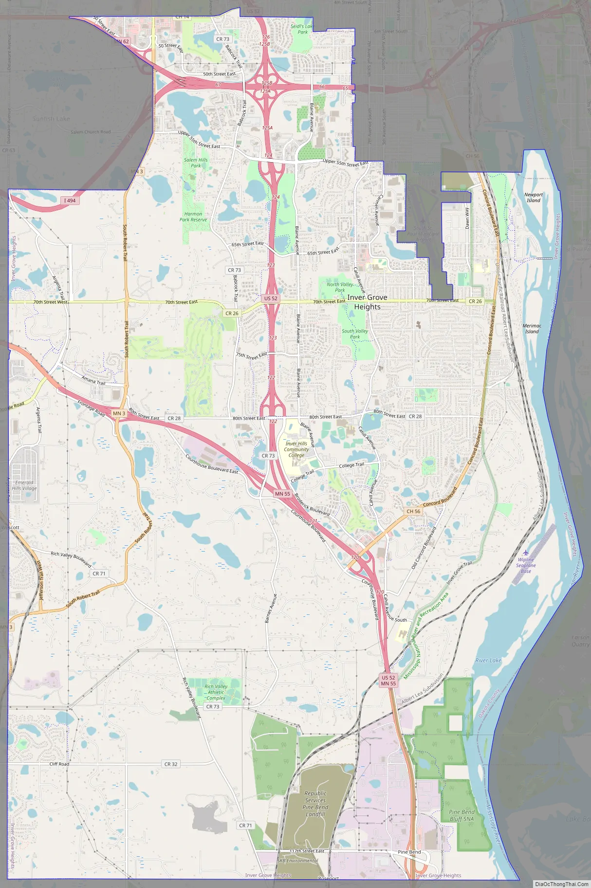
Inver Grove Heights Road Map
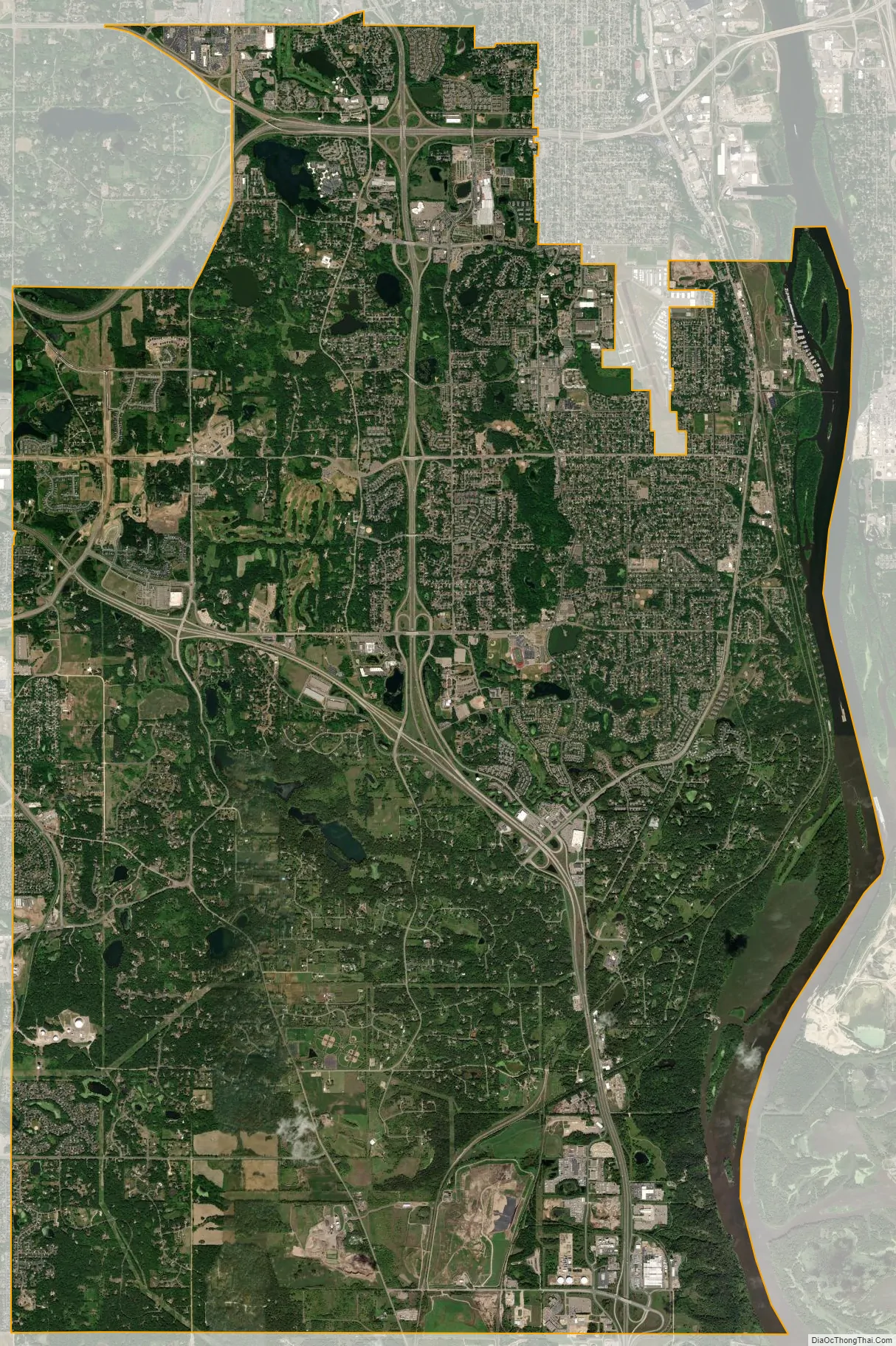
Inver Grove Heights city Satellite Map
Geography
According to the United States Census Bureau, the city has an area of 30.12 square miles (78.01 km), of which 27.76 square miles (71.90 km) is land and 2.36 square miles (6.11 km) is water.
Interstate Highway 494 (a beltway bypass of Minneapolis–Saint Paul), U.S. Highway 52, Minnesota Highway 55, and Minnesota Highway 3 are four of Inver Grove Heights’s main routes. 80th Street East (numbered from downtown Saint Paul) crosses the city in an east–west direction.
In 2022, a meteoric impact crater was identified in the Pine Bend Bluffs Scientific and Natural Area in southern Inver Grove Heights. It has been informally named the “Pine Bend impact” and has been dated to 500 million years ago. It has a diameter of about four kilometers.
See also
Map of Minnesota State and its subdivision:- Aitkin
- Anoka
- Becker
- Beltrami
- Benton
- Big Stone
- Blue Earth
- Brown
- Carlton
- Carver
- Cass
- Chippewa
- Chisago
- Clay
- Clearwater
- Cook
- Cottonwood
- Crow Wing
- Dakota
- Dodge
- Douglas
- Faribault
- Fillmore
- Freeborn
- Goodhue
- Grant
- Hennepin
- Houston
- Hubbard
- Isanti
- Itasca
- Jackson
- Kanabec
- Kandiyohi
- Kittson
- Koochiching
- Lac qui Parle
- Lake
- Lake of the Woods
- Lake Superior
- Le Sueur
- Lincoln
- Lyon
- Mahnomen
- Marshall
- Martin
- McLeod
- Meeker
- Mille Lacs
- Morrison
- Mower
- Murray
- Nicollet
- Nobles
- Norman
- Olmsted
- Otter Tail
- Pennington
- Pine
- Pipestone
- Polk
- Pope
- Ramsey
- Red Lake
- Redwood
- Renville
- Rice
- Rock
- Roseau
- Saint Louis
- Scott
- Sherburne
- Sibley
- Stearns
- Steele
- Stevens
- Swift
- Todd
- Traverse
- Wabasha
- Wadena
- Waseca
- Washington
- Watonwan
- Wilkin
- Winona
- Wright
- Yellow Medicine
- Alabama
- Alaska
- Arizona
- Arkansas
- California
- Colorado
- Connecticut
- Delaware
- District of Columbia
- Florida
- Georgia
- Hawaii
- Idaho
- Illinois
- Indiana
- Iowa
- Kansas
- Kentucky
- Louisiana
- Maine
- Maryland
- Massachusetts
- Michigan
- Minnesota
- Mississippi
- Missouri
- Montana
- Nebraska
- Nevada
- New Hampshire
- New Jersey
- New Mexico
- New York
- North Carolina
- North Dakota
- Ohio
- Oklahoma
- Oregon
- Pennsylvania
- Rhode Island
- South Carolina
- South Dakota
- Tennessee
- Texas
- Utah
- Vermont
- Virginia
- Washington
- West Virginia
- Wisconsin
- Wyoming