Lakeville /ˈleɪkvɪl/ is an exurb of Minneapolis-Saint Paul, and the largest city in Dakota County, Minnesota, United States. It is approximately 20 miles (32 km) south of both downtown Minneapolis and downtown St. Paul along Interstate Highway 35. Starting as a flourishing milling center, its agriculture industry and other major industries are still in operation. Lakeville is one of the fastest-growing cities in the Twin Cities area. The population was 69,490 at the 2020 census. making it Minnesota’s tenth most populous city.
Lakeville first became notable in 1910 when Marion Savage built the Dan Patch Railroad Line to service his Antlers Amusement Park. While many of Lakeville’s workers commute northward to Minneapolis, Saint Paul, and more central suburbs like Bloomington, Lakeville has had major industry since the 1960s—including the Airlake Industrial Park, which is served by Airlake Airport, a regional reliever airport.
| Name: | Lakeville city |
|---|---|
| LSAD Code: | 25 |
| LSAD Description: | city (suffix) |
| State: | Minnesota |
| County: | Dakota County |
| Founded: | 1855 |
| Incorporated: | 1967 |
| Elevation: | 971 ft (296 m) |
| Land Area: | 36.59 sq mi (94.78 km²) |
| Water Area: | 1.76 sq mi (4.55 km²) |
| Population Density: | 1,898.95/sq mi (733.19/km²) |
| ZIP code: | 55044 |
| Area code: | 952 |
| FIPS code: | 2735180 |
| GNISfeature ID: | 0646445 |
| Website: | lakevillemn.gov |
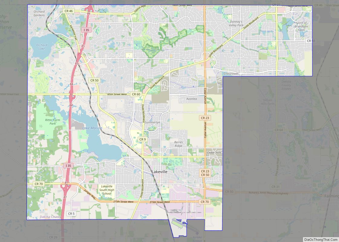
Online Interactive Map
Click on ![]() to view map in "full screen" mode.
to view map in "full screen" mode.
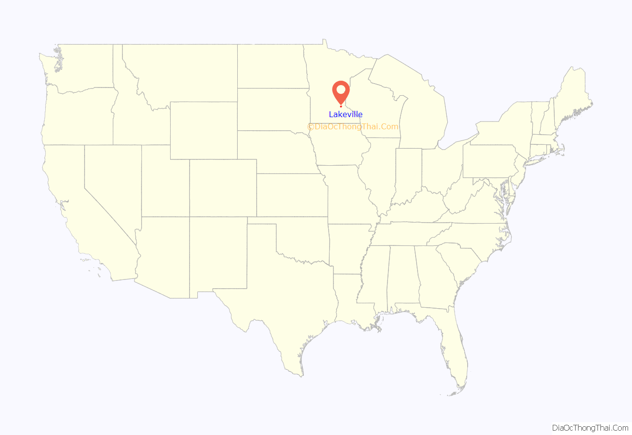
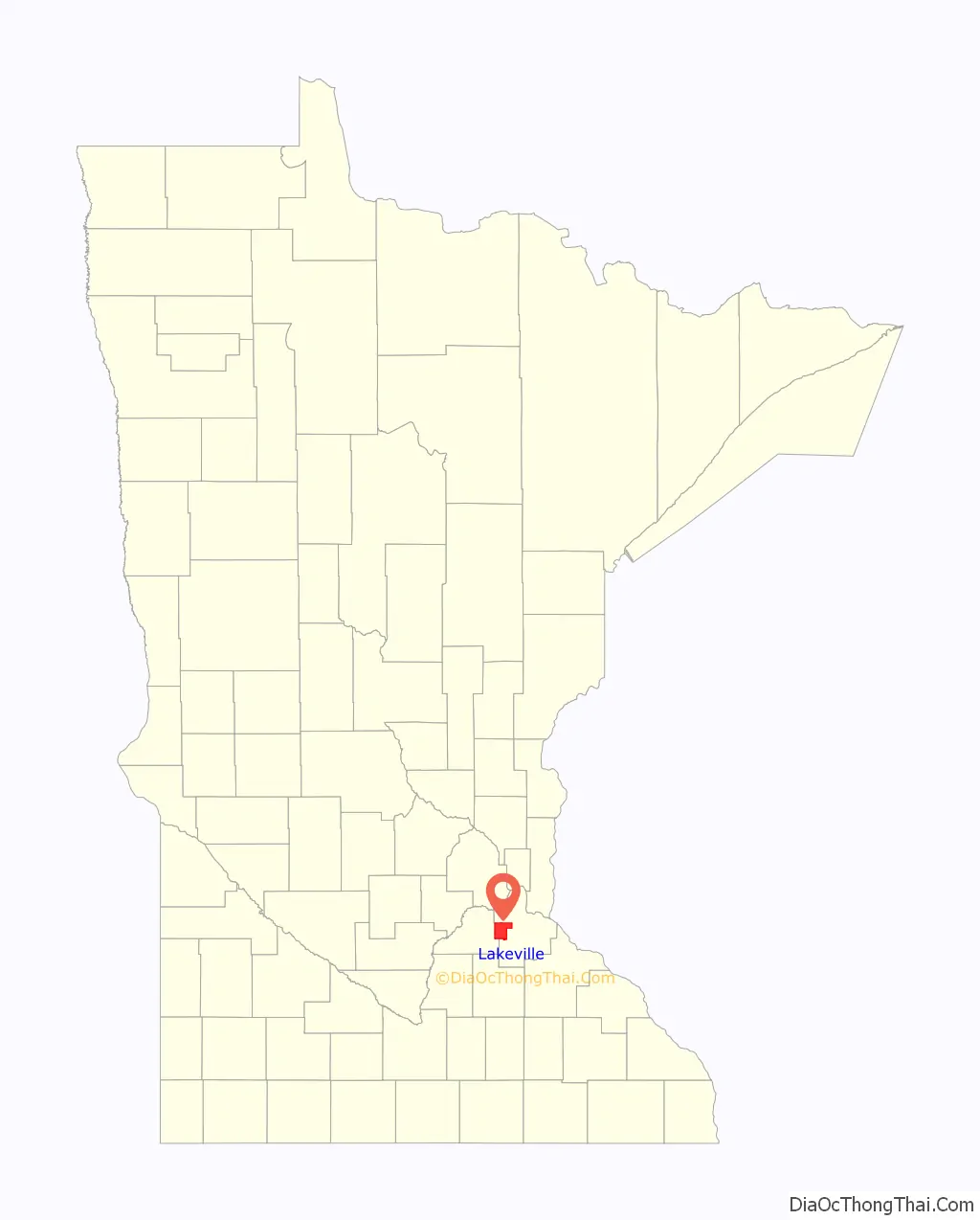
Lakeville location map. Where is Lakeville city?
History
A military road was constructed between Fort Snelling and forts to the south. In 1855, J.J. Brackett, a Saint Paul lumber baron and mail carrier using the road, decided to plant a site halfway between Saint Paul and Saint Peter on a lake he named Prairie Lake. The village was established as Lakeville Township in 1858. Notoriety came when Colonel Marion Savage expanded his entertainment business by constructing Antlers Amusement Park in 1910. Riding on fame from his success with the Dan Patch racing horse and the park’s popularity, the lake was renamed Lake Marion, and the rail line servicing the park named the Dan Patch Railroad Line.
With the mostly rural landscape, early settlers were farmers. A high percentage were Scandinavian. Other ethnic groups included Irish, Scots, and English, each of whom had spread out from Hamilton Landing and Burnsville. In Karen Miller’s diary from 1840 to 1895, Danes reportedly outnumbered Norwegians; travel to Minneapolis was not uncommon for the rural township. Enggren’s Grocery was a downtown staple since 1900 until it closed in 2006.
Lakeville’s development later in the 20th century followed the typical pattern for the outer-ring suburban Twin Cities. The town was officially incorporated as the City of Lakeville in 1967. It remained primarily agricultural, as postwar development did not immediately absorb Lakeville (as well as Interstate 35’s later completion date). In the early 21st century, housing and population increases were due to rising land costs in the metropolitan area, causing Lakeville to become a boomtown.
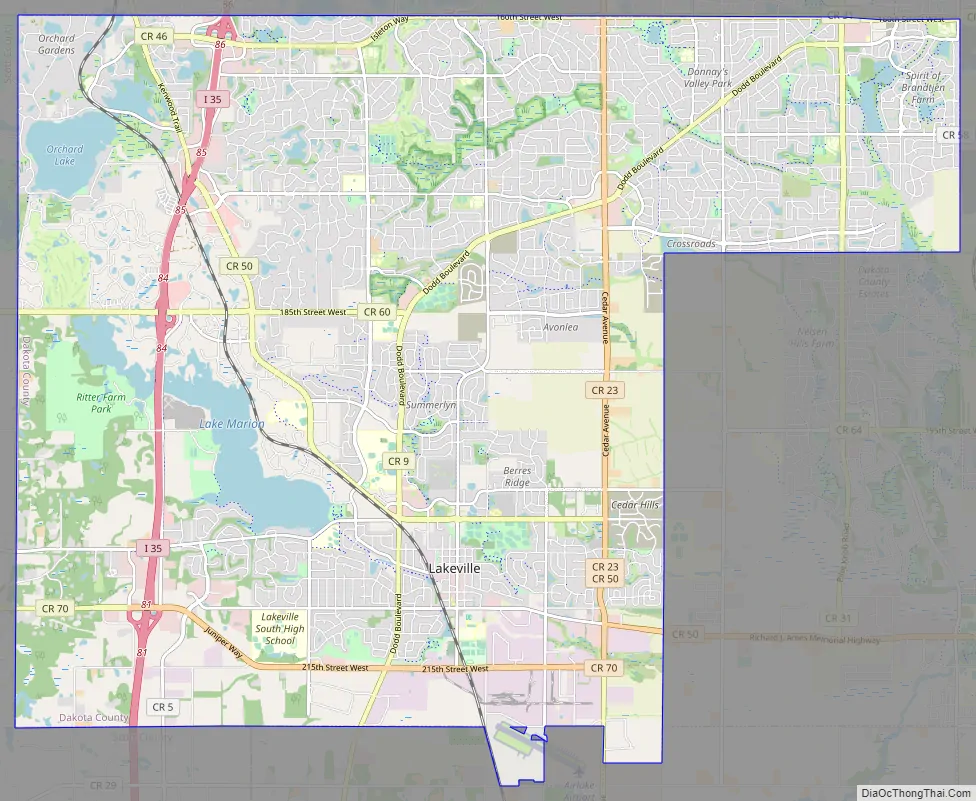
Lakeville Road Map
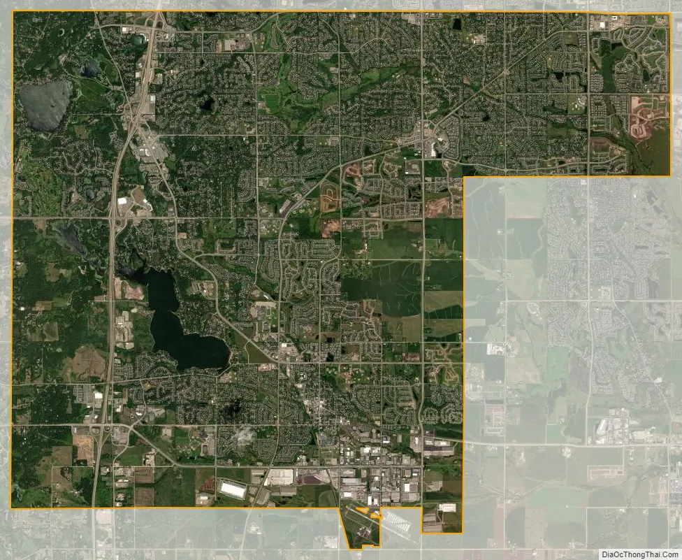
Lakeville city Satellite Map
Geography
According to the United States Census Bureau, the city has a total area of 37.83 square miles (97.98 km), of which 36.06 square miles (93.39 km) is land and 1.77 square miles (4.58 km) is water. Lakeville includes the Argonne Farms post-World War I settlement project which failed in the early 20th century and was redeveloped in the 21st century into typical suburban retail. Since it was a semi-autonomous village within Lakeville Township before the city’s incorporation, it continues to appear today on maps as Argonne.
A branch of the Vermillion River flows through Lakeville. Its headwaters are just west of the city limits in Credit River Township, and it flows eastward across Dakota County until it empties into the Mississippi River at the Wisconsin border. Much of Lakeville drains into the Vermillion River watershed. North Creek, a major tributary of the Vermillion, begins its flow in northern Lakeville and flows eastward to meet the Vermillion near downtown Farmington just east of Lakeville. The Vermillion River has been designated as a trout stream by the Minnesota Department of Natural Resources.
Climate
Lakeville’s climate is classified as warm-summer humid continental with features of a hot-summer humid continental (Köppen Dfa).
See also
Map of Minnesota State and its subdivision:- Aitkin
- Anoka
- Becker
- Beltrami
- Benton
- Big Stone
- Blue Earth
- Brown
- Carlton
- Carver
- Cass
- Chippewa
- Chisago
- Clay
- Clearwater
- Cook
- Cottonwood
- Crow Wing
- Dakota
- Dodge
- Douglas
- Faribault
- Fillmore
- Freeborn
- Goodhue
- Grant
- Hennepin
- Houston
- Hubbard
- Isanti
- Itasca
- Jackson
- Kanabec
- Kandiyohi
- Kittson
- Koochiching
- Lac qui Parle
- Lake
- Lake of the Woods
- Lake Superior
- Le Sueur
- Lincoln
- Lyon
- Mahnomen
- Marshall
- Martin
- McLeod
- Meeker
- Mille Lacs
- Morrison
- Mower
- Murray
- Nicollet
- Nobles
- Norman
- Olmsted
- Otter Tail
- Pennington
- Pine
- Pipestone
- Polk
- Pope
- Ramsey
- Red Lake
- Redwood
- Renville
- Rice
- Rock
- Roseau
- Saint Louis
- Scott
- Sherburne
- Sibley
- Stearns
- Steele
- Stevens
- Swift
- Todd
- Traverse
- Wabasha
- Wadena
- Waseca
- Washington
- Watonwan
- Wilkin
- Winona
- Wright
- Yellow Medicine
- Alabama
- Alaska
- Arizona
- Arkansas
- California
- Colorado
- Connecticut
- Delaware
- District of Columbia
- Florida
- Georgia
- Hawaii
- Idaho
- Illinois
- Indiana
- Iowa
- Kansas
- Kentucky
- Louisiana
- Maine
- Maryland
- Massachusetts
- Michigan
- Minnesota
- Mississippi
- Missouri
- Montana
- Nebraska
- Nevada
- New Hampshire
- New Jersey
- New Mexico
- New York
- North Carolina
- North Dakota
- Ohio
- Oklahoma
- Oregon
- Pennsylvania
- Rhode Island
- South Carolina
- South Dakota
- Tennessee
- Texas
- Utah
- Vermont
- Virginia
- Washington
- West Virginia
- Wisconsin
- Wyoming