Coates is a town in the U.S. state of Minnesota located west of the Upper Mississippi River on the exurban fringe in central Dakota County.
U.S. Highway 52 connects north to the city of Saint Paul, while County Road 46 draws east–west to nearby suburban cities. The population was 161 at the 2010 census. It is named for Civil War Captain Henry C. Coates who served in the 1st Minnesota Volunteer Infantry.
Major employers are in trucking, moving and recycling services. The city is popular among people from the Twin Cities for the House of Coates, a burger restaurant opened in 1962. St. Agatha’s Catholic Church serves as city hall.
Originally a rural post office hub in the 1900s, the U.S. Postal Service now designates addresses as part of the larger nearby city of Rosemount. The city of Coates was officially incorporated in 1953 at the northwest corner of Vermillion Township.
| Name: | Coates city |
|---|---|
| LSAD Code: | 25 |
| LSAD Description: | city (suffix) |
| State: | Minnesota |
| County: | Dakota County |
| Elevation: | 912 ft (278 m) |
| Total Area: | 1.50 sq mi (3.88 km²) |
| Land Area: | 1.50 sq mi (3.88 km²) |
| Water Area: | 0.00 sq mi (0.00 km²) |
| Total Population: | 147 |
| Population Density: | 98.13/sq mi (37.89/km²) |
| Area code: | 651 |
| FIPS code: | 2712376 |
| GNISfeature ID: | 0641366 |
Online Interactive Map
Click on ![]() to view map in "full screen" mode.
to view map in "full screen" mode.
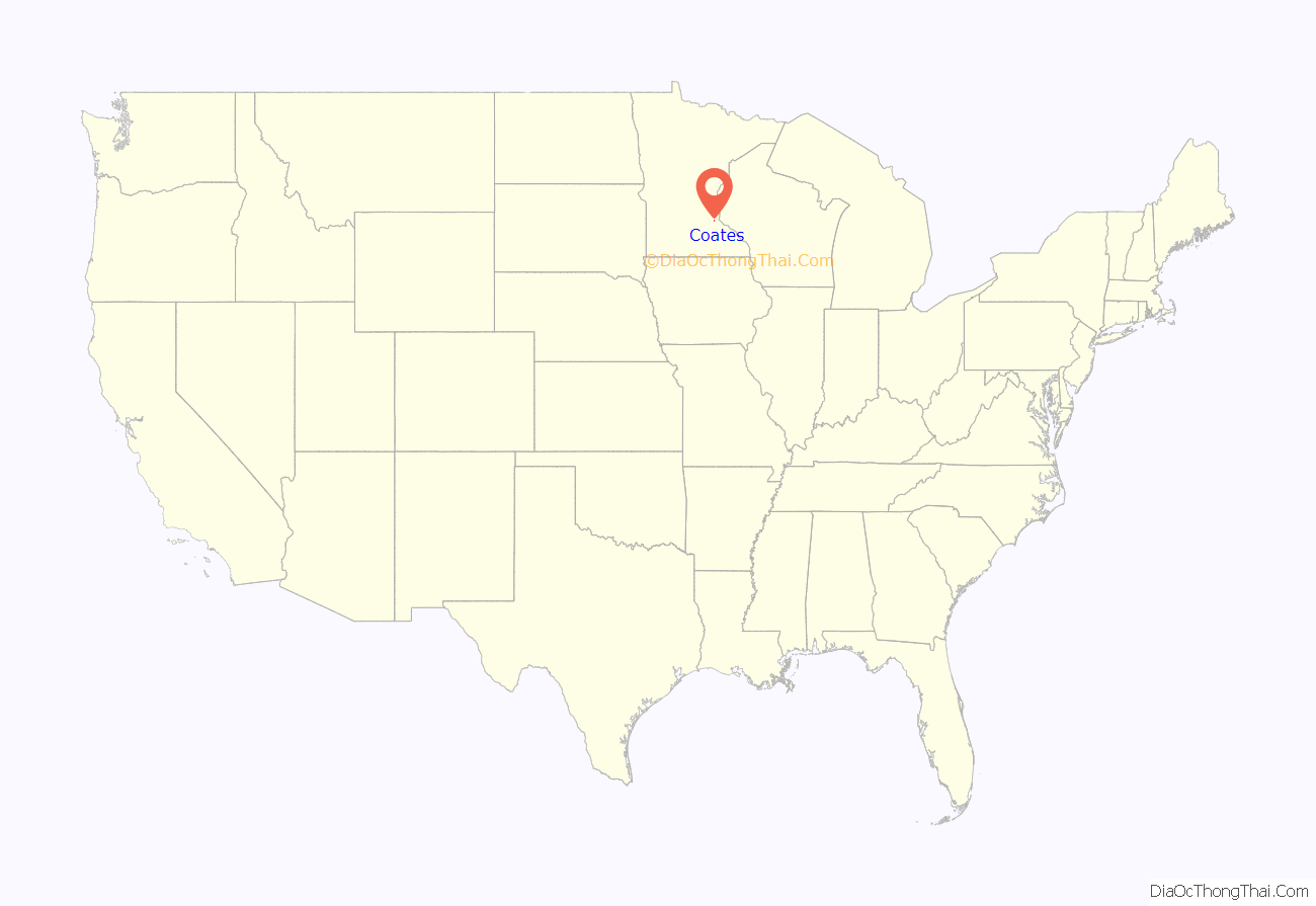
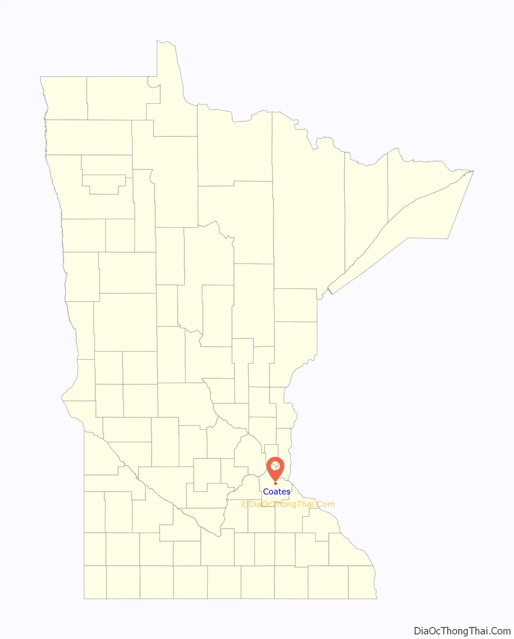
Coates location map. Where is Coates city?
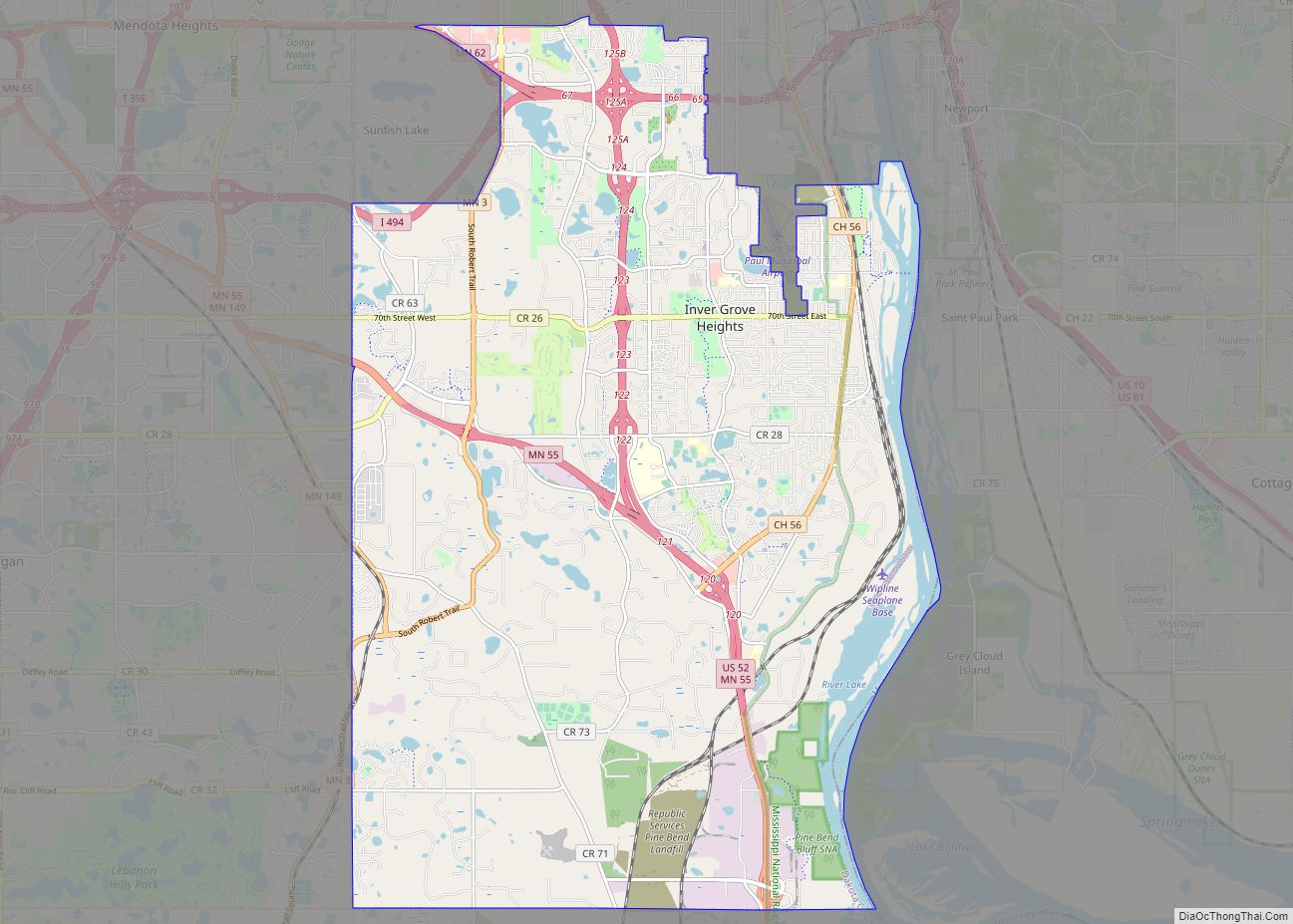
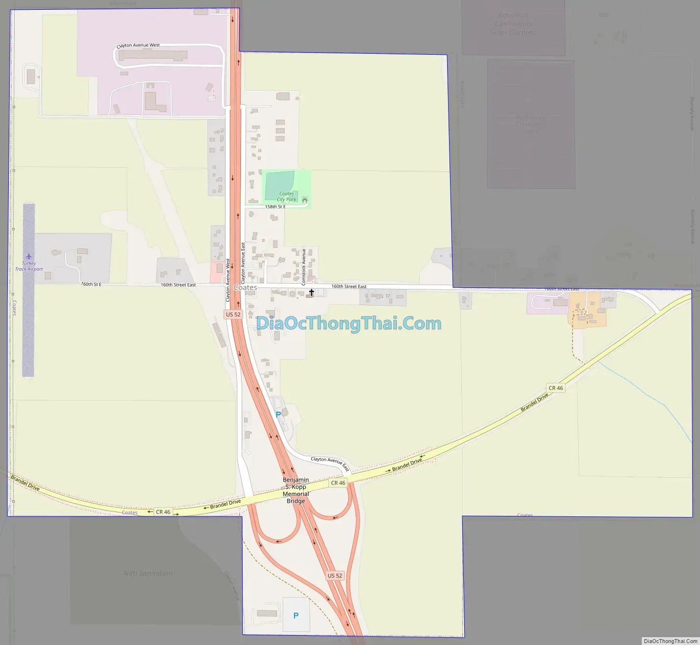
Coates Road Map
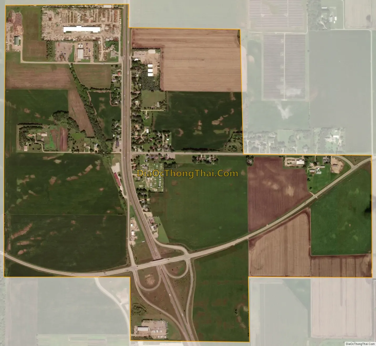
Coates city Satellite Map
Geography
According to the United States Census Bureau, the city has a total area of 1.41 square miles (3.65 km), all land.
See also
Map of Minnesota State and its subdivision:- Aitkin
- Anoka
- Becker
- Beltrami
- Benton
- Big Stone
- Blue Earth
- Brown
- Carlton
- Carver
- Cass
- Chippewa
- Chisago
- Clay
- Clearwater
- Cook
- Cottonwood
- Crow Wing
- Dakota
- Dodge
- Douglas
- Faribault
- Fillmore
- Freeborn
- Goodhue
- Grant
- Hennepin
- Houston
- Hubbard
- Isanti
- Itasca
- Jackson
- Kanabec
- Kandiyohi
- Kittson
- Koochiching
- Lac qui Parle
- Lake
- Lake of the Woods
- Lake Superior
- Le Sueur
- Lincoln
- Lyon
- Mahnomen
- Marshall
- Martin
- McLeod
- Meeker
- Mille Lacs
- Morrison
- Mower
- Murray
- Nicollet
- Nobles
- Norman
- Olmsted
- Otter Tail
- Pennington
- Pine
- Pipestone
- Polk
- Pope
- Ramsey
- Red Lake
- Redwood
- Renville
- Rice
- Rock
- Roseau
- Saint Louis
- Scott
- Sherburne
- Sibley
- Stearns
- Steele
- Stevens
- Swift
- Todd
- Traverse
- Wabasha
- Wadena
- Waseca
- Washington
- Watonwan
- Wilkin
- Winona
- Wright
- Yellow Medicine
- Alabama
- Alaska
- Arizona
- Arkansas
- California
- Colorado
- Connecticut
- Delaware
- District of Columbia
- Florida
- Georgia
- Hawaii
- Idaho
- Illinois
- Indiana
- Iowa
- Kansas
- Kentucky
- Louisiana
- Maine
- Maryland
- Massachusetts
- Michigan
- Minnesota
- Mississippi
- Missouri
- Montana
- Nebraska
- Nevada
- New Hampshire
- New Jersey
- New Mexico
- New York
- North Carolina
- North Dakota
- Ohio
- Oklahoma
- Oregon
- Pennsylvania
- Rhode Island
- South Carolina
- South Dakota
- Tennessee
- Texas
- Utah
- Vermont
- Virginia
- Washington
- West Virginia
- Wisconsin
- Wyoming