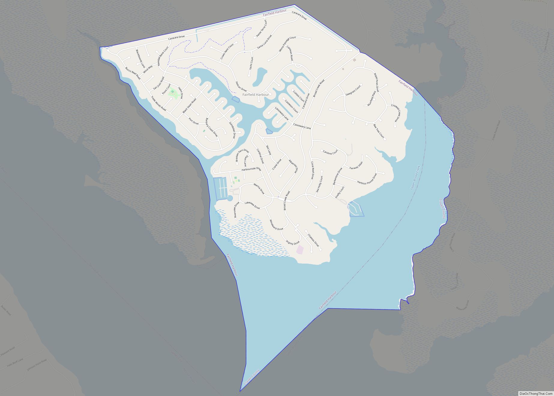
Fairfield Harbour is an unincorporated community and census-designated place (CDP) in Craven County, North Carolina, United States. The population was 2,952 at the 2010 census, up from 1,983 in 2000. It is part of the New Bern, North Carolina Metropolitan Statistical Area.
| Name: | Fairfield Harbour CDP |
|---|---|
| LSAD Code: | 57 |
| LSAD Description: | CDP (suffix) |
| State: | North Carolina |
| County: | Craven County |
| Elevation: | 7 ft (2 m) |
| Total Area: | 4.67 sq mi (12.08 km²) |
| Land Area: | 2.88 sq mi (7.46 km²) |
| Water Area: | 1.79 sq mi (4.63 km²) |
| Total Population: | 2,767 |
| Population Density: | 961.43/sq mi (371.15/km²) |
| FIPS code: | 3722305 |
| GNISfeature ID: | 1024777 |
Online Interactive Map
Click on ![]() to view map in "full screen" mode.
to view map in "full screen" mode.
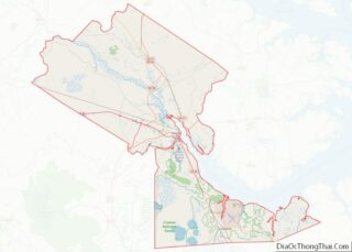
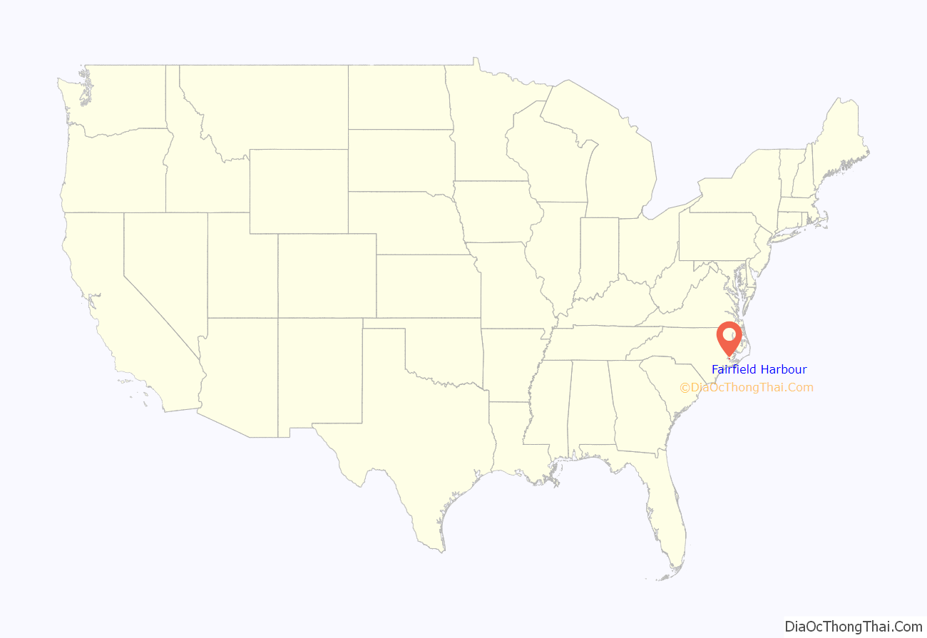
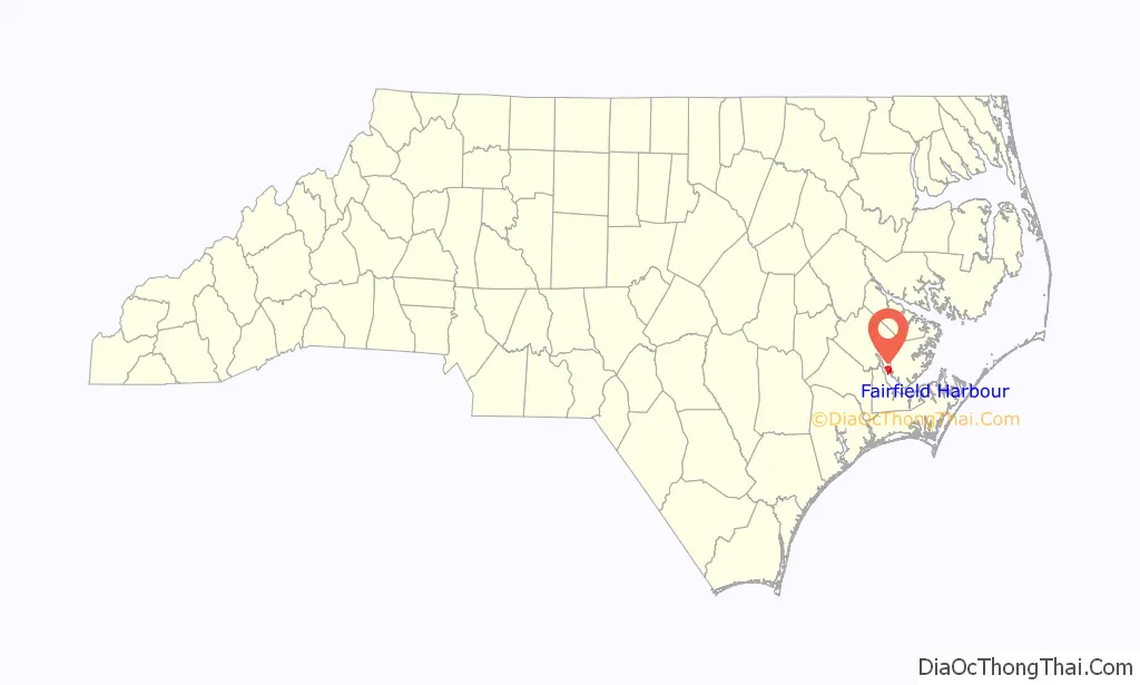
Fairfield Harbour location map. Where is Fairfield Harbour CDP?
Fairfield Harbour Road Map
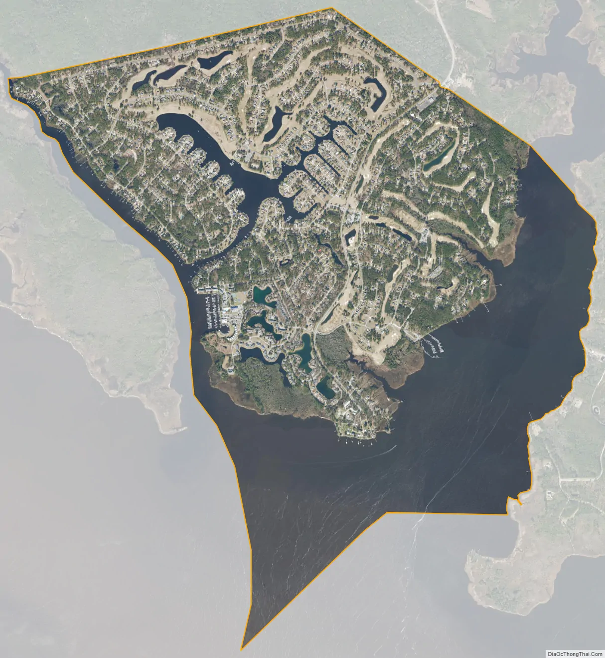
Fairfield Harbour city Satellite Map
Geography
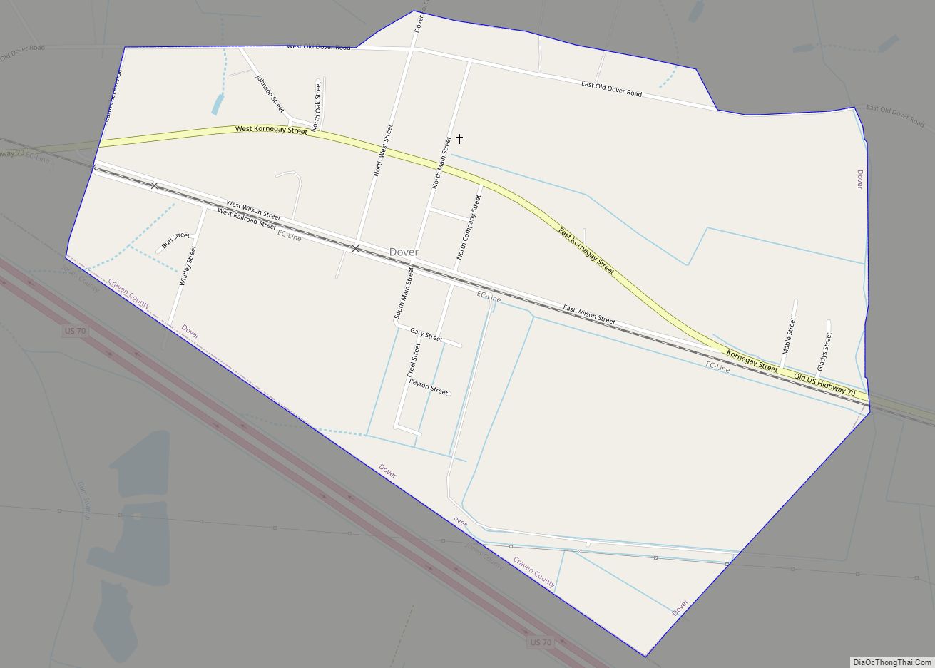
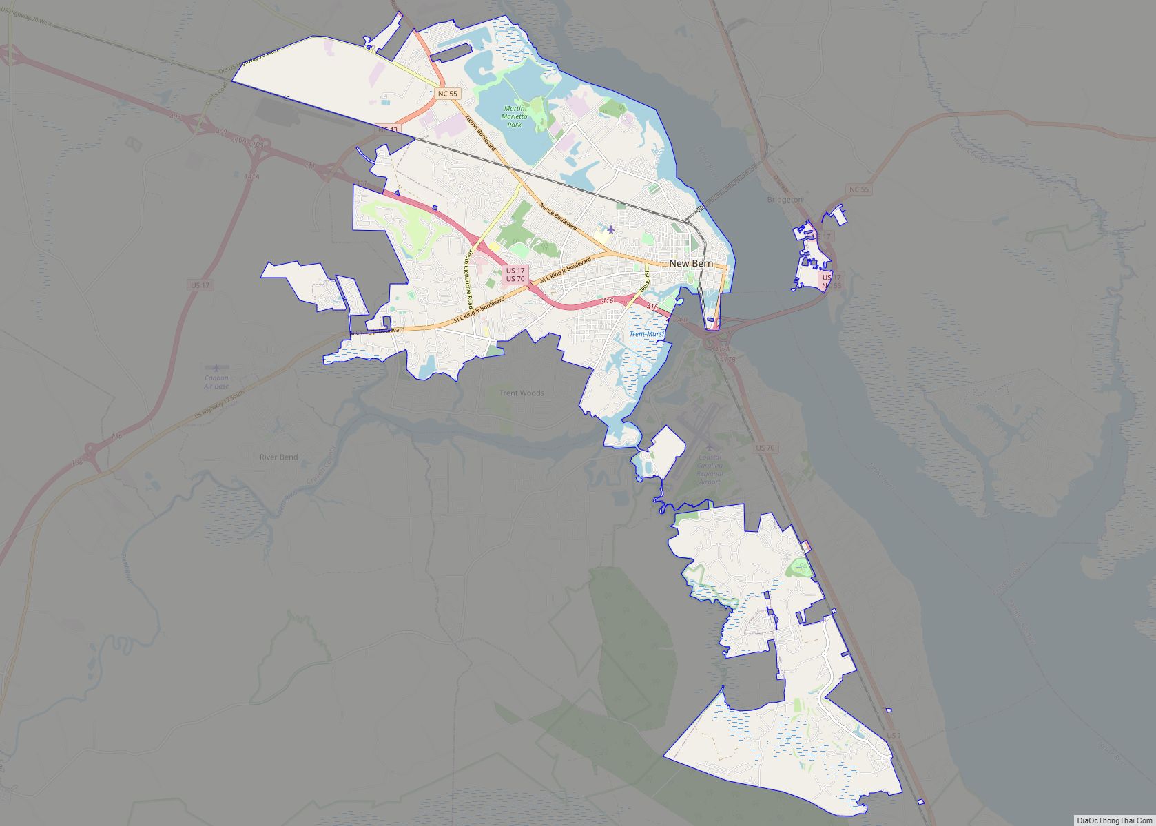
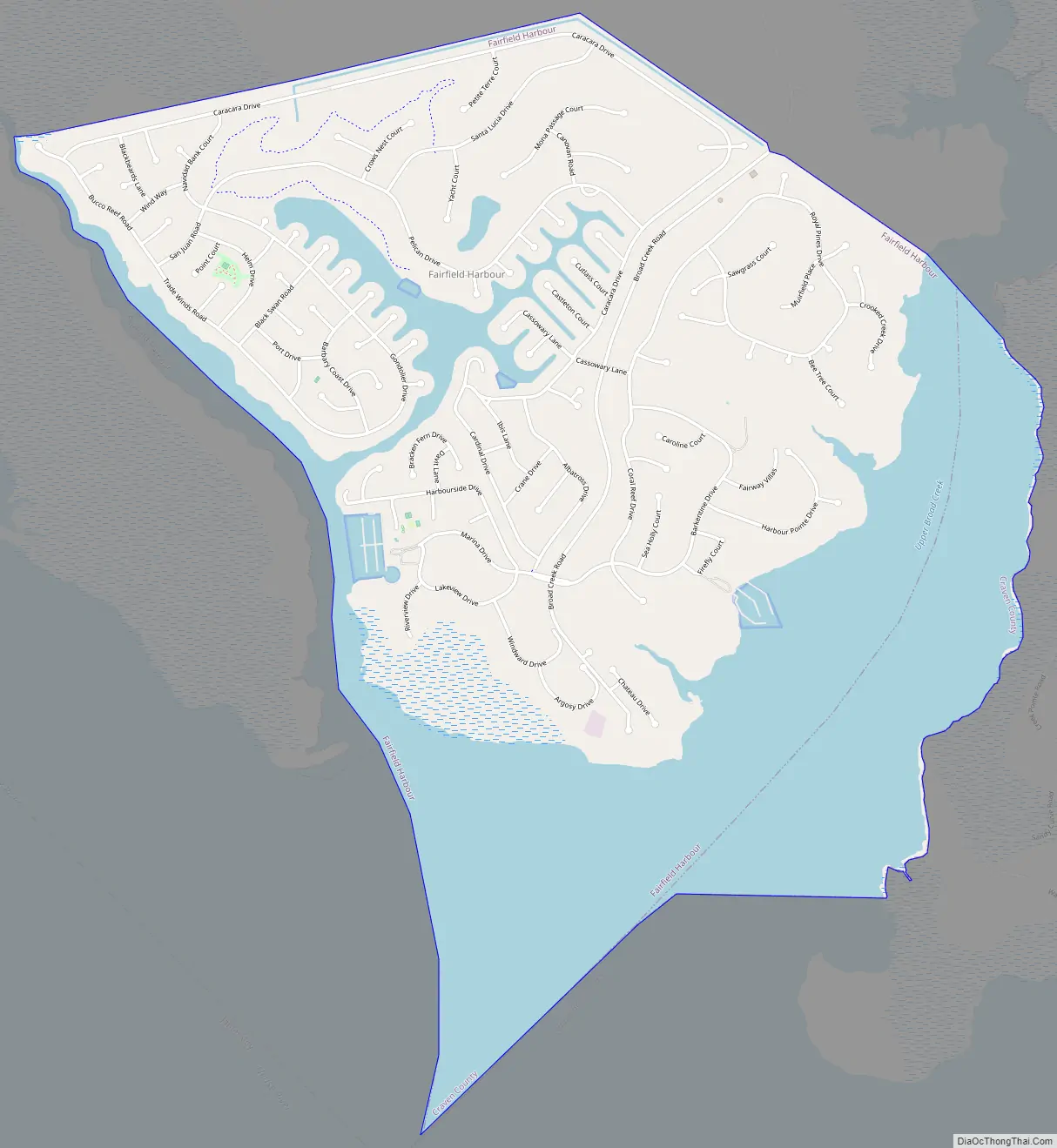
Fairfield Harbour is located in east-central Craven County at 35°4′27″N 76°57′39″W / 35.07417°N 76.96083°W / 35.07417; -76.96083 (35.074045, -76.960898), in reclaimed marshland bordered by the Neuse River to the southwest and Upper Broad Creek to the east. Via Broad Creek Road and U.S. Route 17, it is 11 miles (18 km) north and west to the center of New Bern, the county seat.
According to the United States Census Bureau, Fairfield Harbour has a total area of 4.1 square miles (10.7 km), of which 2.9 square miles (7.5 km) is land and 1.2 square miles (3.2 km), or 30.22%, is water.
See also
Map of North Carolina State and its subdivision:- Alamance
- Alexander
- Alleghany
- Anson
- Ashe
- Avery
- Beaufort
- Bertie
- Bladen
- Brunswick
- Buncombe
- Burke
- Cabarrus
- Caldwell
- Camden
- Carteret
- Caswell
- Catawba
- Chatham
- Cherokee
- Chowan
- Clay
- Cleveland
- Columbus
- Craven
- Cumberland
- Currituck
- Dare
- Davidson
- Davie
- Duplin
- Durham
- Edgecombe
- Forsyth
- Franklin
- Gaston
- Gates
- Graham
- Granville
- Greene
- Guilford
- Halifax
- Harnett
- Haywood
- Henderson
- Hertford
- Hoke
- Hyde
- Iredell
- Jackson
- Johnston
- Jones
- Lee
- Lenoir
- Lincoln
- Macon
- Madison
- Martin
- McDowell
- Mecklenburg
- Mitchell
- Montgomery
- Moore
- Nash
- New Hanover
- Northampton
- Onslow
- Orange
- Pamlico
- Pasquotank
- Pender
- Perquimans
- Person
- Pitt
- Polk
- Randolph
- Richmond
- Robeson
- Rockingham
- Rowan
- Rutherford
- Sampson
- Scotland
- Stanly
- Stokes
- Surry
- Swain
- Transylvania
- Tyrrell
- Union
- Vance
- Wake
- Warren
- Washington
- Watauga
- Wayne
- Wilkes
- Wilson
- Yadkin
- Yancey
- Alabama
- Alaska
- Arizona
- Arkansas
- California
- Colorado
- Connecticut
- Delaware
- District of Columbia
- Florida
- Georgia
- Hawaii
- Idaho
- Illinois
- Indiana
- Iowa
- Kansas
- Kentucky
- Louisiana
- Maine
- Maryland
- Massachusetts
- Michigan
- Minnesota
- Mississippi
- Missouri
- Montana
- Nebraska
- Nevada
- New Hampshire
- New Jersey
- New Mexico
- New York
- North Carolina
- North Dakota
- Ohio
- Oklahoma
- Oregon
- Pennsylvania
- Rhode Island
- South Carolina
- South Dakota
- Tennessee
- Texas
- Utah
- Vermont
- Virginia
- Washington
- West Virginia
- Wisconsin
- Wyoming