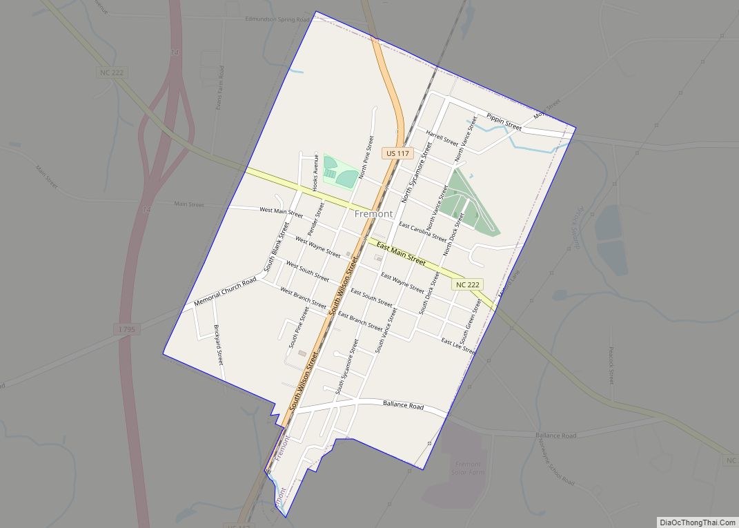
Fremont is a town in Wayne County, North Carolina, United States. The population was 1,255 at the 2010 census. It is included in the Goldsboro, North Carolina Metropolitan Statistical Area.
| Name: | Fremont town |
|---|---|
| LSAD Code: | 43 |
| LSAD Description: | town (suffix) |
| State: | North Carolina |
| County: | Wayne County |
| Elevation: | 148 ft (45 m) |
| Total Area: | 1.36 sq mi (3.51 km²) |
| Land Area: | 1.36 sq mi (3.51 km²) |
| Water Area: | 0.00 sq mi (0.00 km²) |
| Total Population: | 1,196 |
| Population Density: | 882.01/sq mi (340.49/km²) |
| ZIP code: | 27830 |
| Area code: | 919 |
| FIPS code: | 3724900 |
| GNISfeature ID: | 0985403 |
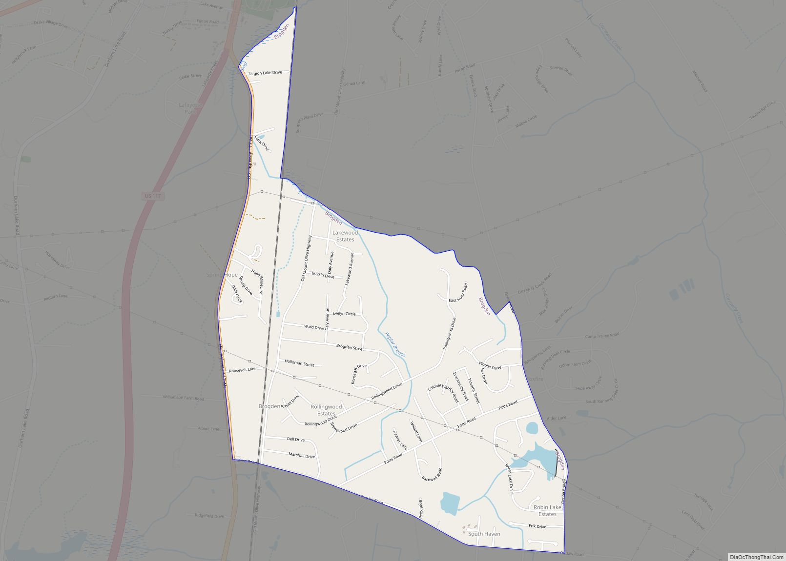
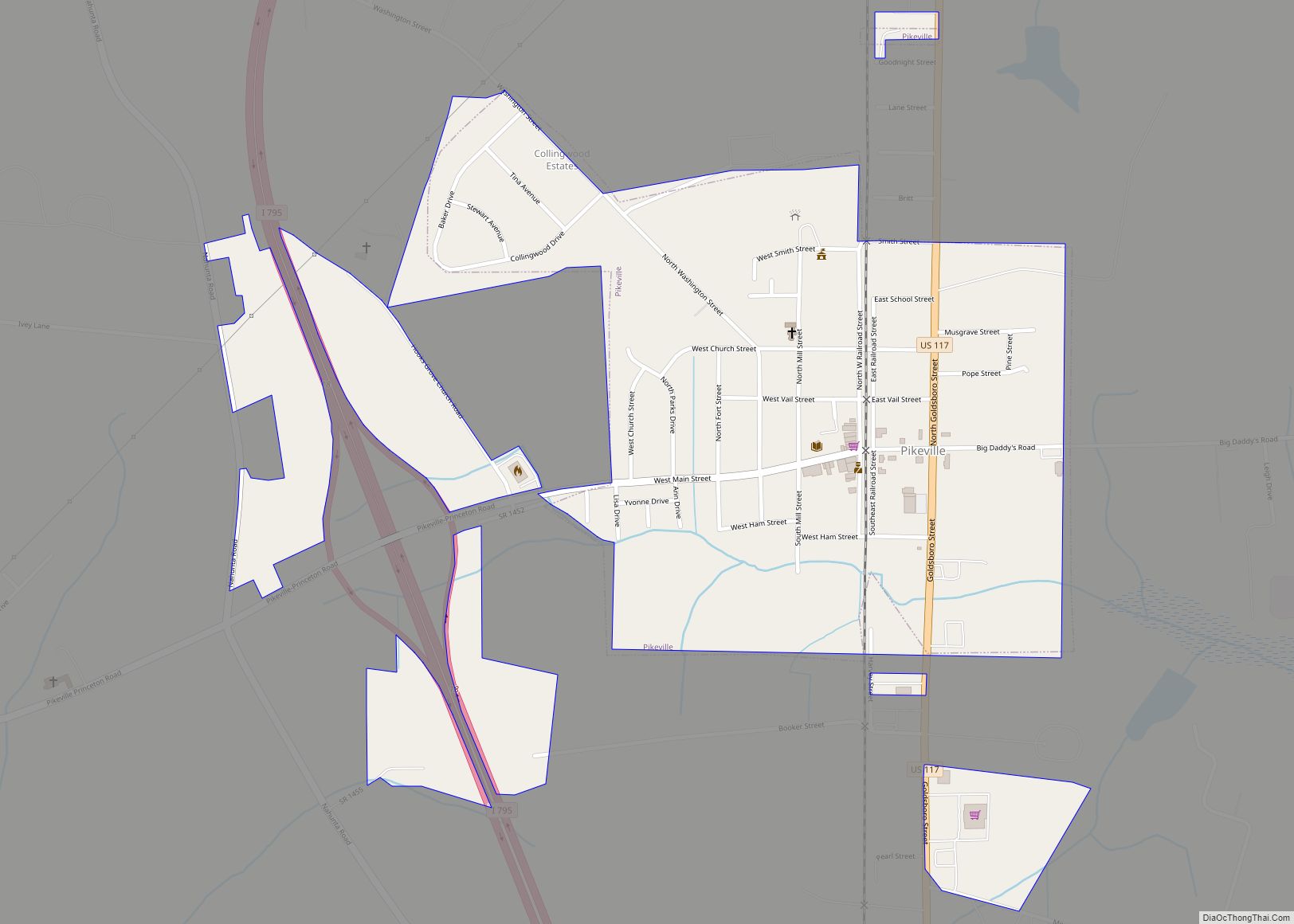
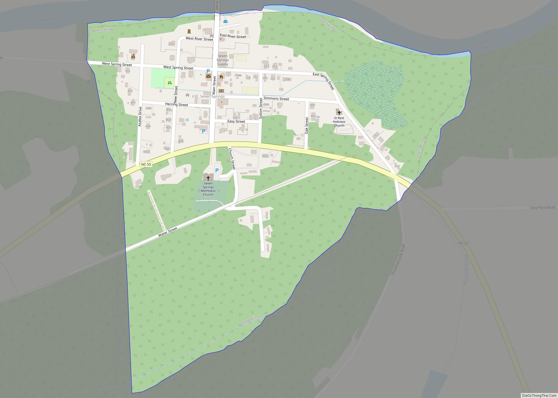
Online Interactive Map
Click on ![]() to view map in "full screen" mode.
to view map in "full screen" mode.
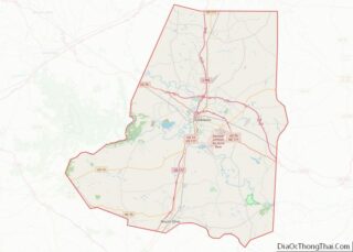
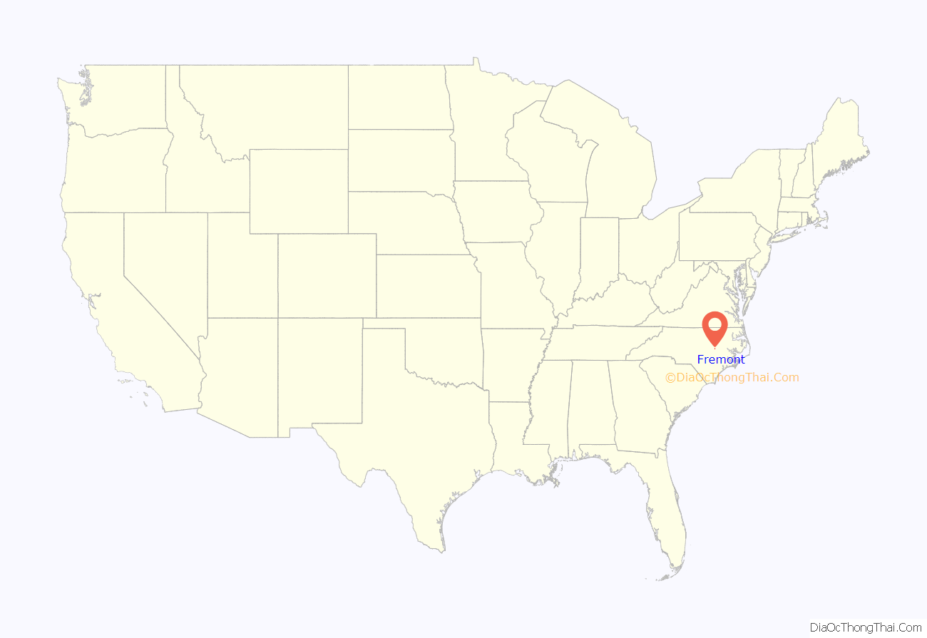
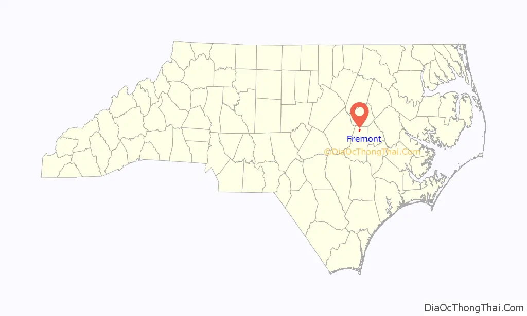
Fremont location map. Where is Fremont town?
History
Originally named Nahunta, it was renamed Fremont in 1869 after Col. Sewall Lawrence Fremont, a former U.S. Army artilleryman and chief engineer of the Wilmington and Wheldon Railroad from 1854 to 1871.
The Aycock Birthplace, Barnes-Hooks Farm, and Dred and Ellen Yelverton House are listed on the National Register of Historic Places.
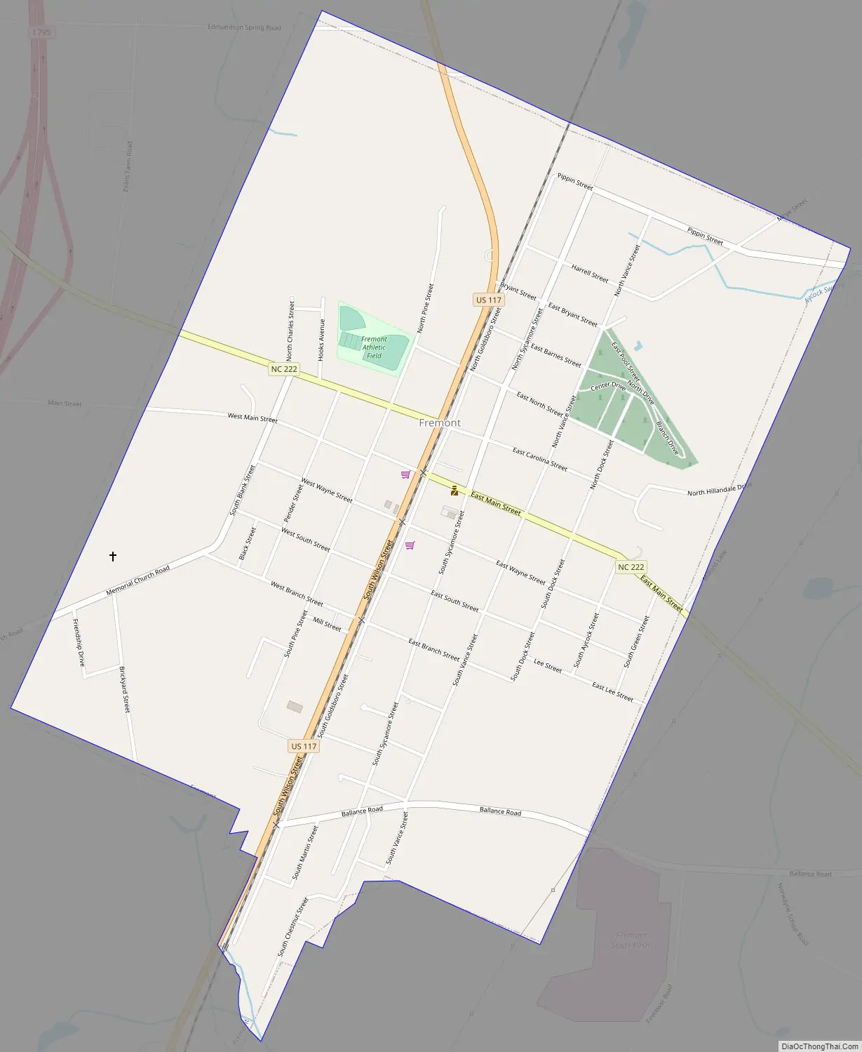
Fremont Road Map
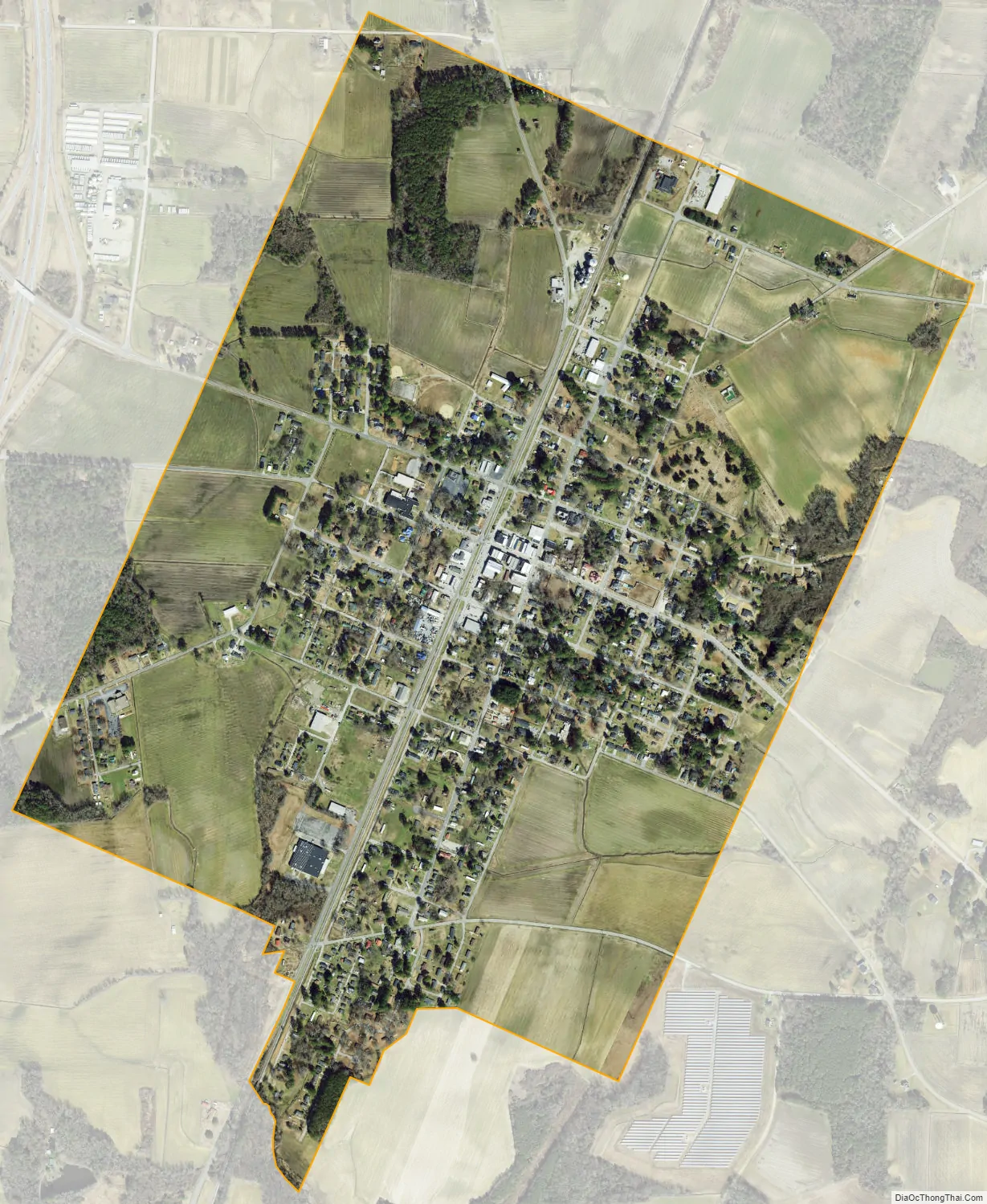
Fremont city Satellite Map
Geography
Fremont is located at 35°32′35″N 77°58′29″W / 35.54306°N 77.97472°W / 35.54306; -77.97472 (35.543071, -77.974792).
According to the United States Census Bureau, the town has a total area of 1.4 square miles (3.6 km), all of it land.
See also
Map of North Carolina State and its subdivision:- Alamance
- Alexander
- Alleghany
- Anson
- Ashe
- Avery
- Beaufort
- Bertie
- Bladen
- Brunswick
- Buncombe
- Burke
- Cabarrus
- Caldwell
- Camden
- Carteret
- Caswell
- Catawba
- Chatham
- Cherokee
- Chowan
- Clay
- Cleveland
- Columbus
- Craven
- Cumberland
- Currituck
- Dare
- Davidson
- Davie
- Duplin
- Durham
- Edgecombe
- Forsyth
- Franklin
- Gaston
- Gates
- Graham
- Granville
- Greene
- Guilford
- Halifax
- Harnett
- Haywood
- Henderson
- Hertford
- Hoke
- Hyde
- Iredell
- Jackson
- Johnston
- Jones
- Lee
- Lenoir
- Lincoln
- Macon
- Madison
- Martin
- McDowell
- Mecklenburg
- Mitchell
- Montgomery
- Moore
- Nash
- New Hanover
- Northampton
- Onslow
- Orange
- Pamlico
- Pasquotank
- Pender
- Perquimans
- Person
- Pitt
- Polk
- Randolph
- Richmond
- Robeson
- Rockingham
- Rowan
- Rutherford
- Sampson
- Scotland
- Stanly
- Stokes
- Surry
- Swain
- Transylvania
- Tyrrell
- Union
- Vance
- Wake
- Warren
- Washington
- Watauga
- Wayne
- Wilkes
- Wilson
- Yadkin
- Yancey
- Alabama
- Alaska
- Arizona
- Arkansas
- California
- Colorado
- Connecticut
- Delaware
- District of Columbia
- Florida
- Georgia
- Hawaii
- Idaho
- Illinois
- Indiana
- Iowa
- Kansas
- Kentucky
- Louisiana
- Maine
- Maryland
- Massachusetts
- Michigan
- Minnesota
- Mississippi
- Missouri
- Montana
- Nebraska
- Nevada
- New Hampshire
- New Jersey
- New Mexico
- New York
- North Carolina
- North Dakota
- Ohio
- Oklahoma
- Oregon
- Pennsylvania
- Rhode Island
- South Carolina
- South Dakota
- Tennessee
- Texas
- Utah
- Vermont
- Virginia
- Washington
- West Virginia
- Wisconsin
- Wyoming