La Grange is a town in Lenoir County, North Carolina, United States. The population was 2,873 based on the 2010 census. La Grange is located in North Carolina’s Inner Banks region.
| Name: | La Grange town |
|---|---|
| LSAD Code: | 43 |
| LSAD Description: | town (suffix) |
| State: | North Carolina |
| County: | Lenoir County |
| Elevation: | 108 ft (33 m) |
| Total Area: | 2.31 sq mi (5.99 km²) |
| Land Area: | 2.30 sq mi (5.97 km²) |
| Water Area: | 0.01 sq mi (0.02 km²) |
| Total Population: | 2,595 |
| Population Density: | 1,126.79/sq mi (434.97/km²) |
| ZIP code: | 28551 |
| Area code: | 252 |
| FIPS code: | 3736400 |
| GNISfeature ID: | 0988067 |
| Website: | www.lagrangenc.com |
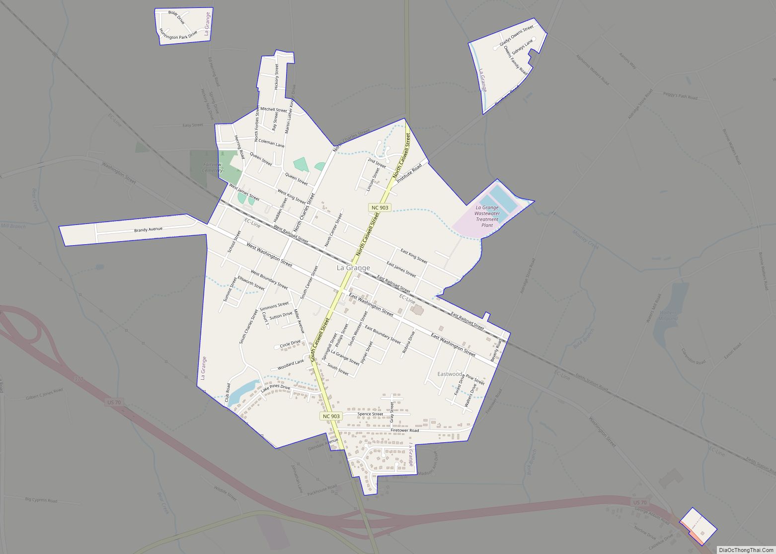
Online Interactive Map
Click on ![]() to view map in "full screen" mode.
to view map in "full screen" mode.
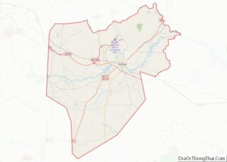
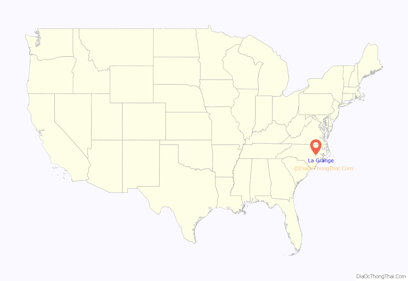
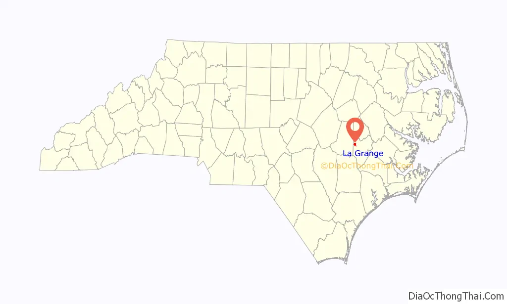
La Grange location map. Where is La Grange town?
History
La Grange was named for the French estate of the Marquis de Lafayette, the Château de la Grange-Bléneau. The Herring House, La Grange Presbyterian Church, and La Grange Historic District are listed on the National Register of Historic Places.
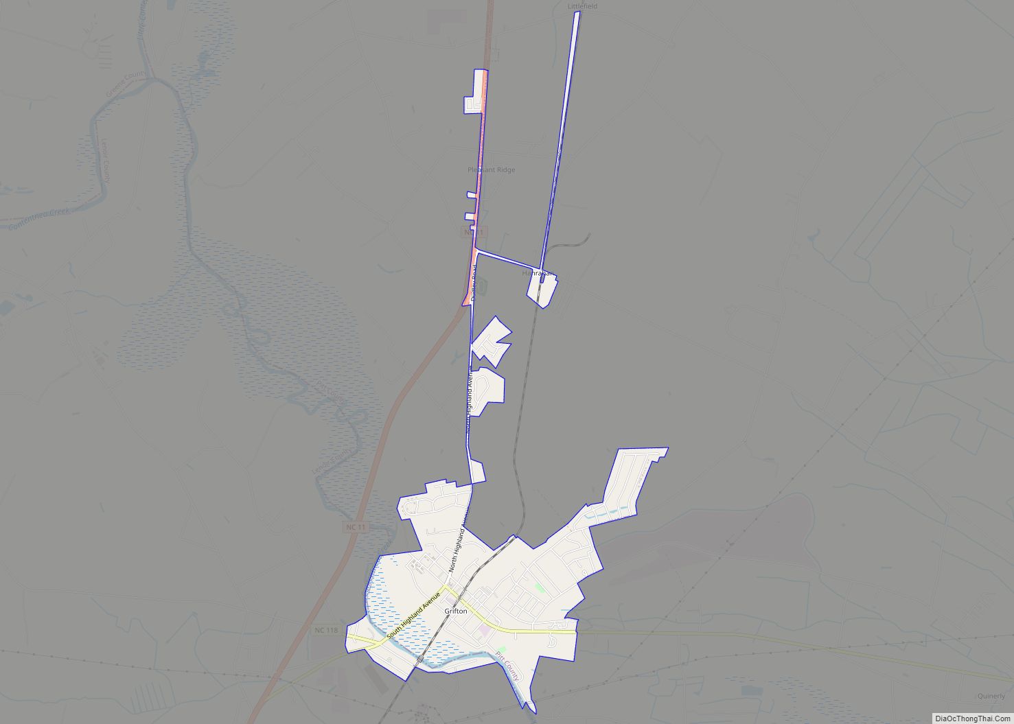
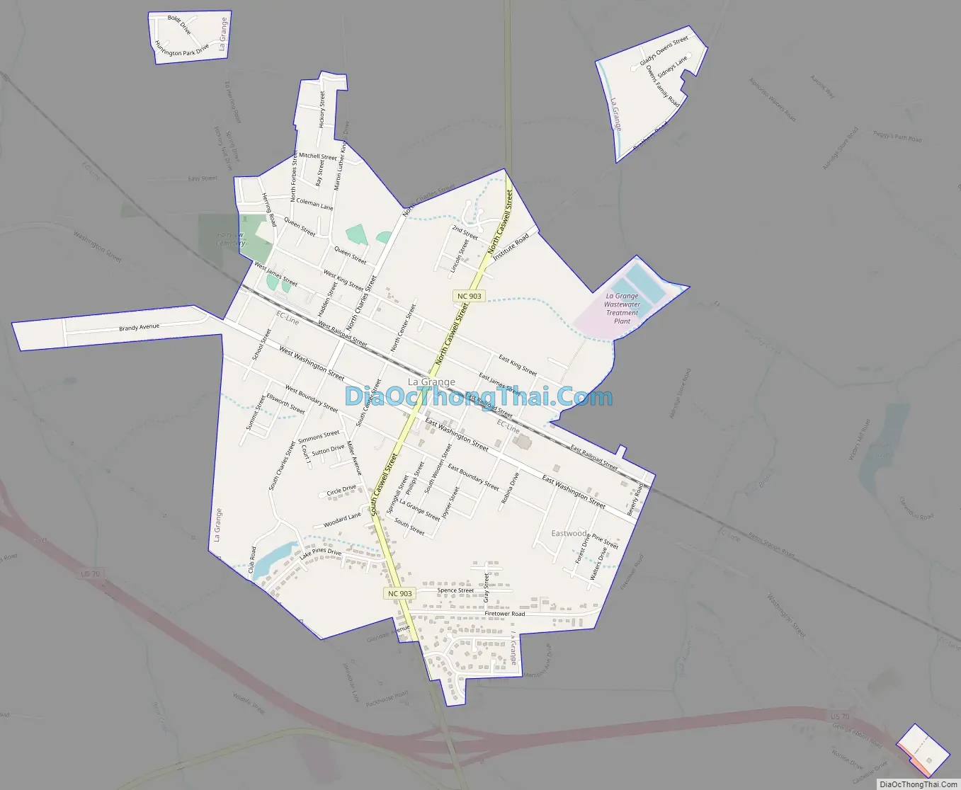
La Grange Road Map
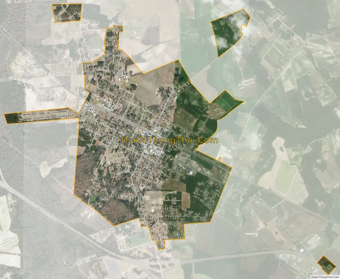
La Grange city Satellite Map
Geography
La Grange is located at 35°18′31″N 77°47′32″W / 35.30861°N 77.79222°W / 35.30861; -77.79222 (35.308583, -77.792118).
According to the United States Census Bureau, the town has a total area of 2.3 square miles (6.0 km), of which 2.3 square miles (6.0 km) is land and 0.44% is water.
See also
Map of North Carolina State and its subdivision:- Alamance
- Alexander
- Alleghany
- Anson
- Ashe
- Avery
- Beaufort
- Bertie
- Bladen
- Brunswick
- Buncombe
- Burke
- Cabarrus
- Caldwell
- Camden
- Carteret
- Caswell
- Catawba
- Chatham
- Cherokee
- Chowan
- Clay
- Cleveland
- Columbus
- Craven
- Cumberland
- Currituck
- Dare
- Davidson
- Davie
- Duplin
- Durham
- Edgecombe
- Forsyth
- Franklin
- Gaston
- Gates
- Graham
- Granville
- Greene
- Guilford
- Halifax
- Harnett
- Haywood
- Henderson
- Hertford
- Hoke
- Hyde
- Iredell
- Jackson
- Johnston
- Jones
- Lee
- Lenoir
- Lincoln
- Macon
- Madison
- Martin
- McDowell
- Mecklenburg
- Mitchell
- Montgomery
- Moore
- Nash
- New Hanover
- Northampton
- Onslow
- Orange
- Pamlico
- Pasquotank
- Pender
- Perquimans
- Person
- Pitt
- Polk
- Randolph
- Richmond
- Robeson
- Rockingham
- Rowan
- Rutherford
- Sampson
- Scotland
- Stanly
- Stokes
- Surry
- Swain
- Transylvania
- Tyrrell
- Union
- Vance
- Wake
- Warren
- Washington
- Watauga
- Wayne
- Wilkes
- Wilson
- Yadkin
- Yancey
- Alabama
- Alaska
- Arizona
- Arkansas
- California
- Colorado
- Connecticut
- Delaware
- District of Columbia
- Florida
- Georgia
- Hawaii
- Idaho
- Illinois
- Indiana
- Iowa
- Kansas
- Kentucky
- Louisiana
- Maine
- Maryland
- Massachusetts
- Michigan
- Minnesota
- Mississippi
- Missouri
- Montana
- Nebraska
- Nevada
- New Hampshire
- New Jersey
- New Mexico
- New York
- North Carolina
- North Dakota
- Ohio
- Oklahoma
- Oregon
- Pennsylvania
- Rhode Island
- South Carolina
- South Dakota
- Tennessee
- Texas
- Utah
- Vermont
- Virginia
- Washington
- West Virginia
- Wisconsin
- Wyoming