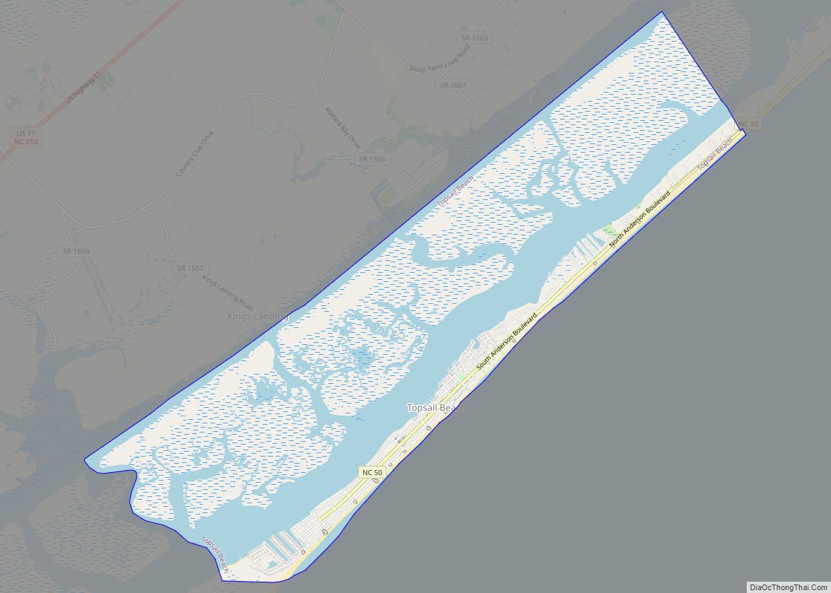
Topsail Beach is a town in Pender County, North Carolina, United States. The population was 383 at the 2012 census. It is part of the Wilmington Metropolitan Statistical Area.
| Name: | Topsail Beach town |
|---|---|
| LSAD Code: | 43 |
| LSAD Description: | town (suffix) |
| State: | North Carolina |
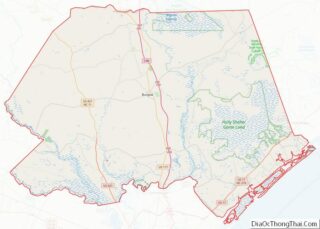
| County: | Pender County |
| Elevation: | 7 ft (2 m) |
| Total Area: | 5.88 sq mi (15.23 km²) |
| Land Area: | 4.39 sq mi (11.37 km²) |
| Water Area: | 1.49 sq mi (3.86 km²) |
| Total Population: | 461 |
| Population Density: | 105.01/sq mi (40.54/km²) |
| FIPS code: | 3768040 |
| GNISfeature ID: | 0996165 |
| Website: | www.topsailbeach.org |
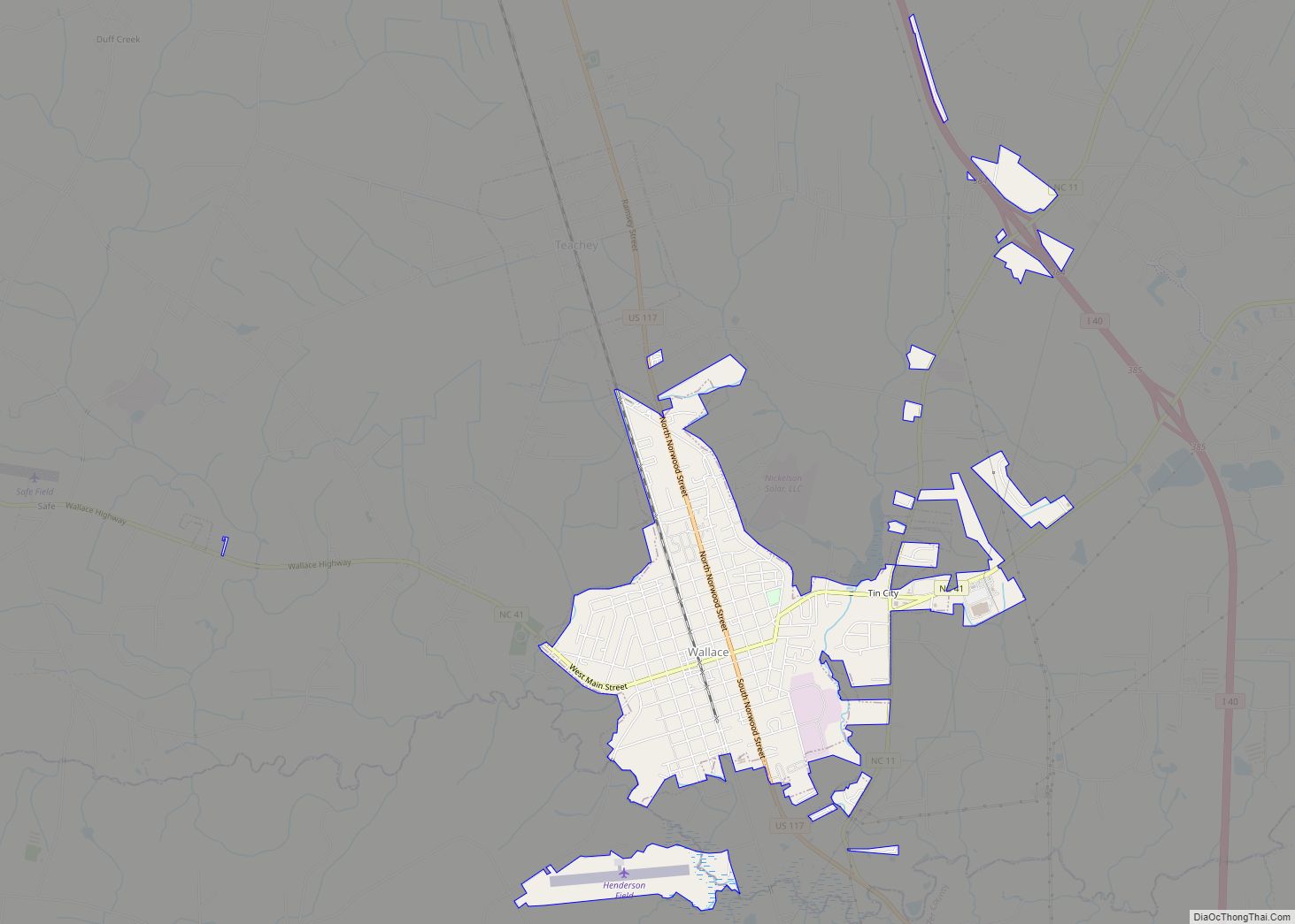
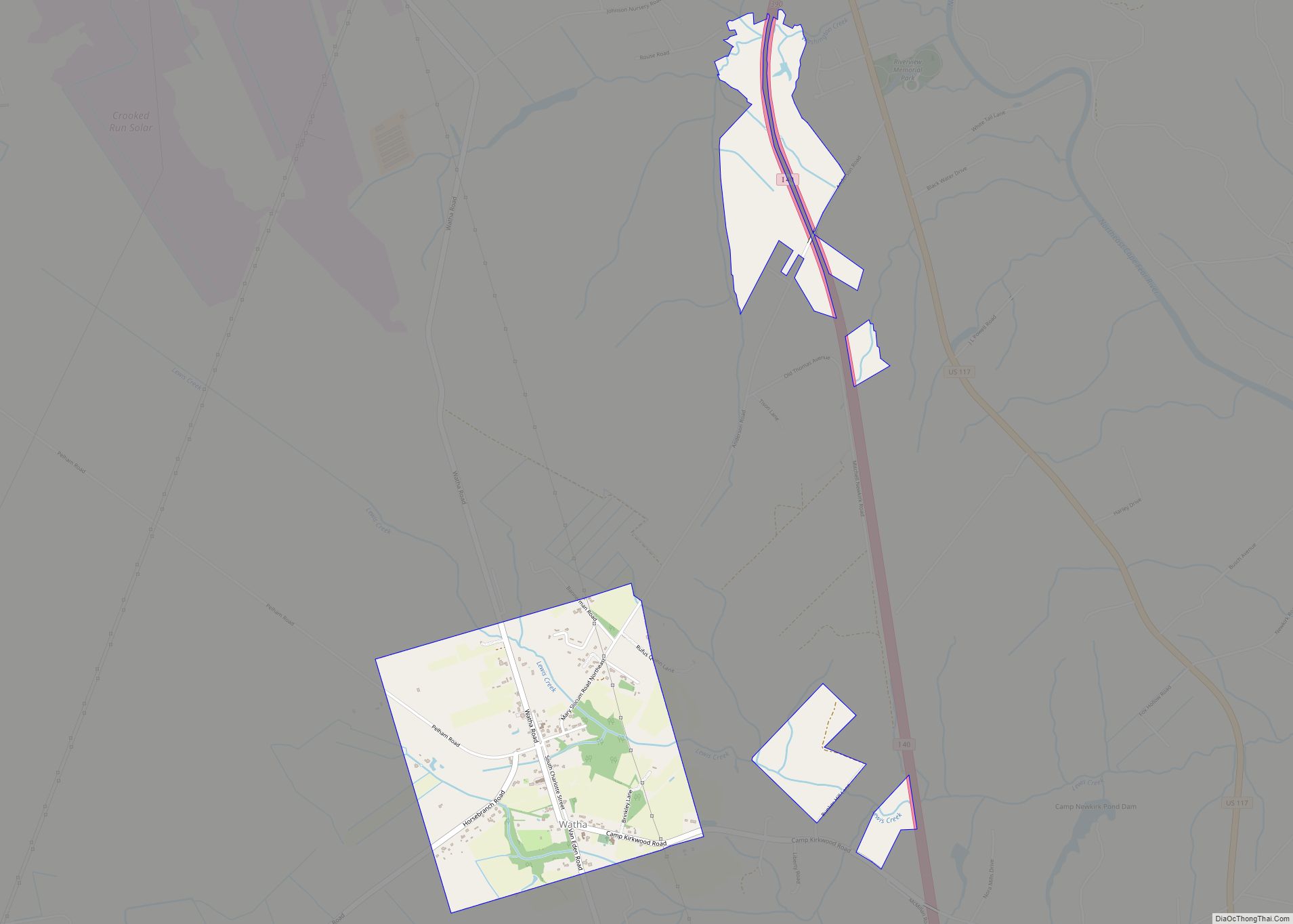
Online Interactive Map
Click on ![]() to view map in "full screen" mode.
to view map in "full screen" mode.
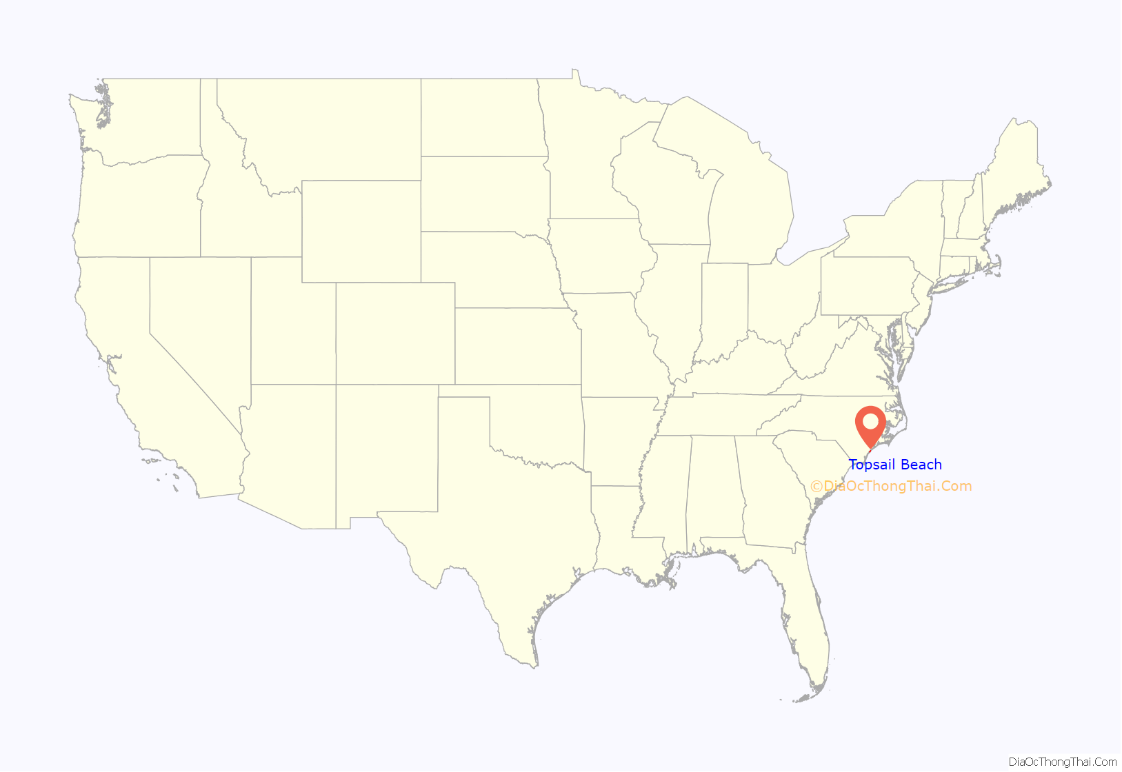
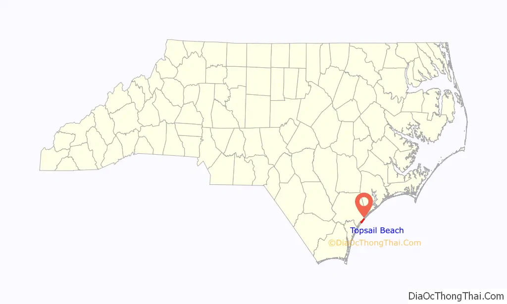
Topsail Beach location map. Where is Topsail Beach town?
History
Local folklore claims the name, Topsail (pronounced Tops’l), originated during the 1700s when pirate ships, including Blackbeard, roamed the coastal waters. Historians explain that marauding pirates hid their ships in the channel behind the island and waited for passing merchant ships loaded with goods. The pirates would pursue and attack the merchants, claiming the cargoes as their own. Eventually, the merchants became aware of this infamous hiding place and began to watch for the tops of the pirates’ sails showing over the rolling dunes – hence the name Topsail Island.
Prior to World War II, the only access to Topsail Island was by boat. Area residents frequently made this short trip to picnic and search for the pirate Blackbeard’s rumored buried treasure.
During World War II, the U.S. Navy took over the island and began a joint venture with Johns Hopkins University known as Operation Bumblebee. The waterway was dredged, roads were built, and fresh water was piped onto the island. Operation Bumblebee was the beginning of the space program for the United States Government. An arsenal center for the assembly and storage of rockets was built on the sound side of the island, and launching pads were constructed on the oceanfront. Concrete observation towers were built throughout the island to monitor the experimental launchings. Over 200 rocket launchings took place on the island between 1946 and 1948. When the testing program was dismantled, the government sold the island to the public. The Town of Topsail Beach was incorporated in 1963. Many of the original military structures still exist today, and several of the concrete observation towers have since been converted into private residences and places of business.
The Cape Fear Civil War Shipwreck Discontiguous District, US Naval Ordnance Testing Facility Assembly Building, US Naval Ordnance Testing Facility Control Tower, and US Naval Ordnance Testing Facility Observation Tower No. 2 are listed on the National Register of Historic Places.
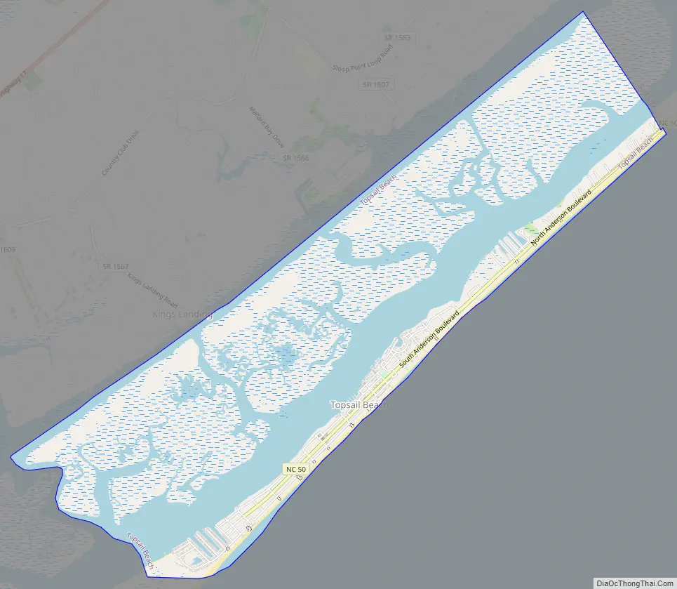
Topsail Beach Road Map
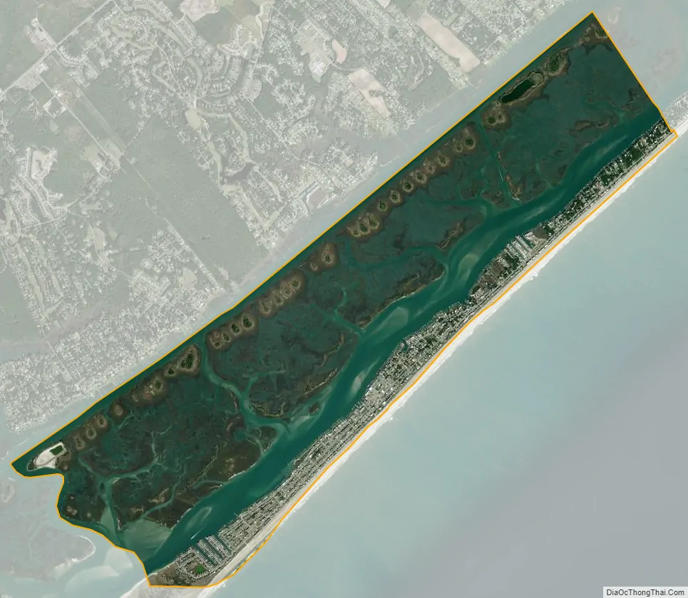
Topsail Beach city Satellite Map
Geography
Topsail Beach is located at 34°22′13″N 77°37′33″W / 34.37028°N 77.62583°W / 34.37028; -77.62583 (34.370399, -77.625756).
According to the United States Census Bureau, the town has a total area of 5.8 square miles (15 km), of which 4.4 square miles (11.3 km) is land and 1.5 square miles (3.9 km) (25.30%) is water.
It is the southernmost town on Topsail Island.
See also
Map of North Carolina State and its subdivision:- Alamance
- Alexander
- Alleghany
- Anson
- Ashe
- Avery
- Beaufort
- Bertie
- Bladen
- Brunswick
- Buncombe
- Burke
- Cabarrus
- Caldwell
- Camden
- Carteret
- Caswell
- Catawba
- Chatham
- Cherokee
- Chowan
- Clay
- Cleveland
- Columbus
- Craven
- Cumberland
- Currituck
- Dare
- Davidson
- Davie
- Duplin
- Durham
- Edgecombe
- Forsyth
- Franklin
- Gaston
- Gates
- Graham
- Granville
- Greene
- Guilford
- Halifax
- Harnett
- Haywood
- Henderson
- Hertford
- Hoke
- Hyde
- Iredell
- Jackson
- Johnston
- Jones
- Lee
- Lenoir
- Lincoln
- Macon
- Madison
- Martin
- McDowell
- Mecklenburg
- Mitchell
- Montgomery
- Moore
- Nash
- New Hanover
- Northampton
- Onslow
- Orange
- Pamlico
- Pasquotank
- Pender
- Perquimans
- Person
- Pitt
- Polk
- Randolph
- Richmond
- Robeson
- Rockingham
- Rowan
- Rutherford
- Sampson
- Scotland
- Stanly
- Stokes
- Surry
- Swain
- Transylvania
- Tyrrell
- Union
- Vance
- Wake
- Warren
- Washington
- Watauga
- Wayne
- Wilkes
- Wilson
- Yadkin
- Yancey
- Alabama
- Alaska
- Arizona
- Arkansas
- California
- Colorado
- Connecticut
- Delaware
- District of Columbia
- Florida
- Georgia
- Hawaii
- Idaho
- Illinois
- Indiana
- Iowa
- Kansas
- Kentucky
- Louisiana
- Maine
- Maryland
- Massachusetts
- Michigan
- Minnesota
- Mississippi
- Missouri
- Montana
- Nebraska
- Nevada
- New Hampshire
- New Jersey
- New Mexico
- New York
- North Carolina
- North Dakota
- Ohio
- Oklahoma
- Oregon
- Pennsylvania
- Rhode Island
- South Carolina
- South Dakota
- Tennessee
- Texas
- Utah
- Vermont
- Virginia
- Washington
- West Virginia
- Wisconsin
- Wyoming