Elizabethtown (Pennsylvania Dutch: Betzischteddel) is a borough in Lancaster County, Pennsylvania, United States. It is located 18 miles (29 km) southeast of Harrisburg, the state capital. Small factories existed at the turn of the 20th century when the population in 1900 was 1,861. As of the 2020 census, the population of the borough was 11,639. Elizabethtown is commonly referred to in south-central Pennsylvania as “E-Town.” This nickname is also used for the local college and high school.
| Name: | Elizabethtown borough |
|---|---|
| LSAD Code: | 21 |
| LSAD Description: | borough (suffix) |
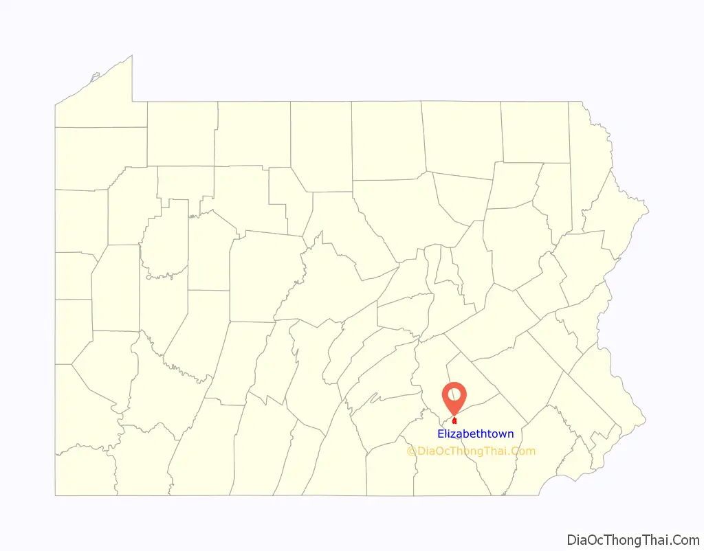
| State: | Pennsylvania |
| County: | Lancaster County |
| Elevation: | 463 ft (141 m) |
| Total Area: | 2.67 sq mi (6.90 km²) |
| Land Area: | 2.65 sq mi (6.87 km²) |
| Water Area: | 0.01 sq mi (0.03 km²) |
| Total Population: | 11,639 |
| Population Density: | 4,388.76/sq mi (1,694.29/km²) |
| ZIP code: | 17022 |
| FIPS code: | 4223016 |
| Website: | www.etownonline.com |
Online Interactive Map
Click on ![]() to view map in "full screen" mode.
to view map in "full screen" mode.
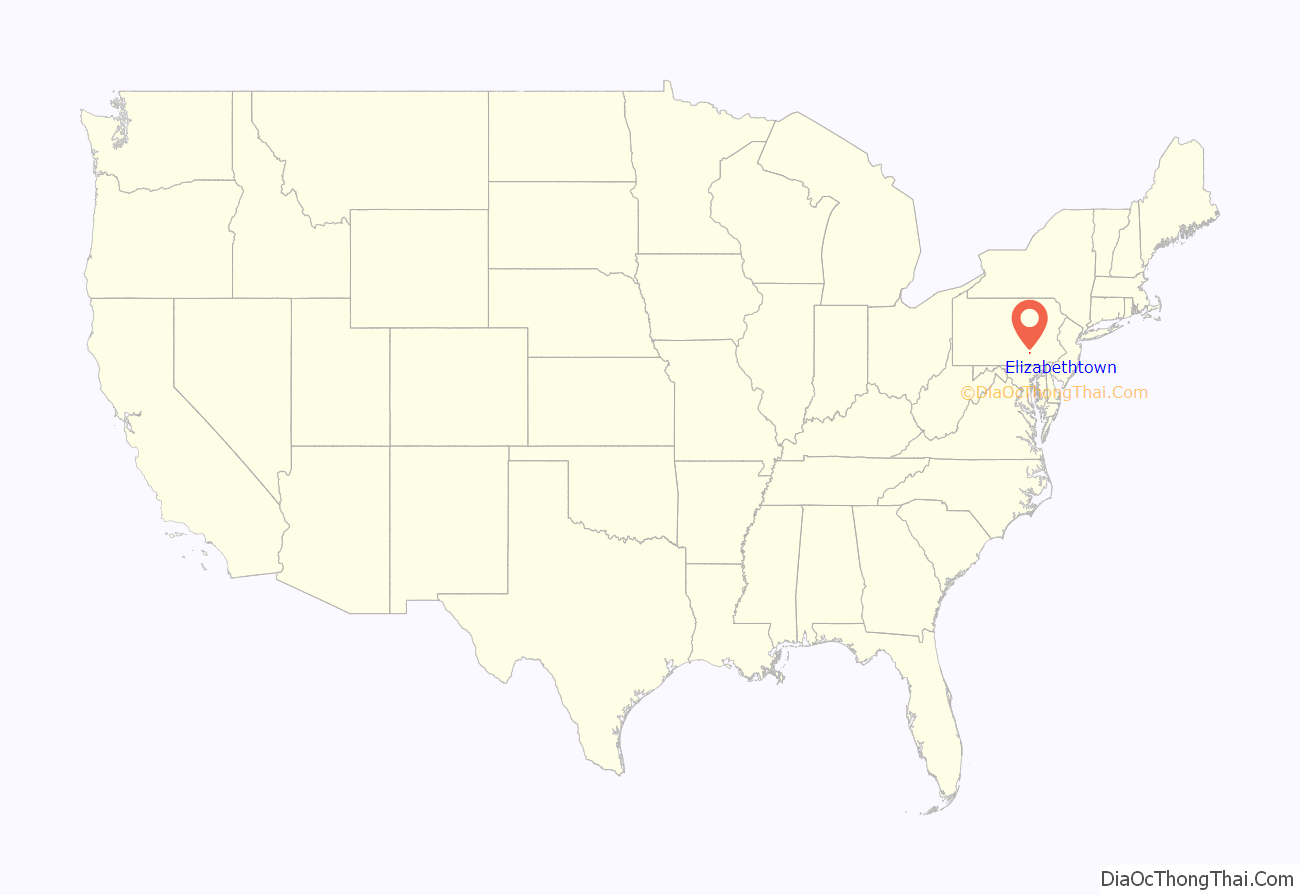
Elizabethtown location map. Where is Elizabethtown borough?
History
There are two stories about the origin of the town’s name. In one version it is named after Elizabeth Reeby, wife of Michael Reeby who sold the first building lots here in about 1795. The officially accepted history is that, in 1753, Captain Barnabas Hughes acquired land and laid out a town, naming it for his wife, Elizabeth. The early settlers were primarily Scots-Irish and Pennsylvania Dutch. In 1758 General John Forbes supplied the expedition to Fort Duquesne with flour and oats and stationed a regiment here to protect his supplies.
Elizabethtown became a borough in 1827, and a railroad was built through the area in the 1830s. The town was primarily agricultural until the early 1900s, when the Klein Chocolate Company (now part of Mars, Inc.) and several shoe factories (the last of which closed in 1979) opened. Elizabethtown College was established in 1899, and the Masonic Homes (now the Masonic Village) followed in 1910.
After World War II, Elizabethtown grew rapidly, more than doubling its population between 1950 and 2000. Homes and businesses expanded into nearby farmland, making sprawl, farmland preservation, and revitalizing the downtown area important issues.
The Kreider Shoe Manufacturing Company was listed on the National Register of Historic Places in 1980.
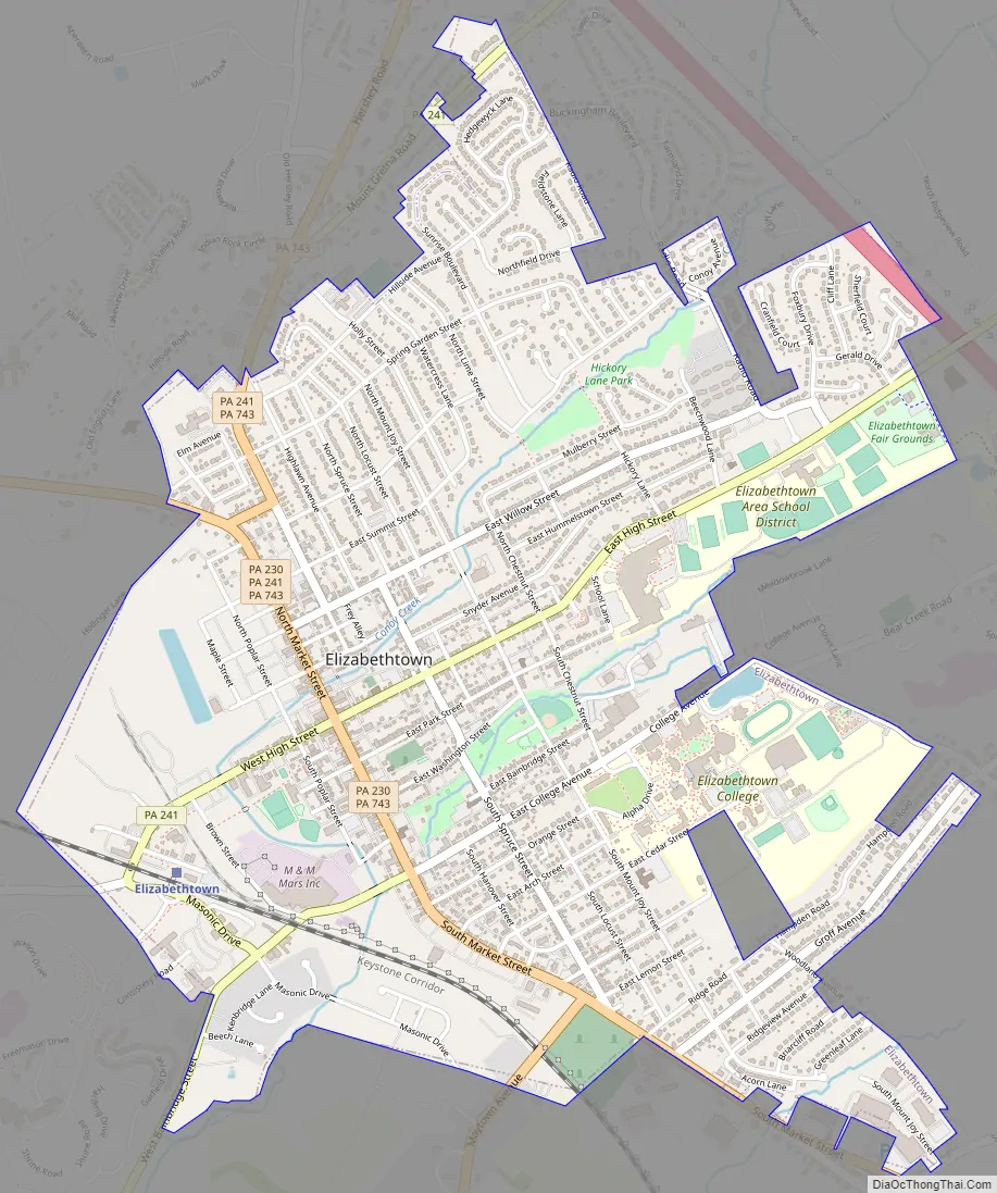
Elizabethtown Road Map
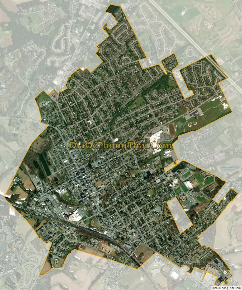
Elizabethtown city Satellite Map
Geography
Elizabethtown is located in northwestern Lancaster County at 40°9′12″N 76°36′2″W / 40.15333°N 76.60056°W / 40.15333; -76.60056 (40.153207, -76.600431). Pennsylvania Route 230 passes through the center of town, leading northwest 18 miles (29 km) to Harrisburg and southeast 6 miles (10 km) to Mount Joy. Pennsylvania Route 283, a four-lane freeway, touches the northeast boundary of the borough and provides access from an interchange with PA 743. PA 283 leads southeast 18 miles (29 km) to Lancaster and northwest the same distance to Harrisburg. PA 743 leads north 10 miles (16 km) to Hershey and south 8 miles (13 km) to Marietta.
According to the U.S. Census Bureau, the borough of Elizabethtown has a total area of 2.7 square miles (6.9 km), of which 0.01 square miles (0.03 km), or 0.51%, are water. The borough is drained primarily by Conoy Creek, which flows southwest to the Susquehanna River at Bainbridge.
The borough has a hot-summer humid continental climate (Dfa), and average monthly temperatures range from 30.1 °F (−1.1 °C) in January to 74.9 °F (23.8 °C) in July. The hardiness zone is 6b.
See also
Map of Pennsylvania State and its subdivision:- Adams
- Allegheny
- Armstrong
- Beaver
- Bedford
- Berks
- Blair
- Bradford
- Bucks
- Butler
- Cambria
- Cameron
- Carbon
- Centre
- Chester
- Clarion
- Clearfield
- Clinton
- Columbia
- Crawford
- Cumberland
- Dauphin
- Delaware
- Elk
- Erie
- Fayette
- Forest
- Franklin
- Fulton
- Greene
- Huntingdon
- Indiana
- Jefferson
- Juniata
- Lackawanna
- Lancaster
- Lawrence
- Lebanon
- Lehigh
- Luzerne
- Lycoming
- Mc Kean
- Mercer
- Mifflin
- Monroe
- Montgomery
- Montour
- Northampton
- Northumberland
- Perry
- Philadelphia
- Pike
- Potter
- Schuylkill
- Snyder
- Somerset
- Sullivan
- Susquehanna
- Tioga
- Union
- Venango
- Warren
- Washington
- Wayne
- Westmoreland
- Wyoming
- York
- Alabama
- Alaska
- Arizona
- Arkansas
- California
- Colorado
- Connecticut
- Delaware
- District of Columbia
- Florida
- Georgia
- Hawaii
- Idaho
- Illinois
- Indiana
- Iowa
- Kansas
- Kentucky
- Louisiana
- Maine
- Maryland
- Massachusetts
- Michigan
- Minnesota
- Mississippi
- Missouri
- Montana
- Nebraska
- Nevada
- New Hampshire
- New Jersey
- New Mexico
- New York
- North Carolina
- North Dakota
- Ohio
- Oklahoma
- Oregon
- Pennsylvania
- Rhode Island
- South Carolina
- South Dakota
- Tennessee
- Texas
- Utah
- Vermont
- Virginia
- Washington
- West Virginia
- Wisconsin
- Wyoming


