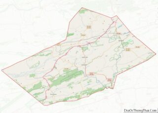
Frackville is a borough in Schuylkill County, Pennsylvania, United States, incorporated in 1876. Today, the intersection of Interstate 81 and Pennsylvania State Route 61 is located near the borough, which is approximately 102 miles (164 km) northwest of Philadelphia and 60 miles (97 km) southwest of Scranton. Frackville is named for Daniel Frack, an early Anglo-American settler.
| Name: | Frackville borough |
|---|---|
| LSAD Code: | 21 |
| LSAD Description: | borough (suffix) |
| State: | Pennsylvania |
| County: | Schuylkill County |
| Elevation: | 1,470 ft (450 m) |
| Total Area: | 0.59 sq mi (1.54 km²) |
| Land Area: | 0.59 sq mi (1.54 km²) |
| Water Area: | 0.00 sq mi (0.00 km²) |
| Total Population: | 3,860 |
| Population Density: | 6,487.39/sq mi (2,506.05/km²) |
| ZIP code: | 17931 |
| FIPS code: | 4227232 |
| Website: | www.frackvillepa.org |
Online Interactive Map
Click on ![]() to view map in "full screen" mode.
to view map in "full screen" mode.
Frackville location map. Where is Frackville borough?
History
Frackville was settled in 1861. It was incorporated more than a decade later in 1876, when the villages of Frackville and Mountain City merged to form the borough of Frackville. The name “Mountain City”, however, is still a common nickname for the borough. A past diner and beer distributor were both named after it.
Early in the twentieth century, anthracite coal mining was the chief industry of this area, Northeastern Pennsylvania’s historic Coal Region. While many mines were operated in the area, the borough developed about 4 miles south of Shenandoah as a predominantly residential community – for workers in and related to mining. With many immigrants to the borough and region, they developed businesses reflecting their cultures. In 1922, Frackville had its own independent brewery. This was short lived after Prohibition was implemented by a national constitutional amendment. (It was later repealed.)
The Mahanoy Plane, which operated from 1862 to 1931 on Broad Mountain just to the north of the borough, was able to hoist 50,000 tons of coal daily. A small coal town, also known as a “patch town”, owned the name “Mahanoy Plane”. It is located at the northern foot of Frackville’s Broad Mountain. Railroad companies once located here transported coal from the region to markets.
Since the late 20th century, coal mining has largely ceased in the area. Industrial relics and infrastructure can be found in the thick forest north of the borough’s youth baseball complex, but historical preservation or restoration has yet to take place of such structures.
Frackville celebrated its centennial in 1976, while James Nahas was mayor. The week-long event, from August 22 to 28, hosted parades each night and brought the community closer together. The borough’s 125th anniversary celebration was held in 2001 and had similar events and effects. It culminated with a Frackville Cruise Night, which had car routes defined for roadways throughout the borough.
Today many Frackville’s residents are employed at local factories of other industries, retail outlets, and the numerous Pennsylvania State Prisons in the immediate area. More commute daily for work in the cities of Pottsville, Hazleton, Allentown, Reading, or Harrisburg.
In 1900, the population was 2,595; in 1910, 3,118; and in 1940, 8,035, its peak. With the decline in coal mining and related jobs in the region, the population has declined. It was 4,361 at the 2000 census and 3,805 in 2010.
With access via Exit 24 from Interstate 81, Frackville is a popular stop for travelers. Destinations include Dutch Kitchen, a renovated diner. The Schuylkill Mall, a former Crown American shopping mall and one of the largest in Pennsylvania, operated in the south end of the borough from 1980 to January 15, 2018. The mall was demolished and replaced by an industrial warehouse.
Frackville was home of the Schuylkill County Brew Fest from 2015 to 2018. The fest moved in 2019 to Pottsville, Pennsylvania.
Frackville Road Map
Frackville city Satellite Map
Geography
Frackville is located at 40°47′1″N 76°14′1″W / 40.78361°N 76.23361°W / 40.78361; -76.23361 (40.783618, -76.233662).
According to the United States Census Bureau, the borough has a total area of 0.6 square miles (1.6 km), all land. It is located on the north slope of Broad Mountain and is drained by the Mahanoy Creek into the Susquehanna River. It has a warm-summer humid continental climate (Dfb) and average monthly temperatures range from 24.8 °F in January to 70.5 °F in July. [1] The hardiness zone is 6a.
See also
Map of Pennsylvania State and its subdivision:- Adams
- Allegheny
- Armstrong
- Beaver
- Bedford
- Berks
- Blair
- Bradford
- Bucks
- Butler
- Cambria
- Cameron
- Carbon
- Centre
- Chester
- Clarion
- Clearfield
- Clinton
- Columbia
- Crawford
- Cumberland
- Dauphin
- Delaware
- Elk
- Erie
- Fayette
- Forest
- Franklin
- Fulton
- Greene
- Huntingdon
- Indiana
- Jefferson
- Juniata
- Lackawanna
- Lancaster
- Lawrence
- Lebanon
- Lehigh
- Luzerne
- Lycoming
- Mc Kean
- Mercer
- Mifflin
- Monroe
- Montgomery
- Montour
- Northampton
- Northumberland
- Perry
- Philadelphia
- Pike
- Potter
- Schuylkill
- Snyder
- Somerset
- Sullivan
- Susquehanna
- Tioga
- Union
- Venango
- Warren
- Washington
- Wayne
- Westmoreland
- Wyoming
- York
- Alabama
- Alaska
- Arizona
- Arkansas
- California
- Colorado
- Connecticut
- Delaware
- District of Columbia
- Florida
- Georgia
- Hawaii
- Idaho
- Illinois
- Indiana
- Iowa
- Kansas
- Kentucky
- Louisiana
- Maine
- Maryland
- Massachusetts
- Michigan
- Minnesota
- Mississippi
- Missouri
- Montana
- Nebraska
- Nevada
- New Hampshire
- New Jersey
- New Mexico
- New York
- North Carolina
- North Dakota
- Ohio
- Oklahoma
- Oregon
- Pennsylvania
- Rhode Island
- South Carolina
- South Dakota
- Tennessee
- Texas
- Utah
- Vermont
- Virginia
- Washington
- West Virginia
- Wisconsin
- Wyoming


